
Vernon Singhroy
Sessions in which Vernon Singhroy attends
quarta-feira 21 abril, 2021

Join us for the the launch of GeoIgnite with Jonathan Murphy, the Chair of GeoIgnite, and Dr. Minda Suchan of MDA.Abstract of MDA Keynote: Canada is the world leader in wide area space-based radar Earth observation through the highly successful RADARSAT program, supporting numerous operational and scientific uses for Synthetic Aperture Radar (SAR) data. MDA, in conjunction with the Canadian government, has created an internationally recognized brand and reputation for...


The Canadian Centre for Mapping and Earth Observation (NRCan) continues its work to implement the National Elevation Data Strategy. Through this strategy, one of NRCan's goal is to provide Canadians with an accurate three-dimensional representation of the country, in support of government priorities such as flood mapping. Because of the enormous task of obtaining a high-precision and up-to-date national elevation layer, NRCan works with different entities.The data coverage of the st...

À l'automne 2020, NV5 Geospatial, propulsé par Quantum Spatial, a été mandaté par la Communauté Métropolitaine de Montréal (CMM) pour réaliser l'un des plus grands levés lidar topobathymétriques aériens fluviaux jamais entrepris au Canada. Cette présentation examinera de plus près le contexte, les objectifs, les défis, la technologie, la méthodologie, ainsi que les résultats et conclusions préliminaires de cette importante étude aérienne des vingt-huit principaux cours d'eau entourant la v...

Maxar is building the highest resolution and most accurate 3D map of the planet and this talk will provide an overview of the products and capabilities that are making it possible.

Title: Advancing Space Based Observation in Canada:The GeoIgnite 2021 Directors General Geospatial Panel, part of Canada's National Geospatial Conference.Title: Advancing Space Based Observation in CanadaThis is a must attend panel for anyone interested in learning the direction Canada's Federal government geospatial leadership is taking.Join our panelists for an exploration of Canada's geospatial priorities and mission in this exciting discuss...


quinta-feira 22 abril, 2021

Abstract forth coming: Oversight for CSA program sectors, including in Space Utilization, Space Exploration, and Space Science and Technology.


At a time of rising climate change impacts, there is a vital and growing need to prepare for, respond to, and recover from natural disasters. But there is a critical communication gap between authorities and citizens. Drawing on the results of our massive multi-year climate change R&D project, and with assistance from hundreds of students, citizens, academics, NGOs, and government officials, we have identified the top perceived climate change-relatedcommunication problem...

Join us April 22nd for a Fireside Chat with Dr. Steve Liang, Founder and CTO of SensorUp. Professor and Rogers IoT Research Chair at University of Calgary and Dr. Nadine Alameh the OGC’s Chief Executive Office (CEO).Steve's goal is to disrupt the silos of the Internet of Things by creating, using, and implementing open and interoperable standards and products for device-cloud communications and cloud-cloud communications. Steve is chairing and the editor of several key IoT enabling...


In this presentation, Dr. Walter Scott will compare the satellite imaging constellations of Maxar and other commercial companies to show how they stack up in three key metrics: product-market fit, adaptability and capital efficiency. He will also share some key insights on the next generation of Earth Intelligence arriving in 2021 with the launch of WorldView Legion, and what impact that will have for the Canadian geospatial market in the months and years ahead.

Applying SafeGraph’s Canadian POI data for community-level analysis in ArcGIS and TableauGeospatial data empowers research bodies, government agencies, and the private sector to visualize and analyze complex problems in new and innovative ways. But location data is only valuable if it is accurate - something many GIS and data analysts know all too well. Armed with accurate, precisely geocoded POI data that includes key attribution related to brands and business types, analys...

For nearly 50 years, geomatics representatives from Canadian provinces and territories have collaborated together and with the federal government on geomatics initiatives. This presentation will explore why such a council came to be and why its work matters to the Canadian geomatics sector and citizens alike. While the geomatics sector and the world we live in continue to change, the need for coordination across jurisdictions remains crucial to support decision-making and response to share...

With PetaBytes of data flowing out of Low Earth Orbit everyday, the opportunity afforded by Earth Observation seems to be greater than ever. But is our community realizing that opportunity yet? Are there winners? How should we be thinking about EO businesses in the roaring 2020s?


sexta-feira 23 abril, 2021

The global geospatial industry is estimated at US$ 500 Billion and delivers an even more significant impact on society, with derived economic benefits estimated to be multifold. These benefits, however, are still not fully understood by key stakeholders and policy and decision-makers, ultimately hindering the global uptake of geospatial information. With decades of national spatial data infrastructure efforts around the world, how can this be? Focusing on the importance of...


In this presentation by Avenza Systems, we will be showcasing how high quality cartographic outputs after your data analysis can actually be achieved! We will demonstrate how to develop and design a map from raw statistical census data in Adobe Illustrator by leveraging the geospatial functionalities of MAPublisher - the industry-standard cartography solution for high quality graphical output. We’ll show how GIS data can be imported, managed, and transformed on-the-fly all d...

In 2003, when GISPartner entered the business Poland was still far behind more developed countries in terms of IT implementation. In 2021 the gap is incomparably smaller and some of Polish IT solutions are widely used across the globe. When public administration is considered, it was also GISPartner, which greatly contributed into transforming paper & stamps into high-class software solutions. We want to share our thoughts on how clever, tailor-made IT solutions are driving this transf...

With rapid advances in Earth observation, cloud computing, and analytics technologies, more information on our changing world is more readily available than ever before. Planet is an aerospace and data analytics company at the forefront of these advances -- working to make global change visible, accessible, and actionable, Planet images the full Earth daily at 3.5m resolution and anywhere sub-daily at <50cm. In this talk, we’ll hear from Tara O’Shea, Planet’s Director of Forest Programs, o...

Join GeoIgnite for this inaugural panel of provincial and territorial geospatial and location technology leaders.We will be discussing issues surrounding: What are main priorities and challenges across jurisdictions? What types of geospatial tools we use to monitor and respond to key challenges like emergency response? How are jurisdictions aligning geospatial tools, data, and people to address climate change? What are some current data...


segunda-feira 26 abril, 2021

Tickets for this workshop must be claimed in advance.Join Maxar Product Manager, Jake Dickinson, to learn first-hand how SecureWatch provides commercial and government organizations access to authoritative geospatial information to make decisions and act with confidence. Satellite imagery is foundational to geospatial workflows because it enables analysts to understand and model the locations and characteristics of land, facilities and equipment. But histori...


terça-feira 27 abril, 2021

Google Chrome is the preferred browser for this session.Tickets for this workshop must be claimed in advance.This session will occur from 10:00AM-11:00AM and repeat again from 11:00AM-12:00PMBeSpatial is a geospatial community platform in Ontario that has opened doors to connect, communicate and innovate. BeSpatial aims to provide networking opportunities, programs, and ...
quinta-feira 29 abril, 2021

With the increased demand for accurate subsurface utility information, the need for inexpensive and timely data capture has come to the forefront. Many of the existing data capture methods are expensive, time consuming and are often still labour intensive. But thanks to several advancements, the cost and complexity edge computing and sensor technology has decreased substantially. This has enabled the development of a wide range of new technologies available for utility mapping and the crea...

sexta-feira 30 abril, 2021
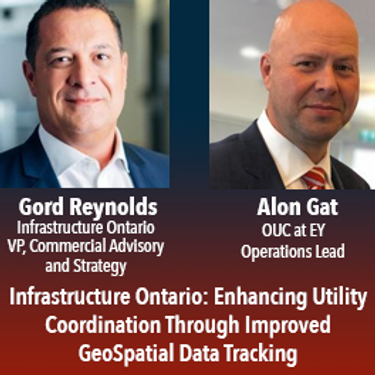
In July of 2020 the Government of Ontario passed Bill 171, the Building Transit Faster Act(“BTFA”) to streamline the delivery of the province’s four priority transit projects. In response to this new legislation, Metrolinx partnered with Infrastructure Ontario and the Ministry of Transportation to establish the Utility Coordination Program (UCP), a new initiative which oversees the development of utility relocation standards and the supporting process to improve the location, trea...
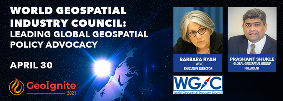
World Geospatial Industry Council: Leading global geospatial policy AdvocacyApril 30 2021, 13:00 - 14:30 EDTVirtual Workshop at GeoIgnite 2021: Canada's National Geospatial Conferencehttps://sites.grenadine.co/sites/goge...

quarta-feira 2 março, 2022

Dr. Marshall and Keith Masback will explore climate change and what happens at the intersection of climate and the Earth’s surface.


Maritime regions are vast, vessels of interest operate dark, and the agencies responsible for maritime enforcement need to deploy scant resources efficiently to make the greatest mission impact. Maxar has developed the Crow’s Nest Maritime Monitoring and Security (MMS) product to address this need. The product leverages space-based optical and radar imagery, AIS, advanced ma...


MDA's new multi-sensor Earth observation satellite constellation, CHORUS, will bring together multiple diverse and unique perspectives in harmony, opening the aperture and the art of the possible to provide a new level of real-time insight about our planet.Building on the legendary RADARSAT program, CHORUS will provide the most extensive radar imaging capacity on the market. With advanced C-band and X-band Synthetic Aperture Rada...

quinta-feira 3 março, 2022

Sanjay Kumar is the founder and CEO of Geospatial Media & Communications. He also lends his time and experience to many organizations helping them to further the cause of increasing the impact of geospatial technology and its applications at a global scale.


By some estimates, 80% of response time during a disater is spent procuring and preparing data, leaving 20% of the time learning from data. We can do better. Sponsored by USGS/FGDC, Natural Resource Canada, NASA and supported by CONIDA (Peru) and Amazon Web Services, the goal of the pilot was to develop standards-based services to support rapid decision making through the full life-cycle of disaster management for multiple hazards.

terça-feira 25 abril, 2023


This is not meant to be an exhaustive review of all the changes and advancements in lidar for the past 20 years, but rather some observations of a user of lidar technology. Lidar sensors in the early days were either set to first or last returns, then eventually allowed both first and last returns to be captured. Terrestrial lidar evolved into mobile mapping systems where advanced navigation systems allows data to be coll...
quarta-feira 29 janeiro, 2025

This keynote presentation will revisit some of the fundamentals behind lidar that influence the precision and detail the systems produce. The laser ranging systems that are used strongly influence how the lidar system works and factors including: wavelength, beam divergence, pulse width and pulse repetition frequency will be reviewed and discussed. Most airborne topographic lidars use a 1064 nm Near-Infrared laser, while topo-bathymetric lidar systems deploy both a NIR laser and a green laser...

Join us at LiDARCanEX 2025 for an insightful panel discussion moderated by Dr. Tim Webster. This session will bring together experts to explore the current state of LiDAR projects in Canada and discuss what the future holds. Topics include:Wide-Area Topographic LiDAR Mapping: Applications in forestry, flood risk assessment, powerlines, infrastructure, and urban development.Topo-Bathymet...


segunda-feira 12 maio, 2025

This open forum invites all attendees to engage in discussions on Canada’s path toward greater self-reliance in the geospatial sector, particularly in light of emerging trade conflicts, including the recent U.S. tariffs, and evolving global geopolitical shifts. The forum will explore strategies to strengthen Canada’s technological capabilities and reduce reliance on external sources, with a focus on fostering innovation, security, and growth.


