Joel Hergott
Sessions in which Joel Hergott attends
terça-feira 29 outubro, 2024
This career fair is an excellent opportunity for your organization to showcase its vision, culture, and the exciting opportunities on offer. Engage with a diverse pool of candidates, including experienced professionals and emerging talents with fresh perspectives. Each candidate brings unique skills and innovative ideas, making your participation a strategic investment in the future of your organization and the geomatics sector.The Western Canada GeoIgnite Career Fair is crucial for re...
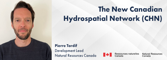
The new Canadian Hydrospatial Network (CHN) is set to replace the National Hydrographic Network (NHN) for Canada. Designed for improved use in hydrological models, the CHN is analysis ready with full-network traversing ability, and value-added attributes such as stream order. The CHN is also created from higher-resolution source data and better aligned to elevation than the NHN, where possible, and has been streamlined for production and maintenance.Work is on-going to refine methods a...
How exactly does artificial intelligence work and what can you use it for in the geomatics domain? Using real-life examples from our projects, they demonstrate how you can use AI to gain new insights and increase efficiency by automating your data processing workflows.We explore how GeoAI is fusing spatial data science and Geomatics technology to help automate the extraction, classification, and analysis of all types of spatial or non-spatial data. Learn how GeoAI can detect clusters, ...
The Alberta Biodiversity Monitoring Institute (ABMI) defines human footprint as the visible alteration or conversion of native ecosystems to temporary or permanent residential, recreational, agricultural, or industrial landscapes. It also includes land that is periodically reset to earlier successional conditions by industrial activities such as forestry harvest areas and seismic lines. To monitor and map human footprint across Alberta, the ABMI, in partnership with the Alberta Human Footprin...
Water is one of our most vital resources, and its management is becoming increasingly complex in the face of climate change, population growth, and competing demands from agriculture, industry, and municipalities. This panel will delve into how geospatial technologies are revolutionizing water policy by providing the data-driven insights needed for smarter decision-making.Join leading experts from academia, provincial and federal gov...
The environmental industry has witnessed a significant transformation in recent years, driven by the adoption of advanced positioning technologies. Geomatics positioning tools have emerged as a pivotal component in this paradigm shift, offering unparalleled precision, efficiency, and accuracy in environmental monitoring, management and remediation projects. ProDelta Projects has been an early adopter and developer of these tools including Field DMS, Smart Dig, R20 and through our Minimal dist...
Menu - Big Four OutletAppetizersRoasted Diablo Pork Bites (12) (GF/DF) SaladsSpiced Cauliflower, Chickpea & Tofu Bowl (GF/DF/V/VE) Sweet Potato, Roasted Cauliflower, Chickpeas, Mint Chutney,Grilled Tofu, Madras Curry DressingClassi...
The integration of AI in infrastructure modeling has the potential to revolutionize decision-making processes by providing accurate predictions, identifying vulnerabilities, and optimizing resource utilization.The increasing complexity of modern infrastructure systems, coupled with growing demands on utilities, has necessitated the adoption of advanced analytical techniques. This panel discussion brings together ideas from acad...
Methane is a greenhouse gas that has a global warming potential 80 times greater than carbon dioxide over a 20-year period. Reducing methane emissions from industrial facilities is one of the most effective ways to reduce greenhouse gas emissions. This talk gives an overview of GHGSat’s approach to providing stakeholders actionable data by detecting, geolocating, and quantifying methane emissions using our fleet of space-based and airborne instruments.
Today, digital twins, autonomy and artificial intelligence (AI) dominate the lexicon of the geomatics industry. These capabilities provide significant productivity advantages to our profession, but our domain content and knowledge are critical to their success. These tools will change the way we work and transform the industry. However, they will not replace us, but rather change our role. This is no different than when the EDM, total station, CAD, or GPS became part of our professional lives...
quarta-feira 30 outubro, 2024
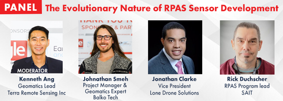
RPAS platforms and sensors have come a long way since their commerical adoption almost a decade ago and have quickly become a main stay of many professional's tool kits. This show's the industry's appetite for adopting new technologies and matching them up with the right application. With a pannel of very experienced professionals from various sectors of Canada's Geospatial RPAS scene, we explore what has driven sensor development and how sensors might further develop along the lines of use c...
Utility mapping is a crucial practice in urban planning and construction, focusing on identifying, documenting, and visualizing the precise locations of underground utilities such as water pipes, gas lines, electrical conduits, and telecommunication cables. Accurate mapping of these utilities is vital to ensure safety, efficiency, and cost-effectiveness in construction projects, preventing accidental damages that can lead to significant service disruptions, safety hazards, and financial losse...
In this year's reality capture track, we have shown you the unprecedented value of reality capture systems when adopted into high-cost, high liability and fast pace environments, some of the problems these systems are solving today, and tools to help the effectiveness and quality of those solutions. However, our presenters will also have demonstrated how critical digital lifecycle planning can be to any asset, from pre-design through construction and lifetime operation right up to demolition,...
Menu - Big Four OutletAppetizersRoasted Diablo Pork Bites (12) (GF/DF) SaladsSpiced Cauliflower, Chickpea & Tofu Bowl (GF/DF/V/VE) Sweet Potato, Roasted Cauliflower, Chickpeas, Mint Chutney,Grilled Tofu, Madras Curry DressingClassi...
In countries that have very accurate and accessible map records, utility damage events are a rare occurrence. Japan with a one third of the population of the US has less than 200 line strikes per year. We will discuss how creating, sharing, and using accurate maps is critical in reducing damage to buried infrastructure.


