Mark Freund
Sessions in which Mark Freund attends
الثّلاثاء 1 مارس, 2022
الأربعاء 2 مارس, 2022
Join Jonathan Murphy and John Roos as they kick off the start of Day 2 Winter Geo:GeoIgnite 2022 and share some information on the upcoming workshop week.
Maritime regions are vast, vessels of interest operate dark, and the agencies responsible for maritime enforcement need to deploy scant resources efficiently to make the greatest mission impact. Maxar has developed the Crow’s Nest Maritime Monitoring and Security (MMS) product to address this need. The product leverages space-based optical and radar imagery, AIS, advanced ma...
Inter-annual variability in agricultural production in Canada is largely determined by weather and climate. Climate-related impacts have caused billions of dollars in financial losses in some years, with the incidence of extreme weather and related costs expected in increase in a changing climate. The National Agroclimate Information Service at Agriculture and Agri-Food Canada monitors the impacts of weather and climate on agricultural activities using a number of geospatial data sets, mod...
MDA's new multi-sensor Earth observation satellite constellation, CHORUS, will bring together multiple diverse and unique perspectives in harmony, opening the aperture and the art of the possible to provide a new level of real-time insight about our planet.Building on the legendary RADARSAT program, CHORUS will provide the most extensive radar imaging capacity on the market. With advanced C-band and X-band Synthetic Aperture Rada...
Join our DG Panel discussion moderated by Jonathan Murphy, Managing Director of GoGeomatics Canada. Our panelists are Eric Laliberté, Éric Loubier and David Harper.As a country spanning almost 10 million square kilometres, Canada has always faced a unique challenge in collecting the day-to-day information needed to provide critical services to Canadians. Today, space offers a unique perspective that is increasingly important to under...
الخميس 3 مارس, 2022
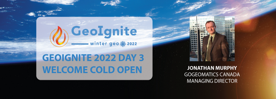
Join Jonathan Murphy as they kick off the start of Day 3 Winter Geo:GeoIgnite 2022 and announce our award recipients.
By some estimates, 80% of response time during a disater is spent procuring and preparing data, leaving 20% of the time learning from data. We can do better. Sponsored by USGS/FGDC, Natural Resource Canada, NASA and supported by CONIDA (Peru) and Amazon Web Services, the goal of the pilot was to develop standards-based services to support rapid decision making through the full life-cycle of disaster management for multiple hazards.
الجمعة 4 مارس, 2022
The Association of Canada Lands Surveyord (ACLS) has developed a certification model for hydrographers which, has been officially recognized by the IHO/FIG/ICA International Board of Standards and Competence for Hydrographic Surveyors and Nautical Cartographers (IBSC) in April of 2016. The ACLS program is the second internationally recognized scheme in the world. Certification for a hydrographic surveyor is desirable because: - Certification provides a formal...
الأربعاء 6 أبريل, 2022
In this informative discussion, learn how to easily display and manage mobile Lidar and static laser snap from a unique source of trustful data in the cloud. Key take-aways include:Turn structured and unstructured mobile point clouds in high-resolution 3D meshesMake the most of your static or indoor mobile scanners in a combined workflowEffortlessly use visual analysis to reconcile your BIM models to your scansUse cost effective pro...
Learn more about the transportation industry's most productive software solution for extracting topography, 3D models, GIS Assets, and more from drone (UAV) point cloud data. We will demonstrate how TopoDOT®'s comprehensive tool suite allows you to establish a highly productive process to extract break-lines, surface models and assets in a CAD environment. Learn how high quality data promote feature extraction automatization and productivity.
Lidar! This ubiquitous 3D technology is transforming how we visualize, map and analyze the world around us. What is it and how does it fit into the remote sensing toolbox? This presentation provides an overview of the core advantages of lidar data and an overview of the latest sensor solutions from RIEGL.


