Doug Dale-Johnson
Sessions in which Doug Dale-Johnson attends
الأربعاء 22 يوليو, 2020
Opening Remarks by GeoIgnite founder Jonathan MurphyKeynote address: Geospatial Opportunities in COVID TimesGeospatial capacity has been helpful in providing answers to Canadians during a time where nothing seems normal anymore. At the forefront of tracking, reporting and managing the response to the COVID crisis are geospatial tools, data and leadership. Natural Resources Canada’s Canada Centre for Mapping and Earth Observation supported the Government of Canada’s response b...
Strategic Geospatial for a Complex WorldWhere humans move and landscapes change there is value. That’s geospatial. This talk is about how to think strategically about geospatial technology in an increasingly complex world.In particular, we will focus on canada’s strengths, and how we might inject novel geospatial technology into new markets
Space-Based Earth Observation in Canada - A Vision for the Future Today, Canada’s landscape, coasts, waters, and cities are changing rapidly, in a large part due to unstable geopolitical currents and the acceleration of global climate change. Our future economic and environmental security, as well as the safety and well-being of its citizens, depend on our ability to understand, plan, and respond quickly to change. Space-Based Earth Observation (SBEO) technologies ...
GIS users’ numbers are expanding around the world. It is now possible to find a GIS use in every field and to optimize their success. Discover how Business Geografic work throughout all fields to offer a new and modern approach to use Geografic Information Systems. Wheter your need are the one of an expanding business, a wide world telecom company or an official government entity, find out how we can help you vizualise your data and improve your process.
Geospatial and location technologies is present and continues to expand its reach in many sectors. Much of the current digital transformation taking place globally is built upon geospatial foundations. In this open panel discussion, our experts will discuss the latest developments and challenges facing the Canadian and global geospatial sector and what the future holds. Key components to be addressed include how has the global pandemic affected our sector and how may we be impacted in the...
الخميس 23 يوليو, 2020
Title: Growing Canada’s Next Earth Observation (EO) GenerationCanada has a proud history in Earth Observation, supporting a strong export industry driven on EO imagery and geospatial analytics. It is incumbent on all of us to continue Canada’s strong presence in the global EO community and we can only do that with a concerted effort and plan to grow the next generation of leaders. After 51 years of leadership in space and spatial information technology MDA was recen...
A new era of human experience is upon us. The current disruption brought by the COVID-19 crisis has thrust us from a mere “digital transformation” into a new digital reality.The COVID-19 crisis is rapidly reshaping the "what" and "how" of digital transformation agendas. Through leveraging IoT, Big Data, blockchain, AI, location intelligence, etc., organizations are improving their operations and business decisions.We reached a turning point in ...
Agriculture Canada’s COVID-19 response with location data & technology helping drive Objectives and Key Results (OKR’s) on the Enterprise GIS Roadmap This talk is designed to provide insights and guidelines for managing and directing Geospatial programs and uses the COVID-19 response (Maps Apps and Data) and digital transformation as the means to achieve the Objectives and Key Results of the Geomatics program.At AAFC the strategic initiatives of our data driven...
The GeoIgnite Conference and our sponsors are proud to present the second Diversity Leadership panel. Our inaugural Summit was a great success featuring relevant diversity and inclusion topics, a powerful panel of speakers, and a "full house" of engaged participants.Increasing the diversity, equity, and inclusiveness of the Geomatics community is essential to our mission. There can be no barrier to talent at Geospatial organizations as solving the world’s most intractable proble...
الجمعة 24 يوليو, 2020
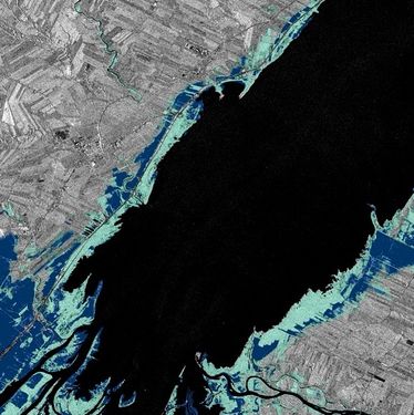
In recognition of the increasing costs and risk due to flooding, the Government of Canada is investing in flood mapping as part of the Government’s commitment to build safer and more resilient communities. Flood maps are critical for the public to understand their flood risks, and the availability of up to date flood hazard maps are key to strengthening the resilience of Canadian communities to overland flooding. Natural Resources Canada (NRCan) has been working in collaboration to advance...
Title: DEIL experiments and outputs with open geospatial dataThe Data Exploration and Integration Lab (DEIL) at Statistics Canada has implemented a number of projects using, to the extent possible, open georeferenced data and open source tools. This presentation outlines some of this work. We will present recent developments of the Linkable Open Data Environment (LODE), examples of the use of LODE data, the development of a Proximity Measures Database and Data Viewer, and an R&amp...
Abstract A fundamental shift in the geospatial industry has occurred over recent years. Modern remote sensing technology has been developed at PCI Geomatics and in Canada through advanced research through partnerships with private industry, academia, and government researchers. Ubiquitous access to openly accessible earth observation data, cloud computing infrastructures and international collaboration have created opportunities to increase downstream access to inf...
الخميس 22 أبريل, 2021
Join us April 22nd for a Fireside Chat with Dr. Steve Liang, Founder and CTO of SensorUp. Professor and Rogers IoT Research Chair at University of Calgary and Dr. Nadine Alameh the OGC’s Chief Executive Office (CEO).Steve's goal is to disrupt the silos of the Internet of Things by creating, using, and implementing open and interoperable standards and products for device-cloud communications and cloud-cloud communications. Steve is chairing and the editor of several key IoT enabling...
Applying SafeGraph’s Canadian POI data for community-level analysis in ArcGIS and TableauGeospatial data empowers research bodies, government agencies, and the private sector to visualize and analyze complex problems in new and innovative ways. But location data is only valuable if it is accurate - something many GIS and data analysts know all too well. Armed with accurate, precisely geocoded POI data that includes key attribution related to brands and business types, analys...
For nearly 50 years, geomatics representatives from Canadian provinces and territories have collaborated together and with the federal government on geomatics initiatives. This presentation will explore why such a council came to be and why its work matters to the Canadian geomatics sector and citizens alike. While the geomatics sector and the world we live in continue to change, the need for coordination across jurisdictions remains crucial to support decision-making and response to share...
The Canadian Geodetic Survey (CGS) of Natural Resources Canada (NRCan) is responsible for defining, maintaining, and providing access to the Canadian Spatial Reference System (CSRS). The CSRS provides a consistent reference for surveying, mapping, and other applications which require accurate positioning. This presentation will describe the CGS products, tools and services which are currently available and provide access to the Canadian Spatial Reference System (CSRS). It will also take a ...
الجمعة 23 أبريل, 2021
The global geospatial industry is estimated at US$ 500 Billion and delivers an even more significant impact on society, with derived economic benefits estimated to be multifold. These benefits, however, are still not fully understood by key stakeholders and policy and decision-makers, ultimately hindering the global uptake of geospatial information. With decades of national spatial data infrastructure efforts around the world, how can this be? Focusing on the importance of...
With rapid advances in Earth observation, cloud computing, and analytics technologies, more information on our changing world is more readily available than ever before. Planet is an aerospace and data analytics company at the forefront of these advances -- working to make global change visible, accessible, and actionable, Planet images the full Earth daily at 3.5m resolution and anywhere sub-daily at <50cm. In this talk, we’ll hear from Tara O’Shea, Planet’s Director of Forest Programs, o...
The Government of Canada and organizations such as the UN recognize the critical role of standards in geographic information and geomatics to support stewardship and interoperability of information, ensuring that organizations access, use and share geospatial data efficiently and effectively to support program and service delivery to Citizens. The data inventory/catalogue and the supporting standards are foundational components of any national geospatial information framework. As such, wel...
Join GeoIgnite for this inaugural panel of provincial and territorial geospatial and location technology leaders.We will be discussing issues surrounding: What are main priorities and challenges across jurisdictions? What types of geospatial tools we use to monitor and respond to key challenges like emergency response? How are jurisdictions aligning geospatial tools, data, and people to address climate change? What are some current data...
الثّلاثاء 27 أبريل, 2021
Google Chrome is the preferred browser for this session.Tickets for this workshop must be claimed in advance.This session is intended to provide opportunities for those in the geomatics community to engage with the national mirror committee for ISO/TC 211, to learn about Canada's involvement, and to answer questions related to membership in the national committee.
الأربعاء 28 أبريل, 2021
Tickets for this seminar must be claimed in advance.GeoIgnite , and Peggy March, Paul VanZant, Dr. Lynn Moorman, Dr. Gordon Osinski, Dave MacLean, Dr. Trevor Bell, Jonathan Murphy, and Ewan Geddes, all Fellows of the Royal Canadian Geographical Society www.rcgs.org, in conjunction with Canadian Geographic Education www.cgeducation.ca , invite you to this event. The purpose is to showcase and raise awareness ...
الخميس 29 أبريل, 2021
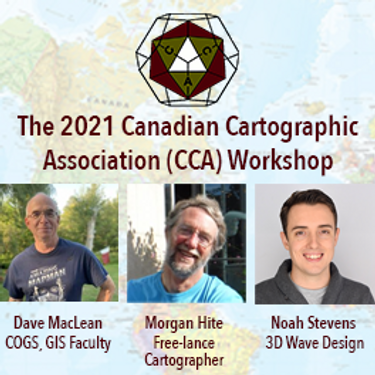
The Canadian Cartographic Association (CCA), is a National non-profit organization that helps advance geographic education in Canada through the use of mapping technology. We host annual cartography related conference and events, and promote geography awareness through scholarship and awards. CAA membership is open to anyone with an interest in any aspect of mapping. If you have a passion for maps then we encourage you to check out our website https://cca-acc....
الجمعة 30 أبريل, 2021
Tickets for this workshop must be claimed in advance.This half-day workshop cuts through the theory and fluff to present, in practical terms, the essential practices for successful GIS project planning and management. Its intent is to provide project managers, teams, and stakeholders with the key actions methods, and tools to launch and execute successful projects --delivering results on time and on budget providing valuable...
الثّلاثاء 8 مارس, 2022
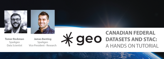
This workshop will use open tools and standards to create STAC compliant data for a Canadian Federal Dataset. The workshop will focus on the nuances of working on Canadian Data in a Cloud environment. It will further demonstrate modern geospatial data science tools to create a SpatioTemporal Asset Catalogue. Sparkgeo will also demonstrate use in leading desktop and cloud mapping software.
الأربعاء 9 مارس, 2022
Join us in this training to learn about some of the latest and greatest features in ERDAS IMAGINE! With the exponentially increasing amount of data being collected in the world today, customized repeatable, batchable workflows are needed to extract as much valuable information from raw data as possible. The Spatial Modeler is the key to setting up these types of workflows. The creation of spatial models and the use of AI, machine learning and deep learning allow mo...


