
Celso Isidro
I concentrate on the application of mining and geospatial technology, and the delivery of ISO-compliant technical packages. I bring extensive experience in project management, business modelling, long-range mine planning and environmental assessment. Known for my collaborative approach, I demonstrate strong strategic thinking, and a proven track record of meeting project milestones effectively.
Sessions in which Celso Isidro attends
الجمعة 24 يوليو, 2020

We are living through a transformative time, not least in the space industry. A graph of upcoming satellite launches looks like a hockey stick – soon there will be orders of magnitude leading to more satellites being launched and more downstream data being generated from space than ever before. The question is, what is the most effective means of ensuring that space data brings tangible benefits to business operations and value to end users? In our talk we cover a satellit...
الأربعاء 21 أبريل, 2021

Explore the structure of an enterprise location intelligence platform at Agriculture Agri-food Canada and how they created a strategic road map to systematically diagnose strengths and weaknesses to drive the use of location intelligence in everyday program and policy decisions of a federal department.Agriculture and Agri-Food Canada supports the Canadian agriculture and agri-food sector through initiatives that promote innovation and competitiveness.

Maxar is building the highest resolution and most accurate 3D map of the planet and this talk will provide an overview of the products and capabilities that are making it possible.

Title: Advancing Space Based Observation in Canada:The GeoIgnite 2021 Directors General Geospatial Panel, part of Canada's National Geospatial Conference.Title: Advancing Space Based Observation in CanadaThis is a must attend panel for anyone interested in learning the direction Canada's Federal government geospatial leadership is taking.Join our panelists for an exploration of Canada's geospatial priorities and mission in this exciting discuss...


الأربعاء 28 أبريل, 2021

Tickets for this workshop must be claimed in advance.At a time of rising climate change impacts, there is a vital and growing need to prepare for, respond to, and recover from natural disasters. But there is a critical communication gap between authorities and citizens.Drawing on the ongoing results of our massive multi-year climate change R&D project, and with assistance from hundreds of students, citizens...

الخميس 24 مارس, 2022

GIS platforms are typically populated with XYZ coordinates with a point spacing of 1 meter or more. in fact, most traditional land surveying techniques, like GPS, often have a point spacing of 3 meters or more, and that is understandable given the procedure to obtain these points. But have you ever wondered what amount of detail is lost when increasing the point frequency? Well, in this seminar, Otto Ballintijn will demonstrate the impact point frequency has on pipe detail usin...

الجمعة 25 مارس, 2022

For decades, cities have required all utilities, communication providers and municipal services providers to build their facilities below ground. In addition, the increase in severe natural disaster conditions have driven traditional overhead utilities to revise their construction standards and build their new facilities underground. As the proliferation of underground construction continues, all utility groups must improve their procedures to ensure that any newly installed fa...


الثّلاثاء 7 نوفمبر, 2023

Since 2018, students from geomatics programs across Canada have been participating in the annual National Geomatics Competition. Now in it's 5th year, the University of Sherbrooke will be hosting the next iteration in March.We invite you to participate in this discussion around the opportunity for industry and academia to meet at NGC 2024.


What are the trends in education, technology, policy, perception and markets that will mold the future of Geomatics – and how has the profession responded? The presenter has worked in and written about numerous aspects of surveying for several decades and views the future of the profession as one of both challenges and opportunity – new, exciting and sometimes surprising opportunities. This session will be interactive, challenge conventional wisdom, poke a little fun, and hopefully provides s...


Over his decade plus at Suncor, Alonzo has been both witness to and active participant in a quiet digital Geospatial revolution. This revolution has democratized access to Geospatial data and tools to everyone at Suncor. Which meant that teams and professionals across a myriad of disciplines have embraced and pushed the limits of Geospatial data and software. The constant demand for newer and higher-resolution data has relegated the paper map to secondary status as the tool for spatial commun...


Planet scans the entire land mass of the planet nearly everyday with high resolution multispectral imagery, enabling exciting new opportunities and solving old challenges for digital transformations and sustainable business acceleration. Now with our growing fleet of 8-band Superdoves in orbit, the launch of our Planetary Variables - daily soil moisture, temperature, crop and forest biomass, etc - we have evolved even greater capabilities for a new era of Earth Observation technologies. In th...


In the face of escalating environmental challenges, Canada grapples with the urgent need for advanced solutions in wildfire monitoring, emissions reduction, and natural resource management. This panel discussion explores how the burgeoning "New Space" frontier offers innovative approaches to address these critical issues.We aim to provide a platform for various industry players to share their own innovative technologies and insights, creating a vibrant dialogue on crucial geospatial...


Flooding is Canada’s most costly natural disaster, and flood risk intensifies as a result of urbanization and climate change. These impacts will change over time and can jeopardize the overall sustainability of communities if they remain unaddressed. As socio-economic consequences worsen, it underlines the need for governments to provide current and accurate hazard information to vulnerable populations, including Indigenous communities who are disproportionately affected, to make decisions...


This talk focused on those seeking work in GIS, cartography, remote sensing, programming, and other related geospatial fields.Jonathan Murphy, Managing Director of GoGeomatics Canada and geospatial career coach, will be sharing his valued tips and insight for your job search. He is an expert geomatics professional with close to 20 years of experience. Jon’s career has ranged from the oil fields of Alberta to projects with...

With an increasing multitude of new Earth Observation (EO) satellites, it is imperative for the geomatics community to assess the fit of these emerging space assets. This presentation aims to provide a comprehensive analysis of the diverse range of EO satellites currently being deployed, and their potential applications.Topics:1) An Overview of the recent surge in EO satellite launches2) New satellite capabilities, and use cases3) An exploration of the challenges customers ...


Creating, managing and sharing geospatial information has never been easier, but how do we ensure the information we are using to make key business decisions is current, correct, accurate and the best fit for purpose? This session will explore the different types of geospatial information assets being used at The City and the different tools, methods and standards that are being used capture, manage and share authoritative City data across the organization and to the Citizens of Calgary.

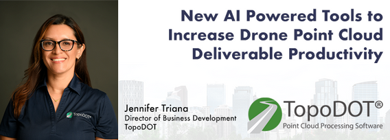
Learn how newly implemented surface modeling tools employing artificial intelligence reduce the turnaround time of point cloud surface models by 400% while maintaining high-fidelity results around break lines. Faster ground extraction routines for UAV data can be achieved without the need for classification or noise removal. In this presentation, we'll discuss several examples including how a query volume calculation project compared with traditional modeling workflows yielded nearly exact...

الأربعاء 8 نوفمبر, 2023

Wetlands are important to water quality, nutrient cycling, and biodiversity, and have been identified as a management priority across Canada. Reclaiming wetlands that have been impacted can be a long-term, costly process depending on the type of wetland, location, and potential access constraints. One challenge with wetland reclamation is that the work may cause additional or new wetland impacts during access and execution of the work. Concurrent with wetland reclamation priorities, there ...


How do you decide when to mobilize and when not to, or even where can you safely and legally fly. As the frequency of unpredictable weather and forest fire smoke increase, so too does the risk in mobilizing to a job site. This presentation will demonstrate OGL Engineering’s process and different geospatial resources available to better inform your decision and minimize risks.

The talk presents how multi-band SARs (X-band Iceye, C-band RADARSAT-2 and L-band SAOCOM) support various earth observation applications, such as target identification, change and displacement detection, and soil moisture map generation. Furthermore, it presents MDA's next-generation Chorus constellation (combination of C-band and X-band SARs).


Geoff Zeiss devoted over 30 years of his life to the Geospatial industry and global community, focusing on utility and construction sectors, and mapping underground utility infrastructure among many other projects. Sadly, Geoff passed away in September of 2022. The Geoff Zeiss Urban Infrastructure Mapping Fund was established to build on decades of innovation by Dr. Zeiss in developing effective and sustainable urban infrastructure through research and development supporting urban infor...


Research Presentation:Airborne Topo-Bathymetric Lidar Combined with Thermal Imaging for Fish Habitat Studies in RiversResearchers at Nova Scotia Community College’s Applied Geomatics Research Group have been using the airborne Leica Chiroptera 4X topo-bathymetric lidar sensor for nearly a decade and have surveyed coastal, riverine and lake environments. They have concentrated on mapping submerged aquatic vegetation (SAV). Topo-bathy lidar data of rivers provides an opportu...
