Allen
He/Him
Sessions in which Allen attends
الأربعاء 21 أبريل, 2021
À l'automne 2020, NV5 Geospatial, propulsé par Quantum Spatial, a été mandaté par la Communauté Métropolitaine de Montréal (CMM) pour réaliser l'un des plus grands levés lidar topobathymétriques aériens fluviaux jamais entrepris au Canada. Cette présentation examinera de plus près le contexte, les objectifs, les défis, la technologie, la méthodologie, ainsi que les résultats et conclusions préliminaires de cette importante étude aérienne des vingt-huit principaux cours d'eau entourant la v...
الخميس 22 أبريل, 2021
In this presentation, Dr. Walter Scott will compare the satellite imaging constellations of Maxar and other commercial companies to show how they stack up in three key metrics: product-market fit, adaptability and capital efficiency. He will also share some key insights on the next generation of Earth Intelligence arriving in 2021 with the launch of WorldView Legion, and what impact that will have for the Canadian geospatial market in the months and years ahead.
الجمعة 23 أبريل, 2021
With rapid advances in Earth observation, cloud computing, and analytics technologies, more information on our changing world is more readily available than ever before. Planet is an aerospace and data analytics company at the forefront of these advances -- working to make global change visible, accessible, and actionable, Planet images the full Earth daily at 3.5m resolution and anywhere sub-daily at <50cm. In this talk, we’ll hear from Tara O’Shea, Planet’s Director of Forest Programs, o...
الإثنين 26 أبريل, 2021
PLEASE NOTE THE PREFERRED BROWSER IS GOOGLE CHROME. If you are running into any issues accessing the session, please try logging in via Google Chrome.The use of drones or UAVs has expanded dramatically over the last few years and this technology is rapidly permeating a wide variety of professional disciplines and industries, including the broad field of GIS. Ideally suited for on-demand geospatial data collection, drones can effectively eliminate the logjam tha...
السّبت 29 مايو, 2021
Note all times are in Eastern Time.Traditional Geospatial Job Search StrategiesThinking about the right geospatial Job for youEvaluating Geomatics JobsBuilding your Resume and Cover LetterDiscussion
الخميس 2 ديسمبر, 2021
This half-day workshop cuts through the theory and fluff to practically present, the essential practices for successful GIS project planning and management. Its intent is to provide project managers, teams, and stakeholders with the key actions, methods, and tools to launch and execute successful projects, delivering results on time and within budget providing valuable deliverables to the customers and user community. It is applicable to all types of GIS ...
الجمعة 4 مارس, 2022
The Association of Canada Lands Surveyord (ACLS) has developed a certification model for hydrographers which, has been officially recognized by the IHO/FIG/ICA International Board of Standards and Competence for Hydrographic Surveyors and Nautical Cartographers (IBSC) in April of 2016. The ACLS program is the second internationally recognized scheme in the world. Certification for a hydrographic surveyor is desirable because: - Certification provides a formal...
In this short technical demonstration, I’ll explore some of the ways that Planetscope’s new 8-band capabilities can be used to both detect and monitor invasive plant species, such as Watermoss-Salvinia, within water bodies. We’ll focus on the role that the 4 new spectral bands (Coastal Blue (433-453nm) , Yellow (600-620nm), Green-II (547-583nm) and Red-edge (697-713nm)) can have in this use case. I’ll compare how some spectral indices unlocked via 8-band data compare to previous 4-band, RG...
الإثنين 7 مارس, 2022
The world is dynamically changing and so are businesses. By some estimates, 20% of new businesses close within one year of opening. In 2020,
الثّلاثاء 8 مارس, 2022
Maxar’s WeatherDesk is a mature product platform that has continually evolved to satisfy changing customer requirements. It sets the standard for reliable and accurate weather forecasting through sound attention to science, an intense focus on customer service including 24/7 meteorological and operational support, and optimally solving customer problems. WeatherDesk products elegantly translate weather data into insights and actionable intelligen...
The Integrated Cadastral Information Society (ICI Society) is a leader in sharing geospatial information, promoting the integration, adoption, and use of spatial data for the social and economic benefit of British Columbians. In addition to data sharing, ICI Society works to facilitate opportunities for training, education, and collaboration across government, industry, and other interested organizations. Incorporated in May 2001 and registered under the BC Societies Act as a ...
This workshop will use open tools and standards to create STAC compliant data for a Canadian Federal Dataset. The workshop will focus on the nuances of working on Canadian Data in a Cloud environment. It will further demonstrate modern geospatial data science tools to create a SpatioTemporal Asset Catalogue. Sparkgeo will also demonstrate use in leading desktop and cloud mapping software.
الأربعاء 9 مارس, 2022
The Topobathymetric Lidar Solutions & Applications Workshop presented by NV5 Geospatial is designed to provide a comprehensive overview of topobathymetric lidar in a relaxed, collaborative environment to allow discussion and answer any questions. This interactive, virtual event will review our latest sensor technology, present typical project planning and execution, and provide processing insights to successfully completing and delivering ...
Join us in this training to learn about some of the latest and greatest features in ERDAS IMAGINE! With the exponentially increasing amount of data being collected in the world today, customized repeatable, batchable workflows are needed to extract as much valuable information from raw data as possible. The Spatial Modeler is the key to setting up these types of workflows. The creation of spatial models and the use of AI, machine learning and deep learning allow mo...
الخميس 10 مارس, 2022
Taking urgent action to combat climate change and its impacts" is a crucial goal set forward under Goal 13 – Climate Action as part of the United Nations Sustainable Development Goals (SDGs).Climate action requires global efforts related to climate change mitigation – reducing the flow of heat-trapping greenhouse gases into the atmosphere, or enhancing the "sinks" that accu...
Join this session to get the latest information on Maxar foundational products as well as demonstrations and round-table conversation with our subject matter experts. Please bring your questions if you're a current user, or come ready to experience the industry's best satellite imagery for the first time.
الجمعة 11 مارس, 2022
Please join us for the MDA-hosted workshop on multi-band SAR presented by MDA (Canada), Iceye (Finland) and VENG (Argentina). After presenting SAR fundamentals, we will dive deep into the specifications of X-band (Iceye), C-band (RADARSAT-2) and L-band (SAOCOM) missions, as well as the sensors’ merit and strength in specific applications that are of relevance to Canada. The last hour would be Q&As and discussion.
At a time of rising climate change impacts, there is a vital and growing need to prepare for, respond to, and recover from natural disasters. But there is a critical communication gap between authorities, citizens, and communities. Drawing on the ongoing results of our massive multi-year climate change research project, and with assistance from hundreds of students, citizens, academics, NGOs, government officials, and industry partners, Deploy Solutions has identif...
الأربعاء 23 مارس, 2022
Utility and energy buried pipelines represent an extensive underground network covering most of a country's territory. Their precise lateral, horizontal positioning along with their depth of cover is a critical element of any operator's GIS. It enables to deploy more accurate pipeline predictive maintenance models and avoid third party interferences. The latter being identified as one of the main causes of pipeline failures. The 2020 CGA Dirt report states that 3...
الخميس 24 مارس, 2022
GIS platforms are typically populated with XYZ coordinates with a point spacing of 1 meter or more. in fact, most traditional land surveying techniques, like GPS, often have a point spacing of 3 meters or more, and that is understandable given the procedure to obtain these points. But have you ever wondered what amount of detail is lost when increasing the point frequency? Well, in this seminar, Otto Ballintijn will demonstrate the impact point frequency has on pipe detail usin...
Scribble Maps is an easy-to-use online GIS and web mapping visualization solution. The software has a robust toolset along with vast operations that can help you annotate maps, plot territories, filter and analyze data, optimize routes, add images, and more.Our powerful mapping software can easily be integrated with many different file formats including GeoJson, SHP, KML, CSV, GPX, DXF, and PDF. Founded in 2009, Scribble Maps has been developed from direct user f...
Reveal is building the world's most advanced and accurate digital twin technology for subsurface infrastructure. We're driving a safer, more efficient and sustainable world by revealing the truth of the underground. Join us for a 30min presentation where we will be showcasing our technology through our flagship project in Wellington, New Zealand.
الجمعة 25 مارس, 2022
An overview of Prostar's "Cloud and Mobile Precision Field Data Collection Solution and the set up of the ProStar "PointMan Plus" application FREE to WorkShop attendees. PointMan is a patented cloud and mobile mapping software application that captures, records, and displays the precise location and the associated metadata of critical surface and subsurface infrastructure, all in "real-time" Workshop includes: -1 FREE annual subscription of...
For decades, cities have required all utilities, communication providers and municipal services providers to build their facilities below ground. In addition, the increase in severe natural disaster conditions have driven traditional overhead utilities to revise their construction standards and build their new facilities underground. As the proliferation of underground construction continues, all utility groups must improve their procedures to ensure that any newly installed fa...
الثّلاثاء 26 مارس, 2024
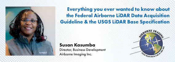
The Canadian government first formally created LiDAR Guidelines in 2017. The document was updated in 2022 to Version 3.1. This session will review the Canadian Guidelines and compare them to the USGS LiDAR Base specification, updated in 2023. Included in the presentation will be:LiDAR for Flood Mapping and funding from the National D...
الأربعاء 27 مارس, 2024
The United States’ National Geodetic Survey (NGS) plans to modernize their National Spatial Reference System (NSRS) in 2025, including adopting a new dynamic geometric reference (the North American Terrestrial Reference Frame of 2022 (NATRF2022)) and a new geoid-based height system (the North American-Pacific Geopotential Datum of 2022 (NAPGD2022)). To ensure continued geospatial referencing compatibility, the Canadian Geodetic Survey (CGS) plans to modernize the Canadian Spatial Reference Sy...
الإثنين 28 أكتوبر, 2024
Join us at the National Geomatics Networking Reception Enjoy a selection of gourmet hors d'oeuvres, including savoury Moroccan lamb meatballs, smoked pork belly lollipops, and wild mushroom arancini with truffle oil. Vegetarian options like vegetable samosas with mango chutney and goat cheese tartelettes will satisfy all palates. Plus, your ticket includes a drink to enjoy while you connect with industry professionals. Elevate your evening with these delicious bites and great company!<...
الثّلاثاء 29 أكتوبر, 2024
How exactly does artificial intelligence work and what can you use it for in the geomatics domain? Using real-life examples from our projects, they demonstrate how you can use AI to gain new insights and increase efficiency by automating your data processing workflows.We explore how GeoAI is fusing spatial data science and Geomatics technology to help automate the extraction, classification, and analysis of all types of spatial or non-spatial data. Learn how GeoAI can detect clusters, ...
Maintaining undisturbed habitat is key to the recovery strategy of the Woodland Caribou boreal population. Seismic lines have been identified as a human footprint feature that requires specific attention for habitat restoration in part because linear features are linked to increases in the predation rates of caribou as they provide lines of sight and easy transportation routes for predators. It is estimated that there are hundreds of thousands of kilometers of seismic lines within Alberta (AB...
Large-scale habitat inventories are necessary for understanding how human land-use, natural disturbances (e.g., fire) and climate change are influencing ecological processes, species declines and how restoration can address these changes. Within the boreal forest of Alberta, Canada anthropogenic habitat alteration, also referred to as human footprint or the physical disturbance of a landscape as a result of human activity, covers over 19% of the land area. Much of this human footprint is not ...
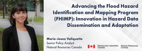
In 2021, the Government of Canada invested $63.8M in the Flood Hazard Identification and Mapping Program (FHIMP) to to create and disseminate engineering-level flood hazard maps that can help Canadians better plan and prepare for future flood risks. The program was recently extended to 2028 through the National Adaptation Strategy and enhanced with an additional $164 Million investment.Given that many Canadians are unaware of flood hazards, the FHIMP is working to fill gaps in knowledg...
For the last five years I have been providing reality capture services to documentary film producers. These series have included NatGeo's Buried Secrets of WWII, NatGeo's Drain the Oceans, Discovery's Expedition Unknown and Expedition Bigfoot. LiDAR, photogrammetry, thermography, magnetometry, and multi spectral imagine all provide context that professional storytellers (TV producers) crave. Join me as I share stories, successes, and failures of these unique service offerings.
The three building blocks of digital building delivery are BIM, VDC and Digital Twins. There are various definitions for these three things, but based on my experience I define them as follows:- Building Information Modelling: a model with or without 3D geometry that hosts the information about building material, dimensions, connections, forces, power, flow rates, and all other elements required in each element that forms the building. - A key subset of understanding BIM is under...
In flood mapping and dam breach analysis, engineers and planners define inundation areas through flow modeling. A crucial input for this analysis is a comprehensive topographic surface of the area of interest and any upstream zones. These areas can span hundreds of kilometers and cover thousands of square kilometers.Previous studies have indicated that low-resolution topography can results in larger inundation areas, greater flow volumes, and faster flood streams. However, a comparison...
Despite the rhetoric surrounding the use of building information modelling (BIM) to enhance collaboration by connecting people and data, the status quo is to work with proprietary solutions and closed file formats, limiting accessibility and interoperability. Additionally, the increasing complexity of projects in the Architecture, Engineering, Construction, and Operations (AECO) industry requires technology that integrates data at a range of scales, from asset to city, and beyond. To address ...
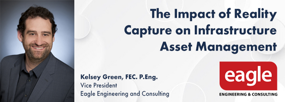
The integration of reality capture technologies—such as LiDAR, photogrammetry, and 3D scanning—into infrastructure asset management is revolutionizing how municipalities and organizations manage and maintain, their assets and deliver services. This presentation will explore the transformative impact of reality capture on the accuracy, efficiency, and overall effectiveness of infrastructure management practices. By enabling effective data collection and visualization, reality capture provides ...
Wrap up the first full day of Canada's National Geomatics Expo with the GoGeomatics Meetup! This lively party and networking event, free to attend, starts right after the day's sessions, offering a perfect blend of fun and professional interaction. Held on the expo main floor, the meetup features a cash bar to help you unwind and enjoy the evening. Join us for an exciting night of music, mingling, and making connections with fellow attendees. Don't miss this chance to relax and expand your ne...
Today, digital twins, autonomy and artificial intelligence (AI) dominate the lexicon of the geomatics industry. These capabilities provide significant productivity advantages to our profession, but our domain content and knowledge are critical to their success. These tools will change the way we work and transform the industry. However, they will not replace us, but rather change our role. This is no different than when the EDM, total station, CAD, or GPS became part of our professional lives...
الأربعاء 30 أكتوبر, 2024
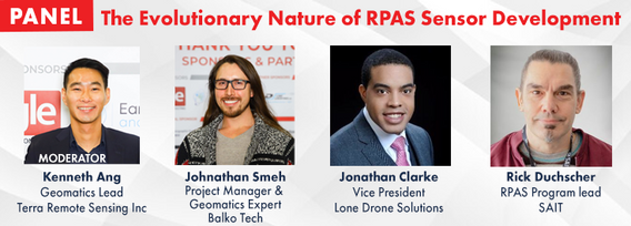
RPAS platforms and sensors have come a long way since their commerical adoption almost a decade ago and have quickly become a main stay of many professional's tool kits. This show's the industry's appetite for adopting new technologies and matching them up with the right application. With a pannel of very experienced professionals from various sectors of Canada's Geospatial RPAS scene, we explore what has driven sensor development and how sensors might further develop along the lines of use c...
Join us for an engaging panel discussion on Geo-Entrepreneurship, featuring distinguished experts from geospatial consultancies, geomatics communication and event companies, and geomatics software firms. This session is designed for those interested in the intersection of geospatial technology and entrepreneurship.Journey to Entrepreneurship: Hear from our panelists on their motivations for leaving traditional careers to pursue entrepreneurial ventures in the geospatial field. Dis...
With drones like the DJI Matrice 300 now being positioned using RTK GNSS, combined with Structure from Motion (SfM), high precision mosaics are possible without deploying targets. The ability to mount lidars (DJI L1 and L2) and other optical sensors (RGB, multispectral, thermal) allows for precise surveying and the production of high resolution and high accuracy mosaics with minimal ground control. While battery power still remains an issue and the limiting factor for flight duration (10’s of...
In this year's reality capture track, we have shown you the unprecedented value of reality capture systems when adopted into high-cost, high liability and fast pace environments, some of the problems these systems are solving today, and tools to help the effectiveness and quality of those solutions. However, our presenters will also have demonstrated how critical digital lifecycle planning can be to any asset, from pre-design through construction and lifetime operation right up to demolition,...
As the drone industry is increasingly focuses on developing larger airframes and equipping them with bigger sensors, Spexi is taking a revolutionary approach to aerial imagery. At Spexi, we believe that the future of geospatial data collection lies not in size and complexity, but in numbers and standardization. The Spexi platform leverages the power of crowdsourcing, deploying local pilots with small drones to capture standardized imagery across entire cities. This method allows us to achieve...
Led by the World Geospatial Industry Council (WGIC) and moderated by Aaron Addison, Executive Director of WGIC, this panel will explore the transformative role of Earth observation (EO) technologies in fostering a resilient and sustainable future for Canada. With growing environmental challenges such as climate change and resource management, EO solutions provide essential insights into monitoring ecosystems, disaster resilience, and sustainable development. Panelists from diverse sectors wil...
Project Overview: Discuss the integration process of the Connectiv LiDAR system with the Velos Rotors V3 UAV, focusing on custom modifications for transportation infrastructure inspections and topographic mapping. Highlight the key features and benefits of the custom UAV solution, such as modularity, precision, and safety.Innovative Payloads: Highlight the use of Phase One P3, Drone Rescue Systems DRS-25 parachute, Riegl MiniVux3, and Sony 61 MP camera.Technological Advancements...
Traditional teaching methods in post-secondary often included using powerpoint presentations and writing on a white or blackboard. The newer generations of students have been exposed to different ways of learning and this requires instructors or teaching professors to change their way of presenting information to help the students learn it at a deeper level. Using a radical constructivism philosophy, the students are required to engage in the material in their own way, connect wit...
How do hydrographic surveys, aerial Remote Sensing and GIS help with environmental efforts? Terra explores 2 projects that use a combination of different sensors and visualizations to achieve these goals. The projects include a rapid marine data collection supported by Aerial LiDAR to aid in rescue efforts of a trapped Orca cafe, and using LiDAR with GIS to support change detection efforts of a major land slide.
A presentation on the latest advancements in construction technology. The session will begin with an introduction to key concepts such as Visual Intelligence and Reality Capture, and a quick look at how construction tech has evolved. The presentation will also include discussions on the use of Visual Intelligence and Reality Capture in construction, with real-world examples from platforms like Timescapes, Cupix, Buildots, and DroneDeploy. Attendees will learn about the challenges and solution...
Reduced snowpack in the Rockies presents a severe drought risk for Southern Alberta. Mountain snowmelt in the Bow and Oldman basins maintains reservoir levels, crop irrigation, municipal and industrial supply, and ecosystem services. As climate and consumption pressures increase, accurate snow water equivalent (SWE) data is crucial for water supply forecasts, which impact allocations and emergency drought measures. Field snowpack monitoring does not provide accu...
Earth Observation technologies have experienced unprecedented innovation and accessibility over the past several years. The role of the commercial sector has stepped in to offer several capabilities historically only available from government. This session will focus on examples of how EO technology is being...
