
Arnold Rudy
Sessions in which Arnold Rudy attends
الخميس 22 أبريل, 2021

At a time of rising climate change impacts, there is a vital and growing need to prepare for, respond to, and recover from natural disasters. But there is a critical communication gap between authorities and citizens. Drawing on the results of our massive multi-year climate change R&D project, and with assistance from hundreds of students, citizens, academics, NGOs, and government officials, we have identified the top perceived climate change-relatedcommunication problem...

In this presentation, Dr. Walter Scott will compare the satellite imaging constellations of Maxar and other commercial companies to show how they stack up in three key metrics: product-market fit, adaptability and capital efficiency. He will also share some key insights on the next generation of Earth Intelligence arriving in 2021 with the launch of WorldView Legion, and what impact that will have for the Canadian geospatial market in the months and years ahead.
الجمعة 23 أبريل, 2021

With rapid advances in Earth observation, cloud computing, and analytics technologies, more information on our changing world is more readily available than ever before. Planet is an aerospace and data analytics company at the forefront of these advances -- working to make global change visible, accessible, and actionable, Planet images the full Earth daily at 3.5m resolution and anywhere sub-daily at <50cm. In this talk, we’ll hear from Tara O’Shea, Planet’s Director of Forest Programs, o...
الإثنين 26 أبريل, 2021

PLEASE NOTE THE PREFERRED BROWSER IS GOOGLE CHROME. If you are running into any issues accessing the session, please try logging in via Google Chrome.The use of drones or UAVs has expanded dramatically over the last few years and this technology is rapidly permeating a wide variety of professional disciplines and industries, including the broad field of GIS. Ideally suited for on-demand geospatial data collection, drones can effectively eliminate the logjam tha...

الثّلاثاء 27 أبريل, 2021

Google Chrome is the preferred browser for this session.Tickets for this workshop must be claimed in advance.This session will occur from 10:00AM-11:00AM and repeat again from 11:00AM-12:00PMBeSpatial is a geospatial community platform in Ontario that has opened doors to connect, communicate and innovate. BeSpatial aims to provide networking opportunities, programs, and ...

Google Chrome is the preferred browser for this session.Tickets for this workshop must be claimed in advance.Have you ever wanted to learn more about Synthetic Aperture RADAR (SAR) and Electo-Optical (EO) products? Come join this session for an introduction to some of the basic imaging parameters and learn about the different p...

Google Chrome is the preferred browser for this session.Tickets for this workshop must be claimed in advance.This workshop will be broken down into 4 parts:1. Introduction to ERDAS IMAGINE2. Spatial Modeling for Wildlife Applications3. Using AI, Spatial Modeling and Python to Break Down Big Data Barriers4. Q & ASpatial Modeling ...

الأربعاء 28 أبريل, 2021

Tickets for this workshop must be claimed in advance.At a time of rising climate change impacts, there is a vital and growing need to prepare for, respond to, and recover from natural disasters. But there is a critical communication gap between authorities and citizens.Drawing on the ongoing results of our massive multi-year climate change R&D project, and with assistance from hundreds of students, citizens...


Tickets for this workshop must be claimed in advance.The use of drones, officially referred to as Remotely Piloted Aerial Systems (RPAS), has been forecasted to play a key role in the digitalization and further optimization of a variety of geomatics applications such as in resource aggregates management, landfill management, civil engineering (3D reality capture, virtual surveying), and precision agriculture. To help realize this forecast it is important for ...


الخميس 29 أبريل, 2021

Tickets for this workshop must be purchased in advance.
الجمعة 30 أبريل, 2021
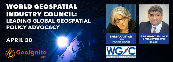
World Geospatial Industry Council: Leading global geospatial policy AdvocacyApril 30 2021, 13:00 - 14:30 EDTVirtual Workshop at GeoIgnite 2021: Canada's National Geospatial Conferencehttps://sites.grenadine.co/sites/goge...

