Robert Kingdon
he/him
Dr. Robert Kingdon is an Associate Professor and Chair of Geodesy and Geomatics Engineering Department at University of New Brunswick. He is passionate about teaching and learning and about the role of academia in serving society. He also loves his research in physical geodesy and WILL make sure you know what the geoid is, whether you like it or not. Feel free to chat to him about online learning, communities of learning, precise surveying, land administration, geodesy, or any subject you are passionate about.
Sessions in which Robert Kingdon attends
الإثنين 28 أكتوبر, 2024

الثّلاثاء 29 أكتوبر, 2024


We are hosting a special gallery of maps and posters for this year’s expo.The Canada Maps & Poster Gallery will run from October 29th to the 30th in Calgary and is an excellent opportunity to showcase your team's work and impact for the public good.This initiative is in partnership with the Canadian Cartographic Association (CCA), the Inter...


We explore the motivations behind the implementation of openBIM and its integral role in advancing the built asset industry. The built environment is immense and complex, it is also a huge responsibility. Our industry directly impacts it, designing, creating and maintaining it. In an era where what we all need is a better built environment, openBIM stands out as a key enabler. Together we will imagine a future where our industry works more effectively, efficiently and with more c...


How exactly does artificial intelligence work and what can you use it for in the geomatics domain? Using real-life examples from our projects, they demonstrate how you can use AI to gain new insights and increase efficiency by automating your data processing workflows.We explore how GeoAI is fusing spatial data science and Geomatics technology to help automate the extraction, classification, and analysis of all types of spatial or non-spatial data. Learn how GeoAI can detect clusters, ...


Building Information Modeling (BIM) is transforming the built asset industry, yet firms of varying sizes—large, medium, and small—adopt BIM in distinct ways tailored to their unique resources and project demands. This session will explore BIM’s origins, current applications, and future directions as shared by representatives from three different firms. A significant focus will be on the importance of data integrity and governance, particularly as Artificial Intelligence (AI) becomes increasin...


From ancient cave drawings depicting hunting grounds to hand-sketched layouts of backyard gardens, humans conceptualize space through map making. Maps serve both to capture what exists on the landscape and to plan future uses by intentionally defining where specific activities can happen. Modern satellite technology creates geospatial datasets that can contribute to current and proposed land use management planning, all underpinned by the pursuit of the public good.Background


Menu - Big Four OutletAppetizersRoasted Diablo Pork Bites (12) (GF/DF) SaladsSpiced Cauliflower, Chickpea & Tofu Bowl (GF/DF/V/VE) Sweet Potato, Roasted Cauliflower, Chickpeas, Mint Chutney,Grilled Tofu, Madras Curry DressingClassi...

The session will focus on considerations for deploying Artificial Intelligence in professional practice; identifying potential landmines and working on solutions from a privacy-first perspective. The talk will include a high-level overview that underscores the fundamental components that encapsulate an AI derived “solution” and delve into a practical, real-world example being tested on an active project.Topics Covered:• An illustrated example of BIM model query using AI• AI too...


Session Human footprint datasets for Canada: mapping and monitoring in support of land and resource managementHuman activities have disturbed biodiversity, ecosystems, and ecological processes over the last century. Given the growing trends of habitat loss and biodiversity decline, understanding patterns of human pressures has become a crucial element of conservation planning. In this context, cumulative pressure mapping is used to quantify the extent and intensity of multiple pressure...


Construction contracts are the same worldwide. While there are differences in language, classification, project delivery and other factors, the one common denominator is that a construction contract requires Drawings and Specifications. While geometric modelling software and specification software have both evolved over time, very little effort is currently being exerted in Canada to integrate them in document development processes.According to Arcadis global surveys, the #1 cause of c...


Menu - Big Four OutletAppetizersRoasted Diablo Pork Bites (12) (GF/DF) SaladsSpiced Cauliflower, Chickpea & Tofu Bowl (GF/DF/V/VE) Sweet Potato, Roasted Cauliflower, Chickpeas, Mint Chutney,Grilled Tofu, Madras Curry DressingClassi...

30 years ago, a small group of engineers came together to work on the then difficult problem of interoperable technology, systems and data. These visionaries formed the Open Geospatial Consortium which has helped the world figure out how to collect, process, and share geospatial data over the internet and across a wide variety of technology systems. Today, with the proliferation of technology types, sensors and a...


The First Peoples Innovation Centre (FPIC) plays a significant role in empowering Indigenous communities. The Centre has adapted the FabLab (Fabrication Laboratory) model developed by the Massachusetts Institute of Technology (MIT) with a culturally appropriate response to Indigenous youth, enabling them to take charge of their professional future. The FPIC, incorporating the FabLab Onaki, is pivotal in this empowerment process, as it funds and partners with various organizations to create co...


Menu - Big Four OutletAppetizersRoasted Diablo Pork Bites (12) (GF/DF) SaladsSpiced Cauliflower, Chickpea & Tofu Bowl (GF/DF/V/VE) Sweet Potato, Roasted Cauliflower, Chickpeas, Mint Chutney,Grilled Tofu, Madras Curry DressingClassi...

Despite the rhetoric surrounding the use of building information modelling (BIM) to enhance collaboration by connecting people and data, the status quo is to work with proprietary solutions and closed file formats, limiting accessibility and interoperability. Additionally, the increasing complexity of projects in the Architecture, Engineering, Construction, and Operations (AECO) industry requires technology that integrates data at a range of scales, from asset to city, and beyond. To address ...


Wrap up the first full day of Canada's National Geomatics Expo with the GoGeomatics Meetup! This lively party and networking event, free to attend, starts right after the day's sessions, offering a perfect blend of fun and professional interaction. Held on the expo main floor, the meetup features a cash bar to help you unwind and enjoy the evening. Join us for an exciting night of music, mingling, and making connections with fellow attendees. Don't miss this chance to relax and expand your ne...

Maxar has doubled the size of its electro-optical constellation in 2024 with the launch of four new WorldView Legion satellites, and two more will be launched soon. The Maxar constellation will be tripling its 30 cm-class resolution imaging capacity and collecting imagery at new times of day. This speech will cover what these new imaging capabilities mean for monitoring opportunities that will enable energy companies to optimize operations and stay ahead of risk.


Today, digital twins, autonomy and artificial intelligence (AI) dominate the lexicon of the geomatics industry. These capabilities provide significant productivity advantages to our profession, but our domain content and knowledge are critical to their success. These tools will change the way we work and transform the industry. However, they will not replace us, but rather change our role. This is no different than when the EDM, total station, CAD, or GPS became part of our professional lives...

الأربعاء 30 أكتوبر, 2024


This presentation details the results of a field study conducted in July in Santa Cruz, California, where thirteen participants employed terrestrial laser scanning (TLS) to assess concrete tolerance on a construction site. The study aimed to establish the precision of TLS as a test method for verifying concrete tolerance in accordance with ASTM E-691-23. Additionally, it sought to quantify the bias of the TLS method by compar...


Photogrammetry is not just limited to aerial platforms. Modern mobile devices contain high-quality cameras and increasingly have LiDAR and depth sensors built in. When combined with high-accuracy GNSS systems, these mobile devices can quickly collect accurate data for utilities, infrastructure, inspection, as-builts, construction, and more. Utilizing these readily available devices can reduce project delays, capture better documentation of utilities, and lay the foundations for digital infras...

Menu - Big Four OutletAppetizersRoasted Diablo Pork Bites (12) (GF/DF) SaladsSpiced Cauliflower, Chickpea & Tofu Bowl (GF/DF/V/VE) Sweet Potato, Roasted Cauliflower, Chickpeas, Mint Chutney,Grilled Tofu, Madras Curry DressingClassi...

In this year's reality capture track, we have shown you the unprecedented value of reality capture systems when adopted into high-cost, high liability and fast pace environments, some of the problems these systems are solving today, and tools to help the effectiveness and quality of those solutions. However, our presenters will also have demonstrated how critical digital lifecycle planning can be to any asset, from pre-design through construction and lifetime operation right up to demolition,...


The time has come for the presentation of this year's mobile mapping system and SLAM system participants.Are you looking to collect more data, faster and accurately? Looking to buy a mobile mobile mapping or SLAM system and incorporate it into your workflows? If you are, you're considering tens of thousands to millions of dollars of investment. Do you know what's available to you? Are you sure that's all of them? Do the options available suit your needs? Is there candid data you can lo...


Menu - Big Four OutletAppetizersRoasted Diablo Pork Bites (12) (GF/DF) SaladsSpiced Cauliflower, Chickpea & Tofu Bowl (GF/DF/V/VE) Sweet Potato, Roasted Cauliflower, Chickpeas, Mint Chutney,Grilled Tofu, Madras Curry DressingClassi...

Traditional teaching methods in post-secondary often included using powerpoint presentations and writing on a white or blackboard. The newer generations of students have been exposed to different ways of learning and this requires instructors or teaching professors to change their way of presenting information to help the students learn it at a deeper level. Using a radical constructivism philosophy, the students are required to engage in the material in their own way, connect wit...
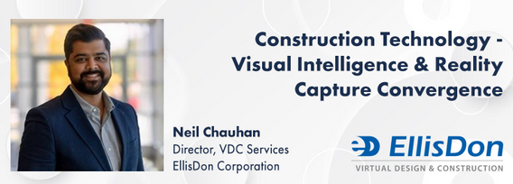
A presentation on the latest advancements in construction technology. The session will begin with an introduction to key concepts such as Visual Intelligence and Reality Capture, and a quick look at how construction tech has evolved. The presentation will also include discussions on the use of Visual Intelligence and Reality Capture in construction, with real-world examples from platforms like Timescapes, Cupix, Buildots, and DroneDeploy. Attendees will learn about the challenges and solution...

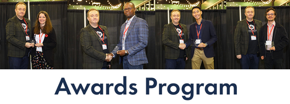
Canada’s National Geomatics Expo Awards are a great opportunity to recognize the people and organizations making a difference in the geomatics field. Whether it’s groundbreaking technology or strong leadership, these awards celebrate the achievements that are pushing the industry forward. This year, the nominees were chosen by the public, and now it’s your turn to make your voice heard. You can vote across all categories or select only the ones you’re interested in. You are limited to


In our rapidly evolving urban landscapes, inadequate accessibility maps leave many people with disabilities facing significant challenges. This talk begins by illustrating the problem with real examples of accessibility fails on platforms like Google Maps. Attendees are encouraged to check accessibility features on their phones, highlighting current gaps.We will then explore the necessity of specialized tools for meaningful navigation and destination planning for people with disabiliti...