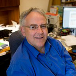
Dr. Tim Webster is a research scientist with the Applied Geomatics Research Group, part of Applied Research at Nova Scotia Community College in Nova Scotia, Canada. His research focus is mapping and modeling earth’s surface processes and uses a topo-bathymetric lidar and other geomatics data to support his research. He obtained his PhD from Dalhousie University in 2006, MSc from Acadia University in 1996, an Advanced Diploma in Remote Sensing in 1988, and a BSc (Geology-Physics) in 1987. In 2002 he was co-awarded the Government of Canada “Science Awards to Leaders in Sustainable Development” for coastal flood risk and climate change in Prince Edward Island. In 2010 he received the Gulf of “Maine Council Visionary Award”. In 2017 he was presented with the Geomatics Association of Nova Scotia “Award of Distinction”. In 2022 he was awarded the Discovery Centre “Public Impact Award”. He has also consulted for the Government Dominica on their lidar and orthophoto acquisition. He has consulted for Natural Resources Canada on their Flood Mapping Guidelines, writing the Topo-bathymetric lidar appendix and the Detecting Coastal Change (erosion) guideline. He has conducted several major projects and authored papers on coastal and fluvial flood risk mapping utilizing lidar and other geomatics tools. He has been with the college for over 30 years, with over 20 as a research scientist and as a consultant for over 20 years and published over 30 peer reviewed papers.
Sessions in which Dr. Tim Webster participates
Wednesday 8 November, 2023
Join us at the GoGeomatics Expo for a dynamic panel discussion on the latest trends in Lidar technology. Our panel of experts will dive into the advancements in Lidar data, hardware, and software, providing valuable insights into the ever-evolving geospatial world. Discover the future of Lidar and its applications, and stay at the forefront of geomatics innovation.lidarcanex.com
Research Presentation:Airborne Topo-Bathymetric Lidar Combined with Thermal Imaging for Fish Habitat Studies in RiversResearchers at Nova Scotia Community College’s Applied Geomatics Research Group have been using the airborne Leica Chiroptera 4X topo-bathymetric lidar sensor for nearly a decade and have surveyed coastal, riverine and lake environments. They have concentrated on mapping submerged aquatic vegetation (SAV). Topo-bathy lidar data of rivers provides an opportu...
Sessions in which Dr. Tim Webster attends
Tuesday 7 November, 2023
Join Canadian GNSS manufacturer Eos Positioning Systems for an in-depth look at using the high-accuracy Arrow Gold+ GNSS Receiver with RTK corrections and Esri’s ArcGIS Field Maps.In this live and interactive presentation, you will learn how to do the following:1. Add GNSS metadata fields to ArcGIS Field Maps 2. Easily connect to the local RTK network to achieve real-time <2cm accuracy in the field 3. Collect high-accuracy data in the field according to best...


