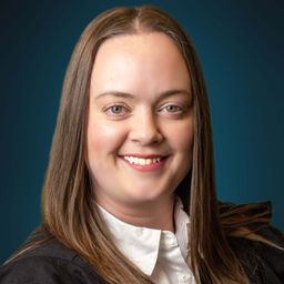
Jamie has served the City of Calgary for over fifteen years, offering essential services and geospatial solutions that support municipal operations. She remains resilient and adaptive by treating new tasks and challenges as opportunities to apply GIS knowledge and analytical skills. A portion of her time is dedicated to the Aerial Imagery Program, which continues to deliver tangible benefits, value, and cost savings to Corporate business units through primary and derivative imagery products.
Sessions in which Jamie Jack participates
Tuesday 7 November, 2023
Harnessing the power of regular collection of imagery and Lidar, the City of Calgary provides valuable information for municipal service delivery. The City publicly shares various datasets in different formats, including Orthophotos, Lidar, and 3D buildings, oh-my! Beginning in 1990, the Aerial Imagery Program supported planning, development, and operations.Regularly collecting spatial data allows for more accurate assessments of changes over time. Annual Orthophoto collection aids in ...
Sessions in which Jamie Jack attends
Monday 6 November, 2023
Join us as we open the GoGeomatics Expo with a memorable evening filled with delicious food and great conversation! Elevate your Expo experience and forge valuable connections with fellow attendees, exhibitors, speakers and panelists. Following dinner, there will be a special panel moderated by GoGeomatics founder...
Tuesday 7 November, 2023
Join us for a riveting panel discussion featuring leading experts in the realm of reality capture. As the industry stands on the precipice of monumental change, this session aims to unpack the intricacies of current challenges, explore the intricacies of the digital twin concept, and envision the future trajectory of reality capture. Our esteemed panelists, with their wealth of knowledge and diverse experiences, will shed light on the multifaceted struggles the industry grapple...
Is change the new normal? Every year seems to be the next warmest year. Those of us looking back at our planet from space are seeing these changes across our planet in near real-time through the eyes of satellites. But behind those pixels are real human stories of catastrophe and suffering. So, with all our constellations of satellites, massive computing power and new generative AI algorithms, can we do anything more than simply report what happened? What does the future hold for geospatial t...
With climate change comes a massively increased risk to billions of people due to disasters, reduced food and energy security, environmental degradation, and sea level rise to name a few. For example, it is estimated that 200,000,000 people live in low-lying areas of the world considered highly vulnerable.The global OGC community has mobilized to improve how well we connect land, sea, and air Geospatial data and information, improve regional connectivity between various SDIS &nbs...
MAXAR Technology provides integrated space infrastructure and earth intelligence capabilities that make global change visible, information actionable and space accessible. MAXAR has been highly active in remotely sensed projects in Western Canada and this talk with discuss some of the current applications using high resolution data across a number of important sectors. Moreover, it will discuss the current and future platforms that are bei...
Geodetic Reference Systems are the foundation for geospatial data, serving as the official reference for latitude, longitude, height and gravity in Canada. There are many contributors to providing such standards to Canadians, including Federal, Provincial and Municipal governments, the private sector, academia, and others. Users will know that every few years there are new versions introduced of the datums or reference frames. A change in reference system, however, invo...
Incidents involving dangerous goods, including flammable gases and liquids, can happen at any time and in any place. When they do, Emergency Response Assistance Canada's 320+ members count on us to provide a safe and effective emergency response 24 hours a day, 365 days a year.Various GIS solutions exist within Emergency Response Assistance Canada (ERAC) to support these functions. Examples include our resource locator tool that spatially queries and returns key information from 40+...
Join us at the BIM/GIS panel of our conference as we delve into critical subjects shaping the intersection of Building Information Modeling (BIM) and Geographic Information Systems (GIS). Our expert panelists will explore the evolving landscape of BIM and GIS, offering invaluable insights into various aspects of this dynamic field.Agenda:The Importance of Standards and Interoperability...
Wednesday 8 November, 2023
Join us at the GoGeomatics Expo for a dynamic panel discussion on the latest trends in Lidar technology. Our panel of experts will dive into the advancements in Lidar data, hardware, and software, providing valuable insights into the ever-evolving geospatial world. Discover the future of Lidar and its applications, and stay at the forefront of geomatics innovation.lidarcanex.com
Great Leadership is central to our Industry – leaders that are adeptly able to connect and interoperate with business, government, and institutional entities. While traditional hub-and-spoke leadership structures remain, a wave of agile, resilient, and dynamic leaders are stepping up. But organizations aren’t made up simply of leaders. In our quest for the best leadership, have we overlooked or forgotten about the skills, resources, and commitment to developing and empoweri...
This panel will delve into some Geoff Zeiss's favorite topics:Example - Colorado DOT, PennDOT. Not an explicit requirement but required for permitting in their RoW’s – effectively a regulatory standard. Metrolink Regulation1: Business Case for SUE DataASCE – Not a regulatory requirement but a recommendation.Regulate on Backend – Permitting Process requirement for ASCE Benefits of Accurate Data2: Standards
Geoff Zeiss devoted over 30 years of his life to the Geospatial industry and global community, focusing on utility and construction sectors, and mapping underground utility infrastructure among many other projects. Sadly, Geoff passed away in September of 2022. The Geoff Zeiss Urban Infrastructure Mapping Fund was established to build on decades of innovation by Dr. Zeiss in developing effective and sustainable urban infrastructure through research and development supporting urban infor...
The Department of National Defence, as steward of a real property (RP) portfolio that includes tens of thousands of buildings and supporting infrastructure, is seeking to manage its Real Property (RP) assets more effectively by modernizing and improving its digital capability. In this effort, interoperability between BIM and GIS through open data standards is crucial to enable the Integrated Digital Built Environment. BIM allows representation of detailed information regarding building elemen...

