9:00 AM
9:00 AM
- The Synergies of BIM and GIS Ottawa Conference and Event Centre - buildingSMART Canada tract
- 9:00 AM - 9:30 AM | 30 minutes
- The domains of BIM and GIS have historically been separate areas of expertise and been considered distinct and separate domains. However, the...
- Keynote

9:30 AM
9:30 AM
- A Twenty-year Journey Using GIS Digital Twin to Improve the Health and Well-Being of the Community Ottawa Conference and Event Centre - buildingSMART Canada tract
- 9:30 AM - 10:00 AM | 30 minutes
- This presentation will explore how Sault Ste. Marie leveraged two decades of Geographic Information Systems (GIS) to craft and maintain its cutting...
- Talk

10:00 AM
10:00 AM
- How BIM and GIS integration is critical to achieve a digital twin capability for the Department of National Defence Ottawa Conference and Event Centre - buildingSMART Canada tract
- 10:00 AM - 10:30 AM | 30 minutes
- The Department of National Defence, as steward of a real property (RP) portfolio that includes tens of thousands of buildings and supporting infras...
- Talk

11:15 AM
11:15 AM
- Bridging Worlds: Integrating BIM and GIS for a Digital Future in Built Asset Management Ottawa Conference and Event Centre - buildingSMART Canada tract
- 11:15 AM - 12:15 PM | 1 hour
- GeoIgnite is proud to present a vital panel discussion titled "Bridging Worlds: Integrating BIM and GIS for a Digital F...
- Panel

12:15 PM
12:15 PM
- Advancing Drones in Construction Ottawa Conference and Event Centre - buildingSMART Canada tract
- 12:15 PM - 12:45 PM | 30 minutes
- Remotely Piloted Aircraft Systems (RPAS), or drones, are becoming more common in the construction industry as a key tool to complete complex buildi...
- Talk

2:00 PM
2:00 PM
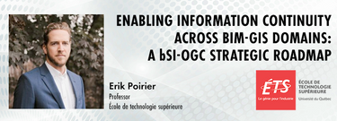
- Enabling information continuity across BIM-GIS domains: a bSI-OGC strategic roadmap Ottawa Conference and Event Centre - buildingSMART Canada tract
- 2:00 PM - 2:30 PM | 30 minutes
- buildingSMART and the Open Geospatial Consortium have recently published the results of their collaborative effort aimed at developing a joint road...
- Talk

2:30 PM
2:30 PM
- Scaling Data In Complex Projects Ottawa Conference and Event Centre - buildingSMART Canada tract
- 2:30 PM - 3:30 PM | 1 hour
- The presentation will be focused on the deployment of technological processes on the Centre Block Rehabilitation project and illustrate how the tea...
- Talk


