
Catherine Robin
Catherine Robin is at the Canadian Geodetic Survey (CGS) since 2011, and is currently section chief (Geodetic Analysis and Development). She leads the implementation of the Canadian Spatial Reference System (CSRS) modernization project at CGS, and chairs the Unified Reference Frames Task Team of the Canadian Geodetic Reference System Committee (CGRSC).
Sessions in which Catherine Robin attends
Monday 12 May, 2025

This open forum invites all attendees to engage in discussions on Canada’s path toward greater self-reliance in the geospatial sector, particularly in light of emerging trade conflicts, including the recent U.S. tariffs, and evolving global geopolitical shifts. The forum will explore strategies to strengthen Canada’s technological capabilities and reduce reliance on external sources, with a focus on fostering innovation, security, and growth.


Canada's Centre for Mapping and Earth Observation (CCMEO) and GoGeomatics Canada have invited Canadian students to use GEO.ca, the definitive source for Canada's open geospatial information, to develop innovative solutions for a specific challenge scenario in the months leading up to GeoIgnite.The results of the 2025 Hackathon will be announced at GeoIgnite. The presentation will include an overview of GEO.ca and the purpose and challenge of the Hackathon, followed by presentations from t...

Join us for the OGC Canada Forum! We’ll dive into key topics like the Canadian Geospatial Data Infrastructure (CGDI) and how Building Information Modeling (BIM) integrates with Geographic Information Systems (GIS). This event gathers experts from industry, academia, Indigenous organizations, and government to explore these technologies' impact on Canada’s built environment. We'll also cover how OGC standards boost interoperability and innovation. All Canadian organ...


Tuesday 13 May, 2025

The Canadian Hydrographic Service (CHS) is Canada's agency for charting Canadian waters. Canada has the longest coastline of any country in the world, with more than a third of its territory under water. As a maritime nation, global maritime transport traffic is significant. Hydrography supports safe navigation and shipping through the production of nautical charts and other publications including water levels. With opportunities provided by emerging technologies and the move to e-navig...


In 2006, British mathematician Clive Humby declared that data was the new oil. Soon after there was a significant rush around the world to embrace a data revolution to try and improve humanity’s social, economic and environmental well being. Twenty-years later, the hard work of data continues. Like Canadian oil and gas, it is for the most part – a landlocked asset; unable to push us to the next levels of productivity and innovation. This keynote looks at ...

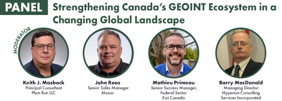
Keith J. Masback is one of the most respected voices in the field of geospatial intelligence (GEOINT), with over three decades of leadership spanning the U.S. government, military, and private sector. His deep expertise in remote sensing, intelligence, and national security has positioned him at the forefront of how geospatial data is used for strategic decision-making.As the former CEO of the United States Geospatial Intelligence Foundation (USGIF) and a senior leader at the National ...


A seasoned leader in geomatics and Earth Observation with two decades of experience in the federal government, Eric Loubier has vast expertise in developing and implementing national geomatics and Earth observation strategies. In his talk, Eric will explore the integration of AI with Earth observation, and how this powerful combination is transforming Canada’s approach to addressing critical national issues like climate change, natural resource management, urban planning, and disaster response.


Wednesday 14 May, 2025

Mini Continental BreakfastGeoIgnite is delighted to offer a selection of chilled fruit juices, freshly baked croissants, muffins, and breakfast pastries, served with butter and preserves. Guests can also enjoy fruit cocktails and yogurt. Available beverages include coffee, tea, and decaffeinated coffee.


The Oceans cover more than 70% of our Planet… with offshore, near shore and coastal waters including rivers and lakes that are navigable or not.This Keynote Address will kick off the Hydrospatial Track on Day TWO of the GeoIgnite 2025 - Ottawa. The presentation will articulate the context and the timing of WHAT is HYDROSPATIAL in the global Geospatial community? SO WHAT is important to Measure, to Monitor an to Model? THEN WHAT is the Strategy, the Challenges, t...


As the geopolitical landscape shifts and a new global space economy emerges, Canada must navigate complex international dynamics and seize opportunities in all facets of the space ecosystem. In this talk, we will explore how space can be part of the solution to geopolitical and national challenges—and what Canada must do to stay ahead in a rapidly evolving global landscape.


Presenting the CHN and highlighting how its new features leverage advancements in hydrography to improve both water-related models and their applications to support decision making. The Canadian Hydrospatial Network (CHN) was officially launched this past May, marking a significant milestone in the development of hydrospatial networks in Canada. Over the past year, the network has expanded and grown in importance, positioning itself as a key resource for the future of its field. CHN continues...

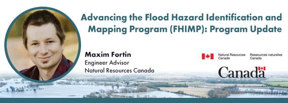
Under the FHIMP, Natural Resources Canada, supported by Public Safety and Environment and Climate Change Canada, collaborates with provinces and territories to create, and disseminate engineering-level flood hazard maps and information. In this presentation, Natural Resources Canada (NRCan) will provide an update on the ongoing work under FHIMP with results of the first stage of the FHIMP (2021-24) and the kickoff of the FHIMP expansion (2023-2028) which will see investments in every jurisdic...


The successful implementation of the S-100 suite hinges on various factors, with final product specification and comprehensive testing of route monitoring layers being paramount. Canada is proposing an international designated area for these tests, underscoring its commitment to the S-100 suite's success and global maritime safety. Canada has selected the St-Lawrence River in Québec as the S-100 sea trial area for 2025. The trial aims to evaluate the S-100 system's ability to ingest and displ...


In 1976 the Canadian Hydrographic Service was the first hydrographic agency to recognize and display a satellite-discovered feature on a nautical chart. This was the discovery of Landsat island off the coast of Labrador.In the time since the capabilities of satellites to survey coastal waters have grown exponentially yet the use of satellite based depth information on nautical charts has not. Satellite based surveying offers a multitude of benefits to the safety of operations, empowering ...


Aerial thermal infrared (TIR) surveys have been a crucial tool supporting river restoration project across the North America as many salmonid-bearing rivers are projected to warm in the coming decades due to increases in atmospheric temperatures and concomitant decreases and earlier melt of snowpack. The objectives of collecting TIR imagery are to assess the current summer thermal state and the distribution of cold-water refuges within the river system, and to identify opportunities and...


In this session, we will explore key trends and insights from FEMA's National Flood Insurance Program (NFIP) data for the United States. Using publicly available data from OpenFEMA, we will analyze patterns in flood risk and claims frequency, with a particular emphasis on the impacts of major flooding events such as Hurricane Katrina (2005) and Hurricane Sandy (2012). Through a deep dive into historical claims data, we will uncover trends over time and examine how these significant storms, al...


New innovations in hydrography has led to the use of a next generation Uncrewed Survey Vessel for the collection of bathymetric data in Canadian waters. The Canadian Hydrographic Service contracted IIC Technologies to test the suitability of the latest Autonomous Survey Technology in remote locations with challenging weather conditions. The contract required the acquisition of high-resolution bathymetric data in water depths of up to 200m over an 8002km area off of Thunder Bay, Ontario,...


In a world of constant change and uncertainty, how can we make informed decisions in real-time, grounded in the realities of ambiguity? This presentation tackles these fundamental questions by exploring the evolution of how we understand and interpret our world—from childhood curiosity to professional expertise—and how these insights shape decision-making in complex environments.Using case studies in GEOINT adoption inside and outside traditional national security communities, I will d...

With still about 75% of our ocean still insufficiently surveyed, the hydrospatial challenges ahead are immense - yet so are the opportunities. Join this dynamic panel of LEADERS to hear their vision and insights on the future of ocean, coastal mapping and digital data. The discussion will feature experts in: Hydrospatial Information Systems (HIS/GIS)Satellite-Derived Bathymetry (SDB)In-situ SurveyingResearch & EducationGovernm...


The Canadian Ocean Mapping Research and Education Network (COMREN) is a national group of academic, non-profit, and federal researchers in ocean and coastal mapping. Since 2016, COMREN has focused on developing research activities, technology transfer to industry, and educational programs that support ocean mapping as a network of dedicated individuals. The group partners with government agencies and international organizations to increase Canada’s domestic and global ocean and coastal mappin...