Tiffany Chisholm
Sessions in which Tiffany Chisholm attends
Monday 12 May, 2025

This open forum invites all attendees to engage in discussions on Canada’s path toward greater self-reliance in the geospatial sector, particularly in light of emerging trade conflicts, including the recent U.S. tariffs, and evolving global geopolitical shifts. The forum will explore strategies to strengthen Canada’s technological capabilities and reduce reliance on external sources, with a focus on fostering innovation, security, and growth.


BUY YOUR TICKETAre you a GIS professional navigating the evolving intersection of GIS and BIM? Or a government decision-maker wondering why integrating the built environment into GIS is crucial for your department’s future? Join us for BIM & GIS: Smarter Data, Smarter Decisions, a foundational wo...

BUY YOUR TICKETJoin SolidCAD and EllisDon for an in-depth overview of the buildingSMART Certification plus additional information on ISO 19650 compliance and BIM Executive Management using Plannerly.All stakeholders in the construction and real estate industry who are eng...


Join us for the OGC Canada Forum! We’ll dive into key topics like the Canadian Geospatial Data Infrastructure (CGDI) and how Building Information Modeling (BIM) integrates with Geographic Information Systems (GIS). This event gathers experts from industry, academia, Indigenous organizations, and government to explore these technologies' impact on Canada’s built environment. We'll also cover how OGC standards boost interoperability and innovation. All Canadian organ...


BUY YOUR TICKETThe workshop begins with IFC model preparation using BonsaiBIM, where participants will learn to create or modify an IFC model enriched with precise geospatial data, including longitude, latitude, and elevation and potentially export the geometry to glTF for web integration. Next, the focus shi...


📅 Date: Monday, May 12, 2025📍 Location: Rainbow Bistro, 76 Murray Street, ByWard Market, Ottawa⏰ Time: Networking at 6:30 PM | Panel begins at 7:00 PM | Live music to follow🍽 Details: Cash bar and hors d’oeuvres provided Event OverviewJoin us for an evening of high-level discussion, networking, and live music in the heart of Ottawa’s historic By...


Tuesday 13 May, 2025

Mini Continental BreakfastGeoIgnite is delighted to offer a selection of chilled fruit juices, freshly baked croissants, muffins, and breakfast pastries, served with butter and preserves. Guests can also enjoy fruit cocktails and yogurt. Available beverages include coffee, tea, and decaffeinated coffee.


For decades, Canada’s geospatial ecosystem has thrived on deep integration with the U.S., benefiting from shared technology, markets, and collaboration. But today, shifting geopolitical and economic realities—trade conflicts, supply chain vulnerabilities, and data sovereignty concerns—are forcing us to rethink this reliance. The question is no longer whether we should adapt, but how.

Dr. Nadine Alameh, the inaugural Executive Director of the Taylor Geospatial Institute, has been leading an ambitious effort to accelerate geospatial research for tackling today’s biggest challenges—climate, disasters, health, and national security. In this session, she will reflect on what it takes to build a truly impactful geospatial ecosystem, challenge assumptions about the roles of national mapping agencies, academia, and nonprofi...

In 2006, British mathematician Clive Humby declared that data was the new oil. Soon after there was a significant rush around the world to embrace a data revolution to try and improve humanity’s social, economic and environmental well being. Twenty-years later, the hard work of data continues. Like Canadian oil and gas, it is for the most part – a landlocked asset; unable to push us to the next levels of productivity and innovation. This keynote looks at ...

Artificial Intelligence is transforming how we interpret and act on information—but what does that mean for the geospatial world? As AI models generate synthetic maps, infer locations, and automate analysis, geospatial professionals face a critical moment: will we shape the future, or be shaped by it?In this session, the CEO of the Open Geospatial Consortium (OGC) will explore the complex relationship between AI and geospatial systems—from the risks of black-box models and data halluci...

Top technical performers are often promoted into leadership roles, yet many struggle. In AI-driven, data-intensive industries, expertise alone is not enough—leaders must also navigate complexity, inspire teams, and drive execution. Without these skills, organizations face decision paralysis, disengaged teams, and stalled innovation.Senior leaders know that competency is crucial—technical excellence is the foundation of succes...


At GeoIgnite 2025, Alexander will explore how Canada's geospatial community is uniquely positioned to lead in developing solutions to environmental challenges in a rapidly changing geopolitical landscape. Drawing on compelling case studies from around the globe, including successful Dutch-Canadian collaborations, he will demonstrate how geospatial technologies are becoming indispensable tools for environmental monitoring, climate resilience planning, and sustainable...

A seasoned leader in geomatics and Earth Observation with two decades of experience in the federal government, Eric Loubier has vast expertise in developing and implementing national geomatics and Earth observation strategies. In his talk, Eric will explore the integration of AI with Earth observation, and how this powerful combination is transforming Canada’s approach to addressing critical national issues like climate change, natural resource management, urban planning, and disaster response.


GET YOUR TICKETMORE PURCHASING OPTIONSJoin us for an exclusive Networking Party at the Canada Science & Technology Museum as part of the 2025 buildingSMART Canada National...
Wednesday 14 May, 2025

Mini Continental BreakfastGeoIgnite is delighted to offer a selection of chilled fruit juices, freshly baked croissants, muffins, and breakfast pastries, served with butter and preserves. Guests can also enjoy fruit cocktails and yogurt. Available beverages include coffee, tea, and decaffeinated coffee.

As the built asset industry embraces digital transformation, the integration of Building Information Modeling (BIM) and Digital Twin technologies is redefining how we manage the built environment. While BIM facilitates data-rich 3D modeling during design and construction, Digital Twins extend this functionality into operations, enabling real-time insights and lifecycle optimization.Attendees will gain insights into buildingSMART Canada’s initiatives supporting this integration, its ali...


As digital collaboration becomes the norm in the construction industry, ensuring the authenticity and integrity of Building Information Models (BIM) is more critical than ever. While BIM and openBIM standards, such as the Industry Foundation Classes (IFC), have improved interoperability and data exchange, challenges remain in verifying data at the object level.This presentation explores the potential of digital signatures as a solution to enhance trust, transparency, and traceability i...


Presenting the CHN and highlighting how its new features leverage advancements in hydrography to improve both water-related models and their applications to support decision making. The Canadian Hydrospatial Network (CHN) was officially launched this past May, marking a significant milestone in the development of hydrospatial networks in Canada. Over the past year, the network has expanded and grown in importance, positioning itself as a key resource for the future of its field. CHN continues...


This session unveils the findings of this groundbreaking report, which builds on international research and best practices in digital construction from countries leading in BIM and data standards. Central to the roadmap is the use of OpenBIM principles to ensure compatibility, transparency, and collaboration across diverse systems and stakeholders. The report outlines strategies to enhance data management, improve BIM compatibility, achieve interoperability within Common Data Environments (CD...


This talk will highlight method innovations in water research using satellite earth observations (SEO) in the Canada Centre for Mapping and Earth Observation (CCMEO) of Natural Resources Canada (NRCan). They include dynamic surface water mapping and modelling for water areas and water volume changes, terrestrial water storage variations, groundwater recharge evolution and storage changes, water extreme events (drought and flood) characterization, and environmental and climate impacts on the w...


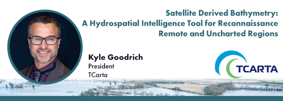
In 1976 the Canadian Hydrographic Service was the first hydrographic agency to recognize and display a satellite-discovered feature on a nautical chart. This was the discovery of Landsat island off the coast of Labrador.In the time since the capabilities of satellites to survey coastal waters have grown exponentially yet the use of satellite based depth information on nautical charts has not. Satellite based surveying offers a multitude of benefits to the safety of operations, empowering ...


In this session, we will explore key trends and insights from FEMA's National Flood Insurance Program (NFIP) data for the United States. Using publicly available data from OpenFEMA, we will analyze patterns in flood risk and claims frequency, with a particular emphasis on the impacts of major flooding events such as Hurricane Katrina (2005) and Hurricane Sandy (2012). Through a deep dive into historical claims data, we will uncover trends over time and examine how these significant storms, al...


The convergence of generative artificial intelligence and geospatial technology is transforming how we validate and ensure the quality of location-based data. This talk explores how AWS is enabling new approaches to geospatial data validation through the power of generative AI, which helps public and private sector organizations achieve their sustainability missions.As we operate in a world with more earth observation data being generated everyday, the planet is imaged daily and, with ...


New innovations in hydrography has led to the use of a next generation Uncrewed Survey Vessel for the collection of bathymetric data in Canadian waters. The Canadian Hydrographic Service contracted IIC Technologies to test the suitability of the latest Autonomous Survey Technology in remote locations with challenging weather conditions. The contract required the acquisition of high-resolution bathymetric data in water depths of up to 200m over an 8002km area off of Thunder Bay, Ontario,...


Digital Twins hold enormous potential for the buildings and infrastructure sectors, but their implementation faces key challenges. What is a Digital Twin? The industry lacks a clear consensus, leading to misinformation and confusion. While Digital Twins can scale, not every project requires every possible capability—so how do we manage this effectively? More importantly, the industry is not ready—foundational work in data standards, interoperability, and governance is still needed.In r...


In today’s fast-paced world, having timely information at your fingertips is more important than ever. That’s why Health Canada’s Radiation Protection Bureau reached out to Natural Resources Canada’s Centre for Mapping and Earth Observation (CCMEO) for geomatics expertise. The two departments collaborated to create the Real-Time Environmental Radioactivity Monitoring dataset. This map and geospatial data give Canadians clear information on radioactivity levels and fluctuations from natural so...


As digital transformation reshapes the global construction industry, many countries have implemented BIM mandates to drive standardization, efficiency, and improved project outcomes. But does Canada need one?This panel brings together industry leaders, policymakers, and technology experts to debate whether a national BIM mandate is the right approach for Canada. Advocates argue that mandates drive consistency, enhance productivity, and align Canada with international best practices. Sk...