
Zackary King
Sessions in which Zackary King attends
Monday 17 June, 2019

Gain insights on the possibilities and challenges with leveraging and integrating a complete open source GIS stack into your applications and projects. Sessions will be led by members of OSGEO-Ottawa.The first session involves high level presentations showcasing use case scenarios and highlighting strengths and limitations of each tools. This session is designed for managers, analysts, and non-technical individuals to discover and learn about what open source GIS tools are available, ...

The second session is a hands-on workshop, with a maximum participation of 12, and is designed more for participants that have a more technical background. This allows them to actually gain practical experience in the use of the open source GIS tools. Sessions will be led by members of OSGEO-Ottawa. Topics will include leveraging QGIS Desktop and the Semi-Automatic Classification plugin to extract a forest canopy cover map of Ottawa using either Sentinel or Landsat satellite imagery...
Tuesday 18 June, 2019

Jonathan Murphy the Founder of GeoIgnite and GoGeomatics welcome participants to the conference

Mayor Watson welcomes delegates, exhibitors and VIPS to the inaugural National Geospatial event in Canada.
There's never been a more exciting time to be a part of the geospatial profession. From mapping the infrastructure beneath our cities to indoor wayfinding, to plentiful and powerful remote sensing capabilities in air and space which we could hardly have imagined just a few years ago, the opportunities - and the expectations - for geospatial professionals are immense. Technology is evolving at a pace which outstrips the ability of academics, governments, and industries to keep pace. How will w...

Let’s admit it! We live in exciting times with technology, social interactions and business models changing before our eyes: Flying taxis, self-driving cars, commercial Space missions, smart cities, SmallSats and Internet Of Things (IOT) to name just a few innovations! Our kids are growing up in a world of on-demand TV, GPS availability, all around virtual assistants, and mobile devices that pretty much can do anything! Each and every one of these innovations has a location element to i...
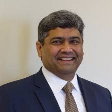
Prashant Shukle is the Director General for the Canada Centre for Mapping and Earth Observation Branch, Earth Sciences Sector, at Natural Resources Canada (NRCan).NRCan has fostered an enabling policy mechanism and provided a conducive framework for geospatial information infrastructure. In today’s digital age when geospatial is becoming more and more ubiquitous, open and inter-disciplinary policies are the key instruments of harnessing the true value of this wonderful technology...
What are the ramifications of the current digital transformation globally and what will it mean for Canada and the globe? Our award winning panel of international and Canadian experts disscuss and take questions from delegates.


Alberta View: Economic impacts and Opportunities of the Geospatial SectorLocation technologies are changing the way we live, work, and play, and are having a transformative impact on industries across Canada. The intersection of location technologies with Virtual Reality and Augmented reality are rapidly transforming key sectors of the Canadian economy including transportation, the resource sector, the digital and interactive media sector and transforming how governments d...

The future is digital. Big data is an integral part of the digital transformation of a private or public organization. Location and geospatial technologies are at the heart of the digital transformation as enablers, game changers and contribute to the success of big data in many ways. Combined with emerging geospatial artificial intelligence, the possibilities are limitless. Smart cities and autonomous vehicles are examples of this potential. However, this big data revolution raises many lega...

Several key trends in the geospatial industry over the last few years have created the conditions needed to truly leverage remote sensing as a technology that has the potential to provide tremendous benefit to civil society. These include changes in data policy, most notably with USGS's decision in 2008 to make all Landsat archives free and open, a policy which led the European Space Agency to also implement free and open access to the Copernicus constellation. The volume of data that is incr...

Hope Spots are special places that are critical to the health of the ocean — Earth’s blue heart. Some Hope Spots are already formally protected, while others still need defined protection. The Mission Blue team has embarked on a series of expeditions to shed light on these vital ecosystems and ignite support to safeguard them as marine protected areas.The IUCN are an integral partner in the Mission Blue initiative and the Hope Spot concept ties into UN amb...

Today, geospatial technologies are embedded in many of the workflows that support the Fourth Industrial Revolution and therefore invaluable to users. This means that geospatial information is no longer the domain of specialists and suddenly has become a context for the rest of our augmented existence.From Pokémon Go, to Uber and autonomous vehicles (AV), Internet of Things (IoT) and Artificial Intelligence (AI), smart applications and on-line mapping tools give the public almost insta...

The Internet of Things (IoT) is here. Whether applied to industrial automation, wearables, connected transportation and logistics, drones or smart cities, IoT is poised to disrupt how we work, live and relate to each other, delivering great benefits along with new challenges. Improved revenue, costs, quality of life and convenience benefits are often confounded by concerns such as privacy, security, and social disruption, with location info playing no small role on both sides. So, what exactl...
The UK Government as part of its building information modeling (BIM) initiative has said repeatedly that it expects the big payoff of a digital model will be during operations and maintenance, which typically represents 80% of the cost of a facility. Companies who do design, build, finance, and maintain, or design, build, operate, or PPP projects often employ a full lifecycle BIM + geospatial strategy. For example, Crossrail appears to be the first major project that may be able to provide su...
The Earth is immense, and abundant with interesting information. Recent advancements in geospatial sensors (e.g. satellites, smart phones, meteorological instruments, and LIDAR) have resulted in the development of technologies capable of collecting large and dynamic geospatial data. As a result, we are experiencing an explosion in the volume and variability of geospatial data, and yet many in public remain unaware of or unable to access this wealth of data to make informed decisions regarding...

Cloudy with a chance of data science.Sparkgeo had been building cloud first geospatial applications, from day 1. But that was not the plan. The plan was to make more maps for more people, using the internet.Sitting at the intersection of software development and GIS we see how these two communities can benefit from each other. But, to do so, we will have to step out of our comfort zones.Let me tell you the story of a lowly GIS tech's journey through the technol...

The Mapbox live location platform was designed to serve all levels of government and the critical services they support. Develop custom mapping and location applications from start to finish in your own private cloud or on-premises infrastructure. Atlas offers the same capabilities found on Mapbox.com only offline, and deployable anywhere, even on your own infrastructure. Learn more about accessing and analyzing your sensitive geospatial data on and off network during this 30 minute session. ...

We are entering a new era of positioning, navigation and timing. Global, instantaneous, and easily accessible positioning at better than 10cm is coming, which will provide new ways of doing business and create new businesses in areas such as augmented reality. In recent years global Positioning, Navigation and Timing have been undergoing rapid technological development. New GNSS constellations (Galileo, Beidou) with new signal structures offer increased capabilities, while future posi...
Wednesday 19 June, 2019
Mainstreaming of the geospatial market has created a big demand for geospatial content and solutions across governments, businesses and consumers. The Fourth Industrial Revolution (4IR) has also helped scale up applications and value to much larger markets, amplifying overall impact and contribution of geospatial information in the world economy and society. With every added application and consumer, the return on investments get bigger and better. The panel shall focus...


NAV CANADA is a privately run, not-for-profit organization that is the Air Navigation Service Provider for Canada. With an airspace that spans all three coastlines of the country, from the west coast of British Columbia to the Arctic Ocean in the North to the east coast of Newfoundland, NAV CANADA covers a lot of territory. The Aeronautical Information Management group is responsible for creating instrument flight procedure designs (airways, instrument approach procedures, departure procedure...
Brampton built a hub for the City’s Open Data and made it available to Staff, Citizens, Businesses and Students. The GeoHub makes discovering and using the City’s data more purposeful, and promotes transparency, fostering innovation everywhere. In our ongoing effort to develop a mature GIS system, the GeoHub is a big step in our goal of creating a self-serve environment. The City leveraged ArcGIS Open Data to transform it into a community hub, effectively increasing the usage of Open Data and...
Creating maps has traditionally been a one-way process in which GIS professionals and cartographers translate spatial data into for use by maps used by other knowledgeable professionals. However, as the volume of data being collected by virtually every industry increases the demographic of the map consuming audience is changing to include more people with less GIS knowledge. The challenge has become how best to simplify maps for the user and also to find ways to incorporate input from users i...

As we worked with multiple government organizations this past year, we faced this same question along the way: Should we move our data processes to the cloud? Now as much as we would like to give you a yes or no answer, there are different paths or options you need to explore inside your organization before taking this decision. In this presentation, you will hear about the latest trends and some ways to use the Cloud as a platform for geo data processes. You will also learn different conside...

The Government of Canada purchases on average $22 billion in goods and services each year to help deliver programs and services to Canadians. Many departments and agencies collect and manage large amounts of geospatial data, and significant investments have been made within these organizations. The demand for, and use of, geospatially-related data and tools is rapidly increasing across government, as well as in the broader public context. This information session will help you understand the ...
The purpose of this presentation is to make the case for greater Indigenous participation in the development of geospatial technology and information. Next to government and resource companies, Indigenous people are the prominent stakeholders of the land and all the economic development that can happen on their territory. For this reason, they should have access to their own Geospatial data such as GIS data and ground imagery. Often the sources for Geospatial data comes from the proponent who...

Over the last few years, the Data Exploration and Integration Lab (DEIL) at Statistics Canada has conducted an increasing amount of work with open data using various open source tools in an open ecosystem. This exploration and experience has given rise to the idea of using an “open project” approach; that is, an approach that, to the extent possible, makes use of open source software, open code, open standards, open data, open platforms and open project management tools. The presentation outl...
Due to climate change, natural hazards are happening more in recent days. Analyzing these changes and prediction of future hazards have been always a challenge in the field of Geographic information systems (GISs). Traditional GIS aims to use map versus globe for their models, standards, and analysis. With the advances on Discrete Global Grid Systems, a new research question has been raised on what if we adapt our traditional approaches into a Digital Earth rather than a map. Digital Earth (G...