Hazel Cameron-Inglis
Sessions in which Hazel Cameron-Inglis attends
Monday 28 October, 2024
In this virtual workshop, you will fine-tune a pretrained model from the ArcGIS Living Atlas of the World collection and apply it to high-resolution imagery to efficiently detect and classify objects in ArcGIS Pro. Participants will gain hands-on experience in adjusting the deep learning model parameters to enhance its accuracy and performance for specific use cases. Additionally, you will learn advanced techniques for data preprocessing, prepare training samples, and model evaluation, ensuri...
Join us at the National Geomatics Networking Reception Enjoy a selection of gourmet hors d'oeuvres, including savoury Moroccan lamb meatballs, smoked pork belly lollipops, and wild mushroom arancini with truffle oil. Vegetarian options like vegetable samosas with mango chutney and goat cheese tartelettes will satisfy all palates. Plus, your ticket includes a drink to enjoy while you connect with industry professionals. Elevate your evening with these delicious bites and great company!<...
Tuesday 29 October, 2024
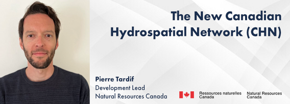
The new Canadian Hydrospatial Network (CHN) is set to replace the National Hydrographic Network (NHN) for Canada. Designed for improved use in hydrological models, the CHN is analysis ready with full-network traversing ability, and value-added attributes such as stream order. The CHN is also created from higher-resolution source data and better aligned to elevation than the NHN, where possible, and has been streamlined for production and maintenance.Work is on-going to refine methods a...
The Alberta Biodiversity Monitoring Institute (ABMI) defines human footprint as the visible alteration or conversion of native ecosystems to temporary or permanent residential, recreational, agricultural, or industrial landscapes. It also includes land that is periodically reset to earlier successional conditions by industrial activities such as forestry harvest areas and seismic lines. To monitor and map human footprint across Alberta, the ABMI, in partnership with the Alberta Human Footprin...
Building Information Modeling (BIM) is transforming the built asset industry, yet firms of varying sizes—large, medium, and small—adopt BIM in distinct ways tailored to their unique resources and project demands. This session will explore BIM’s origins, current applications, and future directions as shared by representatives from three different firms. A significant focus will be on the importance of data integrity and governance, particularly as Artificial Intelligence (AI) becomes increasin...
How exactly does artificial intelligence work and what can you use it for in the geomatics domain? Using real-life examples from our projects, they demonstrate how you can use AI to gain new insights and increase efficiency by automating your data processing workflows.We explore how GeoAI is fusing spatial data science and Geomatics technology to help automate the extraction, classification, and analysis of all types of spatial or non-spatial data. Learn how GeoAI can detect clusters, ...
Sessions: Human footprint datasets for Canada: mapping and monitoring in support of land and resource managementDisturbance is a key component of boreal-forest ecosystems, impacting their structure and functions. In Alberta, disturbances are both natural and anthropogenic, including > 30,000 sqkm of harvest areas. The recovery of all types of forest disturbance influences not only local landscapes, but also carbon dynamics and biodiversity. In the face of a changing climate, the imp...
From ancient cave drawings depicting hunting grounds to hand-sketched layouts of backyard gardens, humans conceptualize space through map making. Maps serve both to capture what exists on the landscape and to plan future uses by intentionally defining where specific activities can happen. Modern satellite technology creates geospatial datasets that can contribute to current and proposed land use management planning, all underpinned by the pursuit of the public good.Background
Maintaining undisturbed habitat is key to the recovery strategy of the Woodland Caribou boreal population. Seismic lines have been identified as a human footprint feature that requires specific attention for habitat restoration in part because linear features are linked to increases in the predation rates of caribou as they provide lines of sight and easy transportation routes for predators. It is estimated that there are hundreds of thousands of kilometers of seismic lines within Alberta (AB...
Accurate mapping of road networks is essential for navigation, disaster response, and urban planning. Traditional methods relying on remote sensing images, Lidar data, and GPS trajectories are hampered by time-consuming manual updates and incomplete extraction due to obstructions from trees, buildings, and shadows. However, recent advancements in deep learning models have shown promise in improving road mapping and automating the detection of missing roads.This study uses a transfer le...
Large-scale habitat inventories are necessary for understanding how human land-use, natural disturbances (e.g., fire) and climate change are influencing ecological processes, species declines and how restoration can address these changes. Within the boreal forest of Alberta, Canada anthropogenic habitat alteration, also referred to as human footprint or the physical disturbance of a landscape as a result of human activity, covers over 19% of the land area. Much of this human footprint is not ...
Session Human footprint datasets for Canada: mapping and monitoring in support of land and resource managementHuman activities have disturbed biodiversity, ecosystems, and ecological processes over the last century. Given the growing trends of habitat loss and biodiversity decline, understanding patterns of human pressures has become a crucial element of conservation planning. In this context, cumulative pressure mapping is used to quantify the extent and intensity of multiple pressure...
The environmental industry has witnessed a significant transformation in recent years, driven by the adoption of advanced positioning technologies. Geomatics positioning tools have emerged as a pivotal component in this paradigm shift, offering unparalleled precision, efficiency, and accuracy in environmental monitoring, management and remediation projects. ProDelta Projects has been an early adopter and developer of these tools including Field DMS, Smart Dig, R20 and through our Minimal dist...
Regional and provincial conservation efforts require detailed human pressure mapping to manage and mitigate human impacts effectively. However, in the province of British Columbia (BC), existing efforts to map human pressures have faced significant challenges, particularly in adequately capturing their full extent. The Geospatial Centre of Biodiversity Pathways at the University of Northern British Columbia, in collaboration with the West Moberly First Nations and the Alberta Biodiversity Mon...
For the last five years I have been providing reality capture services to documentary film producers. These series have included NatGeo's Buried Secrets of WWII, NatGeo's Drain the Oceans, Discovery's Expedition Unknown and Expedition Bigfoot. LiDAR, photogrammetry, thermography, magnetometry, and multi spectral imagine all provide context that professional storytellers (TV producers) crave. Join me as I share stories, successes, and failures of these unique service offerings.
The Riparian Web Portal (www.riparian.info) is an award-winning project, launched in 2021 by Alberta’s watershed community. This dynamic online space empowers Albertans to enhance riparian health through interactive access to comprehensive data and resources. It serves a crucial role in advancing the riparian health objectives pursued by various watershed groups.At its core, the portal integrates innovative GIS-based assessments from six watershed agencies, covering over 60,000 km of r...
Stand Out in a Crowded Market In a world overflowing with information, every company needs a compelling marketing strategy to stand out. It’s not enough to simply analyze and map data—you need to tell its story in a way that truly resonates with people. But let’s face it—translating complex geospatial data into engaging content can be a challenge.
Today, digital twins, autonomy and artificial intelligence (AI) dominate the lexicon of the geomatics industry. These capabilities provide significant productivity advantages to our profession, but our domain content and knowledge are critical to their success. These tools will change the way we work and transform the industry. However, they will not replace us, but rather change our role. This is no different than when the EDM, total station, CAD, or GPS became part of our professional lives...
Wednesday 30 October, 2024
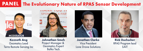
RPAS platforms and sensors have come a long way since their commerical adoption almost a decade ago and have quickly become a main stay of many professional's tool kits. This show's the industry's appetite for adopting new technologies and matching them up with the right application. With a pannel of very experienced professionals from various sectors of Canada's Geospatial RPAS scene, we explore what has driven sensor development and how sensors might further develop along the lines of use c...
We will explore tangible ways in which to involve Indigenous people, especially youth, in a new ad, emerging infrastructure business sector.Dale Booth will lead you through a more fulsome understanding of Indigenous inclusion and participation on major infrastructure projects and how working with Indigenous companies, especially in the BIM modelling space, can greatly improve opportunities for everyone.Innovation 7 has been successful in the identification of training and work p...
Photogrammetry is not just limited to aerial platforms. Modern mobile devices contain high-quality cameras and increasingly have LiDAR and depth sensors built in. When combined with high-accuracy GNSS systems, these mobile devices can quickly collect accurate data for utilities, infrastructure, inspection, as-builts, construction, and more. Utilizing these readily available devices can reduce project delays, capture better documentation of utilities, and lay the foundations for digital infras...
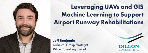
Dillon was retained by the Government of Nunavut to perform a Needs Assessment for the rehabilitation of the Runway 13-31, Taxiway A (Alpha), Taxiway C (Charlie), Apron A, and Apron C of the Rankin Inlet Airport.The project included pavement rehabilitation and geotechnical investigations for Runway 13-31, which is a 6000’ x 150’ asphalt paved runway, along with Phase I ...
With drones like the DJI Matrice 300 now being positioned using RTK GNSS, combined with Structure from Motion (SfM), high precision mosaics are possible without deploying targets. The ability to mount lidars (DJI L1 and L2) and other optical sensors (RGB, multispectral, thermal) allows for precise surveying and the production of high resolution and high accuracy mosaics with minimal ground control. While battery power still remains an issue and the limiting factor for flight duration (10’s of...
As the drone industry is increasingly focuses on developing larger airframes and equipping them with bigger sensors, Spexi is taking a revolutionary approach to aerial imagery. At Spexi, we believe that the future of geospatial data collection lies not in size and complexity, but in numbers and standardization. The Spexi platform leverages the power of crowdsourcing, deploying local pilots with small drones to capture standardized imagery across entire cities. This method allows us to achieve...
Project Overview: Discuss the integration process of the Connectiv LiDAR system with the Velos Rotors V3 UAV, focusing on custom modifications for transportation infrastructure inspections and topographic mapping. Highlight the key features and benefits of the custom UAV solution, such as modularity, precision, and safety.Innovative Payloads: Highlight the use of Phase One P3, Drone Rescue Systems DRS-25 parachute, Riegl MiniVux3, and Sony 61 MP camera.Technological Advancements...
Traditional teaching methods in post-secondary often included using powerpoint presentations and writing on a white or blackboard. The newer generations of students have been exposed to different ways of learning and this requires instructors or teaching professors to change their way of presenting information to help the students learn it at a deeper level. Using a radical constructivism philosophy, the students are required to engage in the material in their own way, connect wit...
How do hydrographic surveys, aerial Remote Sensing and GIS help with environmental efforts? Terra explores 2 projects that use a combination of different sensors and visualizations to achieve these goals. The projects include a rapid marine data collection supported by Aerial LiDAR to aid in rescue efforts of a trapped Orca cafe, and using LiDAR with GIS to support change detection efforts of a major land slide.


