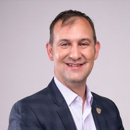
Iliana Tsali
Sessions in which Iliana Tsali attends
Monday 28 October, 2024
We are excited to announce that the next Canada Forum will be held during the GoGeomatics Expo in Calgary, from October 28th to 30th. This event will bring together key stakeholders from across Canada’s geospatial sector, including industry leaders, academics, indigenous communities, government representatives, and technologists, to continue vital discussions on advancing geospatial standards, interoperability, and spatial data infrastructure (SDI) in Canada.
Join us at the National Geomatics Networking Reception Enjoy a selection of gourmet hors d'oeuvres, including savoury Moroccan lamb meatballs, smoked pork belly lollipops, and wild mushroom arancini with truffle oil. Vegetarian options like vegetable samosas with mango chutney and goat cheese tartelettes will satisfy all palates. Plus, your ticket includes a drink to enjoy while you connect with industry professionals. Elevate your evening with these delicious bites and great company!
Tuesday 29 October, 2024
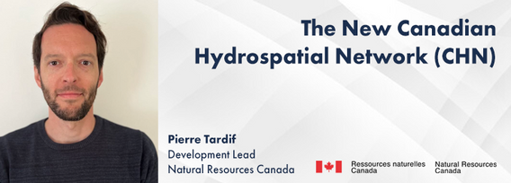
The new Canadian Hydrospatial Network (CHN) is set to replace the National Hydrographic Network (NHN) for Canada. Designed for improved use in hydrological models, the CHN is analysis ready with full-network traversing ability, and value-added attributes such as stream order. The CHN is also created from higher-resolution source data and better aligned to elevation than the NHN, where possible, and has been streamlined for production and maintenance.Work is on-going to refine methods a...
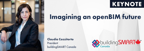
We explore the motivations behind the implementation of openBIM and its integral role in advancing the built asset industry. The built environment is immense and complex, it is also a huge responsibility. Our industry directly impacts it, designing, creating and maintaining it. In an era where what we all need is a better built environment, openBIM stands out as a key enabler. Together we will imagine a future where our industry works more effectively, efficiently and with more c...
The session will focus on considerations for deploying Artificial Intelligence in professional practice; identifying potential landmines and working on solutions from a privacy-first perspective. The talk will include a high-level overview that underscores the fundamental components that encapsulate an AI derived “solution” and delve into a practical, real-world example being tested on an active project.Topics Covered:• An illustrated example of BIM model query using AI• AI too...
Water is one of our most vital resources, and its management is becoming increasingly complex in the face of climate change, population growth, and competing demands from agriculture, industry, and municipalities. This panel will delve into how geospatial technologies are revolutionizing water policy by providing the data-driven insights needed for smarter decision-making.Join leading experts from academia, provincial and federal gov...
The environmental industry has witnessed a significant transformation in recent years, driven by the adoption of advanced positioning technologies. Geomatics positioning tools have emerged as a pivotal component in this paradigm shift, offering unparalleled precision, efficiency, and accuracy in environmental monitoring, management and remediation projects. ProDelta Projects has been an early adopter and developer of these tools including Field DMS, Smart Dig, R20 and through our Minimal dist...
Menu - Big Four OutletAppetizersRoasted Diablo Pork Bites (12) (GF/DF) SaladsSpiced Cauliflower, Chickpea & Tofu Bowl (GF/DF/V/VE) Sweet Potato, Roasted Cauliflower, Chickpeas, Mint Chutney,Grilled Tofu, Madras Curry DressingClassi...
The health of the global ocean environment is of critical importance. Planetary limits for climate change and biodiversity are being reached, and unsustainable resource management practices are rampant. Space-based Maritime Monitoring has proven to provide foundational support for sustainable management of ocean resources. In the Keynote, John will provide a high-level overview of ocean problems, space-based maritime monitoring, the beneficiaries and outcomes of the application of...
The Riparian Web Portal (www.riparian.info) is an award-winning project, launched in 2021 by Alberta’s watershed community. This dynamic online space empowers Albertans to enhance riparian health through interactive access to comprehensive data and resources. It serves a crucial role in advancing the riparian health objectives pursued by various watershed groups.At its core, the portal integrates innovative GIS-based assessments from six watershed agencies, covering over 60,000 km of r...
The integration of AI in infrastructure modeling has the potential to revolutionize decision-making processes by providing accurate predictions, identifying vulnerabilities, and optimizing resource utilization.The increasing complexity of modern infrastructure systems, coupled with growing demands on utilities, has necessitated the adoption of advanced analytical techniques. This panel discussion brings together ideas from acad...
Menu - Big Four OutletAppetizersRoasted Diablo Pork Bites (12) (GF/DF) SaladsSpiced Cauliflower, Chickpea & Tofu Bowl (GF/DF/V/VE) Sweet Potato, Roasted Cauliflower, Chickpeas, Mint Chutney,Grilled Tofu, Madras Curry DressingClassi...
Methane is a greenhouse gas that has a global warming potential 80 times greater than carbon dioxide over a 20-year period. Reducing methane emissions from industrial facilities is one of the most effective ways to reduce greenhouse gas emissions. This talk gives an overview of GHGSat’s approach to providing stakeholders actionable data by detecting, geolocating, and quantifying methane emissions using our fleet of space-based and airborne instruments.
Wrap up the first full day of Canada's National Geomatics Expo with the GoGeomatics Meetup! This lively party and networking event, free to attend, starts right after the day's sessions, offering a perfect blend of fun and professional interaction. Held on the expo main floor, the meetup features a cash bar to help you unwind and enjoy the evening. Join us for an exciting night of music, mingling, and making connections with fellow attendees. Don't miss this chance to relax and expand your ne...
buildingSMART Canada will summarize the buildingSMART International Certification Program and its implementation in Canada. Attendees will gain insights into how the certification process works, including the steps required for individuals and organizations to achieve certification. We will explain the program's goals, benefits, and by adhering to internationally recognized standards, professionals and organizations in Canada can ensure enhanced collaboration, interoperability, and efficiency...
Maxar has doubled the size of its electro-optical constellation in 2024 with the launch of four new WorldView Legion satellites, and two more will be launched soon. The Maxar constellation will be tripling its 30 cm-class resolution imaging capacity and collecting imagery at new times of day. This speech will cover what these new imaging capabilities mean for monitoring opportunities that will enable energy companies to optimize operations and stay ahead of risk.
Today, digital twins, autonomy and artificial intelligence (AI) dominate the lexicon of the geomatics industry. These capabilities provide significant productivity advantages to our profession, but our domain content and knowledge are critical to their success. These tools will change the way we work and transform the industry. However, they will not replace us, but rather change our role. This is no different than when the EDM, total station, CAD, or GPS became part of our professional lives...
Wednesday 30 October, 2024
Local governments have been updating their asset inventories to comply with the TCA legislation since the early 2000s, paying particular attention to the attributes, locations, ages and conditions of their assets. However, infrastructure changes constantly due to capital projects and land development, especially in fast-growing municipalities like Kelowna. Collecting accurate and complete information on new assets has been a major challenge, mainly due to limited staff resources. To address t...
Join us for an engaging panel discussion on Geo-Entrepreneurship, featuring distinguished experts from geospatial consultancies, geomatics communication and event companies, and geomatics software firms. This session is designed for those interested in the intersection of geospatial technology and entrepreneurship.Journey to Entrepreneurship: Hear from our panelists on their motivations for leaving traditional careers to pursue entrepreneurial ventures in the geospatial field. Dis...
Menu - Big Four OutletAppetizersRoasted Diablo Pork Bites (12) (GF/DF) SaladsSpiced Cauliflower, Chickpea & Tofu Bowl (GF/DF/V/VE) Sweet Potato, Roasted Cauliflower, Chickpeas, Mint Chutney,Grilled Tofu, Madras Curry DressingClassi...
Utility mapping is a crucial practice in urban planning and construction, focusing on identifying, documenting, and visualizing the precise locations of underground utilities such as water pipes, gas lines, electrical conduits, and telecommunication cables. Accurate mapping of these utilities is vital to ensure safety, efficiency, and cost-effectiveness in construction projects, preventing accidental damages that can lead to significant service disruptions, safety hazards, and financial losse...
The time has come for the presentation of this year's mobile mapping system and SLAM system participants.Are you looking to collect more data, faster and accurately? Looking to buy a mobile mobile mapping or SLAM system and incorporate it into your workflows? If you are, you're considering tens of thousands to millions of dollars of investment. Do you know what's available to you? Are you sure that's all of them? Do the options available suit your needs? Is there candid data you can lo...
This panel will explore how to effectively identify the standard and quality level under which Subsurface Utility Engineering (SUE) data was collected, following established guidelines such as the ASCE 38-22 Standard. A key focus will be on how this data can be repurposed for future projects while ensuring that liability does not fall back on the original professional who signed off on the data. Panelists will also discuss t...
Menu - Big Four OutletAppetizersRoasted Diablo Pork Bites (12) (GF/DF) SaladsSpiced Cauliflower, Chickpea & Tofu Bowl (GF/DF/V/VE) Sweet Potato, Roasted Cauliflower, Chickpeas, Mint Chutney,Grilled Tofu, Madras Curry DressingClassi...
Led by the World Geospatial Industry Council (WGIC) and moderated by Aaron Addison, Executive Director of WGIC, this panel will explore the transformative role of Earth observation (EO) technologies in fostering a resilient and sustainable future for Canada. With growing environmental challenges such as climate change and resource management, EO solutions provide essential insights into monitoring ecosystems, disaster resilience, and sustainable development. Panelists from diverse sectors wil...
With the increasing focus on damage prevention, public safety concerns, and environmental damage due to underground utility strikes, it has become more critical to accuracy locate, store and be able to visualize subsurface utilities. Several key technical details are discussed when implementing a subsurface mapping system from data collection to the use of machine learning for 3D modelling and visualization. The ability to make safe and effective decisions for i...
In our rapidly evolving urban landscapes, inadequate accessibility maps leave many people with disabilities facing significant challenges. This talk begins by illustrating the problem with real examples of accessibility fails on platforms like Google Maps. Attendees are encouraged to check accessibility features on their phones, highlighting current gaps.We will then explore the necessity of specialized tools for meaningful navigation and destination planning for people with disabiliti...


