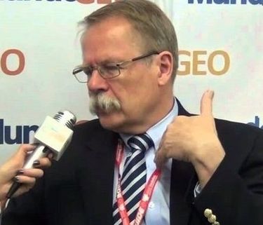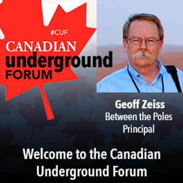
Geoff has been tracking the contribution of geospatial technology to the digitization of construction, operation and maintenance of energy, building and transportation infrastructure - primarily in his blog “Between The Poles”, on LinkedIn and Geospatial World. From 2014 to 2016 Geoff was Editor for Energy and Building with Geospatial Media. Prior to that Geoff was responsible for thought leadership, evangelization, and industry messaging for the utility industry program at Autodesk. Geoff Zeiss has more than 20 years experience in the geospatial IT industry working with utilities, communications, and public works in enterprise IT around the world. In his early career, he was responsible for some of the largest successful implementations of location-aware enterprise design and records management software in the utility and telecommunications sectors. In 2004, he received a global technology award from Oracle Corporation for technical innovation and leadership in the use of Oracle. In recognition of his efforts to increase the awareness of geospatial data and technologies in utilities and construction, Geoff received the Geospatial Ambassador Award at Geospatial World Forum 2014 in Geneva, Switzerland. He actively supports open standards as a director of the Open Geospatial Consortium and contributed to the founding of the Open Source Geospatial Foundation in 2005/2006.
Sessions auxquelles Geoff Zeiss participe
Mardi 18 Juin, 2019
The UK Government as part of its building information modeling (BIM) initiative has said repeatedly that it expects the big payoff of a digital model will be during operations and maintenance, which typically represents 80% of the cost of a facility. Companies who do design, build, finance, and maintain, or design, build, operate, or PPP projects often employ a full lifecycle BIM + geospatial strategy. For example, Crossrail appears to be the first major project that may be able to provide su...
Jeudi 29 Avril, 2021
Awareness of the human and economic cost of not knowing the location of underground utilities and other infrastructure has grown dramatically in the last few years. At this forum we will hear from leaders of relatively new companies or startups that are providing technology that has begun to seriously impact our ability to detect, record and share accurate location data about underground infrastructure. We will also hear about the latest developments in standards including the latest ASCE ...
Vendredi 30 Avril, 2021
Mardi 22 Mars, 2022
Mercredi 23 Mars, 2022
Sessions auxquelles Geoff Zeiss assiste
Mercredi 22 Juillet, 2020
Opening Remarks by GeoIgnite founder Jonathan MurphyKeynote address: Geospatial Opportunities in COVID TimesGeospatial capacity has been helpful in providing answers to Canadians during a time where nothing seems normal anymore. At the forefront of tracking, reporting and managing the response to the COVID crisis are geospatial tools, data and leadership. Natural Resources Canada’s Canada Centre for Mapping and Earth Observation supported the Government of Canada’s response b...
The U.S. reference system modernization effort will replace the North American Datum of 1983 (NAD83) with a new North American Terrestrial Reference Frame (NATRF2022), creating 1.3 to 1.5 m horizontal coordinate differences at the Canada–U.S. border with respect to Canada’s NAD83(CSRS). Never before have such significant differences existed between our two countries’ reference frames.There are compelling reasons for Canada to follow suit and adopt the NATRF2022 frame as our ...
Presented by: Jake Dickinson & John Roos Abstract: As shrinking polar ice creates new opportunities for resource exploration and shipping routes, the importance for Arctic nations to monitor the ongoing expansion in the Arctic is ever increasing. Additionally, climate change continues to impact people and the environment. High resolution satellite imagery remains one of the most effective means of monitoring inaccessible and de...
Geospatial and location technologies is present and continues to expand its reach in many sectors. Much of the current digital transformation taking place globally is built upon geospatial foundations. In this open panel discussion, our experts will discuss the latest developments and challenges facing the Canadian and global geospatial sector and what the future holds. Key components to be addressed include how has the global pandemic affected our sector and how may we be impacted in the...
Our next-generation Earth imaging constellation will change everything. We're not just launching more satellites. In 2021, we will deploy WorldView Legion which will provide unprecedented visibility into our changing planet to solve the biggest challenges facing our world today. Grab your favorite beverage and join Maxar for a casual conversation about our next constellation, Legion! Everyone who joins will be entered for a chance to win an IPad!
Jeudi 23 Juillet, 2020
Title: Growing Canada’s Next Earth Observation (EO) GenerationCanada has a proud history in Earth Observation, supporting a strong export industry driven on EO imagery and geospatial analytics. It is incumbent on all of us to continue Canada’s strong presence in the global EO community and we can only do that with a concerted effort and plan to grow the next generation of leaders. After 51 years of leadership in space and spatial information technology MDA was recen...
Vendredi 24 Juillet, 2020
We are living through a transformative time, not least in the space industry. A graph of upcoming satellite launches looks like a hockey stick – soon there will be orders of magnitude leading to more satellites being launched and more downstream data being generated from space than ever before. The question is, what is the most effective means of ensuring that space data brings tangible benefits to business operations and value to end users? In our talk we cover a satellit...
Mercredi 21 Avril, 2021
Le Canada est le chef de file mondial dans le domaine de l'observation de la Terre par radar spatial à grande échelle grâce au programme RADARSAT, qui soutient de nombreuses utilisations opérationnelles et scientifiques des données radar à synthèse d'ouverture (SAR).MDA, en collaboration avec le gouvernement canadien, a créé une marque et une réputation d'excellence internationalement reconnues en matière de données SAR en temps quasi réel sur de vastes zones pour les applica...
Savez-vous ce qu'est le piège des produits géospatiaux? Nous tombons amoureux de la technologie, pas du problème. Je suis une personne chanceuse. Mon travail est devenu celui où je parle principalement de technologie géospatiale toute la journée. Je pourrais être en train d'étudier des projets internes ou externes ou d'évaluer des technologies. De plus en plus, je donne des conseils sur des idées de produits. Cette dernière situation m'a obligé à réflé...
Maxar construit la carte 3D la plus haute résolution et la plus précise de la planète et cet exposé fournira un aperçu des produits et des capacités qui le rendent possible.
Jeudi 22 Avril, 2021
Résumé à venir: Surveillance des secteurs de programme de l'ASC, y compris l'utilisation de l'espace, l'exploration spatiale et les sciences et technologies spatiales.
À une époque où les impacts du changement climatique augmentent, il est vital et croissant de se préparer, de réagir et de se remettre des catastrophes naturelles. Mais il existe un déficit de communication critique entre les autorités et les citoyens. En nous appuyant sur les résultats de notre vaste projet pluriannuel de R&D sur le changement climatique et avec l'aide de centaines d'étudiants, de citoyens, d'universitaires, d'ONG et de représentants du gouvernement...
Rejoignez-nous le 22 avril pour une discussion au coin du feu avec le Dr Steve Liang, fondateur et directeur technique de SensorUp. Professeur et titulaire de la chaire de recherche Rogers IoT à l’Université de Calgary et Dr Nadine Alameh, chef de la direction (PDG) de l’OGC.L'objectif de Steve est de perturber les silos de l'Internet des objets en créant, en utilisant et en mettant en œuvre des normes et des produits ouverts et interopérables pour les communications appa...
Dans cette présentation, le Dr Walter Scott comparera les constellations d'imagerie par satellite de Maxar et d'autres sociétés commerciales pour montrer comment elles se comparent à trois paramètres clés: l'adéquation produit-marché, l'adaptabilité et l'efficacité du capital. Il partagera également des informations clés sur la prochaine génération d'intelligence terrestre qui arrivera en 2021 avec le lancement de WorldView Legion, et sur l'impact que cela aura sur le marché géospatial can...
Le levé géodésique canadien (SCG) de Ressources naturelles Canada (RNCan) est chargé de définir, de maintenir et de fournir l'accès au Système canadien de référence spatiale (SCRS). Le CSRS fournit une référence cohérente pour l'arpentage, la cartographie et d'autres applications qui nécessitent un positionnement précis. Cette présentation décrira les produits, les outils et les services de BESC actuellement disponibles et donnera accès au Système canadien de référence spatiale (SCRS). Il ...
Avec des PetaBytes de données sortant de l'orbite terrestre basse tous les jours, l'opportunité offerte par l'observation de la Terre semble être plus grande que jamais. Mais notre communauté réalise-t-elle encore cette opportunité? Y a-t-il des gagnants? Comment devrions-nous penser aux entreprises EO dans les années 2020 rugissantes?
Vendredi 23 Avril, 2021
L'industrie géospatiale mondiale est estimée à 500 milliards de dollars américains et a un impact encore plus significatif sur la société, avec des avantages économiques dérivés estimés à être multiples. Ces avantages, cependant, ne sont toujours pas pleinement compris par les principales parties prenantes et les décideurs politiques, ce qui entrave en fin de compte l'adoption mondiale des informations géospatiales. Avec des décennies d'efforts d'infrastructure nationale de données spatial...
Remise des prix et annonces finales.
Avec les progrès rapides des technologies d'observation de la Terre, de cloud computing et d'analyse, plus d'informations sur notre monde en mutation sont plus facilement disponibles que jamais. Planet est une société aérospatiale et d'analyse de données à la pointe de ces avancées - travaillant pour rendre le changement global visible, accessible et exploitable, Planet visualise la Terre entière quotidiennement à une résolution de 3,5 m et n'importe où sous-quotidienne à <50 cm. Dans cett...
Le gouvernement du Canada et des organisations comme l'ONU reconnaissent le rôle essentiel des normes en matière d'information géographique et de géomatique pour soutenir l'intendance et l'interopérabilité de l'information, en veillant à ce que les organisations accèdent, utilisent et partagent les données géospatiales de manière efficace et efficiente pour soutenir la prestation de programmes et de services aux citoyens. . L'inventaire / catalogue des données et les normes de soutien sont...
Mardi 22 Mars, 2022
Gyroscopic mapping of underground ducts and pipes has been around for a few decades now, and it continues to gain traction amongst the worlds' utilities as an accurate and unique technology. Nevertheless, the market perception until now is that Gyro-mapping, as it's also often referred to, is more expensive than traditional mapping and locating technologies. And although that perception is true, it is not due to the cost of the technology, but rather...
As the world continues to grow and urbanize, new urban infrastructure is being constructed at an unprecedented rate while old world infrastructure is being replaced and upgraded. This has lead to a greater demand for accurate and current utility locating and mapping. This demand is further exacerbated by the fact that infrastructure construction costs continue to rise and the slightest delay or extra cost associated with insufficient utility locating has an...
This presentation will be focusing on the advancement of "Cloud and Mobile" technologies that are currenlty being used to easily and accurately map assets and underground utilities that can be shared, re-located and leveraged thoughout the many project phases.It is critical that data accruacy and integrity is leveraged and accumulated throughout every phase of the BIM procress, creating a live "digital twin" all the way back to t...
Utilities and their Contractor Organizations have traditionally been responsible for the safe and effective construction of new underground facilities. An important aspect of the construction process is the accurate documentation and location of the newly installed assets for update into the Utilities’ Geographic Information Systems, Work Management Systems and Asset Repositories. This process is typically performed via paper-based folders that may contain missing or incorrect attribute da...
Mercredi 23 Mars, 2022
Utility and energy buried pipelines represent an extensive underground network covering most of a country's territory. Their precise lateral, horizontal positioning along with their depth of cover is a critical element of any operator's GIS. It enables to deploy more accurate pipeline predictive maintenance models and avoid third party interferences. The latter being identified as one of the main causes of pipeline failures. The 2020 CGA Dirt report states that 3...
Leading construction companies are finding a new software as a service component that enables them to view their virtual sites, saving them time and money. This technology breakthrough enabled pioneer construction companies serving clients in multiple industries (colleges, hospitals, residential compounds, malls) to use a new way of representing information about their buildings and utilities, above ground and underground. Benefits include avoiding planning mista...
Jeudi 24 Mars, 2022
Reveal is building the world's most advanced and accurate digital twin technology for subsurface infrastructure. We're driving a safer, more efficient and sustainable world by revealing the truth of the underground. Join us for a 30min presentation where we will be showcasing our technology through our flagship project in Wellington, New Zealand.
