
Sarah Pitts
Sessions auxquelles Sarah Pitts assiste
Mercredi 23 Mars, 2022


Jeudi 24 Mars, 2022

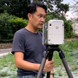
GIS platforms are typically populated with XYZ coordinates with a point spacing of 1 meter or more. in fact, most traditional land surveying techniques, like GPS, often have a point spacing of 3 meters or more, and that is understandable given the procedure to obtain these points. But have you ever wondered what amount of detail is lost when increasing the point frequency? Well, in this seminar, Otto Ballintijn will demonstrate the impact point frequency has on pipe detail usin...


Scribble Maps is an easy-to-use online GIS and web mapping visualization solution. The software has a robust toolset along with vast operations that can help you annotate maps, plot territories, filter and analyze data, optimize routes, add images, and more.Our powerful mapping software can easily be integrated with many different file formats including GeoJson, SHP, KML, CSV, GPX, DXF, and PDF. Founded in 2009, Scribble Maps has been developed from direct user f...


Reveal is building the world's most advanced and accurate digital twin technology for subsurface infrastructure. We're driving a safer, more efficient and sustainable world by revealing the truth of the underground. Join us for a 30min presentation where we will be showcasing our technology through our flagship project in Wellington, New Zealand.

Vendredi 25 Mars, 2022

An overview of Prostar's "Cloud and Mobile Precision Field Data Collection Solution and the set up of the ProStar "PointMan Plus" application FREE to WorkShop attendees. PointMan is a patented cloud and mobile mapping software application that captures, records, and displays the precise location and the associated metadata of critical surface and subsurface infrastructure, all in "real-time" Workshop includes: -1 FREE annual subscription of...

For decades, cities have required all utilities, communication providers and municipal services providers to build their facilities below ground. In addition, the increase in severe natural disaster conditions have driven traditional overhead utilities to revise their construction standards and build their new facilities underground. As the proliferation of underground construction continues, all utility groups must improve their procedures to ensure that any newly installed fa...


Mardi 16 Mai, 2023

The talk summarizes a market product of deep learning based semantic segmentation of point clouds and automatic 3D reconstruction of as-built BIM for underground utilities and pipework for 3D GIS. The presentation covers a general workflow of the approach (including point cloud labeling, definition of classes, deep neural network, information extraction, and pipe modeling), accuracy of semantic segmentation, real case studies, and foreseeable challenges down the road. Also, the speakers wi...
Mercredi 17 Mai, 2023

Geoff Zeiss devoted over 30 years of his life to the Geospatial industry and global community, focusing on utility and construction sectors, and mapping underground utility infrastructure among many other projects. Sadly, Geoff passed away in September of 2022. The Geoff Zeiss Urban Infrastructure Mapping Fund was established to build on decades of innovation by Dr. Zeiss in developing effective and sustainable urban infrastructure through research and development supporting ...


A deep dive into Reveal's new platform for major civil infrastructure projects, highlighting the workflow and features for project managers, engineers and contractors. Reveal for Projects helps stakeholders in the underground build a Unified Utility Model from multiple sources of data, with an intuitive and efficient web interface.