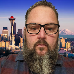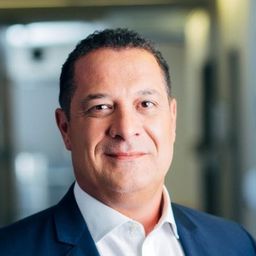
Kris Kwiatkowski P.Eng
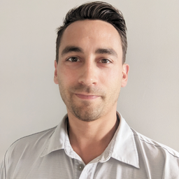
Kris Kwiatkowski, P.Eng., is an accomplished Manager and Executive with over 18 years of proven experience in the Geomatics, Environmental, and Construction industries. His expertise spans project management, land development, boundary survey, construction survey, spatial analysis, pipeline management, and the utilization of advanced technologies including UAV, Laser Scanning, Mobile Mapping, Ground Penetrating Radar, and Hydrography. Kris has also been instrumental in the establishment of industry standards.
Kris embarked on his career as a survey assistant, steadily advancing over the course of 18 years to contribute significantly to the advancement and improvement of the industries he serves. He dedicated over a decade to enhancing, creating, developing, and providing training on Geomatics tools and systems at the largest Geomatics company in Canada.
With the progression of his career, Kris transitioned into the Construction and Environmental sectors, consistently advocating for the integration of Geomatics tools to enhance organizational capabilities. Currently, Kris serves as the Director of Geomatics/Engineering at ProDelta Projects Inc.
In addition to his professional roles, Kris is a Certified Advanced Drone Pilot and a practicing Engineer licensed in British Columbia, Alberta, Saskatchewan, and the Yukon. He is also an Associate member of the Alberta Land Surveyors Association. Kris actively contributed to the industry through his involvement in the ALSA futures committee, participation on the Board of Directors of Eclipse College, and volunteer work for the Calgary Stampede.
Sessions auxquelles Kris Kwiatkowski P.Eng participe
Mardi 29 Octobre, 2024
The environmental industry has witnessed a significant transformation in recent years, driven by the adoption of advanced positioning technologies. Geomatics positioning tools have emerged as a pivotal component in this paradigm shift, offering unparalleled precision, efficiency, and accuracy in environmental monitoring, management and remediation projects. ProDelta Projects has been an early adopter and developer of these tools including Field DMS, Smart Dig, R20 and through our Minimal dist...
Sessions auxquelles Kris Kwiatkowski P.Eng assiste
Mardi 7 Novembre, 2023
Join us for a riveting panel discussion featuring leading experts in the realm of reality capture. As the industry stands on the precipice of monumental change, this session aims to unpack the intricacies of current challenges, explore the intricacies of the digital twin concept, and envision the future trajectory of reality capture. Our esteemed panelists, with their wealth of knowledge and diverse experiences, will shed light on the multifaceted struggles the industry grapple...
Over his decade plus at Suncor, Alonzo has been both witness to and active participant in a quiet digital Geospatial revolution. This revolution has democratized access to Geospatial data and tools to everyone at Suncor. Which meant that teams and professionals across a myriad of disciplines have embraced and pushed the limits of Geospatial data and software. The constant demand for newer and higher-resolution data has relegated the paper map to secondary status as the tool for spatial commun...
Planet scans the entire land mass of the planet nearly everyday with high resolution multispectral imagery, enabling exciting new opportunities and solving old challenges for digital transformations and sustainable business acceleration. Now with our growing fleet of 8-band Superdoves in orbit, the launch of our Planetary Variables - daily soil moisture, temperature, crop and forest biomass, etc - we have evolved even greater capabilities for a new era of Earth Observation technologies. In th...
In the face of escalating environmental challenges, Canada grapples with the urgent need for advanced solutions in wildfire monitoring, emissions reduction, and natural resource management. This panel discussion explores how the burgeoning "New Space" frontier offers innovative approaches to address these critical issues.We aim to provide a platform for various industry players to share their own innovative technologies and insights, creating a vibrant dialogue on crucial geospatial...
Flooding is Canada’s most costly natural disaster, and flood risk intensifies as a result of urbanization and climate change. These impacts will change over time and can jeopardize the overall sustainability of communities if they remain unaddressed. As socio-economic consequences worsen, it underlines the need for governments to provide current and accurate hazard information to vulnerable populations, including Indigenous communities who are disproportionately affected, to make decisions...
With an increasing multitude of new Earth Observation (EO) satellites, it is imperative for the geomatics community to assess the fit of these emerging space assets. This presentation aims to provide a comprehensive analysis of the diverse range of EO satellites currently being deployed, and their potential applications.Topics:1) An Overview of the recent surge in EO satellite launches2) New satellite capabilities, and use cases3) An exploration of the challenges customers ...
Join us at the BIM/GIS panel of our conference as we delve into critical subjects shaping the intersection of Building Information Modeling (BIM) and Geographic Information Systems (GIS). Our expert panelists will explore the evolving landscape of BIM and GIS, offering invaluable insights into various aspects of this dynamic field.Agenda:The Importance of Standards and Interoperability...
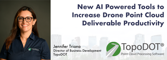
Learn how newly implemented surface modeling tools employing artificial intelligence reduce the turnaround time of point cloud surface models by 400% while maintaining high-fidelity results around break lines. Faster ground extraction routines for UAV data can be achieved without the need for classification or noise removal. In this presentation, we'll discuss several examples including how a query volume calculation project compared with traditional modeling workflows yielded nearly exact...
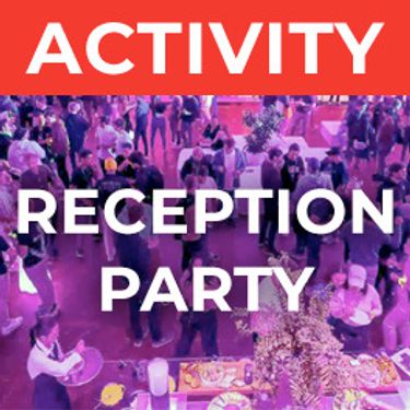
The end of the first day of the National Canadian GoGeomatics Expo is being marked by a lively party that is eagerly anticipated by all participants. The party is being held on the floor of the tradeshow in a venue that hosts many of the best rock concerts and shows for the Calgary Stampede. It promises to be a lot of fun, with an atmosphere buzzing with excitement and energy as attendees mingle, network, and celebrate the end of a successful day.The party is made even better by the in...
Mercredi 8 Novembre, 2023
Join us at the GoGeomatics Expo for a dynamic panel discussion on the latest trends in Lidar technology. Our panel of experts will dive into the advancements in Lidar data, hardware, and software, providing valuable insights into the ever-evolving geospatial world. Discover the future of Lidar and its applications, and stay at the forefront of geomatics innovation.lidarcanex.com
This panel will delve into some Geoff Zeiss's favorite topics:Example - Colorado DOT, PennDOT. Not an explicit requirement but required for permitting in their RoW’s – effectively a regulatory standard. Metrolink Regulation1: Business Case for SUE DataASCE – Not a regulatory requirement but a recommendation.Regulate on Backend – Permitting Process requirement for ASCE Benefits of Accurate Data2: Standards
Research Presentation:Airborne Topo-Bathymetric Lidar Combined with Thermal Imaging for Fish Habitat Studies in RiversResearchers at Nova Scotia Community College’s Applied Geomatics Research Group have been using the airborne Leica Chiroptera 4X topo-bathymetric lidar sensor for nearly a decade and have surveyed coastal, riverine and lake environments. They have concentrated on mapping submerged aquatic vegetation (SAV). Topo-bathy lidar data of rivers provides an opportu...
Join us at the GoGeomatics Expo for an insightful panel discussion that tackles the pressing question: Where will the next generation of land surveyors emerge from? Our panel, featuring experienced educators and professional land surveyors, will engage in a thought-provoking dialogue on strategies and solutions to attract and nurture the future leaders of the land surveying profession. Don't miss this opportunity to gain valuable perspectives on the future of land surveying.


