Sessions auxquelles Lesley Gamble participe
Vendredi 11 Mars, 2022
Please join us for the MDA-hosted workshop on multi-band SAR presented by MDA (Canada), Iceye (Finland) and VENG (Argentina). After presenting SAR fundamentals, we will dive deep into the specifications of X-band (Iceye), C-band (RADARSAT-2) and L-band (SAOCOM) missions, as well as the sensors’ merit and strength in specific applications that are of relevance to Canada. The last hour would be Q&As and discussion.
Sessions auxquelles Lesley Gamble assiste
Mercredi 21 Avril, 2021
Le Canada est le chef de file mondial dans le domaine de l'observation de la Terre par radar spatial à grande échelle grâce au programme RADARSAT, qui soutient de nombreuses utilisations opérationnelles et scientifiques des données radar à synthèse d'ouverture (SAR).MDA, en collaboration avec le gouvernement canadien, a créé une marque et une réputation d'excellence internationalement reconnues en matière de données SAR en temps quasi réel sur de vastes zones pour les applica...
Le Centre canadien de cartographie et d'observation de la Terre (RNCan) poursuit ses travaux de mise en œuvre de la Stratégie nationale sur les données d'élévation. Grâce à cette stratégie, l'un des objectifs de RNCan est de fournir aux Canadiens une représentation tridimensionnelle précise du pays, à l'appui des priorités du gouvernement comme la cartographie des inondations. En raison de l'énorme tâche d'obtenir une couche d'élévation nationale de haute précision et à jour, RNCan travail...
Titre: Faire progresser l'observation spatiale au Canada: Le Panel géospatial des directeurs généraux de GeoIgnite 2021, dans le cadre de la Conférence géospatiale nationale du Canada. Titre: Faire progresser l'observation spatiale au Canada Il s'agit d'un panel incontournable pour quiconque souhaite connaître la direction que prend le leadership géospatial du gouvernement fédéral du Canada. Joignez-vous à nos pané...
Jeudi 22 Avril, 2021
Résumé à venir: Surveillance des secteurs de programme de l'ASC, y compris l'utilisation de l'espace, l'exploration spatiale et les sciences et technologies spatiales.
Dans cette présentation, le Dr Walter Scott comparera les constellations d'imagerie par satellite de Maxar et d'autres sociétés commerciales pour montrer comment elles se comparent à trois paramètres clés: l'adéquation produit-marché, l'adaptabilité et l'efficacité du capital. Il partagera également des informations clés sur la prochaine génération d'intelligence terrestre qui arrivera en 2021 avec le lancement de WorldView Legion, et sur l'impact que cela aura sur le marché géospatial can...
Vendredi 23 Avril, 2021
Avec les progrès rapides des technologies d'observation de la Terre, de cloud computing et d'analyse, plus d'informations sur notre monde en mutation sont plus facilement disponibles que jamais. Planet est une société aérospatiale et d'analyse de données à la pointe de ces avancées - travaillant pour rendre le changement global visible, accessible et exploitable, Planet visualise la Terre entière quotidiennement à une résolution de 3,5 m et n'importe où sous-quotidienne à <50 cm. Dans cett...
Le gouvernement du Canada et des organisations comme l'ONU reconnaissent le rôle essentiel des normes en matière d'information géographique et de géomatique pour soutenir l'intendance et l'interopérabilité de l'information, en veillant à ce que les organisations accèdent, utilisent et partagent les données géospatiales de manière efficace et efficiente pour soutenir la prestation de programmes et de services aux citoyens. . L'inventaire / catalogue des données et les normes de soutien sont...
Lundi 26 Avril, 2021
Les billets pour cet atelier doivent être achetés à l'avance.
Mardi 27 Avril, 2021
Les billets pour cet atelier doivent être achetés à l'avance.
Jeudi 2 Décembre, 2021
This half-day workshop cuts through the theory and fluff to practically present, the essential practices for successful GIS project planning and management. Its intent is to provide project managers, teams, and stakeholders with the key actions, methods, and tools to launch and execute successful projects, delivering results on time and within budget providing valuable deliverables to the customers and user community. It is applicable to all types of GIS ...
Mardi 1 Mars, 2022
Join Jonathan Murphy, Nicholas Kellett and John Roos as they kick off the start of Winter Geo:GeoIgnite 2022.
In this talk Dan Nord will share key insights on Maxar’s position as a centerpiece in the global tech shift from 2D to 3D. Join us to hear more about how Maxar is accelerating its Earth Intelligence business with the launch of WorldView Legion in 2022, as well as building on our lead in mapping, monitoring, and new markets of the future.
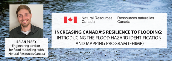
In Budget 2021, the government tabled a recovery plan for jobs, growth, and resilience. Within the budget were specific investments to promoting a healthy environment for a healthy economy, with $145.5 million dedicated to supporting initiatives that will increase resiliency to the natural hazards of wildfires and floods, which are becoming more frequent, severe, and devastating due to climate change and urban development. Flood hazard maps are essential to un...
Mercredi 2 Mars, 2022
Dr. Marshall and Keith Masback will explore climate change and what happens at the intersection of climate and the Earth’s surface.
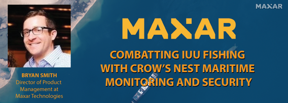
Maritime regions are vast, vessels of interest operate dark, and the agencies responsible for maritime enforcement need to deploy scant resources efficiently to make the greatest mission impact. Maxar has developed the Crow’s Nest Maritime Monitoring and Security (MMS) product to address this need. The product leverages space-based optical and radar imagery, AIS, advanced ma...
MDA's new multi-sensor Earth observation satellite constellation, CHORUS, will bring together multiple diverse and unique perspectives in harmony, opening the aperture and the art of the possible to provide a new level of real-time insight about our planet.Building on the legendary RADARSAT program, CHORUS will provide the most extensive radar imaging capacity on the market. With advanced C-band and X-band Synthetic Aperture Rada...
Join our DG Panel discussion moderated by Jonathan Murphy, Managing Director of GoGeomatics Canada. Our panelists are Eric Laliberté, Éric Loubier and David Harper.As a country spanning almost 10 million square kilometres, Canada has always faced a unique challenge in collecting the day-to-day information needed to provide critical services to Canadians. Today, space offers a unique perspective that is increasingly important to under...


