
Vivienne Wu has been with MDA for more than 24 years in the business development role, with knowledge and credential in optical and SAR sensors (ground segment, data, derived information and services). She has extensive experience supporting MDA’s clients and partners in Canada, Latin America and Asia Pacific.
Sessions auxquelles Vivienne Wu participe
Vendredi 11 Mars, 2022

Please join us for the MDA-hosted workshop on multi-band SAR presented by MDA (Canada), Iceye (Finland) and VENG (Argentina). After presenting SAR fundamentals, we will dive deep into the specifications of X-band (Iceye), C-band (RADARSAT-2) and L-band (SAOCOM) missions, as well as the sensors’ merit and strength in specific applications that are of relevance to Canada. The last hour would be Q&As and discussion.


Mercredi 8 Novembre, 2023

The talk presents how multi-band SARs (X-band Iceye, C-band RADARSAT-2 and L-band SAOCOM) support various earth observation applications, such as target identification, change and displacement detection, and soil moisture map generation. Furthermore, it presents MDA's next-generation Chorus constellation (combination of C-band and X-band SARs).
Sessions auxquelles Vivienne Wu assiste
Mercredi 21 Avril, 2021

Le Canada est le chef de file mondial dans le domaine de l'observation de la Terre par radar spatial à grande échelle grâce au programme RADARSAT, qui soutient de nombreuses utilisations opérationnelles et scientifiques des données radar à synthèse d'ouverture (SAR).MDA, en collaboration avec le gouvernement canadien, a créé une marque et une réputation d'excellence internationalement reconnues en matière de données SAR en temps quasi réel sur de vastes zones pour les applica...


Savez-vous ce qu'est le piège des produits géospatiaux? Nous tombons amoureux de la technologie, pas du problème. Je suis une personne chanceuse. Mon travail est devenu celui où je parle principalement de technologie géospatiale toute la journée. Je pourrais être en train d'étudier des projets internes ou externes ou d'évaluer des technologies. De plus en plus, je donne des conseils sur des idées de produits. Cette dernière situation m'a obligé à réflé...

Le Centre canadien de cartographie et d'observation de la Terre (RNCan) poursuit ses travaux de mise en œuvre de la Stratégie nationale sur les données d'élévation. Grâce à cette stratégie, l'un des objectifs de RNCan est de fournir aux Canadiens une représentation tridimensionnelle précise du pays, à l'appui des priorités du gouvernement comme la cartographie des inondations. En raison de l'énorme tâche d'obtenir une couche d'élévation nationale de haute précision et à jour, RNCan travail...

Au cours de la dernière année, Minerva Intelligence, une entreprise d'IA cognitive basée à Vancouver, a remporté deux contrats avec Ressources naturelles Canada pour concevoir des schémas au niveau national: le National Flood Hazard Data Layer (NFHDL) et le National Hydro Network V2 (NHNv2 ). Vous vous demandez peut-être pourquoi une entreprise d'IA conçoit et construit ces structures de base de données importantes. Le système d'IA cognitive de Minerva utilise des données sémantiquement in...

Session hébergée par NRCan

Explorez la structure d'une plateforme de renseignements de localisation d'entreprise à Agriculture Agroalimentaire Canada et comment ils ont créé une feuille de route stratégique pour diagnostiquer systématiquement les forces et les faiblesses afin de stimuler l'utilisation de l'intelligence de localisation dans les décisions quotidiennes de programme et de politique d'un ministère fédéral. Agriculture et Agroalimentaire Canada appuie le secteur canadien de l'agricultur...

Maxar construit la carte 3D la plus haute résolution et la plus précise de la planète et cet exposé fournira un aperçu des produits et des capacités qui le rendent possible.

Titre: Faire progresser l'observation spatiale au Canada: Le Panel géospatial des directeurs généraux de GeoIgnite 2021, dans le cadre de la Conférence géospatiale nationale du Canada. Titre: Faire progresser l'observation spatiale au Canada Il s'agit d'un panel incontournable pour quiconque souhaite connaître la direction que prend le leadership géospatial du gouvernement fédéral du Canada. Joignez-vous à nos pané...


Jeudi 22 Avril, 2021

Résumé à venir: Surveillance des secteurs de programme de l'ASC, y compris l'utilisation de l'espace, l'exploration spatiale et les sciences et technologies spatiales.


À une époque où les impacts du changement climatique augmentent, il est vital et croissant de se préparer, de réagir et de se remettre des catastrophes naturelles. Mais il existe un déficit de communication critique entre les autorités et les citoyens. En nous appuyant sur les résultats de notre vaste projet pluriannuel de R&D sur le changement climatique et avec l'aide de centaines d'étudiants, de citoyens, d'universitaires, d'ONG et de représentants du gouvernement...

Dans cette présentation, le Dr Walter Scott comparera les constellations d'imagerie par satellite de Maxar et d'autres sociétés commerciales pour montrer comment elles se comparent à trois paramètres clés: l'adéquation produit-marché, l'adaptabilité et l'efficacité du capital. Il partagera également des informations clés sur la prochaine génération d'intelligence terrestre qui arrivera en 2021 avec le lancement de WorldView Legion, et sur l'impact que cela aura sur le marché géospatial can...

Depuis près de 50 ans, des représentants de la géomatique des provinces et territoires canadiens ont collaboré avec le gouvernement fédéral à des initiatives de géomatique. Cette présentation explorera pourquoi un tel conseil a vu le jour et pourquoi son travail est important pour le secteur canadien de la géomatique et les citoyens. Alors que le secteur de la géomatique et le monde dans lequel nous vivons continuent d'évoluer, le besoin de coordination entre les juridictions demeure crucial ...

Avec des PetaBytes de données sortant de l'orbite terrestre basse tous les jours, l'opportunité offerte par l'observation de la Terre semble être plus grande que jamais. Mais notre communauté réalise-t-elle encore cette opportunité? Y a-t-il des gagnants? Comment devrions-nous penser aux entreprises EO dans les années 2020 rugissantes?


Vendredi 23 Avril, 2021

L'industrie géospatiale mondiale est estimée à 500 milliards de dollars américains et a un impact encore plus significatif sur la société, avec des avantages économiques dérivés estimés à être multiples. Ces avantages, cependant, ne sont toujours pas pleinement compris par les principales parties prenantes et les décideurs politiques, ce qui entrave en fin de compte l'adoption mondiale des informations géospatiales. Avec des décennies d'efforts d'infrastructure nationale de données spatial...


Avec les progrès rapides des technologies d'observation de la Terre, de cloud computing et d'analyse, plus d'informations sur notre monde en mutation sont plus facilement disponibles que jamais. Planet est une société aérospatiale et d'analyse de données à la pointe de ces avancées - travaillant pour rendre le changement global visible, accessible et exploitable, Planet visualise la Terre entière quotidiennement à une résolution de 3,5 m et n'importe où sous-quotidienne à <50 cm. Dans cett...

Cette conférence réunira la puissance de l'intelligence de localisation et de la technologie blockchain pour une vitesse et une précision accrues des transactions et une prise de décision améliorée.La valeur que la blockchain apporte à la technologie géospatiale est la sécurité, l'immuabilité et les données fiables. D'autre part, la technologie géospatiale fournit la puissance de localisation à la blockchain. Ensemble, ils changent la donne à la fois pour leur utilité et ...

oignez-vous à GeoIgnite pour ce premier panel de chefs de file provinciaux et territoriaux de la géospatiale et des technologies de localisation. Nous discuterons des problèmes entourant: Quelles sont les principales priorités et défis à travers les juridictions?Quels types d'outils géospatiaux utilisons-nous pour surveiller et répondre à des défis clés tels que les interventions d'urgence?Comment les juridictions harmonisent-elle...


Lundi 26 Avril, 2021

Les billets pour cet atelier doivent être achetés à l'avance.


Mardi 27 Avril, 2021

Les billets pour cet atelier doivent être achetés à l'avance.

Les billets pour cet atelier doivent être achetés à l'avance.

Mercredi 28 Avril, 2021

Les billets pour cet atelier doivent être achetés à l'avance.

Jeudi 29 Avril, 2021
Les billets pour cet atelier doivent être achetés à l'avance.
Vendredi 30 Avril, 2021
World Geospatial Industry Council: Leading global geospatial policy AdvocacyApril 30 2021, 13:00 - 14:30 EDTVirtual Workshop at GeoIgnite 2021: Canada's National Geospatial Conferencehttps://sites.grenadine.co/sites/goge...

Mardi 1 Mars, 2022

In this talk Dan Nord will share key insights on Maxar’s position as a centerpiece in the global tech shift from 2D to 3D. Join us to hear more about how Maxar is accelerating its Earth Intelligence business with the launch of WorldView Legion in 2022, as well as building on our lead in mapping, monitoring, and new markets of the future.


In Budget 2021, the government tabled a recovery plan for jobs, growth, and resilience. Within the budget were specific investments to promoting a healthy environment for a healthy economy, with $145.5 million dedicated to supporting initiatives that will increase resiliency to the natural hazards of wildfires and floods, which are becoming more frequent, severe, and devastating due to climate change and urban development. Flood hazard maps are essential to un...


Planet's constellation of satellites capture the whole of Earth's landmass every day. This unprecedented dataset provides insights to the agricultural sector, helping farmers and the companies that serve them make informed, timely decisions. But translating that data into insights isn’t always straightforward. In this session, Greg Crutsinger will go over the fundamental ways space observation is serving agricultural customers and present new applications in satellite data - everything fro...


Abstract: Organizations are increasingly relying on geospatial analysis to power their decision making and business processes. But in such a dynamically changing world, maintaining an accurate database of critical locations is no small task. Everyday worldwide, businesses open and close, change names, or update their operating hours. When these changes happen, any map, application, or model immediately becomes stale. How can organizations strategize if they are not...


NV5 Geospatial has been at the forefront of hydrospatial data acquisition and processing for decades. This presentation will provide a brief corporate introduction and overview of some of the technologies relevant to remotely sensed hydrospatial data collection and development. This will also include associated analyses and ancillary data integration to solve questions surrounding hydrology and wetland mapping, flood risk modeling, and habitat...


The landscapes in the Northwest Territories (NWT, Canada) are amongst the most rapidly changing in the world due to climate-induced permafrost thaw. This presentation provides an overview of recent remote sensing and mapping investigations of permafrost thaw landslides across different spatial and temporal scales in the NWT. A common thread of ever-expanding geospatial capabilities (remote sensing, machine learning) is juxtaposed against rapidly intensifying permafrost thaw with many growi...


Mercredi 2 Mars, 2022

At a time of rising climate change impacts, there is a vital and growing need to prepare for, respond to, and recover from natural disasters. But there is a critical communication gap between authorities and citizens.Drawing on the ongoing results of our massive multi-year climate change research and development project, and with assistance from hundreds of students, citizens, academics, NGOs, government officials, and industry p...

Dr. Marshall and Keith Masback will explore climate change and what happens at the intersection of climate and the Earth’s surface.


Maritime regions are vast, vessels of interest operate dark, and the agencies responsible for maritime enforcement need to deploy scant resources efficiently to make the greatest mission impact. Maxar has developed the Crow’s Nest Maritime Monitoring and Security (MMS) product to address this need. The product leverages space-based optical and radar imagery, AIS, advanced ma...


Statistics Canada along with their partner, VertiGIS Studio (formerly Geocortex), have collaborated to update the original Census Program Data Viewer (CPDV) https://www12.statcan.gc.ca/census-recensement/2021/dp-pd/dv-vd/cpdv-vdpr/index-eng.cfm. VertiGIS Studio Web and Reporting were used to configure an advanced web-based data visualization tool, that supports the dissemination of statistical data gathered in the 2021 Canadian census. This tool will make statistical information more...


Inter-annual variability in agricultural production in Canada is largely determined by weather and climate. Climate-related impacts have caused billions of dollars in financial losses in some years, with the incidence of extreme weather and related costs expected in increase in a changing climate. The National Agroclimate Information Service at Agriculture and Agri-Food Canada monitors the impacts of weather and climate on agricultural activities using a number of geospatial data sets, mod...


MDA's new multi-sensor Earth observation satellite constellation, CHORUS, will bring together multiple diverse and unique perspectives in harmony, opening the aperture and the art of the possible to provide a new level of real-time insight about our planet.Building on the legendary RADARSAT program, CHORUS will provide the most extensive radar imaging capacity on the market. With advanced C-band and X-band Synthetic Aperture Rada...


Join our DG Panel discussion moderated by Jonathan Murphy, Managing Director of GoGeomatics Canada. Our panelists are Eric Laliberté, Éric Loubier and David Harper.As a country spanning almost 10 million square kilometres, Canada has always faced a unique challenge in collecting the day-to-day information needed to provide critical services to Canadians. Today, space offers a unique perspective that is increasingly important to under...
Jeudi 3 Mars, 2022

Sanjay Kumar is the founder and CEO of Geospatial Media & Communications. He also lends his time and experience to many organizations helping them to further the cause of increasing the impact of geospatial technology and its applications at a global scale.


Sree, the CEO of NeoGeoInfo will give a brief introduction of the organization along with our focus on 3D Data, Sub Surface Utility Detection (GPR surveys). NeoGeoInfo had been continuously investing in latest data acquisition techniques and equipment. Our proficiency in Data Processing using DL/ ML or other Cognitive technologies is unmatched. We adopt to the customer technology stacks and provide the best solution possible for application development. Sree will announce NeoGeoInfo' plans...

By some estimates, 80% of response time during a disater is spent procuring and preparing data, leaving 20% of the time learning from data. We can do better. Sponsored by USGS/FGDC, Natural Resource Canada, NASA and supported by CONIDA (Peru) and Amazon Web Services, the goal of the pilot was to develop standards-based services to support rapid decision making through the full life-cycle of disaster management for multiple hazards.

Vendredi 4 Mars, 2022

The Association of Canada Lands Surveyord (ACLS) has developed a certification model for hydrographers which, has been officially recognized by the IHO/FIG/ICA International Board of Standards and Competence for Hydrographic Surveyors and Nautical Cartographers (IBSC) in April of 2016. The ACLS program is the second internationally recognized scheme in the world. Certification for a hydrographic surveyor is desirable because: - Certification provides a formal...

In this short technical demonstration, I’ll explore some of the ways that Planetscope’s new 8-band capabilities can be used to both detect and monitor invasive plant species, such as Watermoss-Salvinia, within water bodies. We’ll focus on the role that the 4 new spectral bands (Coastal Blue (433-453nm) , Yellow (600-620nm), Green-II (547-583nm) and Red-edge (697-713nm)) can have in this use case. I’ll compare how some spectral indices unlocked via 8-band data compare to previous 4-band, RG...

Mardi 8 Mars, 2022

Maxar’s WeatherDesk is a mature product platform that has continually evolved to satisfy changing customer requirements. It sets the standard for reliable and accurate weather forecasting through sound attention to science, an intense focus on customer service including 24/7 meteorological and operational support, and optimally solving customer problems. WeatherDesk products elegantly translate weather data into insights and actionable intelligen...


This workshop will use open tools and standards to create STAC compliant data for a Canadian Federal Dataset. The workshop will focus on the nuances of working on Canadian Data in a Cloud environment. It will further demonstrate modern geospatial data science tools to create a SpatioTemporal Asset Catalogue. Sparkgeo will also demonstrate use in leading desktop and cloud mapping software.


Mercredi 9 Mars, 2022

The Topobathymetric Lidar Solutions & Applications Workshop presented by NV5 Geospatial is designed to provide a comprehensive overview of topobathymetric lidar in a relaxed, collaborative environment to allow discussion and answer any questions. This interactive, virtual event will review our latest sensor technology, present typical project planning and execution, and provide processing insights to successfully completing and delivering ...

Join us in this training to learn about some of the latest and greatest features in ERDAS IMAGINE! With the exponentially increasing amount of data being collected in the world today, customized repeatable, batchable workflows are needed to extract as much valuable information from raw data as possible. The Spatial Modeler is the key to setting up these types of workflows. The creation of spatial models and the use of AI, machine learning and deep learning allow mo...
Jeudi 10 Mars, 2022

Taking urgent action to combat climate change and its impacts" is a crucial goal set forward under Goal 13 – Climate Action as part of the United Nations Sustainable Development Goals (SDGs).Climate action requires global efforts related to climate change mitigation – reducing the flow of heat-trapping greenhouse gases into the atmosphere, or enhancing the "sinks" that accu...


Join this session to get the latest information on Maxar foundational products as well as demonstrations and round-table conversation with our subject matter experts. Please bring your questions if you're a current user, or come ready to experience the industry's best satellite imagery for the first time.


Vendredi 11 Mars, 2022

At a time of rising climate change impacts, there is a vital and growing need to prepare for, respond to, and recover from natural disasters. But there is a critical communication gap between authorities, citizens, and communities. Drawing on the ongoing results of our massive multi-year climate change research project, and with assistance from hundreds of students, citizens, academics, NGOs, government officials, and industry partners, Deploy Solutions has identif...
Lundi 12 Mai, 2025

BUY YOUR TICKETAre you a GIS professional navigating the evolving intersection of GIS and BIM? Or a government decision-maker wondering why integrating the built environment into GIS is crucial for your department’s future? Join us for BIM & GIS: Smarter Data, Smarter Decisions, a foundational wo...

Mardi 13 Mai, 2025

The Canadian Hydrographic Service (CHS) is Canada's agency for charting Canadian waters. Canada has the longest coastline of any country in the world, with more than a third of its territory under water. As a maritime nation, global maritime transport traffic is significant. Hydrography supports safe navigation and shipping through the production of nautical charts and other publications including water levels. With opportunities provided by emerging technologies and the move to e-navig...


In 2006, British mathematician Clive Humby declared that data was the new oil. Soon after there was a significant rush around the world to embrace a data revolution to try and improve humanity’s social, economic and environmental well being. Twenty-years later, the hard work of data continues. Like Canadian oil and gas, it is for the most part – a landlocked asset; unable to push us to the next levels of productivity and innovation. This keynote looks at ...

Keith J. Masback is one of the most respected voices in the field of geospatial intelligence (GEOINT), with over three decades of leadership spanning the U.S. government, military, and private sector. His deep expertise in remote sensing, intelligence, and national security has positioned him at the forefront of how geospatial data is used for strategic decision-making.As the former CEO of the United States Geospatial Intelligence Foundation (USGIF) and a senior leader at the National ...


A seasoned leader in geomatics and Earth Observation with two decades of experience in the federal government, Eric Loubier has vast expertise in developing and implementing national geomatics and Earth observation strategies. In his talk, Eric will explore the integration of AI with Earth observation, and how this powerful combination is transforming Canada’s approach to addressing critical national issues like climate change, natural resource management, urban planning, and disaster response.


Mercredi 14 Mai, 2025

The Oceans cover more than 70% of our Planet… with offshore, near shore and coastal waters including rivers and lakes that are navigable or not.This Keynote Address will kick off the Hydrospatial Track on Day TWO of the GeoIgnite 2025 - Ottawa. The presentation will articulate the context and the timing of WHAT is HYDROSPATIAL in the global Geospatial community? SO WHAT is important to Measure, to Monitor an to Model? THEN WHAT is the Strategy, the Challenges, t...


As the geopolitical landscape shifts and a new global space economy emerges, Canada must navigate complex international dynamics and seize opportunities in all facets of the space ecosystem. In this talk, we will explore how space can be part of the solution to geopolitical and national challenges—and what Canada must do to stay ahead in a rapidly evolving global landscape.


As digital collaboration becomes the norm in the construction industry, ensuring the authenticity and integrity of Building Information Models (BIM) is more critical than ever. While BIM and openBIM standards, such as the Industry Foundation Classes (IFC), have improved interoperability and data exchange, challenges remain in verifying data at the object level.This presentation explores the potential of digital signatures as a solution to enhance trust, transparency, and traceability i...


Presenting the CHN and highlighting how its new features leverage advancements in hydrography to improve both water-related models and their applications to support decision making. The Canadian Hydrospatial Network (CHN) was officially launched this past May, marking a significant milestone in the development of hydrospatial networks in Canada. Over the past year, the network has expanded and grown in importance, positioning itself as a key resource for the future of its field. CHN continues...


This session unveils the findings of this groundbreaking report, which builds on international research and best practices in digital construction from countries leading in BIM and data standards. Central to the roadmap is the use of OpenBIM principles to ensure compatibility, transparency, and collaboration across diverse systems and stakeholders. The report outlines strategies to enhance data management, improve BIM compatibility, achieve interoperability within Common Data Environments (CD...


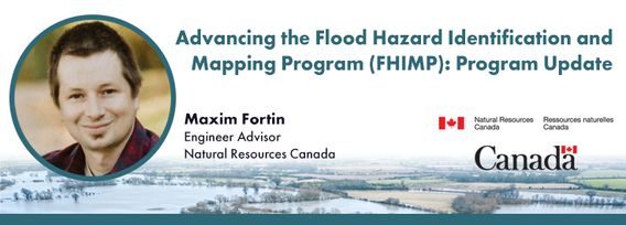
Under the FHIMP, Natural Resources Canada, supported by Public Safety and Environment and Climate Change Canada, collaborates with provinces and territories to create, and disseminate engineering-level flood hazard maps and information. In this presentation, Natural Resources Canada (NRCan) will provide an update on the ongoing work under FHIMP with results of the first stage of the FHIMP (2021-24) and the kickoff of the FHIMP expansion (2023-2028) which will see investments in every jurisdic...


This talk will highlight method innovations in water research using satellite earth observations (SEO) in the Canada Centre for Mapping and Earth Observation (CCMEO) of Natural Resources Canada (NRCan). They include dynamic surface water mapping and modelling for water areas and water volume changes, terrestrial water storage variations, groundwater recharge evolution and storage changes, water extreme events (drought and flood) characterization, and environmental and climate impacts on the w...


The successful implementation of the S-100 suite hinges on various factors, with final product specification and comprehensive testing of route monitoring layers being paramount. Canada is proposing an international designated area for these tests, underscoring its commitment to the S-100 suite's success and global maritime safety. Canada has selected the St-Lawrence River in Québec as the S-100 sea trial area for 2025. The trial aims to evaluate the S-100 system's ability to ingest and displ...

In 1976 the Canadian Hydrographic Service was the first hydrographic agency to recognize and display a satellite-discovered feature on a nautical chart. This was the discovery of Landsat island off the coast of Labrador.In the time since the capabilities of satellites to survey coastal waters have grown exponentially yet the use of satellite based depth information on nautical charts has not. Satellite based surveying offers a multitude of benefits to the safety of operations, empowering ...


Natural Resources Canada’s (NRCan) Emergency Geomatics Service (EGS), under the Canada Centre for Mapping and Earth Observation (CCMEO), supports the national and international emergency response efforts by providing rapid disaster mapping services. This presentation will give an overview of the service and highlight examples of how it uses satellite imagery and advanced remote sensing technologies to assess the impact of natural disasters like floods, geohazards, and wildfires, enhancing sit...


National and international civil emergencies are happening with increasing frequency. Geospatial Intelligence can play a critical role in informing and assisting planners, leaders and first responders in preparing for and conducting for operations during and recovery from emergencies.There is a significant Geo Int capability in the Government of Canada as well as in the provinces and regional/local governments. Unfortunately, this capacity is limited when it comes to the ab...

In this session, we will explore key trends and insights from FEMA's National Flood Insurance Program (NFIP) data for the United States. Using publicly available data from OpenFEMA, we will analyze patterns in flood risk and claims frequency, with a particular emphasis on the impacts of major flooding events such as Hurricane Katrina (2005) and Hurricane Sandy (2012). Through a deep dive into historical claims data, we will uncover trends over time and examine how these significant storms, al...


In a world of constant change and uncertainty, how can we make informed decisions in real-time, grounded in the realities of ambiguity? This presentation tackles these fundamental questions by exploring the evolution of how we understand and interpret our world—from childhood curiosity to professional expertise—and how these insights shape decision-making in complex environments.Using case studies in GEOINT adoption inside and outside traditional national security communities, I will d...

Nearly 45 years after its construction, the efficiency of the vertical support heat pipes along the Trans-Alaska Pipeline System (TAPS) has shown signs of degradation. These heat pipes are crucial for maintaining ground stability in permafrost regions, where the pipeline is elevated for over half of its 800-mile length. Filled with liquid ammonia, the heat pipes transfer heat from the bottom to the top, preventing excessive thawing around the support structures. Ground-based monitoring of the...


With still about 75% of our ocean still insufficiently surveyed, the hydrospatial challenges ahead are immense - yet so are the opportunities. Join this dynamic panel of LEADERS to hear their vision and insights on the future of ocean, coastal mapping and digital data. The discussion will feature experts in: Hydrospatial Information Systems (HIS/GIS)Satellite-Derived Bathymetry (SDB)In-situ SurveyingResearch & EducationGovernm...


Digital Twins hold enormous potential for the buildings and infrastructure sectors, but their implementation faces key challenges. What is a Digital Twin? The industry lacks a clear consensus, leading to misinformation and confusion. While Digital Twins can scale, not every project requires every possible capability—so how do we manage this effectively? More importantly, the industry is not ready—foundational work in data standards, interoperability, and governance is still needed.In r...


In today’s fast-paced world, having timely information at your fingertips is more important than ever. That’s why Health Canada’s Radiation Protection Bureau reached out to Natural Resources Canada’s Centre for Mapping and Earth Observation (CCMEO) for geomatics expertise. The two departments collaborated to create the Real-Time Environmental Radioactivity Monitoring dataset. This map and geospatial data give Canadians clear information on radioactivity levels and fluctuations from natural so...

Foundation models represent a transformative shift in the utilization of EO data, historically limited by data complexity, and the manual preparation and analysis required to employ the data. By using foundation models with forthcoming AI-ready EO datasets, users will be able to efficiently develop solutions for diverse sustainability applications without extensive labeling efforts. This approach greatly expands the practical value and accessibility of EO data, driving innovations across envi...

The Canadian Ocean Mapping Research and Education Network (COMREN) is a national group of academic, non-profit, and federal researchers in ocean and coastal mapping. Since 2016, COMREN has focused on developing research activities, technology transfer to industry, and educational programs that support ocean mapping as a network of dedicated individuals. The group partners with government agencies and international organizations to increase Canada’s domestic and global ocean and coastal mappin...