
Madoka Otani
Sessions auxquelles Madoka Otani assiste
Mercredi 21 Avril, 2021

Le Canada est le chef de file mondial dans le domaine de l'observation de la Terre par radar spatial à grande échelle grâce au programme RADARSAT, qui soutient de nombreuses utilisations opérationnelles et scientifiques des données radar à synthèse d'ouverture (SAR).MDA, en collaboration avec le gouvernement canadien, a créé une marque et une réputation d'excellence internationalement reconnues en matière de données SAR en temps quasi réel sur de vastes zones pour les applica...

Savez-vous ce qu'est le piège des produits géospatiaux? Nous tombons amoureux de la technologie, pas du problème. Je suis une personne chanceuse. Mon travail est devenu celui où je parle principalement de technologie géospatiale toute la journée. Je pourrais être en train d'étudier des projets internes ou externes ou d'évaluer des technologies. De plus en plus, je donne des conseils sur des idées de produits. Cette dernière situation m'a obligé à réflé...

Le Centre canadien de cartographie et d'observation de la Terre (RNCan) poursuit ses travaux de mise en œuvre de la Stratégie nationale sur les données d'élévation. Grâce à cette stratégie, l'un des objectifs de RNCan est de fournir aux Canadiens une représentation tridimensionnelle précise du pays, à l'appui des priorités du gouvernement comme la cartographie des inondations. En raison de l'énorme tâche d'obtenir une couche d'élévation nationale de haute précision et à jour, RNCan travail...

Au cours de la dernière année, Minerva Intelligence, une entreprise d'IA cognitive basée à Vancouver, a remporté deux contrats avec Ressources naturelles Canada pour concevoir des schémas au niveau national: le National Flood Hazard Data Layer (NFHDL) et le National Hydro Network V2 (NHNv2 ). Vous vous demandez peut-être pourquoi une entreprise d'IA conçoit et construit ces structures de base de données importantes. Le système d'IA cognitive de Minerva utilise des données sémantiquement in...

Session hébergée par NRCan

Explorez la structure d'une plateforme de renseignements de localisation d'entreprise à Agriculture Agroalimentaire Canada et comment ils ont créé une feuille de route stratégique pour diagnostiquer systématiquement les forces et les faiblesses afin de stimuler l'utilisation de l'intelligence de localisation dans les décisions quotidiennes de programme et de politique d'un ministère fédéral. Agriculture et Agroalimentaire Canada appuie le secteur canadien de l'agricultur...

Maxar construit la carte 3D la plus haute résolution et la plus précise de la planète et cet exposé fournira un aperçu des produits et des capacités qui le rendent possible.

Titre: Faire progresser l'observation spatiale au Canada: Le Panel géospatial des directeurs généraux de GeoIgnite 2021, dans le cadre de la Conférence géospatiale nationale du Canada. Titre: Faire progresser l'observation spatiale au Canada Il s'agit d'un panel incontournable pour quiconque souhaite connaître la direction que prend le leadership géospatial du gouvernement fédéral du Canada. Joignez-vous à nos pané...


Jeudi 22 Avril, 2021

Résumé à venir: Surveillance des secteurs de programme de l'ASC, y compris l'utilisation de l'espace, l'exploration spatiale et les sciences et technologies spatiales.


À une époque où les impacts du changement climatique augmentent, il est vital et croissant de se préparer, de réagir et de se remettre des catastrophes naturelles. Mais il existe un déficit de communication critique entre les autorités et les citoyens. En nous appuyant sur les résultats de notre vaste projet pluriannuel de R&D sur le changement climatique et avec l'aide de centaines d'étudiants, de citoyens, d'universitaires, d'ONG et de représentants du gouvernement...

Rejoignez-nous le 22 avril pour une discussion au coin du feu avec le Dr Steve Liang, fondateur et directeur technique de SensorUp. Professeur et titulaire de la chaire de recherche Rogers IoT à l’Université de Calgary et Dr Nadine Alameh, chef de la direction (PDG) de l’OGC.L'objectif de Steve est de perturber les silos de l'Internet des objets en créant, en utilisant et en mettant en œuvre des normes et des produits ouverts et interopérables pour les communications appa...


Dans cette présentation, le Dr Walter Scott comparera les constellations d'imagerie par satellite de Maxar et d'autres sociétés commerciales pour montrer comment elles se comparent à trois paramètres clés: l'adéquation produit-marché, l'adaptabilité et l'efficacité du capital. Il partagera également des informations clés sur la prochaine génération d'intelligence terrestre qui arrivera en 2021 avec le lancement de WorldView Legion, et sur l'impact que cela aura sur le marché géospatial can...

Application des données de POI canadiennes de SafeGraph pour l'analyse au niveau de la communauté dans ArcGIS et Tableau Les données géospatiales permettent aux organismes de recherche, aux agences gouvernementales et au secteur privé de visualiser et d'analyser des problèmes complexes de manière nouvelle et innovante. Mais les données de localisation ne sont utiles que si elles sont exactes - ce que de nombreux analystes de SIG et de données ne savent que trop bien. Arm...

Depuis près de 50 ans, des représentants de la géomatique des provinces et territoires canadiens ont collaboré avec le gouvernement fédéral à des initiatives de géomatique. Cette présentation explorera pourquoi un tel conseil a vu le jour et pourquoi son travail est important pour le secteur canadien de la géomatique et les citoyens. Alors que le secteur de la géomatique et le monde dans lequel nous vivons continuent d'évoluer, le besoin de coordination entre les juridictions demeure crucial ...

Le levé géodésique canadien (SCG) de Ressources naturelles Canada (RNCan) est chargé de définir, de maintenir et de fournir l'accès au Système canadien de référence spatiale (SCRS). Le CSRS fournit une référence cohérente pour l'arpentage, la cartographie et d'autres applications qui nécessitent un positionnement précis. Cette présentation décrira les produits, les outils et les services de BESC actuellement disponibles et donnera accès au Système canadien de référence spatiale (SCRS). Il ...

Avec des PetaBytes de données sortant de l'orbite terrestre basse tous les jours, l'opportunité offerte par l'observation de la Terre semble être plus grande que jamais. Mais notre communauté réalise-t-elle encore cette opportunité? Y a-t-il des gagnants? Comment devrions-nous penser aux entreprises EO dans les années 2020 rugissantes?


Vendredi 23 Avril, 2021

L'industrie géospatiale mondiale est estimée à 500 milliards de dollars américains et a un impact encore plus significatif sur la société, avec des avantages économiques dérivés estimés à être multiples. Ces avantages, cependant, ne sont toujours pas pleinement compris par les principales parties prenantes et les décideurs politiques, ce qui entrave en fin de compte l'adoption mondiale des informations géospatiales. Avec des décennies d'efforts d'infrastructure nationale de données spatial...


Dans cette présentation d'Avenza Systems, nous montrerons comment des résultats cartographiques de haute qualité après votre analyse de données peuvent réellement être obtenus! Nous montrerons comment développer et concevoir une carte à partir de données de recensement statistiques brutes dans Adobe Illustrator en tirant parti des fonctionnalités géospatiales de MAPublisher - la solution de cartographie standard pour une sortie graphique de haute qualité.Nous allons montr...

En 2003, lorsque GISPartner est entré dans l'entreprise, la Pologne était encore loin derrière les pays plus développés en termes de mise en œuvre informatique. En 2021, l'écart est incomparablement plus petit et certaines des solutions informatiques polonaises sont largement utilisées dans le monde entier. Lorsque l'administration publique est envisagée, c'est aussi GISPartner, qui a grandement contribué à transformer le papier et les timbres en solutions logicielles de haut niveau. Nous ...
Remise des prix et annonces finales.

Avec les progrès rapides des technologies d'observation de la Terre, de cloud computing et d'analyse, plus d'informations sur notre monde en mutation sont plus facilement disponibles que jamais. Planet est une société aérospatiale et d'analyse de données à la pointe de ces avancées - travaillant pour rendre le changement global visible, accessible et exploitable, Planet visualise la Terre entière quotidiennement à une résolution de 3,5 m et n'importe où sous-quotidienne à <50 cm. Dans cett...

Le gouvernement du Canada et des organisations comme l'ONU reconnaissent le rôle essentiel des normes en matière d'information géographique et de géomatique pour soutenir l'intendance et l'interopérabilité de l'information, en veillant à ce que les organisations accèdent, utilisent et partagent les données géospatiales de manière efficace et efficiente pour soutenir la prestation de programmes et de services aux citoyens. . L'inventaire / catalogue des données et les normes de soutien sont...

Cette conférence réunira la puissance de l'intelligence de localisation et de la technologie blockchain pour une vitesse et une précision accrues des transactions et une prise de décision améliorée.La valeur que la blockchain apporte à la technologie géospatiale est la sécurité, l'immuabilité et les données fiables. D'autre part, la technologie géospatiale fournit la puissance de localisation à la blockchain. Ensemble, ils changent la donne à la fois pour leur utilité et ...

oignez-vous à GeoIgnite pour ce premier panel de chefs de file provinciaux et territoriaux de la géospatiale et des technologies de localisation. Nous discuterons des problèmes entourant: Quelles sont les principales priorités et défis à travers les juridictions?Quels types d'outils géospatiaux utilisons-nous pour surveiller et répondre à des défis clés tels que les interventions d'urgence?Comment les juridictions harmonisent-elle...


Lundi 26 Avril, 2021

PLEASE NOTE THE PREFERRED BROWSER IS GOOGLE CHROME. If you are running into any issues accessing the session, please try logging in via Google Chrome.The use of drones or UAVs has expanded dramatically over the last few years and this technology is rapidly permeating a wide variety of professional disciplines and industries, including the broad field of GIS. Ideally suited for on-demand geospatial data collection, drones can effectively eliminate the logjam tha...

Jeudi 29 Avril, 2021

Les billets pour cet atelier doivent être achetés à l'avance.

With the increased demand for accurate subsurface utility information, the need for inexpensive and timely data capture has come to the forefront. Many of the existing data capture methods are expensive, time consuming and are often still labour intensive. But thanks to several advancements, the cost and complexity edge computing and sensor technology has decreased substantially. This has enabled the development of a wide range of new technologies available for utility mapping and the crea...

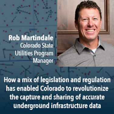
Mapping the Colorado Underground: Colorado is proactively using a 2018 One Call law and new procedures to reduce underground utility hits, which in the US exceed 50,000 annually. The law requires higher accuracy One Call utility locates (Level B). The presentation will describe: 1) including higher accuracy utility locations on contractor bidding documents, 2) installing electronically locatable devices on new utilities, 3) the impact on unde...

UEVO is a Digital Twin of city subsurface infrastructure, which helps solve the problem of managing aging, complex infrastructure under increasingly strained budgets. UEVO unifies fragmented data to enable multiple stakeholders to visualise, manipulate and create subsurface elements quickly and easily, collaborating in real time.


Moderator: Prashant ShuklePresenters: Rob Martindale, Olive Powell, DND, PSPC


Vendredi 30 Avril, 2021

Gyro mapping is rapidly becoming a widely accepted technology for obtaining accurate XYZ data of subsurface utility infrastructure. Whether through national regulation or the utility network owners’ diligent network management policies, gyro mapping is becoming a standard new-build specification, in particular for trenchless installation methods. In addition, Utility network owners see a great benefit in having an objective and accurate as-built profile during the hand-over process with infra...


Les billets pour cet atelier doivent être achetés à l'avance.

Mardi 1 Mars, 2022

Join Jonathan Murphy, Nicholas Kellett and John Roos as they kick off the start of Winter Geo:GeoIgnite 2022.


In this talk Dan Nord will share key insights on Maxar’s position as a centerpiece in the global tech shift from 2D to 3D. Join us to hear more about how Maxar is accelerating its Earth Intelligence business with the launch of WorldView Legion in 2022, as well as building on our lead in mapping, monitoring, and new markets of the future.


"GHG Monitoring from Space: A mapping of capabilities across public, private and hybrid missions" was a collaborative effort undertaken by the Group on Earth Observations (GEO), WattTime, and the World Geospatial Industry Council (WGIC).This report, presented at the United Nations Framework Convention on Climate Change (UNFCCC) Earth Information Day at the 26th session of the Conference of the Parties (COP 26), was the first syst...

In Budget 2021, the government tabled a recovery plan for jobs, growth, and resilience. Within the budget were specific investments to promoting a healthy environment for a healthy economy, with $145.5 million dedicated to supporting initiatives that will increase resiliency to the natural hazards of wildfires and floods, which are becoming more frequent, severe, and devastating due to climate change and urban development. Flood hazard maps are essential to un...


Planet's constellation of satellites capture the whole of Earth's landmass every day. This unprecedented dataset provides insights to the agricultural sector, helping farmers and the companies that serve them make informed, timely decisions. But translating that data into insights isn’t always straightforward. In this session, Greg Crutsinger will go over the fundamental ways space observation is serving agricultural customers and present new applications in satellite data - everything fro...


Abstract: Organizations are increasingly relying on geospatial analysis to power their decision making and business processes. But in such a dynamically changing world, maintaining an accurate database of critical locations is no small task. Everyday worldwide, businesses open and close, change names, or update their operating hours. When these changes happen, any map, application, or model immediately becomes stale. How can organizations strategize if they are not...


NV5 Geospatial has been at the forefront of hydrospatial data acquisition and processing for decades. This presentation will provide a brief corporate introduction and overview of some of the technologies relevant to remotely sensed hydrospatial data collection and development. This will also include associated analyses and ancillary data integration to solve questions surrounding hydrology and wetland mapping, flood risk modeling, and habitat...


The landscapes in the Northwest Territories (NWT, Canada) are amongst the most rapidly changing in the world due to climate-induced permafrost thaw. This presentation provides an overview of recent remote sensing and mapping investigations of permafrost thaw landslides across different spatial and temporal scales in the NWT. A common thread of ever-expanding geospatial capabilities (remote sensing, machine learning) is juxtaposed against rapidly intensifying permafrost thaw with many growi...


Mercredi 2 Mars, 2022

Join Jonathan Murphy and John Roos as they kick off the start of Day 2 Winter Geo:GeoIgnite 2022 and share some information on the upcoming workshop week.

Our planet is in flux: pandemics, climate change, inequality. This talk will explore the ideas of "planetary-scale" as it pertains to the geospatial community’s work. We will be looking at how we need planetary-scale thinking to address the planetary-scale problems we are now being challenged with. We don’t have a “Planet B", so how can geospatial technology be used to ethically approach some of the most pressing issues our species have collectively faced? &...

At a time of rising climate change impacts, there is a vital and growing need to prepare for, respond to, and recover from natural disasters. But there is a critical communication gap between authorities and citizens.Drawing on the ongoing results of our massive multi-year climate change research and development project, and with assistance from hundreds of students, citizens, academics, NGOs, government officials, and industry p...

Dr. Marshall and Keith Masback will explore climate change and what happens at the intersection of climate and the Earth’s surface.


Maritime regions are vast, vessels of interest operate dark, and the agencies responsible for maritime enforcement need to deploy scant resources efficiently to make the greatest mission impact. Maxar has developed the Crow’s Nest Maritime Monitoring and Security (MMS) product to address this need. The product leverages space-based optical and radar imagery, AIS, advanced ma...


Statistics Canada along with their partner, VertiGIS Studio (formerly Geocortex), have collaborated to update the original Census Program Data Viewer (CPDV) https://www12.statcan.gc.ca/census-recensement/2021/dp-pd/dv-vd/cpdv-vdpr/index-eng.cfm. VertiGIS Studio Web and Reporting were used to configure an advanced web-based data visualization tool, that supports the dissemination of statistical data gathered in the 2021 Canadian census. This tool will make statistical information more...


Inter-annual variability in agricultural production in Canada is largely determined by weather and climate. Climate-related impacts have caused billions of dollars in financial losses in some years, with the incidence of extreme weather and related costs expected in increase in a changing climate. The National Agroclimate Information Service at Agriculture and Agri-Food Canada monitors the impacts of weather and climate on agricultural activities using a number of geospatial data sets, mod...


MDA's new multi-sensor Earth observation satellite constellation, CHORUS, will bring together multiple diverse and unique perspectives in harmony, opening the aperture and the art of the possible to provide a new level of real-time insight about our planet.Building on the legendary RADARSAT program, CHORUS will provide the most extensive radar imaging capacity on the market. With advanced C-band and X-band Synthetic Aperture Rada...


Join our DG Panel discussion moderated by Jonathan Murphy, Managing Director of GoGeomatics Canada. Our panelists are Eric Laliberté, Éric Loubier and David Harper.As a country spanning almost 10 million square kilometres, Canada has always faced a unique challenge in collecting the day-to-day information needed to provide critical services to Canadians. Today, space offers a unique perspective that is increasingly important to under...
Jeudi 3 Mars, 2022

Join Jonathan Murphy as they kick off the start of Day 3 Winter Geo:GeoIgnite 2022 and announce our award recipients.

Sanjay Kumar is the founder and CEO of Geospatial Media & Communications. He also lends his time and experience to many organizations helping them to further the cause of increasing the impact of geospatial technology and its applications at a global scale.


The increase in the availability of high-resolution lidar and other point cloud datasets has given rise to the use of this data for detecting change in the environment over time. Continual improvements in airborne technology and the miniaturization of the requisite sensors has cultivated a nimble new branch of the industry that provides cost-effective data collection services virtually on demand. This ability to employ temporal analysis of the geospatial landsca...

Sree, the CEO of NeoGeoInfo will give a brief introduction of the organization along with our focus on 3D Data, Sub Surface Utility Detection (GPR surveys). NeoGeoInfo had been continuously investing in latest data acquisition techniques and equipment. Our proficiency in Data Processing using DL/ ML or other Cognitive technologies is unmatched. We adopt to the customer technology stacks and provide the best solution possible for application development. Sree will announce NeoGeoInfo' plans...

By some estimates, 80% of response time during a disater is spent procuring and preparing data, leaving 20% of the time learning from data. We can do better. Sponsored by USGS/FGDC, Natural Resource Canada, NASA and supported by CONIDA (Peru) and Amazon Web Services, the goal of the pilot was to develop standards-based services to support rapid decision making through the full life-cycle of disaster management for multiple hazards.


Climate change affects everybody. Solutions will be successful when everyone can get involved. An examination of the Diversity of viewpoints, needs, wants, and must haves is vital when approaching this topic. This panel will discuss and engage each other as well at the audience.


