
Juan Reyes
Him/He
I hold a Combined Honours BSc in Physics and Mathematics with a Certificate in Information Technology from Dalhousie University. I later pursued a Graduate Certificate in Geospatial Data Analytics from the Centre of Geographic Sciences (COGS), followed by an MSc in Applied Geomatics at Acadia University—funded through the Esri Canada/Esri Inc. Internship and Grant program.
My background bridges mathematical physics, geospatial analytics, and data science. I specialize in simplifying and modeling complex systems—natural or human-made—using Python, R, and modern GIS tools such as ArcGIS Pro, ArcGIS Online, ArcPy, and more. My approach blends theoretical depth with hands-on spatial data engineering and visualization.
I currently work as a GIS Analyst for Elections BC, where I manage production and test geospatial databases in Oracle 19c, support migration to modern GIS systems, and lead geospatial CI/CD operations for the province’s 43rd General Election. I collaborate with government teams and GIS technicians to deliver accurate, neutral, and scalable electoral data products using automation, spatial ETL, and data integrity checks.
On the personal side, I’m building an MLOps pipeline for LiDAR land cover classification, showcasing cloud-native geospatial data science. Using AWS (EC2, S3), Apache Airflow, DVC, and GitHub, I’m constructing an end-to-end workflow for processing raw LiDAR data, training machine learning models, and deploying results to a public-facing dashboard.
Whether I’m analyzing drone and satellite imagery or crafting reproducible workflows, I strive to make data-driven insights accessible and actionable. I enjoy transforming technical complexity into interactive visual stories and dashboards for decision-makers and the public.
I’m especially interested in how mathematical models from physics—like dynamical systems—can inform machine learning, urban planning, and ecological prediction.
A confident communicator and lifelong learner, I’ve presented at institutions such as the Fields Institute and worked in public science education at Halifax’s Discovery Centre. I’ve also supported university teaching in physics, computing, and data analysis.
Let’s connect if you’re interested in geospatial data science, MLOps, or making sense of complex systems through computation and visualization.
Check out my website or GitHub to see what I’m working on!
Sessions auxquelles Juan Reyes assiste
Samedi 16 Octobre, 2021
Event times are in Eastern Time. Schedule:11:00-12:30pm - Opening Session12:30-1:30pm - BREAK1:30-3:00pm - Closing Session Finding a job in geospatial technology can be difficult. Covid-19 is not making that any easier. That’s why GoGeomatics Canada is bringing back our popular Career Seminar to give job seekers the tools and techniques that will put them ah...
Lundi 12 Mai, 2025

This open forum invites all attendees to engage in discussions on Canada’s path toward greater self-reliance in the geospatial sector, particularly in light of emerging trade conflicts, including the recent U.S. tariffs, and evolving global geopolitical shifts. The forum will explore strategies to strengthen Canada’s technological capabilities and reduce reliance on external sources, with a focus on fostering innovation, security, and growth.


Canada's Centre for Mapping and Earth Observation (CCMEO) and GoGeomatics Canada have invited Canadian students to use GEO.ca, the definitive source for Canada's open geospatial information, to develop innovative solutions for a specific challenge scenario in the months leading up to GeoIgnite.The results of the 2025 Hackathon will be announced at GeoIgnite. The presentation will include an overview of GEO.ca and the purpose and challenge of the Hackathon, followed by presentations from t...

Join us for a thought-provoking lunchtime discussion where we explore the evolving landscape of Canada’s geospatial industry while enjoying a delicious meal.The concept of Two Solitudes has long symbolized the cultural and linguistic divide between English and French Canada, but how does this idea still resonate within our geospatial ecosystem to...


Join us for the OGC Canada Forum! We’ll dive into key topics like the Canadian Geospatial Data Infrastructure (CGDI) and how Building Information Modeling (BIM) integrates with Geographic Information Systems (GIS). This event gathers experts from industry, academia, Indigenous organizations, and government to explore these technologies' impact on Canada’s built environment. We'll also cover how OGC standards boost interoperability and innovation. All Canadian organ...


📅 Date: Monday, May 12, 2025📍 Location: Rainbow Bistro, 76 Murray Street, ByWard Market, Ottawa⏰ Time: Networking at 6:30 PM | Panel begins at 7:00 PM | Live music to follow🍽 Details: Cash bar and hors d’oeuvres provided Event OverviewJoin us for an evening of high-level discussion, networking, and live music in the heart of Ottawa’s historic By...


Mardi 13 Mai, 2025

GET YOUR TICKETMORE PURCHASING OPTIONSJoin us for an exclusive Networking Party at the Canada Science & Technology Museum as part of the 2025 buildingSMART Canada National...
Mercredi 14 Mai, 2025

The convergence of generative artificial intelligence and geospatial technology is transforming how we validate and ensure the quality of location-based data. This talk explores how AWS is enabling new approaches to geospatial data validation through the power of generative AI, which helps public and private sector organizations achieve their sustainability missions.As we operate in a world with more earth observation data being generated everyday, the planet is imaged daily and, with ...

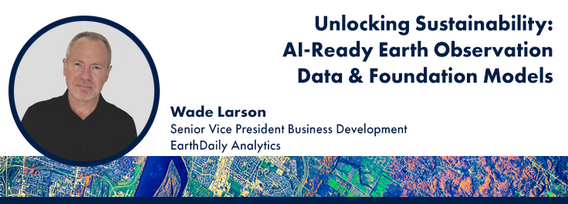
Foundation models represent a transformative shift in the utilization of EO data, historically limited by data complexity, and the manual preparation and analysis required to employ the data. By using foundation models with forthcoming AI-ready EO datasets, users will be able to efficiently develop solutions for diverse sustainability applications without extensive labeling efforts. This approach greatly expands the practical value and accessibility of EO data, driving innovations across envi...
