
Dr. Cassidy Rankine is an Earth Observation evangelist, a global change scientist, and remote sensing solutions connoisseur. He has worked all over the world building satellite calibration and validation sites and developing geospatial data products and platforms to help solve remote monitoring need for our vanishing natural capital resources. His current role as a Sr. Account Executive at Planet Labs Geomatics based in Western Canada brings together expertise in geospatial technologies to help business and government adopt new strategies for digital transformation and sustainability problems by leveraging emerging EO capabilities.
Elementy, w których Cassidy Rankine uczestniczy
wtorek 7 listopad, 2023

Planet scans the entire land mass of the planet nearly everyday with high resolution multispectral imagery, enabling exciting new opportunities and solving old challenges for digital transformations and sustainable business acceleration. Now with our growing fleet of 8-band Superdoves in orbit, the launch of our Planetary Variables - daily soil moisture, temperature, crop and forest biomass, etc - we have evolved even greater capabilities for a new era of Earth Observation technologies. In th...
Elementy, w których Cassidy Rankine attends
wtorek 1 marzec, 2022

Planet's constellation of satellites capture the whole of Earth's landmass every day. This unprecedented dataset provides insights to the agricultural sector, helping farmers and the companies that serve them make informed, timely decisions. But translating that data into insights isn’t always straightforward. In this session, Greg Crutsinger will go over the fundamental ways space observation is serving agricultural customers and present new applications in satellite data - everything fro...

środa 2 marzec, 2022

Our planet is in flux: pandemics, climate change, inequality. This talk will explore the ideas of "planetary-scale" as it pertains to the geospatial community’s work. We will be looking at how we need planetary-scale thinking to address the planetary-scale problems we are now being challenged with. We don’t have a “Planet B", so how can geospatial technology be used to ethically approach some of the most pressing issues our species have collectively faced? &...


Inter-annual variability in agricultural production in Canada is largely determined by weather and climate. Climate-related impacts have caused billions of dollars in financial losses in some years, with the incidence of extreme weather and related costs expected in increase in a changing climate. The National Agroclimate Information Service at Agriculture and Agri-Food Canada monitors the impacts of weather and climate on agricultural activities using a number of geospatial data sets, mod...


Join our DG Panel discussion moderated by Jonathan Murphy, Managing Director of GoGeomatics Canada. Our panelists are Eric Laliberté, Éric Loubier and David Harper.As a country spanning almost 10 million square kilometres, Canada has always faced a unique challenge in collecting the day-to-day information needed to provide critical services to Canadians. Today, space offers a unique perspective that is increasingly important to under...


wtorek 7 listopad, 2023

Is change the new normal? Every year seems to be the next warmest year. Those of us looking back at our planet from space are seeing these changes across our planet in near real-time through the eyes of satellites. But behind those pixels are real human stories of catastrophe and suffering. So, with all our constellations of satellites, massive computing power and new generative AI algorithms, can we do anything more than simply report what happened? What does the future hold for geospatial t...

In the face of escalating environmental challenges, Canada grapples with the urgent need for advanced solutions in wildfire monitoring, emissions reduction, and natural resource management. This panel discussion explores how the burgeoning "New Space" frontier offers innovative approaches to address these critical issues.We aim to provide a platform for various industry players to share their own innovative technologies and insights, creating a vibrant dialogue on crucial geospatial...


With an increasing multitude of new Earth Observation (EO) satellites, it is imperative for the geomatics community to assess the fit of these emerging space assets. This presentation aims to provide a comprehensive analysis of the diverse range of EO satellites currently being deployed, and their potential applications.Topics:1) An Overview of the recent surge in EO satellite launches2) New satellite capabilities, and use cases3) An exploration of the challenges customers ...


There is a pressing need for a global change detection system capable of persistently monitoring the entire earth with globally consistent coverage, temporally consistent sampling, scientific-grade geometric and radiometric quality, and cost-effective management of daily data. These four conditions enable near real-time monitoring and retrospective change detection applications while minimizing false positives and the required work to develop, maintain, and run harmonizing a...
środa 8 listopad, 2023

As part of Planet’s ethos of ‘agile aerospace’, we continually invest in the latest hardware and software advancements to improve the PlanetScope image quality. This dataset began life as a relatively simple 3-band image using commercial, ‘off-the-shelf’ hardware components. Through customer feedback, both software and hardware improvements were tested and launched, resulting in a second-generation of PlanetScope, or ‘Dove’ satellites. Replacing this second generation of satellites involved a...

poniedziałek 12 maj, 2025

📅 Date: Monday, May 12, 2025📍 Location: Rainbow Bistro, 76 Murray Street, ByWard Market, Ottawa⏰ Time: Networking at 6:30 PM | Panel begins at 7:00 PM | Live music to follow🍽 Details: Cash bar and hors d’oeuvres provided Event OverviewJoin us for an evening of high-level discussion, networking, and live music in the heart of Ottawa’s historic By...


wtorek 13 maj, 2025

At GeoIgnite 2025, Alexander will explore how Canada's geospatial community is uniquely positioned to lead in developing solutions to environmental challenges in a rapidly changing geopolitical landscape. Drawing on compelling case studies from around the globe, including successful Dutch-Canadian collaborations, he will demonstrate how geospatial technologies are becoming indispensable tools for environmental monitoring, climate resilience planning, and sustainable...

A seasoned leader in geomatics and Earth Observation with two decades of experience in the federal government, Eric Loubier has vast expertise in developing and implementing national geomatics and Earth observation strategies. In his talk, Eric will explore the integration of AI with Earth observation, and how this powerful combination is transforming Canada’s approach to addressing critical national issues like climate change, natural resource management, urban planning, and disaster response.

środa 14 maj, 2025
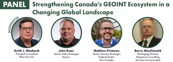


As the geopolitical landscape shifts and a new global space economy emerges, Canada must navigate complex international dynamics and seize opportunities in all facets of the space ecosystem. In this talk, we will explore how space can be part of the solution to geopolitical and national challenges—and what Canada must do to stay ahead in a rapidly evolving global landscape.


This talk will highlight method innovations in water research using satellite earth observations (SEO) in the Canada Centre for Mapping and Earth Observation (CCMEO) of Natural Resources Canada (NRCan). They include dynamic surface water mapping and modelling for water areas and water volume changes, terrestrial water storage variations, groundwater recharge evolution and storage changes, water extreme events (drought and flood) characterization, and environmental and climate impacts on the w...


Natural Resources Canada’s (NRCan) Emergency Geomatics Service (EGS), under the Canada Centre for Mapping and Earth Observation (CCMEO), supports the national and international emergency response efforts by providing rapid disaster mapping services. This presentation will give an overview of the service and highlight examples of how it uses satellite imagery and advanced remote sensing technologies to assess the impact of natural disasters like floods, geohazards, and wildfires, enhancing sit...


Unlocking the Power of EO and AI through Collaboration and PartnershipsThis panel will explore the transformative power of Earth Observations (EO) and Artificial Intelligence (AI), emphasizing the critical role of collaboration and partnerships in unlocking the full potential of these technologies. As global challenges continue to evolve, th...


In a world of constant change and uncertainty, how can we make informed decisions in real-time, grounded in the realities of ambiguity? This presentation tackles these fundamental questions by exploring the evolution of how we understand and interpret our world—from childhood curiosity to professional expertise—and how these insights shape decision-making in complex environments.Using case studies in GEOINT adoption inside and outside traditional national security communities, I will d...
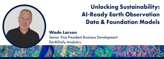
Foundation models represent a transformative shift in the utilization of EO data, historically limited by data complexity, and the manual preparation and analysis required to employ the data. By using foundation models with forthcoming AI-ready EO datasets, users will be able to efficiently develop solutions for diverse sustainability applications without extensive labeling efforts. This approach greatly expands the practical value and accessibility of EO data, driving innovations across envi...
