
Mohamed Attia
Elementy, w których Mohamed Attia attends
wtorek 22 marca, 2022

As the world continues to grow and urbanize, new urban infrastructure is being constructed at an unprecedented rate while old world infrastructure is being replaced and upgraded. This has lead to a greater demand for accurate and current utility locating and mapping. This demand is further exacerbated by the fact that infrastructure construction costs continue to rise and the slightest delay or extra cost associated with insufficient utility locating has an...


This presentation will be focusing on the advancement of "Cloud and Mobile" technologies that are currenlty being used to easily and accurately map assets and underground utilities that can be shared, re-located and leveraged thoughout the many project phases.It is critical that data accruacy and integrity is leveraged and accumulated throughout every phase of the BIM procress, creating a live "digital twin" all the way back to t...


Abstract:The total cost of underground infrastructure damage in Canada during excavation work is estimated to be over $1 billion dollars annually. The primary cause of these damage incidents is the lack of reliable information on the location and other information about buried utilities and other infrastructure. The Canadian Underground Infrastructure Register project is intended to improve the current damage prevention process by providing access to reliable data t...


środa 23 marca, 2022

Utility and energy buried pipelines represent an extensive underground network covering most of a country's territory. Their precise lateral, horizontal positioning along with their depth of cover is a critical element of any operator's GIS. It enables to deploy more accurate pipeline predictive maintenance models and avoid third party interferences. The latter being identified as one of the main causes of pipeline failures. The 2020 CGA Dirt report states that 3...


A longstanding and unsolved problem for utility companies has been how to keep geospatial network asset data up to date as networks are extended and maintained. Currently, it can take weeks if not months for “as-built” changes to make their way back into the enterprise system of record, typically a geographic information system (GIS). Existing mobile solutions can enable workers in the field to capture data about network asset data updates, but are too time consuming and comple...

As one of the oldest American cities, Boston holds a rich history and culture that runs not only through the streets but also beneath them. Many of the large underground infrastructure projects completed between the late 1890s and the late 1920s in Boston are still in use today. The preservation of infrastructure and the insights gleaned from the practices used to create it provide valuable lessons in how to maintain standards of excellen...


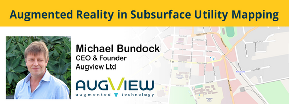
We live in a world where the skill required to interpret maps and engineering drawings is decreasing while the density of underground networks is increasing. The result is increased collateral damage, network outages and poor health & safety outcomes for our field workers.Today, we need better ways to accurately capture and comprehend the location and nature of those networks that are out of site under our feet. AR (Augmented...
czwartek 24 marca, 2022

GIS platforms are typically populated with XYZ coordinates with a point spacing of 1 meter or more. in fact, most traditional land surveying techniques, like GPS, often have a point spacing of 3 meters or more, and that is understandable given the procedure to obtain these points. But have you ever wondered what amount of detail is lost when increasing the point frequency? Well, in this seminar, Otto Ballintijn will demonstrate the impact point frequency has on pipe detail usin...


Scribble Maps is an easy-to-use online GIS and web mapping visualization solution. The software has a robust toolset along with vast operations that can help you annotate maps, plot territories, filter and analyze data, optimize routes, add images, and more.Our powerful mapping software can easily be integrated with many different file formats including GeoJson, SHP, KML, CSV, GPX, DXF, and PDF. Founded in 2009, Scribble Maps has been developed from direct user f...


Reveal is building the world's most advanced and accurate digital twin technology for subsurface infrastructure. We're driving a safer, more efficient and sustainable world by revealing the truth of the underground. Join us for a 30min presentation where we will be showcasing our technology through our flagship project in Wellington, New Zealand.

wtorek 5 kwietnia, 2022

Case study outlining the challenges, solution and final result associated to a complex commercial renovation project.


Use case outlining the challenges, solution and result associated to a Lidar data acquisition using drone and vehicle.


Multi-beam bathymetric surveys are used to gather detailed information about the features on the sea, river or lake bed by measuring multiple depths from a transducer array at high resolution. The result is a highly accurate 3D point cloud representation of the sea floor – similar to aerial LIDAR.

In recent years the geospatial drone market has expanded dramatically. Drone based UAS (LiDAR) and UAV (Imagery) systems vast differences make it difficult to choose one over the other. This presentation aims to explore their differences from the point cloud processing aspect. We will examine the pros and cons of each system for practical survey and mapping applications such as topographies, bare earth, volumetrics, etc. Learn how data accuracy, density, intensit...


A distinguished panel of 3D laser scanning industry veterans will be offering examples of some of their more difficult projects, along with the best practices they applied and the lessons they learned. This will be one of the highlights of the event.


środa 6 kwietnia, 2022

In this informative discussion, learn how to easily display and manage mobile Lidar and static laser snap from a unique source of trustful data in the cloud. Key take-aways include:Turn structured and unstructured mobile point clouds in high-resolution 3D meshesMake the most of your static or indoor mobile scanners in a combined workflowEffortlessly use visual analysis to reconcile your BIM models to your scansUse cost effective pro...


Learn more about the transportation industry's most productive software solution for extracting topography, 3D models, GIS Assets, and more from drone (UAV) point cloud data. We will demonstrate how TopoDOT®'s comprehensive tool suite allows you to establish a highly productive process to extract break-lines, surface models and assets in a CAD environment. Learn how high quality data promote feature extraction automatization and productivity.


Lidar! This ubiquitous 3D technology is transforming how we visualize, map and analyze the world around us. What is it and how does it fit into the remote sensing toolbox? This presentation provides an overview of the core advantages of lidar data and an overview of the latest sensor solutions from RIEGL.

środa 27 marca, 2024

The United States’ National Geodetic Survey (NGS) plans to modernize their National Spatial Reference System (NSRS) in 2025, including adopting a new dynamic geometric reference (the North American Terrestrial Reference Frame of 2022 (NATRF2022)) and a new geoid-based height system (the North American-Pacific Geopotential Datum of 2022 (NAPGD2022)). To ensure continued geospatial referencing compatibility, the Canadian Geodetic Survey (CGS) plans to modernize the Canadian Spatial Reference Sy...

poniedziałek 28 października, 2024


GoGeomatics is hosting a pizza party for the volunteers setting up the Canada Maps and Poster Gallery at the National Geomatics Expo. It's a chance to enjoy some great food while connecting with fellow volunteers. After the event, you'll also have the opportunity to meet and mingle with exhibitors and speakers, providing a relaxed environment to network with industry professionals before the expo kicks off. Join us for a fun and rewarding eve...

Join us at the National Geomatics Networking Reception Enjoy a selection of gourmet hors d'oeuvres, including savoury Moroccan lamb meatballs, smoked pork belly lollipops, and wild mushroom arancini with truffle oil. Vegetarian options like vegetable samosas with mango chutney and goat cheese tartelettes will satisfy all palates. Plus, your ticket includes a drink to enjoy while you connect with industry professionals. Elevate your evening with these delicious bites and great company!<...

wtorek 29 października, 2024

This career fair is an excellent opportunity for your organization to showcase its vision, culture, and the exciting opportunities on offer. Engage with a diverse pool of candidates, including experienced professionals and emerging talents with fresh perspectives. Each candidate brings unique skills and innovative ideas, making your participation a strategic investment in the future of your organization and the geomatics sector.The Western Canada GeoIgnite Career Fair is crucial for re...


How exactly does artificial intelligence work and what can you use it for in the geomatics domain? Using real-life examples from our projects, they demonstrate how you can use AI to gain new insights and increase efficiency by automating your data processing workflows.We explore how GeoAI is fusing spatial data science and Geomatics technology to help automate the extraction, classification, and analysis of all types of spatial or non-spatial data. Learn how GeoAI can detect clusters, ...


The session will focus on considerations for deploying Artificial Intelligence in professional practice; identifying potential landmines and working on solutions from a privacy-first perspective. The talk will include a high-level overview that underscores the fundamental components that encapsulate an AI derived “solution” and delve into a practical, real-world example being tested on an active project.Topics Covered:• An illustrated example of BIM model query using AI• AI too...


