Marikka Williams
Elementy, w których Marikka Williams uczestniczy
wtorek 18 czerwca, 2019
Presentation Summary: As a student or potential student in a GIS Certification Program developing a vision for future career possibilities is an important part of meeting with success. This presentation will provide an overview of the following: •Where have all the GIS graduates gone? •Evaluating the Possibilities •Mapping your Future Career We will discuss the career paths of GIS Certification Program ...
środa 19 czerwca, 2019
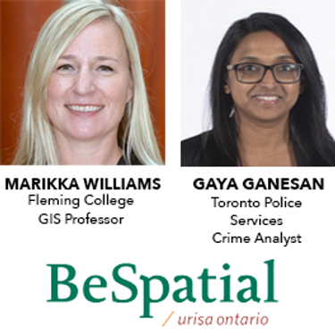
Marikka Williams, MSc, GISP and Professor, Fleming College Geographic Information Systems welcomes delegates to the morning and will be master of ceremonies for the morning.
wtorek 27 kwietnia, 2021
Google Chrome is the preferred browser for this session.Tickets for this workshop must be claimed in advance.This session will occur from 10:00AM-11:00AM and repeat again from 11:00AM-12:00PMBeSpatial is a geospatial community platform in Ontario that has opened doors to connect, communicate and innovate. BeSpatial aims to provide networking opportunities, programs, and ...
Elementy, w których Marikka Williams attends
środa 22 lipca, 2020
Opening Remarks by GeoIgnite founder Jonathan MurphyKeynote address: Geospatial Opportunities in COVID TimesGeospatial capacity has been helpful in providing answers to Canadians during a time where nothing seems normal anymore. At the forefront of tracking, reporting and managing the response to the COVID crisis are geospatial tools, data and leadership. Natural Resources Canada’s Canada Centre for Mapping and Earth Observation supported the Government of Canada’s response b...
Building on the panel discussion at GeoIgnite 2019, David Acco will discuss the potential of geospatial data and analytics to advance issues critical to Indigenous communities across Canada, from exerting sovereignty over territory, to environmental protection and climate change adaptation, to natural resources development. Mr. Acco will further outline how his firm, Acosys Consulting Services Inc., has developed an approach to marrying Indigenous Traditional Knowledge (ITK) and geospatial...
The U.S. reference system modernization effort will replace the North American Datum of 1983 (NAD83) with a new North American Terrestrial Reference Frame (NATRF2022), creating 1.3 to 1.5 m horizontal coordinate differences at the Canada–U.S. border with respect to Canada’s NAD83(CSRS). Never before have such significant differences existed between our two countries’ reference frames.There are compelling reasons for Canada to follow suit and adopt the NATRF2022 frame as our ...
Presented by: Jake Dickinson & John Roos Abstract: As shrinking polar ice creates new opportunities for resource exploration and shipping routes, the importance for Arctic nations to monitor the ongoing expansion in the Arctic is ever increasing. Additionally, climate change continues to impact people and the environment. High resolution satellite imagery remains one of the most effective means of monitoring inaccessible and de...
Strategic Geospatial for a Complex WorldWhere humans move and landscapes change there is value. That’s geospatial. This talk is about how to think strategically about geospatial technology in an increasingly complex world.In particular, we will focus on canada’s strengths, and how we might inject novel geospatial technology into new markets
GIS users’ numbers are expanding around the world. It is now possible to find a GIS use in every field and to optimize their success. Discover how Business Geografic work throughout all fields to offer a new and modern approach to use Geografic Information Systems. Wheter your need are the one of an expanding business, a wide world telecom company or an official government entity, find out how we can help you vizualise your data and improve your process.
Geospatial and location technologies is present and continues to expand its reach in many sectors. Much of the current digital transformation taking place globally is built upon geospatial foundations. In this open panel discussion, our experts will discuss the latest developments and challenges facing the Canadian and global geospatial sector and what the future holds. Key components to be addressed include how has the global pandemic affected our sector and how may we be impacted in the...
czwartek 23 lipca, 2020
The GeoIgnite Conference and our sponsors are proud to present the second Diversity Leadership panel. Our inaugural Summit was a great success featuring relevant diversity and inclusion topics, a powerful panel of speakers, and a "full house" of engaged participants.Increasing the diversity, equity, and inclusiveness of the Geomatics community is essential to our mission. There can be no barrier to talent at Geospatial organizations as solving the world’s most intractable proble...
piątek 24 lipca, 2020
In recognition of the increasing costs and risk due to flooding, the Government of Canada is investing in flood mapping as part of the Government’s commitment to build safer and more resilient communities. Flood maps are critical for the public to understand their flood risks, and the availability of up to date flood hazard maps are key to strengthening the resilience of Canadian communities to overland flooding. Natural Resources Canada (NRCan) has been working in collaboration to advance...
We are living through a transformative time, not least in the space industry. A graph of upcoming satellite launches looks like a hockey stick – soon there will be orders of magnitude leading to more satellites being launched and more downstream data being generated from space than ever before. The question is, what is the most effective means of ensuring that space data brings tangible benefits to business operations and value to end users? In our talk we cover a satellit...
Title: DEIL experiments and outputs with open geospatial dataThe Data Exploration and Integration Lab (DEIL) at Statistics Canada has implemented a number of projects using, to the extent possible, open georeferenced data and open source tools. This presentation outlines some of this work. We will present recent developments of the Linkable Open Data Environment (LODE), examples of the use of LODE data, the development of a Proximity Measures Database and Data Viewer, and an R&amp...
Abstract A fundamental shift in the geospatial industry has occurred over recent years. Modern remote sensing technology has been developed at PCI Geomatics and in Canada through advanced research through partnerships with private industry, academia, and government researchers. Ubiquitous access to openly accessible earth observation data, cloud computing infrastructures and international collaboration have created opportunities to increase downstream access to inf...
poniedziałek 12 maja, 2025
This open forum invites all attendees to engage in discussions on Canada’s path toward greater self-reliance in the geospatial sector, particularly in light of emerging trade conflicts, including the recent U.S. tariffs, and evolving global geopolitical shifts. The forum will explore strategies to strengthen Canada’s technological capabilities and reduce reliance on external sources, with a focus on fostering innovation, security, and growth.
Canada's Centre for Mapping and Earth Observation (CCMEO) and GoGeomatics Canada have invited Canadian students to use GEO.ca, the definitive source for Canada's open geospatial information, to develop innovative solutions for a specific challenge scenario in the months leading up to GeoIgnite.The results of the 2025 Hackathon will be announced at GeoIgnite. The presentation will include an overview of GEO.ca and the purpose and challenge of the Hackathon, followed by presentations from t...
Join us for the OGC Canada Forum! We’ll dive into key topics like the Canadian Geospatial Data Infrastructure (CGDI) and how Building Information Modeling (BIM) integrates with Geographic Information Systems (GIS). This event gathers experts from industry, academia, Indigenous organizations, and government to explore these technologies' impact on Canada’s built environment. We'll also cover how OGC standards boost interoperability and innovation. All Canadian organ...
