Susan Muleme Kasumba
Susan Muleme Kasumba is the Director of Business Development at Airborne Imaging Inc., a Barr GeoSpatial Company. Susan is a graduate of Sir Sanford Fleming’s GIS/Cartography program and attended the University of Guelph. She joined Airborne Imaging in 2011 and has over 20 years of experience in the mapping industry. Susan lives in Ottawa and has been a member of BeSpatial Ontario for 10 years (currently the Manager of Strategy and Outreach and Past-President). This presentation was part of the 2022 Webinar Series.
Elementy, w których Susan Muleme Kasumba uczestniczy
wtorek 18 czerwiec, 2019

BeSpatial / urisa Ontario, is a not for profit representing the Geospatial and Information Community in Ontario. Our BeEmployed session, is designed to help you step out of the comfort zone of applying to jobs posted online. This presentation will teach you about: effective networkingthe information interviewusing social media as part of your job searchrecommended professional organizations to joinsuggested conferences to attenda...
wtorek 26 marzec, 2024

The Canadian government first formally created LiDAR Guidelines in 2017. The document was updated in 2022 to Version 3.1. This session will review the Canadian Guidelines and compare them to the USGS LiDAR Base specification, updated in 2023. Included in the presentation will be:LiDAR for Flood Mapping and funding from the National D...

Canada’s LiDAR Panel: Future Trends in Service and Tech, is a deep dive into the evolving landscape of LiDAR technology in Canada. Our panel of experts will explore cutting-edge developments in LiDAR, focusing on new trends in service delivery and technological advancements. Expect insights into the integration of AI, enhancements in data processing, and future applications in sectors like urban development and environmental management. This session promises to equip attendees with a forward-...


wtorek 14 maj, 2024

Join us at GeoIgnite 2024 for a dynamic career panel featuring a distinguished lineup of leaders from government and industry, who will explore the evolving landscape of geospatial careers in Canada. This panel, moderated by Susan Kasumba, Director of Business Development at Airborne Imaging Inc., will provide invaluable insights into the current and future trends shaping the geospatial sector.Panelists include Melanie Desjardins, Di...


poniedziałek 12 maj, 2025

This open forum invites all attendees to engage in discussions on Canada’s path toward greater self-reliance in the geospatial sector, particularly in light of emerging trade conflicts, including the recent U.S. tariffs, and evolving global geopolitical shifts. The forum will explore strategies to strengthen Canada’s technological capabilities and reduce reliance on external sources, with a focus on fostering innovation, security, and growth.


Elementy, w których Susan Muleme Kasumba attends
środa 6 kwiecień, 2022

In this informative discussion, learn how to easily display and manage mobile Lidar and static laser snap from a unique source of trustful data in the cloud. Key take-aways include:Turn structured and unstructured mobile point clouds in high-resolution 3D meshesMake the most of your static or indoor mobile scanners in a combined workflowEffortlessly use visual analysis to reconcile your BIM models to your scansUse cost effective pro...


Learn more about the transportation industry's most productive software solution for extracting topography, 3D models, GIS Assets, and more from drone (UAV) point cloud data. We will demonstrate how TopoDOT®'s comprehensive tool suite allows you to establish a highly productive process to extract break-lines, surface models and assets in a CAD environment. Learn how high quality data promote feature extraction automatization and productivity.


Lidar! This ubiquitous 3D technology is transforming how we visualize, map and analyze the world around us. What is it and how does it fit into the remote sensing toolbox? This presentation provides an overview of the core advantages of lidar data and an overview of the latest sensor solutions from RIEGL.

wtorek 26 marzec, 2024


Canada has just experienced a record wildfire season with devastating impacts. Public safety and damage mitigation is a priority for all impacted by these disasters. From mapping vegetation, analyzing slope stability, planning fire breaks, qualitfiying wood debris and fuel loads, how does LiDAR play a role in meeting post wildfire needs?
wtorek 14 maj, 2024

Connecting the knowledge economy to the emerging relationship economy in a geospatial context. This talk will emphasize the growing importance of social skills and human connectivity in harnessing the power of data and technology. His talk, titled "Human Interoperability: Enhancing Geospatial Effectiveness in the Relationship Economy," explores the notion of valuing existing resources and optimizing the use of data and technology, particularly in the geospatial sector. As the Executive Office...

GeoIgnite is thrilled to present its keynote session, "Canada's Geospatial Leadership Panel," a gathering of some of Canada's most influential figures in the field of geospatial technology in Canada. Panelist: Melanie Desjardins, Director of the NWT Centre for Geomatics, showcases the application of geospatial technology in public sector management and natural resource governance. Her leadership in geomatics plays a significant role in shaping policies and strategies that utilize ...


Monitoring large numbers of activities and assets from space has long been an aspirational “holy grail” for satellite remote sensing. However, lack of observational cadence, collection capacity, sufficient resolution, multisource capabilities and contextual understanding of monitored sites has meant that true monitoring has been limited to a handful of key facilities and mission use cases. Will we as an industry be able to overcome current challenges and turn site monitoring into a mainstream...

Get ready to mix, mingle, and enjoy an evening of delightful tastes and entertainment at the GeoIgnite Conference Social.Your conference registration includes a delectable assortment of culinary offerings prepared by the head chef of the OEC. Indulge in a variety of hot canapés, including Vegetable Spring Rolls, Spanakopita, Chicken Skewer and Lamb Spiedini. Our cold selection features Cucumber with Dill Cream Cheese and Shrimps, Bri...
środa 15 maj, 2024

As evidenced by the 2023 fire season, we are experiencing unprecedented fire management challenges in Canada. Innovative fire monitoring solutions can help support wildfire managers as they limit the negative impacts of wildland fires while also prioritize the positive benefits in Canada’s forested ecosystems. Opportunities for advancing fire monitoring mirror a broader paradigm shift in the field of Earth observations towards open data, large-scale analyses, and collaborative development. In...

Remote sensing and spatial analytics have substantial utility to support riverine and floodplain assessment and monitoring at extents not feasible with traditional field surveys. This presentation will provide an overview of relevant technologies such as topobathymetric lidar, sonar, and multiple imagery types, as well as processes for integrating and analyzing these data. Broad-scale, objective, and reproducible analytics allow for geographic and temporal comparison across entire...


In an increasingly complex and rapidly evolving geospatial landscape, the demand for skilled professionals who can deliver tailored solutions is at an all-time high. Recognizing this need, GoGeomatics Canada, the Sault Ste. Marie Innovation Centre (SSMIC), and OnPar have joined forces to provide comprehensive staff augmentation services that cater to both the private and public sectors.This presentation at GeoIgnite 2024 will detail ...


Within its highly dynamic environment, Geospatial Leaders need to integrate knowledge, knowhow, and leadership skills to promote and fully enable this domain while communicating their value proposition to decision makers. This talk will introduce a Framework for leadership development to assist Geospatial Leaders to optimize their success as leaders a...


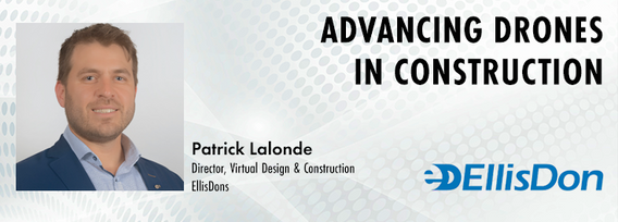
Remotely Piloted Aircraft Systems (RPAS), or drones, are becoming more common in the construction industry as a key tool to complete complex building and infrastructure projects. As technology improves, the barriers to adoption are reduced, creating a huge opportunity for the industry to improve the construction process and support the ongoing digital transformation. Drones boost productivity by enabling construction teams to rapidly and easily survey job sites, track progress, and spot poten...

The City of Ottawa (City) annually invests about $3M in studies of the local subsurface geotechnical, hydrogeological, and environmental conditions in support of municipal planning, development proposals, infrastructure designs, construction, and environmental protection studies. Much of this valuable information remains with individual consulting firms and in City project files, so this data is relatively inaccessible and not ready for use to internal and external stakeholders.