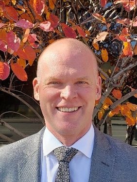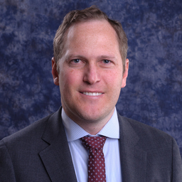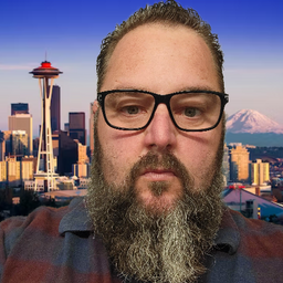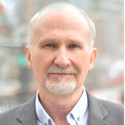
Mr. Robert Boettcher
Elementy, w których Mr. Robert Boettcher attends
środa 22 lipca, 2020
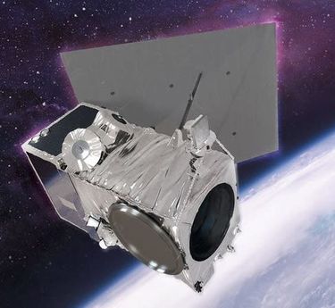
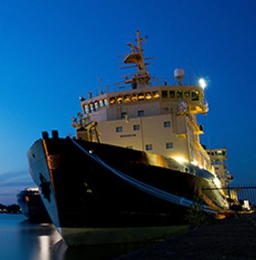
Presented by: Jake Dickinson & John Roos Abstract: As shrinking polar ice creates new opportunities for resource exploration and shipping routes, the importance for Arctic nations to monitor the ongoing expansion in the Arctic is ever increasing. Additionally, climate change continues to impact people and the environment. High resolution satellite imagery remains one of the most effective means of monitoring inaccessible and de...
Space-Based Earth Observation in Canada - A Vision for the Future Today, Canada’s landscape, coasts, waters, and cities are changing rapidly, in a large part due to unstable geopolitical currents and the acceleration of global climate change. Our future economic and environmental security, as well as the safety and well-being of its citizens, depend on our ability to understand, plan, and respond quickly to change. Space-Based Earth Observation (SBEO) technologies ...
Ocean, Marine & Coastal Hydro(Geo)spatial Management is critical for the Blue Economy. Much knowledge, data, information and coordination are needed for the marine and coastal sector in time of disruption to maintain safe and efficient operations. This session will cover the scientific basis; the detection and the response of Earthquake in the Canadian coastal zone and underwater that could potentially generate ocean coastal flooding & Tsunamis. The session will be a...
Geospatial and location technologies is present and continues to expand its reach in many sectors. Much of the current digital transformation taking place globally is built upon geospatial foundations. In this open panel discussion, our experts will discuss the latest developments and challenges facing the Canadian and global geospatial sector and what the future holds. Key components to be addressed include how has the global pandemic affected our sector and how may we be impacted in the...
Our next-generation Earth imaging constellation will change everything. We're not just launching more satellites. In 2021, we will deploy WorldView Legion which will provide unprecedented visibility into our changing planet to solve the biggest challenges facing our world today. Grab your favorite beverage and join Maxar for a casual conversation about our next constellation, Legion! Everyone who joins will be entered for a chance to win an IPad!
środa 21 kwietnia, 2021
Join us for the the launch of GeoIgnite with Jonathan Murphy, the Chair of GeoIgnite, and Dr. Minda Suchan of MDA.Abstract of MDA Keynote: Canada is the world leader in wide area space-based radar Earth observation through the highly successful RADARSAT program, supporting numerous operational and scientific uses for Synthetic Aperture Radar (SAR) data. MDA, in conjunction with the Canadian government, has created an internationally recognized brand and reputation for...
Do you know what the geospatial product trap is? We fall in love with the technology, not the problem. I am a lucky person. My job has evolved to one where I primarily get to talk about geospatial technology all day. I could be scoping out internal or external projects or evaluating technologies. Increasingly, I provide advice on product ideas. This final situation has forced me to consider the nature of our community-of-practice. The common assumption that geospatial ...
The Canadian Centre for Mapping and Earth Observation (NRCan) continues its work to implement the National Elevation Data Strategy. Through this strategy, one of NRCan's goal is to provide Canadians with an accurate three-dimensional representation of the country, in support of government priorities such as flood mapping. Because of the enormous task of obtaining a high-precision and up-to-date national elevation layer, NRCan works with different entities.The data coverage of the st...
À l'automne 2020, NV5 Geospatial, propulsé par Quantum Spatial, a été mandaté par la Communauté Métropolitaine de Montréal (CMM) pour réaliser l'un des plus grands levés lidar topobathymétriques aériens fluviaux jamais entrepris au Canada. Cette présentation examinera de plus près le contexte, les objectifs, les défis, la technologie, la méthodologie, ainsi que les résultats et conclusions préliminaires de cette importante étude aérienne des vingt-huit principaux cours d'eau entourant la v...
Explore the structure of an enterprise location intelligence platform at Agriculture Agri-food Canada and how they created a strategic road map to systematically diagnose strengths and weaknesses to drive the use of location intelligence in everyday program and policy decisions of a federal department.Agriculture and Agri-Food Canada supports the Canadian agriculture and agri-food sector through initiatives that promote innovation and competitiveness.
Maxar is building the highest resolution and most accurate 3D map of the planet and this talk will provide an overview of the products and capabilities that are making it possible.
Title: Advancing Space Based Observation in Canada:The GeoIgnite 2021 Directors General Geospatial Panel, part of Canada's National Geospatial Conference.Title: Advancing Space Based Observation in CanadaThis is a must attend panel for anyone interested in learning the direction Canada's Federal government geospatial leadership is taking.Join our panelists for an exploration of Canada's geospatial priorities and mission in this exciting discuss...
czwartek 22 kwietnia, 2021
Abstract forth coming: Oversight for CSA program sectors, including in Space Utilization, Space Exploration, and Space Science and Technology.
At a time of rising climate change impacts, there is a vital and growing need to prepare for, respond to, and recover from natural disasters. But there is a critical communication gap between authorities and citizens. Drawing on the results of our massive multi-year climate change R&D project, and with assistance from hundreds of students, citizens, academics, NGOs, and government officials, we have identified the top perceived climate change-relatedcommunication problem...
Join us April 22nd for a Fireside Chat with Dr. Steve Liang, Founder and CTO of SensorUp. Professor and Rogers IoT Research Chair at University of Calgary and Dr. Nadine Alameh the OGC’s Chief Executive Office (CEO).Steve's goal is to disrupt the silos of the Internet of Things by creating, using, and implementing open and interoperable standards and products for device-cloud communications and cloud-cloud communications. Steve is chairing and the editor of several key IoT enabling...
In this presentation, Dr. Walter Scott will compare the satellite imaging constellations of Maxar and other commercial companies to show how they stack up in three key metrics: product-market fit, adaptability and capital efficiency. He will also share some key insights on the next generation of Earth Intelligence arriving in 2021 with the launch of WorldView Legion, and what impact that will have for the Canadian geospatial market in the months and years ahead.
Applying SafeGraph’s Canadian POI data for community-level analysis in ArcGIS and TableauGeospatial data empowers research bodies, government agencies, and the private sector to visualize and analyze complex problems in new and innovative ways. But location data is only valuable if it is accurate - something many GIS and data analysts know all too well. Armed with accurate, precisely geocoded POI data that includes key attribution related to brands and business types, analys...
For nearly 50 years, geomatics representatives from Canadian provinces and territories have collaborated together and with the federal government on geomatics initiatives. This presentation will explore why such a council came to be and why its work matters to the Canadian geomatics sector and citizens alike. While the geomatics sector and the world we live in continue to change, the need for coordination across jurisdictions remains crucial to support decision-making and response to share...
The Canadian Geodetic Survey (CGS) of Natural Resources Canada (NRCan) is responsible for defining, maintaining, and providing access to the Canadian Spatial Reference System (CSRS). The CSRS provides a consistent reference for surveying, mapping, and other applications which require accurate positioning. This presentation will describe the CGS products, tools and services which are currently available and provide access to the Canadian Spatial Reference System (CSRS). It will also take a ...
piątek 23 kwietnia, 2021
The global geospatial industry is estimated at US$ 500 Billion and delivers an even more significant impact on society, with derived economic benefits estimated to be multifold. These benefits, however, are still not fully understood by key stakeholders and policy and decision-makers, ultimately hindering the global uptake of geospatial information. With decades of national spatial data infrastructure efforts around the world, how can this be? Focusing on the importance of...
In this presentation by Avenza Systems, we will be showcasing how high quality cartographic outputs after your data analysis can actually be achieved! We will demonstrate how to develop and design a map from raw statistical census data in Adobe Illustrator by leveraging the geospatial functionalities of MAPublisher - the industry-standard cartography solution for high quality graphical output. We’ll show how GIS data can be imported, managed, and transformed on-the-fly all d...
With rapid advances in Earth observation, cloud computing, and analytics technologies, more information on our changing world is more readily available than ever before. Planet is an aerospace and data analytics company at the forefront of these advances -- working to make global change visible, accessible, and actionable, Planet images the full Earth daily at 3.5m resolution and anywhere sub-daily at <50cm. In this talk, we’ll hear from Tara O’Shea, Planet’s Director of Forest Programs, o...
The Government of Canada and organizations such as the UN recognize the critical role of standards in geographic information and geomatics to support stewardship and interoperability of information, ensuring that organizations access, use and share geospatial data efficiently and effectively to support program and service delivery to Citizens. The data inventory/catalogue and the supporting standards are foundational components of any national geospatial information framework. As such, wel...
This talk will be bringing together the power of location intelligence and blockchain technology for an increased speed and accuracy of transactions and improved decision-making.The value that blockchain brings to geospatial technology is security, immutability, and trusted data. On the other hand, geospatial technology provides the power of location to the blockchain. Together, they represent a game-changer both for their utility and disrupt...
Join GeoIgnite for this inaugural panel of provincial and territorial geospatial and location technology leaders.We will be discussing issues surrounding: What are main priorities and challenges across jurisdictions? What types of geospatial tools we use to monitor and respond to key challenges like emergency response? How are jurisdictions aligning geospatial tools, data, and people to address climate change? What are some current data...
poniedziałek 26 kwietnia, 2021
Tickets for this workshop must be claimed in advance.Join Maxar Product Manager, Jake Dickinson, to learn first-hand how SecureWatch provides commercial and government organizations access to authoritative geospatial information to make decisions and act with confidence. Satellite imagery is foundational to geospatial workflows because it enables analysts to understand and model the locations and characteristics of land, facilities and equipment. But histori...
środa 28 kwietnia, 2021
Tickets for this seminar must be claimed in advance.GeoIgnite , and Peggy March, Paul VanZant, Dr. Lynn Moorman, Dr. Gordon Osinski, Dave MacLean, Dr. Trevor Bell, Jonathan Murphy, and Ewan Geddes, all Fellows of the Royal Canadian Geographical Society www.rcgs.org, in conjunction with Canadian Geographic Education www.cgeducation.ca , invite you to this event. The purpose is to showcase and raise awareness ...
poniedziałek 6 listopada, 2023
Step into the exciting realm of the inaugural GoGeomatics Expo in Calgary, a historic event that is set to make waves in Canada's geospatial sector. This compelling panel discussion will delve into the groundbreaking significance of this first-of-its-kind expo, exploring why it is a game-changer for both the public and private sectors, and how it charts a new course for the geospatial industry in Canada. This panel discussion takes place after the expo reception buffet. Participants must b...
wtorek 7 listopada, 2023
This is where Canada’s geomatics sector is meeting for a show that will span manufacturers, service and data providers, professionals, academics, and thought leaders in the Canadian geospatial sector. Positioned in Calgary, Alberta, in the heart of Canada’s geomatics sector, this is an annual event where companies in geomatics will do business and meet new partners, and the sharpest innovators will be there.This expo is hosted by GoGeomatics Canada in consultation with our industry,...
Join us for a riveting panel discussion featuring leading experts in the realm of reality capture. As the industry stands on the precipice of monumental change, this session aims to unpack the intricacies of current challenges, explore the intricacies of the digital twin concept, and envision the future trajectory of reality capture. Our esteemed panelists, with their wealth of knowledge and diverse experiences, will shed light on the multifaceted struggles the industry grapple...
What are the trends in education, technology, policy, perception and markets that will mold the future of Geomatics – and how has the profession responded? The presenter has worked in and written about numerous aspects of surveying for several decades and views the future of the profession as one of both challenges and opportunity – new, exciting and sometimes surprising opportunities. This session will be interactive, challenge conventional wisdom, poke a little fun, and hopefully provides s...
With climate change comes a massively increased risk to billions of people due to disasters, reduced food and energy security, environmental degradation, and sea level rise to name a few. For example, it is estimated that 200,000,000 people live in low-lying areas of the world considered highly vulnerable.The global OGC community has mobilized to improve how well we connect land, sea, and air Geospatial data and information, improve regional connectivity between various SDIS &nbs...
Planet scans the entire land mass of the planet nearly everyday with high resolution multispectral imagery, enabling exciting new opportunities and solving old challenges for digital transformations and sustainable business acceleration. Now with our growing fleet of 8-band Superdoves in orbit, the launch of our Planetary Variables - daily soil moisture, temperature, crop and forest biomass, etc - we have evolved even greater capabilities for a new era of Earth Observation technologies. In th...
MAXAR Technology provides integrated space infrastructure and earth intelligence capabilities that make global change visible, information actionable and space accessible. MAXAR has been highly active in remotely sensed projects in Western Canada and this talk with discuss some of the current applications using high resolution data across a number of important sectors. Moreover, it will discuss the current and future platforms that are bei...
In the face of escalating environmental challenges, Canada grapples with the urgent need for advanced solutions in wildfire monitoring, emissions reduction, and natural resource management. This panel discussion explores how the burgeoning "New Space" frontier offers innovative approaches to address these critical issues.We aim to provide a platform for various industry players to share their own innovative technologies and insights, creating a vibrant dialogue on crucial geospatial...
Flooding is Canada’s most costly natural disaster, and flood risk intensifies as a result of urbanization and climate change. These impacts will change over time and can jeopardize the overall sustainability of communities if they remain unaddressed. As socio-economic consequences worsen, it underlines the need for governments to provide current and accurate hazard information to vulnerable populations, including Indigenous communities who are disproportionately affected, to make decisions...
With an increasing multitude of new Earth Observation (EO) satellites, it is imperative for the geomatics community to assess the fit of these emerging space assets. This presentation aims to provide a comprehensive analysis of the diverse range of EO satellites currently being deployed, and their potential applications.Topics:1) An Overview of the recent surge in EO satellite launches2) New satellite capabilities, and use cases3) An exploration of the challenges customers ...
Incidents involving dangerous goods, including flammable gases and liquids, can happen at any time and in any place. When they do, Emergency Response Assistance Canada's 320+ members count on us to provide a safe and effective emergency response 24 hours a day, 365 days a year.Various GIS solutions exist within Emergency Response Assistance Canada (ERAC) to support these functions. Examples include our resource locator tool that spatially queries and returns key information from 40+...
The end of the first day of the National Canadian GoGeomatics Expo is being marked by a lively party that is eagerly anticipated by all participants. The party is being held on the floor of the tradeshow in a venue that hosts many of the best rock concerts and shows for the Calgary Stampede. It promises to be a lot of fun, with an atmosphere buzzing with excitement and energy as attendees mingle, network, and celebrate the end of a successful day.The party is made even better by the in...
środa 8 listopada, 2023
This is where Canada’s geomatics sector is meeting for a show that will span manufacturers, service and data providers, professionals, academics, and thought leaders in the Canadian geospatial sector. Positioned in Calgary, Alberta, in the heart of Canada’s geomatics sector, this is an annual event where companies in geomatics will do business and meet new partners, and the sharpest innovators will be there.This expo is hosted by GoG...
Great Leadership is central to our Industry – leaders that are adeptly able to connect and interoperate with business, government, and institutional entities. While traditional hub-and-spoke leadership structures remain, a wave of agile, resilient, and dynamic leaders are stepping up. But organizations aren’t made up simply of leaders. In our quest for the best leadership, have we overlooked or forgotten about the skills, resources, and commitment to developing and empoweri...
The talk presents how multi-band SARs (X-band Iceye, C-band RADARSAT-2 and L-band SAOCOM) support various earth observation applications, such as target identification, change and displacement detection, and soil moisture map generation. Furthermore, it presents MDA's next-generation Chorus constellation (combination of C-band and X-band SARs).
Menu - Big Four OutletAppetizersRoasted Diablo Pork Bites (12) (GF/DF) SaladsSpiced Cauliflower, Chickpea & Tofu Bowl (GF/DF/V/VE) Sweet Potato, Roasted Cauliflower, Chickpeas, Mint Chutney,Grilled Tofu, Madras Curry DressingClassi...
The lack of up-to-date, easily available flood risk data has slowed down Canadian attempts to mitigate flood damage, notwithstanding the substantial historical losses associated with frequent and devastating flood episodes. To address this problem, we present a novel flood risk estimation framework. The pipeline is extremely modular and consists of an advanced geographical pre-processing system, a probabilistic deep learning based marginal regional regression model, an advanced hydraulic mode...
Research Presentation:Airborne Topo-Bathymetric Lidar Combined with Thermal Imaging for Fish Habitat Studies in RiversResearchers at Nova Scotia Community College’s Applied Geomatics Research Group have been using the airborne Leica Chiroptera 4X topo-bathymetric lidar sensor for nearly a decade and have surveyed coastal, riverine and lake environments. They have concentrated on mapping submerged aquatic vegetation (SAV). Topo-bathy lidar data of rivers provides an opportu...
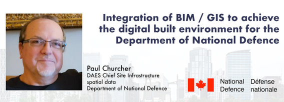
The Department of National Defence, as steward of a real property (RP) portfolio that includes tens of thousands of buildings and supporting infrastructure, is seeking to manage its Real Property (RP) assets more effectively by modernizing and improving its digital capability. In this effort, interoperability between BIM and GIS through open data standards is crucial to enable the Integrated Digital Built Environment. BIM allows representation of detailed information regarding building elemen...
