
Eric Langin
Elementy, w których Eric Langin attends
poniedziałek 17 czerwca, 2019

In conjunction with GeoIgnite 2019, PCI Geomatics is hosting a user-group meeting (UGM) on June 17, 2019 in Ottawa, Canada. The UGM is open to all who want to learn about the latest innovations in PCI software, such as Analysis Ready Data tools, large-volume data processing (with GXL), object-based image analysis, Interferometric SAR (InSAR), DEM extraction, and more. The UGM will focus on the automation possibilities using the Geomatica platform Python API. A review...
wtorek 18 czerwca, 2019

Jonathan Murphy the Founder of GeoIgnite and GoGeomatics welcome participants to the conference

Mayor Watson welcomes delegates, exhibitors and VIPS to the inaugural National Geospatial event in Canada.
There's never been a more exciting time to be a part of the geospatial profession. From mapping the infrastructure beneath our cities to indoor wayfinding, to plentiful and powerful remote sensing capabilities in air and space which we could hardly have imagined just a few years ago, the opportunities - and the expectations - for geospatial professionals are immense. Technology is evolving at a pace which outstrips the ability of academics, governments, and industries to keep pace. How will w...

Let’s admit it! We live in exciting times with technology, social interactions and business models changing before our eyes: Flying taxis, self-driving cars, commercial Space missions, smart cities, SmallSats and Internet Of Things (IOT) to name just a few innovations! Our kids are growing up in a world of on-demand TV, GPS availability, all around virtual assistants, and mobile devices that pretty much can do anything! Each and every one of these innovations has a location element to i...
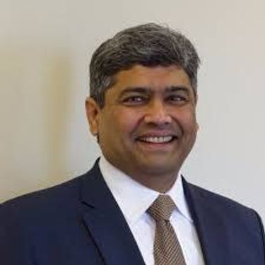
Prashant Shukle is the Director General for the Canada Centre for Mapping and Earth Observation Branch, Earth Sciences Sector, at Natural Resources Canada (NRCan).NRCan has fostered an enabling policy mechanism and provided a conducive framework for geospatial information infrastructure. In today’s digital age when geospatial is becoming more and more ubiquitous, open and inter-disciplinary policies are the key instruments of harnessing the true value of this wonderful technology...
What are the ramifications of the current digital transformation globally and what will it mean for Canada and the globe? Our award winning panel of international and Canadian experts disscuss and take questions from delegates.


Break

Alberta View: Economic impacts and Opportunities of the Geospatial SectorLocation technologies are changing the way we live, work, and play, and are having a transformative impact on industries across Canada. The intersection of location technologies with Virtual Reality and Augmented reality are rapidly transforming key sectors of the Canadian economy including transportation, the resource sector, the digital and interactive media sector and transforming how governments d...

The future is digital. Big data is an integral part of the digital transformation of a private or public organization. Location and geospatial technologies are at the heart of the digital transformation as enablers, game changers and contribute to the success of big data in many ways. Combined with emerging geospatial artificial intelligence, the possibilities are limitless. Smart cities and autonomous vehicles are examples of this potential. However, this big data revolution raises many lega...

Global Grid Systems is pleased to sponsor the first lunch of the conference. GeoIgnite offers our delegates a special meal for the first day of the event. Executive Chef Derek Ragnitz has put together a delicious and healthy lunch.Geoignite Day 1 Mediterranean Style Lunch:Medley of mixed greens cherry tomatoes and cucumbers with dressings.Traditional Greek salad, freshly made hummus with tabbouleh and pita bread.Grilled M...

Today, geospatial technologies are embedded in many of the workflows that support the Fourth Industrial Revolution and therefore invaluable to users. This means that geospatial information is no longer the domain of specialists and suddenly has become a context for the rest of our augmented existence.From Pokémon Go, to Uber and autonomous vehicles (AV), Internet of Things (IoT) and Artificial Intelligence (AI), smart applications and on-line mapping tools give the public almost insta...

The Internet of Things (IoT) is here. Whether applied to industrial automation, wearables, connected transportation and logistics, drones or smart cities, IoT is poised to disrupt how we work, live and relate to each other, delivering great benefits along with new challenges. Improved revenue, costs, quality of life and convenience benefits are often confounded by concerns such as privacy, security, and social disruption, with location info playing no small role on both sides. So, what exactl...
The UK Government as part of its building information modeling (BIM) initiative has said repeatedly that it expects the big payoff of a digital model will be during operations and maintenance, which typically represents 80% of the cost of a facility. Companies who do design, build, finance, and maintain, or design, build, operate, or PPP projects often employ a full lifecycle BIM + geospatial strategy. For example, Crossrail appears to be the first major project that may be able to provide su...


Cloudy with a chance of data science.Sparkgeo had been building cloud first geospatial applications, from day 1. But that was not the plan. The plan was to make more maps for more people, using the internet.Sitting at the intersection of software development and GIS we see how these two communities can benefit from each other. But, to do so, we will have to step out of our comfort zones.Let me tell you the story of a lowly GIS tech's journey through the technol...

Please join fellow conference attendees for an amazing networking reception in the exhibitor hall sponsored by Mapbox. The event will feature surprise performances and appetizers, and will be a great chance to connect with other geospatial professionals.
środa 19 czerwca, 2019
Marikka Williams, MSc, GISP and Professor, Fleming College Geographic Information Systems welcomes delegates to the morning and will be master of ceremonies for the morning.
Mainstreaming of the geospatial market has created a big demand for geospatial content and solutions across governments, businesses and consumers. The Fourth Industrial Revolution (4IR) has also helped scale up applications and value to much larger markets, amplifying overall impact and contribution of geospatial information in the world economy and society. With every added application and consumer, the return on investments get bigger and better. The panel shall focus...


This Canadian military presentation will show various datasets of survey grade terrestrial LiDAR, discuss collection methods to achieve the best results and talk about possible applications/analysis that the data can be used for. Presentaers will demonstrate some workflows in Leica Cyclone to show how survey grade points can be extracted and discuss the pros/cons and considerations of using terrestrial LiDAR.

Ecopia.ai will present how its semi-automated approach of combining deep neural networks with scalable crowd map annotators can be combined to create continental scale vector map data while achieving human-level accuracy. In this discussion, Brandon Palin will speak to use cases and industries that are using our technology to make better decisions quicker, including governments, and NGOs globally.

Megan works with national players in the Construction Industry, balancing high-level strategic direction and thinking with operational needs and technologies. She works with Departmental Stakeholders, Clients, and Private Sector Service Providers alike to bring digital efficiencies and innovation to workflows and processes in Real Property portfolio, program, and project, management. Megan has been a strong voice for digital transformation within the Federal Government's Real Property Communi...
Creating maps has traditionally been a one-way process in which GIS professionals and cartographers translate spatial data into for use by maps used by other knowledgeable professionals. However, as the volume of data being collected by virtually every industry increases the demographic of the map consuming audience is changing to include more people with less GIS knowledge. The challenge has become how best to simplify maps for the user and also to find ways to incorporate input from users i...

The Government of Canada purchases on average $22 billion in goods and services each year to help deliver programs and services to Canadians. Many departments and agencies collect and manage large amounts of geospatial data, and significant investments have been made within these organizations. The demand for, and use of, geospatially-related data and tools is rapidly increasing across government, as well as in the broader public context. This information session will help you understand the ...

Geographic data is ubiquitous in the landscape of organizations, corporations and governments. CartoVista allows you to profit from it by building interactive web maps. Leveraging the best of HTML5, CartoVista delivers a rich, immersive mapping experience that can even surpass desktop GIS! Discover how you can tell a story in your web browser and make your GIS data shine! This presentation will highlight concrete examples of web mapping cartography involving advanced styles and rich data visu...

It takes village to raise a business, but there is no reason it shouldn’t be a global village. Sparkgeo started with the simple idea that it would be good to put maps on the internet. From there we have evolved into a geospatial consultancy providing generalized non-vendor specific geospatial advice, with an ability to back up what we say with code and data. This is a story about serendipity, intermingled with a pinch of good fortune with an occasional lucky break.
The purpose of this presentation is to make the case for greater Indigenous participation in the development of geospatial technology and information. Next to government and resource companies, Indigenous people are the prominent stakeholders of the land and all the economic development that can happen on their territory. For this reason, they should have access to their own Geospatial data such as GIS data and ground imagery. Often the sources for Geospatial data comes from the proponent who...
środa 26 kwietnia, 2023

Join NavVis in-house specialists Gaspar Lima, Senior Channel Manager, and Michael Dutch, Customer Success Team Lead, as they discuss how NavVis users successfully deliver complex survey projects by leveraging hybrid terrestrial and mobile laser scanning workflows. Discover how to get the best accuracy and coverage with reduced time on site and lower cost of capture.


Our team of experts will be running the TopoDOT software workshop showing multiple types of applications using Mobile, Terrestrial, Drone and Airborne point clouds. You will learn about the latest feature extraction workflow developments for transportation applications such as corridor topographies, GIS inventories, surface modeling. See the expanding applications of point clouds in engineering grade data analysis such as Wall Displacement, Cross Slope, Volume Calculation, Clearance/Encroa...


RIEGL's next generation of terrestrial laser scanners are focused on maximizing productivity, simplifying workflow, and improving the overall user experience. Join us as we provide a live demonstration of the features, capabilities and superior performance of RIEGL's innovative VZ-600i terrestrial lidar scanner, a purpose-designed sensor for the collection of engineering-grade data from both static and mobile platforms.

wtorek 26 marca, 2024

Airborne Topo-Bathymetric Lidar Combined with Thermal Imaging for Fish Habitat Studies in RiversResearchers at Nova Scotia Community College’s Applied Geomatics Research Group have been using the airborne Leica Chiroptera 4X topo-bathymetric lidar sensor for nearly a decade and have surveyed coastal, riverine and lake environments. They have concentrated on mapping submerged aquatic vegetation (SAV). Topo-bathy lidar data of rivers provides an opportunity for improved flood hazard h...


The Canadian government first formally created LiDAR Guidelines in 2017. The document was updated in 2022 to Version 3.1. This session will review the Canadian Guidelines and compare them to the USGS LiDAR Base specification, updated in 2023. Included in the presentation will be:LiDAR for Flood Mapping and funding from the National D...


As traditional infrastructure design methods migrate from 2D to 3D modeling, LiDAR data acquisition continues to present an opportunity to improve the base modeling process. This presentation will show how TopoDOT can be used to extract DGN vector data from point clouds to improve the quality of digital as-built base models which enable better transportation 3D design processes like Bentley’s ORD.

Canada has just experienced a record wildfire season with devastating impacts. Public safety and damage mitigation is a priority for all impacted by these disasters. From mapping vegetation, analyzing slope stability, planning fire breaks, qualitfiying wood debris and fuel loads, how does LiDAR play a role in meeting post wildfire needs?

poniedziałek 28 października, 2024

wtorek 29 października, 2024

How exactly does artificial intelligence work and what can you use it for in the geomatics domain? Using real-life examples from our projects, they demonstrate how you can use AI to gain new insights and increase efficiency by automating your data processing workflows.We explore how GeoAI is fusing spatial data science and Geomatics technology to help automate the extraction, classification, and analysis of all types of spatial or non-spatial data. Learn how GeoAI can detect clusters, ...


Accurate mapping of road networks is essential for navigation, disaster response, and urban planning. Traditional methods relying on remote sensing images, Lidar data, and GPS trajectories are hampered by time-consuming manual updates and incomplete extraction due to obstructions from trees, buildings, and shadows. However, recent advancements in deep learning models have shown promise in improving road mapping and automating the detection of missing roads.This study uses a transfer le...


For the last five years I have been providing reality capture services to documentary film producers. These series have included NatGeo's Buried Secrets of WWII, NatGeo's Drain the Oceans, Discovery's Expedition Unknown and Expedition Bigfoot. LiDAR, photogrammetry, thermography, magnetometry, and multi spectral imagine all provide context that professional storytellers (TV producers) crave. Join me as I share stories, successes, and failures of these unique service offerings.


The First Peoples Innovation Centre (FPIC) plays a significant role in empowering Indigenous communities. The Centre has adapted the FabLab (Fabrication Laboratory) model developed by the Massachusetts Institute of Technology (MIT) with a culturally appropriate response to Indigenous youth, enabling them to take charge of their professional future. The FPIC, incorporating the FabLab Onaki, is pivotal in this empowerment process, as it funds and partners with various organizations to create co...


The integration of reality capture technologies—such as LiDAR, photogrammetry, and 3D scanning—into infrastructure asset management is revolutionizing how municipalities and organizations manage and maintain, their assets and deliver services. This presentation will explore the transformative impact of reality capture on the accuracy, efficiency, and overall effectiveness of infrastructure management practices. By enabling effective data collection and visualization, reality capture provides ...


Today, digital twins, autonomy and artificial intelligence (AI) dominate the lexicon of the geomatics industry. These capabilities provide significant productivity advantages to our profession, but our domain content and knowledge are critical to their success. These tools will change the way we work and transform the industry. However, they will not replace us, but rather change our role. This is no different than when the EDM, total station, CAD, or GPS became part of our professional lives...
