Alex Howlett
Elementy, w których Alex Howlett attends
środa 21 kwietnia, 2021
Join us for the the launch of GeoIgnite with Jonathan Murphy, the Chair of GeoIgnite, and Dr. Minda Suchan of MDA.Abstract of MDA Keynote: Canada is the world leader in wide area space-based radar Earth observation through the highly successful RADARSAT program, supporting numerous operational and scientific uses for Synthetic Aperture Radar (SAR) data. MDA, in conjunction with the Canadian government, has created an internationally recognized brand and reputation for...
Do you know what the geospatial product trap is? We fall in love with the technology, not the problem. I am a lucky person. My job has evolved to one where I primarily get to talk about geospatial technology all day. I could be scoping out internal or external projects or evaluating technologies. Increasingly, I provide advice on product ideas. This final situation has forced me to consider the nature of our community-of-practice. The common assumption that geospatial ...
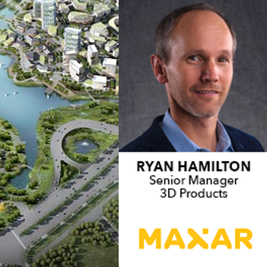
Maxar is building the highest resolution and most accurate 3D map of the planet and this talk will provide an overview of the products and capabilities that are making it possible.
czwartek 22 kwietnia, 2021
Abstract forth coming: Oversight for CSA program sectors, including in Space Utilization, Space Exploration, and Space Science and Technology.
Join us April 22nd for a Fireside Chat with Dr. Steve Liang, Founder and CTO of SensorUp. Professor and Rogers IoT Research Chair at University of Calgary and Dr. Nadine Alameh the OGC’s Chief Executive Office (CEO).Steve's goal is to disrupt the silos of the Internet of Things by creating, using, and implementing open and interoperable standards and products for device-cloud communications and cloud-cloud communications. Steve is chairing and the editor of several key IoT enabling...
For nearly 50 years, geomatics representatives from Canadian provinces and territories have collaborated together and with the federal government on geomatics initiatives. This presentation will explore why such a council came to be and why its work matters to the Canadian geomatics sector and citizens alike. While the geomatics sector and the world we live in continue to change, the need for coordination across jurisdictions remains crucial to support decision-making and response to share...
With PetaBytes of data flowing out of Low Earth Orbit everyday, the opportunity afforded by Earth Observation seems to be greater than ever. But is our community realizing that opportunity yet? Are there winners? How should we be thinking about EO businesses in the roaring 2020s?
piątek 23 kwietnia, 2021
In this presentation by Avenza Systems, we will be showcasing how high quality cartographic outputs after your data analysis can actually be achieved! We will demonstrate how to develop and design a map from raw statistical census data in Adobe Illustrator by leveraging the geospatial functionalities of MAPublisher - the industry-standard cartography solution for high quality graphical output. We’ll show how GIS data can be imported, managed, and transformed on-the-fly all d...
The Government of Canada and organizations such as the UN recognize the critical role of standards in geographic information and geomatics to support stewardship and interoperability of information, ensuring that organizations access, use and share geospatial data efficiently and effectively to support program and service delivery to Citizens. The data inventory/catalogue and the supporting standards are foundational components of any national geospatial information framework. As such, wel...
poniedziałek 26 kwietnia, 2021
PLEASE NOTE THE PREFERRED BROWSER IS GOOGLE CHROME. If you are running into any issues accessing the session, please try logging in via Google Chrome.The use of drones or UAVs has expanded dramatically over the last few years and this technology is rapidly permeating a wide variety of professional disciplines and industries, including the broad field of GIS. Ideally suited for on-demand geospatial data collection, drones can effectively eliminate the logjam tha...
wtorek 27 kwietnia, 2021
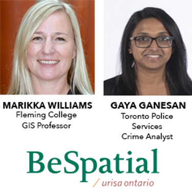
Google Chrome is the preferred browser for this session.Tickets for this workshop must be claimed in advance.This session will occur from 10:00AM-11:00AM and repeat again from 11:00AM-12:00PMBeSpatial is a geospatial community platform in Ontario that has opened doors to connect, communicate and innovate. BeSpatial aims to provide networking opportunities, programs, and ...
Google Chrome is the preferred browser for this session.Tickets for this workshop must be claimed in advance.This workshop will be broken down into 4 parts:1. Introduction to ERDAS IMAGINE2. Spatial Modeling for Wildlife Applications3. Using AI, Spatial Modeling and Python to Break Down Big Data Barriers4. Q & ASpatial Modeling ...
środa 28 kwietnia, 2021
Tickets for this workshop must be claimed in advance.The use of drones, officially referred to as Remotely Piloted Aerial Systems (RPAS), has been forecasted to play a key role in the digitalization and further optimization of a variety of geomatics applications such as in resource aggregates management, landfill management, civil engineering (3D reality capture, virtual surveying), and precision agriculture. To help realize this forecast it is important for ...
czwartek 29 kwietnia, 2021
Tickets for this workshop must be claimed in advance.This workshop will offer a deep-dive into the Avenza Maps app, a mobile app where users can upload or access custom maps for off-line navigation, way-finding, and data collection. The workshop will be composed of 5 modules covering the fundamentals of the apps usage, as well as more advanced industry-relevant features. We will also provide a walkthrough of using the Av...
piątek 30 kwietnia, 2021
Tickets for this workshop must be claimed in advance.This half-day workshop cuts through the theory and fluff to present, in practical terms, the essential practices for successful GIS project planning and management. Its intent is to provide project managers, teams, and stakeholders with the key actions methods, and tools to launch and execute successful projects --delivering results on time and on budget providing valuable...
wtorek 5 kwietnia, 2022
Times have changed - dynamic mobile mapping is now more essential than ever to get the job done quickly and accurately. Join keynote speaker Marek Koltun LIVE as he discusses mobile mapping and its place as standard equipment in the laser scanning toolbox. Learn how scanning with a wearable device like NavVis VLX can significantly benefit your projects - big or small.
Simultaneous localization and mapping (SLAM) based systems have proved their value for rapid mapping of complex environments, but achieving survey grade accuracy and repeatability has been a challenge in some environments. Surveyors were faced with a compromise between fast data capture and data accuracy, depending on the job requirements.This is no longer the case with Emesent's Automated Ground Control feature, which enhances t...
Case study outlining the challenges, solution and final result associated to a complex commercial renovation project.
Use case outlining the challenges, solution and result associated to a Lidar data acquisition using drone and vehicle.
Multi-beam bathymetric surveys are used to gather detailed information about the features on the sea, river or lake bed by measuring multiple depths from a transducer array at high resolution. The result is a highly accurate 3D point cloud representation of the sea floor – similar to aerial LIDAR.
In recent years the geospatial drone market has expanded dramatically. Drone based UAS (LiDAR) and UAV (Imagery) systems vast differences make it difficult to choose one over the other. This presentation aims to explore their differences from the point cloud processing aspect. We will examine the pros and cons of each system for practical survey and mapping applications such as topographies, bare earth, volumetrics, etc. Learn how data accuracy, density, intensit...
The autonomous vehicle industry is in the process of developing high definition (HD) maps to serve as the reference for their real time navigation systems. By 2030 the HD maps market is expected to reach $16.9 billion per year. Currently there is no accepted standard for HD maps here in the U.S. and Canada. It is the Wild West with each vendor collecting their own data. This presentation will encourage the key players to develop a strategic plan that involve...
A distinguished panel of 3D laser scanning industry veterans will be offering examples of some of their more difficult projects, along with the best practices they applied and the lessons they learned. This will be one of the highlights of the event.
środa 6 kwietnia, 2022
Learn more about the transportation industry's most productive software solution for extracting topography, 3D models, GIS Assets, and more from drone (UAV) point cloud data. We will demonstrate how TopoDOT®'s comprehensive tool suite allows you to establish a highly productive process to extract break-lines, surface models and assets in a CAD environment. Learn how high quality data promote feature extraction automatization and productivity.


