
Stefan Price
Elementy, w których Stefan Price attends
środa 21 kwietnia, 2021

Over the past year, Minerva Intelligence, a Vancouver-based cognitive AI company, has been awarded two contracts with Natural Resources Canada to design schemas at a national level: the National Flood Hazard Data Layer (NFHDL) and the National Hydro Network V2 (NHNv2). You might be asking yourself why an AI company is designing and building these important database structures. Minerva's cognitive AI system makes use of semantically inoperable data in knowledge graphs and has designed syste...
czwartek 22 kwietnia, 2021

Join us April 22nd for a Fireside Chat with Dr. Steve Liang, Founder and CTO of SensorUp. Professor and Rogers IoT Research Chair at University of Calgary and Dr. Nadine Alameh the OGC’s Chief Executive Office (CEO).Steve's goal is to disrupt the silos of the Internet of Things by creating, using, and implementing open and interoperable standards and products for device-cloud communications and cloud-cloud communications. Steve is chairing and the editor of several key IoT enabling...


piątek 23 kwietnia, 2021

In this presentation by Avenza Systems, we will be showcasing how high quality cartographic outputs after your data analysis can actually be achieved! We will demonstrate how to develop and design a map from raw statistical census data in Adobe Illustrator by leveraging the geospatial functionalities of MAPublisher - the industry-standard cartography solution for high quality graphical output. We’ll show how GIS data can be imported, managed, and transformed on-the-fly all d...
wtorek 27 kwietnia, 2021

Google Chrome is the preferred browser for this session.Tickets for this workshop must be claimed in advance.This session will occur from 10:00AM-11:00AM and repeat again from 11:00AM-12:00PMBeSpatial is a geospatial community platform in Ontario that has opened doors to connect, communicate and innovate. BeSpatial aims to provide networking opportunities, programs, and ...
czwartek 29 kwietnia, 2021

Tickets for this workshop must be claimed in advance.This workshop will offer a deep-dive into the Avenza Maps app, a mobile app where users can upload or access custom maps for off-line navigation, way-finding, and data collection. The workshop will be composed of 5 modules covering the fundamentals of the apps usage, as well as more advanced industry-relevant features. We will also provide a walkthrough of using the Av...


wtorek 7 listopada, 2023
Student posters will be available for viewing in the Expo Gallery November 7th and 8th. Authors will present a brief summary of their poster and will be available for questions on Tuesday, November 7th from 2-4 pm.
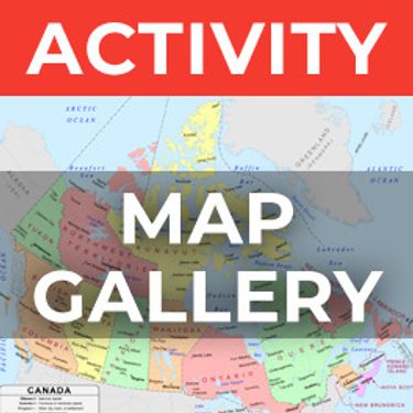
The Expo proudly showcases the Canadian Cartographic Association Student Map Competition.Discover the recipients of the Best Student Presentation & President’s Prizes in thematic map design showcased at the map gallery on the trade show floor.Entries include: President’s Prize (College Level Entries)Jessica Murdoch ...


Join us for a riveting panel discussion featuring leading experts in the realm of reality capture. As the industry stands on the precipice of monumental change, this session aims to unpack the intricacies of current challenges, explore the intricacies of the digital twin concept, and envision the future trajectory of reality capture. Our esteemed panelists, with their wealth of knowledge and diverse experiences, will shed light on the multifaceted struggles the industry grapple...


Is change the new normal? Every year seems to be the next warmest year. Those of us looking back at our planet from space are seeing these changes across our planet in near real-time through the eyes of satellites. But behind those pixels are real human stories of catastrophe and suffering. So, with all our constellations of satellites, massive computing power and new generative AI algorithms, can we do anything more than simply report what happened? What does the future hold for geospatial t...


Join us at the GoGeomatics Expo in Calgary for a concise panel discussion on the present and future of geomatics education. Our panel, comprised of professors and industry experts, will address the following key topics:1. Current State of Geomatics Education:Explore the status of geomatics education in Canada.Understand how educational programs are adapting to ind...


In the face of escalating environmental challenges, Canada grapples with the urgent need for advanced solutions in wildfire monitoring, emissions reduction, and natural resource management. This panel discussion explores how the burgeoning "New Space" frontier offers innovative approaches to address these critical issues.We aim to provide a platform for various industry players to share their own innovative technologies and insights, creating a vibrant dialogue on crucial geospatial...


Menu - Big Four OutletAppetizersRoasted Diablo Pork Bites (12) (GF/DF) SaladsSpiced Cauliflower, Chickpea & Tofu Bowl (GF/DF/V/VE) Sweet Potato, Roasted Cauliflower, Chickpeas, Mint Chutney,Grilled Tofu, Madras Curry DressingClassi...

This talk focused on those seeking work in GIS, cartography, remote sensing, programming, and other related geospatial fields.Jonathan Murphy, Managing Director of GoGeomatics Canada and geospatial career coach, will be sharing his valued tips and insight for your job search. He is an expert geomatics professional with close to 20 years of experience. Jon’s career has ranged from the oil fields of Alberta to projects with...

Join Canadian GNSS manufacturer Eos Positioning Systems for an in-depth look at using the high-accuracy Arrow Gold+ GNSS Receiver with RTK corrections and Esri’s ArcGIS Field Maps.In this live and interactive presentation, you will learn how to do the following:1. Add GNSS metadata fields to ArcGIS Field Maps 2. Easily connect to the local RTK network to achieve real-time <2cm accuracy in the field 3. Collect high-accuracy data in the field according to best...


Join us at the BIM/GIS panel of our conference as we delve into critical subjects shaping the intersection of Building Information Modeling (BIM) and Geographic Information Systems (GIS). Our expert panelists will explore the evolving landscape of BIM and GIS, offering invaluable insights into various aspects of this dynamic field.Agenda:The Importance of Standards and Interoperability...


Harnessing the power of regular collection of imagery and Lidar, the City of Calgary provides valuable information for municipal service delivery. The City publicly shares various datasets in different formats, including Orthophotos, Lidar, and 3D buildings, oh-my! Beginning in 1990, the Aerial Imagery Program supported planning, development, and operations.Regularly collecting spatial data allows for more accurate assessments of changes over time. Annual Orthophoto collection aids in ...


środa 8 listopada, 2023

Join us at the GoGeomatics Expo for a dynamic panel discussion on the latest trends in Lidar technology. Our panel of experts will dive into the advancements in Lidar data, hardware, and software, providing valuable insights into the ever-evolving geospatial world. Discover the future of Lidar and its applications, and stay at the forefront of geomatics innovation.lidarcanex.com


Rapid, short-range data collection will only become more critical as the technological revolution continues. From planning and analytics to VDC and BIM, to Safety, Security, Project, and Facilities management, the applications for reality capture technology is only going to increase as industry calls for cost savings, awareness, accountability, and efficiency. In this climate, Simultaneous Localization and Mapping (SLAM) platforms are emerging as the solution that can meet the needs of ind...

The SLAM Scan-off results are in, but what does that mean, where can this technology be applied, and what technology can be applied to it?Join us for a discussion following the results of the GoGeomatics SLAM Scan-Off:- The strengths and weaknesses of adopting SLAM platforms into your workflow.- The appropriateness of SLAM platforms for specific uses.- The compatibility of SLAM platforms with downstream tools and methods.- The current and possible futures of SLAM sys...


The Department of National Defence, as steward of a real property (RP) portfolio that includes tens of thousands of buildings and supporting infrastructure, is seeking to manage its Real Property (RP) assets more effectively by modernizing and improving its digital capability. In this effort, interoperability between BIM and GIS through open data standards is crucial to enable the Integrated Digital Built Environment. BIM allows representation of detailed information regarding building elemen...
środa 27 marca, 2024

The United States’ National Geodetic Survey (NGS) plans to modernize their National Spatial Reference System (NSRS) in 2025, including adopting a new dynamic geometric reference (the North American Terrestrial Reference Frame of 2022 (NATRF2022)) and a new geoid-based height system (the North American-Pacific Geopotential Datum of 2022 (NAPGD2022)). To ensure continued geospatial referencing compatibility, the Canadian Geodetic Survey (CGS) plans to modernize the Canadian Spatial Reference Sy...

wtorek 29 października, 2024

We explore the motivations behind the implementation of openBIM and its integral role in advancing the built asset industry. The built environment is immense and complex, it is also a huge responsibility. Our industry directly impacts it, designing, creating and maintaining it. In an era where what we all need is a better built environment, openBIM stands out as a key enabler. Together we will imagine a future where our industry works more effectively, efficiently and with more c...


How exactly does artificial intelligence work and what can you use it for in the geomatics domain? Using real-life examples from our projects, they demonstrate how you can use AI to gain new insights and increase efficiency by automating your data processing workflows.We explore how GeoAI is fusing spatial data science and Geomatics technology to help automate the extraction, classification, and analysis of all types of spatial or non-spatial data. Learn how GeoAI can detect clusters, ...

From ancient cave drawings depicting hunting grounds to hand-sketched layouts of backyard gardens, humans conceptualize space through map making. Maps serve both to capture what exists on the landscape and to plan future uses by intentionally defining where specific activities can happen. Modern satellite technology creates geospatial datasets that can contribute to current and proposed land use management planning, all underpinned by the pursuit of the public good.Background


Menu - Big Four OutletAppetizersRoasted Diablo Pork Bites (12) (GF/DF) SaladsSpiced Cauliflower, Chickpea & Tofu Bowl (GF/DF/V/VE) Sweet Potato, Roasted Cauliflower, Chickpeas, Mint Chutney,Grilled Tofu, Madras Curry DressingClassi...

Accurate mapping of road networks is essential for navigation, disaster response, and urban planning. Traditional methods relying on remote sensing images, Lidar data, and GPS trajectories are hampered by time-consuming manual updates and incomplete extraction due to obstructions from trees, buildings, and shadows. However, recent advancements in deep learning models have shown promise in improving road mapping and automating the detection of missing roads.This study uses a transfer le...


In 2021, the Government of Canada invested $63.8M in the Flood Hazard Identification and Mapping Program (FHIMP) to to create and disseminate engineering-level flood hazard maps that can help Canadians better plan and prepare for future flood risks. The program was recently extended to 2028 through the National Adaptation Strategy and enhanced with an additional $164 Million investment.Given that many Canadians are unaware of flood hazards, the FHIMP is working to fill gaps in knowledg...


The government of Alberta manages the production of riverine flood studies under the provincial Flood Hazard Identification Program, to assist communities in keeping Albertans safe and protecting their properties from floods. Flood maps improve public safety, support emergency management, and help us build safer and more resilient communities. The government of Alberta also manages the production of alluvial fan studies to help Albertans learn about flood risks in the steep terrain of Alberta...


The Riparian Web Portal (www.riparian.info) is an award-winning project, launched in 2021 by Alberta’s watershed community. This dynamic online space empowers Albertans to enhance riparian health through interactive access to comprehensive data and resources. It serves a crucial role in advancing the riparian health objectives pursued by various watershed groups.At its core, the portal integrates innovative GIS-based assessments from six watershed agencies, covering over 60,000 km of r...


Menu - Big Four OutletAppetizersRoasted Diablo Pork Bites (12) (GF/DF) SaladsSpiced Cauliflower, Chickpea & Tofu Bowl (GF/DF/V/VE) Sweet Potato, Roasted Cauliflower, Chickpeas, Mint Chutney,Grilled Tofu, Madras Curry DressingClassi...

Despite the rhetoric surrounding the use of building information modelling (BIM) to enhance collaboration by connecting people and data, the status quo is to work with proprietary solutions and closed file formats, limiting accessibility and interoperability. Additionally, the increasing complexity of projects in the Architecture, Engineering, Construction, and Operations (AECO) industry requires technology that integrates data at a range of scales, from asset to city, and beyond. To address ...


In December 2023 a unique gathering of technology and talent gathered on Alcatraz to capture the entire island, inside and out, from the ground and from the air to assist the National Park Service understand the risks seal level rise and climate change present to the island. Join me and, perhaps, other members of the extended team as we share the technology, the experience, and the adventure of this unique experience.


Wrap up the first full day of Canada's National Geomatics Expo with the GoGeomatics Meetup! This lively party and networking event, free to attend, starts right after the day's sessions, offering a perfect blend of fun and professional interaction. Held on the expo main floor, the meetup features a cash bar to help you unwind and enjoy the evening. Join us for an exciting night of music, mingling, and making connections with fellow attendees. Don't miss this chance to relax and expand your ne...
środa 30 października, 2024

Case Study: How DOTs and Utility owners took a Proactive Approach to Protect Underground Pipeline Assets Due to aging infrastructure and lack of accurate utility location information resulting in huge increased operational risk & especially at waterway, transportation, and ROW utility crossings. Utility owners understand the significant underground congestion and utility conflicts which result in future damages and the value the importance of geo location of UNLOCA...


This presentation provides a comprehensive exploration of the latest advancements in construction technology. From traditional methods to cutting-edge innovations, we'll examine how technology is reshaping the construction industry.Key topics will include:Historical Context: A brief overview of the evolution of construction techniques and the impact of technological advancements.Modern Construction Methods: Exploring traditional methods and how they've been enhance...


Menu - Big Four OutletAppetizersRoasted Diablo Pork Bites (12) (GF/DF) SaladsSpiced Cauliflower, Chickpea & Tofu Bowl (GF/DF/V/VE) Sweet Potato, Roasted Cauliflower, Chickpeas, Mint Chutney,Grilled Tofu, Madras Curry DressingClassi...

In this year's reality capture track, we have shown you the unprecedented value of reality capture systems when adopted into high-cost, high liability and fast pace environments, some of the problems these systems are solving today, and tools to help the effectiveness and quality of those solutions. However, our presenters will also have demonstrated how critical digital lifecycle planning can be to any asset, from pre-design through construction and lifetime operation right up to demolition,...


As the drone industry is increasingly focuses on developing larger airframes and equipping them with bigger sensors, Spexi is taking a revolutionary approach to aerial imagery. At Spexi, we believe that the future of geospatial data collection lies not in size and complexity, but in numbers and standardization. The Spexi platform leverages the power of crowdsourcing, deploying local pilots with small drones to capture standardized imagery across entire cities. This method allows us to achieve...


Menu - Big Four OutletAppetizersRoasted Diablo Pork Bites (12) (GF/DF) SaladsSpiced Cauliflower, Chickpea & Tofu Bowl (GF/DF/V/VE) Sweet Potato, Roasted Cauliflower, Chickpeas, Mint Chutney,Grilled Tofu, Madras Curry DressingClassi...

In countries that have very accurate and accessible map records, utility damage events are a rare occurrence. Japan with a one third of the population of the US has less than 200 line strikes per year. We will discuss how creating, sharing, and using accurate maps is critical in reducing damage to buried infrastructure.


With the increasing focus on damage prevention, public safety concerns, and environmental damage due to underground utility strikes, it has become more critical to accuracy locate, store and be able to visualize subsurface utilities. Several key technical details are discussed when implementing a subsurface mapping system from data collection to the use of machine learning for 3D modelling and visualization. The ability to make safe and effective decisions for i...