Dr. Tim Webster
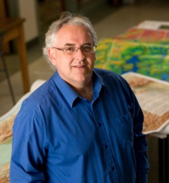
Dr. Tim Webster is a research scientist with the Applied Geomatics Research Group, part of Applied Research at Nova Scotia Community College in Middleton, Nova Scotia, Canada. His research focus is mapping and modeling earth’s surface processes and uses a topo-bathymetric lidar and other geomatics data to support his research. He obtained his PhD from Dalhousie University in 2006, MSc from Acadia University in 1996, an Advanced Diploma in Remote Sensing from the College of Geographic Sciences in 1988, and a BSc (Geology-Physics) from the University of New Brunswick in 1987. In 2002 he was co-awarded the Government of Canada “Science Awards to Leaders in Sustainable Development” for coastal flood risk and climate change in Prince Edward Island research. In 2010 he received the Gulf of “Maine Council Visionary Award”. In 2017 he was presented with the Geomatics Association of Nova Scotia “Award of Distinction”. In 2022 he was awarded the Discovery Centre “Public Impact Award”. He has been with the college for over 30 years, with over 20 as a research scientist and as a consultant for over 20 years. Since 2004 Tim has published over 30 peer-reviewed papers and has supported numerous graduate students in the MSc Applied Geomatics program. Tim typically makes about 20 presentations/year and his research appears in the media as well as being consulted on mapping related topics.
Elementy, w których Dr. Tim Webster uczestniczy
środa 19 czerwiec, 2019
The coastal zone is a challenging place to map, techniques for mapping the land elevation do not work under water and echosounding methods for mapping the seabed elevation work well in deep water but are dangerous and expensive in shallow water. As a result, detailed information in the shallow coastal zone is lacking. This presentation will focus on the Chiroptera II shallow water topo-bathymetric lidar sensor that can collect seamless elevation data in coastal or freshwater environments. The...
wtorek 25 kwiecień, 2023
This is not meant to be an exhaustive review of all the changes and advancements in lidar for the past 20 years, but rather some observations of a user of lidar technology. Lidar sensors in the early days were either set to first or last returns, then eventually allowed both first and last returns to be captured. Terrestrial lidar evolved into mobile mapping systems where advanced navigation systems allows data to be coll...
środa 8 listopad, 2023
Join us at the GoGeomatics Expo for a dynamic panel discussion on the latest trends in Lidar technology. Our panel of experts will dive into the advancements in Lidar data, hardware, and software, providing valuable insights into the ever-evolving geospatial world. Discover the future of Lidar and its applications, and stay at the forefront of geomatics innovation.lidarcanex.com
Research Presentation:Airborne Topo-Bathymetric Lidar Combined with Thermal Imaging for Fish Habitat Studies in RiversResearchers at Nova Scotia Community College’s Applied Geomatics Research Group have been using the airborne Leica Chiroptera 4X topo-bathymetric lidar sensor for nearly a decade and have surveyed coastal, riverine and lake environments. They have concentrated on mapping submerged aquatic vegetation (SAV). Topo-bathy lidar data of rivers provides an opportu...
wtorek 26 marzec, 2024
Airborne Topo-Bathymetric Lidar Combined with Thermal Imaging for Fish Habitat Studies in RiversResearchers at Nova Scotia Community College’s Applied Geomatics Research Group have been using the airborne Leica Chiroptera 4X topo-bathymetric lidar sensor for nearly a decade and have surveyed coastal, riverine and lake environments. They have concentrated on mapping submerged aquatic vegetation (SAV). Topo-bathy lidar data of rivers provides an opportunity for improved flood hazard h...
Canada’s LiDAR Panel: Future Trends in Service and Tech, is a deep dive into the evolving landscape of LiDAR technology in Canada. Our panel of experts will explore cutting-edge developments in LiDAR, focusing on new trends in service delivery and technological advancements. Expect insights into the integration of AI, enhancements in data processing, and future applications in sectors like urban development and environmental management. This session promises to equip attendees with a forward-...
środa 15 maj, 2024
The Applied Geomatics Research Group, a spinoff of COGS at NSCC in 2000 has been conducting applied research using lidar since it’s inception. Originally by contracting lidar providers to conduct surveys in the Maritimes for flood hazard mapping, then in the 2005 operating their our topographic lidar, the Optech ALTM 3100, then moving into the coastal environment with the Leica Chiroptera 4X topo-bathymetric lidar, and most recently moving to the relatively low cost drones for topo-lidar mapp...
środa 30 październik, 2024
With drones like the DJI Matrice 300 now being positioned using RTK GNSS, combined with Structure from Motion (SfM), high precision mosaics are possible without deploying targets. The ability to mount lidars (DJI L1 and L2) and other optical sensors (RGB, multispectral, thermal) allows for precise surveying and the production of high resolution and high accuracy mosaics with minimal ground control. While battery power still remains an issue and the limiting factor for flight duration (10’s of...
środa 29 styczeń, 2025
This keynote presentation will revisit some of the fundamentals behind lidar that influence the precision and detail the systems produce. The laser ranging systems that are used strongly influence how the lidar system works and factors including: wavelength, beam divergence, pulse width and pulse repetition frequency will be reviewed and discussed. Most airborne topographic lidars use a 1064 nm Near-Infrared laser, while topo-bathymetric lidar systems deploy both a NIR laser and a green laser...
Join us at LiDARCanEX 2025 for an insightful panel discussion moderated by Dr. Tim Webster. This session will bring together experts to explore the current state of LiDAR projects in Canada and discuss what the future holds. Topics include:Wide-Area Topographic LiDAR Mapping: Applications in forestry, flood risk assessment, powerlines, infrastructure, and urban development.Topo-Bathymet...
Elementy, w których Dr. Tim Webster attends
wtorek 7 listopad, 2023
Join Canadian GNSS manufacturer Eos Positioning Systems for an in-depth look at using the high-accuracy Arrow Gold+ GNSS Receiver with RTK corrections and Esri’s ArcGIS Field Maps.In this live and interactive presentation, you will learn how to do the following:1. Add GNSS metadata fields to ArcGIS Field Maps 2. Easily connect to the local RTK network to achieve real-time <2cm accuracy in the field 3. Collect high-accuracy data in the field according to best...
poniedziałek 28 październik, 2024
Join us at the National Geomatics Networking Reception Enjoy a selection of gourmet hors d'oeuvres, including savoury Moroccan lamb meatballs, smoked pork belly lollipops, and wild mushroom arancini with truffle oil. Vegetarian options like vegetable samosas with mango chutney and goat cheese tartelettes will satisfy all palates. Plus, your ticket includes a drink to enjoy while you connect with industry professionals. Elevate your evening with these delicious bites and great company!


