Lan Nguyen
Elementy, w których Lan Nguyen attends
poniedziałek 28 październik, 2024
We are excited to announce that the next Canada Forum will be held during the GoGeomatics Expo in Calgary, from October 28th to 30th. This event will bring together key stakeholders from across Canada’s geospatial sector, including industry leaders, academics, indigenous communities, government representatives, and technologists, to continue vital discussions on advancing geospatial standards, interoperability, and spatial data infrastructure (SDI) in Canada.
wtorek 29 październik, 2024
We are hosting a special gallery of maps and posters for this year’s expo.The Canada Maps & Poster Gallery will run from October 29th to the 30th in Calgary and is an excellent opportunity to showcase your team's work and impact for the public good.This initiative is in partnership with the Canadian Cartographic Association (CCA), the Inter...
The Alberta Biodiversity Monitoring Institute (ABMI) defines human footprint as the visible alteration or conversion of native ecosystems to temporary or permanent residential, recreational, agricultural, or industrial landscapes. It also includes land that is periodically reset to earlier successional conditions by industrial activities such as forestry harvest areas and seismic lines. To monitor and map human footprint across Alberta, the ABMI, in partnership with the Alberta Human Footprin...
How exactly does artificial intelligence work and what can you use it for in the geomatics domain? Using real-life examples from our projects, they demonstrate how you can use AI to gain new insights and increase efficiency by automating your data processing workflows.We explore how GeoAI is fusing spatial data science and Geomatics technology to help automate the extraction, classification, and analysis of all types of spatial or non-spatial data. Learn how GeoAI can detect clusters, ...
Too often, when discussing the value proposition of geospatial data, we focus in on raw data or output products without spending a lot of time in the juicy middle of data throughputs. That is to say that modern geospatial is leaving a lot of value on the table and thus limiting our ability to good with our data by: -> Focusing too heavily on the capturing aspect of geospatial technologies;-> Ignoring or discounting analytical capabilities of geospatial technologie...
Maintaining undisturbed habitat is key to the recovery strategy of the Woodland Caribou boreal population. Seismic lines have been identified as a human footprint feature that requires specific attention for habitat restoration in part because linear features are linked to increases in the predation rates of caribou as they provide lines of sight and easy transportation routes for predators. It is estimated that there are hundreds of thousands of kilometers of seismic lines within Alberta (AB...
Water is one of our most vital resources, and its management is becoming increasingly complex in the face of climate change, population growth, and competing demands from agriculture, industry, and municipalities. This panel will delve into how geospatial technologies are revolutionizing water policy by providing the data-driven insights needed for smarter decision-making.Join leading experts from academia, provincial and federal gov...
Menu - Big Four OutletAppetizersRoasted Diablo Pork Bites (12) (GF/DF) SaladsSpiced Cauliflower, Chickpea & Tofu Bowl (GF/DF/V/VE) Sweet Potato, Roasted Cauliflower, Chickpeas, Mint Chutney,Grilled Tofu, Madras Curry DressingClassi...
The government of Alberta manages the production of riverine flood studies under the provincial Flood Hazard Identification Program, to assist communities in keeping Albertans safe and protecting their properties from floods. Flood maps improve public safety, support emergency management, and help us build safer and more resilient communities. The government of Alberta also manages the production of alluvial fan studies to help Albertans learn about flood risks in the steep terrain of Alberta...
The Riparian Web Portal (www.riparian.info) is an award-winning project, launched in 2021 by Alberta’s watershed community. This dynamic online space empowers Albertans to enhance riparian health through interactive access to comprehensive data and resources. It serves a crucial role in advancing the riparian health objectives pursued by various watershed groups.At its core, the portal integrates innovative GIS-based assessments from six watershed agencies, covering over 60,000 km of r...
środa 30 październik, 2024
RPAS platforms and sensors have come a long way since their commerical adoption almost a decade ago and have quickly become a main stay of many professional's tool kits. This show's the industry's appetite for adopting new technologies and matching them up with the right application. With a pannel of very experienced professionals from various sectors of Canada's Geospatial RPAS scene, we explore what has driven sensor development and how sensors might further develop along the lines of use c...
Join us for an engaging panel discussion on Geo-Entrepreneurship, featuring distinguished experts from geospatial consultancies, geomatics communication and event companies, and geomatics software firms. This session is designed for those interested in the intersection of geospatial technology and entrepreneurship.Journey to Entrepreneurship: Hear from our panelists on their motivations for leaving traditional careers to pursue entrepreneurial ventures in the geospatial field. Dis...
Utility mapping is a crucial practice in urban planning and construction, focusing on identifying, documenting, and visualizing the precise locations of underground utilities such as water pipes, gas lines, electrical conduits, and telecommunication cables. Accurate mapping of these utilities is vital to ensure safety, efficiency, and cost-effectiveness in construction projects, preventing accidental damages that can lead to significant service disruptions, safety hazards, and financial losse...
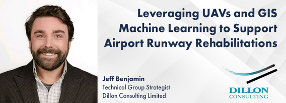
Dillon was retained by the Government of Nunavut to perform a Needs Assessment for the rehabilitation of the Runway 13-31, Taxiway A (Alpha), Taxiway C (Charlie), Apron A, and Apron C of the Rankin Inlet Airport.The project included pavement rehabilitation and geotechnical investigations for Runway 13-31, which is a 6000’ x 150’ asphalt paved runway, along with Phase I ...
Menu - Big Four OutletAppetizersRoasted Diablo Pork Bites (12) (GF/DF) SaladsSpiced Cauliflower, Chickpea & Tofu Bowl (GF/DF/V/VE) Sweet Potato, Roasted Cauliflower, Chickpeas, Mint Chutney,Grilled Tofu, Madras Curry DressingClassi...
Led by the World Geospatial Industry Council (WGIC) and moderated by Aaron Addison, Executive Director of WGIC, this panel will explore the transformative role of Earth observation (EO) technologies in fostering a resilient and sustainable future for Canada. With growing environmental challenges such as climate change and resource management, EO solutions provide essential insights into monitoring ecosystems, disaster resilience, and sustainable development. Panelists from diverse sectors wil...


