Ottawa Conference and Event Centre - Hydrography
Program
9:00
9:00
- WHAT is Hydrospatial, So WHAT & Then WHAT! / QU'EST-CE QUE l'Hydrospatial, alors À QUOI SERT & PUIS APRÈS! Ottawa Conference and Event Centre - Hydrography
- 9:00 - 9:30 | 30 min.
- The Oceans cover more than 70% of our Planet… with offshore, near shore and coastal waters including rivers and lakes that are navigable or not.
- Keynote

9:30
9:30
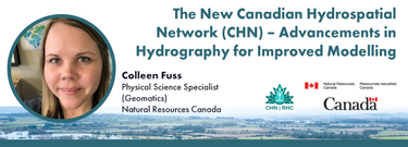
- The New Canadian Hydrospatial Network (CHN) – Advancements in Hydrography for Improved Modelling Ottawa Conference and Event Centre - Hydrography
- 9:30 - 9:50 | 20 min.
- Presenting the CHN and highlighting how its new features leverage advancements in hydrography to improve both water-related models and their applic...
- Talk

9:50
9:50
- Advancing the Flood Hazard Identification and Mapping Program (FHIMP): Program Update Ottawa Conference and Event Centre - Hydrography
- 9:50 - 10:10 | 20 min.
- Under the FHIMP, Natural Resources Canada, supported by Public Safety and Environment and Climate Change Canada, collaborates with provinces and te...
- Talk

10:10
10:10
- Cutting edge Navigation Geospatial Services, international trials in Canada Ottawa Conference and Event Centre - Hydrography
- 10:10 - 10:30 | 20 min.
- The successful implementation of the S-100 suite hinges on various factors, with final product specification and comprehensive testing of route mon...
- Talk

11:15
11:15
- Satellite Derived Bathymetry: A Hydrospatial Intelligence Tool for Reconnaissance Remote and Uncharted Regions Ottawa Conference and Event Centre - Hydrography
- 11:15 - 11:35 | 20 min.
- In 1976 the Canadian Hydrographic Service was the first hydrographic agency to recognize and display a satellite-discovered feature on a nautical c...
- Talk

11:35
11:35
- Riverine Mapping Applications Using Airborne Thermal Infrared Imagery Ottawa Conference and Event Centre - Hydrography
- 11:35 - 11:55 | 20 min.
- Aerial thermal infrared (TIR) surveys have been a crucial tool supporting river restoration project across the North America as many salmonid-beari...
- Talk

11:55
11:55
- Analyzing Flood Insurance Claim Trends in the United States. Insights from FEMA's National Flood Insurance Program Data. Ottawa Conference and Event Centre - Hydrography
- 11:55 - 12:15 | 20 min.
- In this session, we will explore key trends and insights from FEMA's National Flood Insurance Program (NFIP) data for the United States. Using publ...
- Talk

14:00
14:00
- PANEL/OPEN Discussion - HYDROSPATIAL Challenges & Opportunities… Ottawa Conference and Event Centre - Hydrography
- 14:00 - 15:00 | 1 godz.
- With still about 75% of our ocean still insufficiently surveyed, the hydrospatial challenges ahead are immense - yet so are the opportuni...
- Panel

15:00
15:00
- The Canadian Ocean Mapping Research and Eduction Network (COMREN) Ottawa Conference and Event Centre - Hydrography
- 15:00 - 15:30 | 30 min.
- The Canadian Ocean Mapping Research and Education Network (COMREN) is a national group of academic, non-profit, and federal researchers in ocean an...


