Colleen Fuss
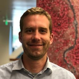
Colleen Fuss is a Physical Science Specialist (Geomatics) at the Canada Centre for Mapping and Earth Observation, in Natural Resources Canada. She has a BSc. Earth Surface Science, an Adv.Dip. Remote Sensing, and an MSc. Geography (Thesis: DEM generation and fusion). She also has an additional 12 years of experience working in various fields of geomatics. With her background and long-standing interest in hydrology she is very excited to be a co-lead on the Canadian Hydrospatial Network (CHN) project.
Sessions in which Colleen Fuss participates
quarta-feira 14 maio, 2025
Presenting the CHN and highlighting how its new features leverage advancements in hydrography to improve both water-related models and their applications to support decision making. The Canadian Hydrospatial Network (CHN) was officially launched this past May, marking a significant milestone in the development of hydrospatial networks in Canada. Over the past year, the network has expanded and grown in importance, positioning itself as a key resource for the future of its field. CHN continues...
With still about 75% of our ocean still insufficiently surveyed, the hydrospatial challenges ahead are immense - yet so are the opportunities. Join this dynamic panel of LEADERS to hear their vision and insights on the future of ocean, coastal mapping and digital data. The discussion will feature experts in: Hydrospatial Information Systems (HIS/GIS)Satellite-Derived Bathymetry (SDB)In-situ SurveyingResearch & EducationGovernm...
Sessions in which Colleen Fuss attends
terça-feira 1 março, 2022
In this talk Dan Nord will share key insights on Maxar’s position as a centerpiece in the global tech shift from 2D to 3D. Join us to hear more about how Maxar is accelerating its Earth Intelligence business with the launch of WorldView Legion in 2022, as well as building on our lead in mapping, monitoring, and new markets of the future.
In Budget 2021, the government tabled a recovery plan for jobs, growth, and resilience. Within the budget were specific investments to promoting a healthy environment for a healthy economy, with $145.5 million dedicated to supporting initiatives that will increase resiliency to the natural hazards of wildfires and floods, which are becoming more frequent, severe, and devastating due to climate change and urban development. Flood hazard maps are essential to un...
Planet's constellation of satellites capture the whole of Earth's landmass every day. This unprecedented dataset provides insights to the agricultural sector, helping farmers and the companies that serve them make informed, timely decisions. But translating that data into insights isn’t always straightforward. In this session, Greg Crutsinger will go over the fundamental ways space observation is serving agricultural customers and present new applications in satellite data - everything fro...
NV5 Geospatial has been at the forefront of hydrospatial data acquisition and processing for decades. This presentation will provide a brief corporate introduction and overview of some of the technologies relevant to remotely sensed hydrospatial data collection and development. This will also include associated analyses and ancillary data integration to solve questions surrounding hydrology and wetland mapping, flood risk modeling, and habitat...
The landscapes in the Northwest Territories (NWT, Canada) are amongst the most rapidly changing in the world due to climate-induced permafrost thaw. This presentation provides an overview of recent remote sensing and mapping investigations of permafrost thaw landslides across different spatial and temporal scales in the NWT. A common thread of ever-expanding geospatial capabilities (remote sensing, machine learning) is juxtaposed against rapidly intensifying permafrost thaw with many growi...
quarta-feira 2 março, 2022
Our planet is in flux: pandemics, climate change, inequality. This talk will explore the ideas of "planetary-scale" as it pertains to the geospatial community’s work. We will be looking at how we need planetary-scale thinking to address the planetary-scale problems we are now being challenged with. We don’t have a “Planet B", so how can geospatial technology be used to ethically approach some of the most pressing issues our species have collectively faced? &...
Inter-annual variability in agricultural production in Canada is largely determined by weather and climate. Climate-related impacts have caused billions of dollars in financial losses in some years, with the incidence of extreme weather and related costs expected in increase in a changing climate. The National Agroclimate Information Service at Agriculture and Agri-Food Canada monitors the impacts of weather and climate on agricultural activities using a number of geospatial data sets, mod...
Join our DG Panel discussion moderated by Jonathan Murphy, Managing Director of GoGeomatics Canada. Our panelists are Eric Laliberté, Éric Loubier and David Harper.As a country spanning almost 10 million square kilometres, Canada has always faced a unique challenge in collecting the day-to-day information needed to provide critical services to Canadians. Today, space offers a unique perspective that is increasingly important to under...
quinta-feira 3 março, 2022
Sanjay Kumar is the founder and CEO of Geospatial Media & Communications. He also lends his time and experience to many organizations helping them to further the cause of increasing the impact of geospatial technology and its applications at a global scale.
The increase in the availability of high-resolution lidar and other point cloud datasets has given rise to the use of this data for detecting change in the environment over time. Continual improvements in airborne technology and the miniaturization of the requisite sensors has cultivated a nimble new branch of the industry that provides cost-effective data collection services virtually on demand. This ability to employ temporal analysis of the geospatial landsca...
By some estimates, 80% of response time during a disater is spent procuring and preparing data, leaving 20% of the time learning from data. We can do better. Sponsored by USGS/FGDC, Natural Resource Canada, NASA and supported by CONIDA (Peru) and Amazon Web Services, the goal of the pilot was to develop standards-based services to support rapid decision making through the full life-cycle of disaster management for multiple hazards.
sexta-feira 4 março, 2022
The Association of Canada Lands Surveyord (ACLS) has developed a certification model for hydrographers which, has been officially recognized by the IHO/FIG/ICA International Board of Standards and Competence for Hydrographic Surveyors and Nautical Cartographers (IBSC) in April of 2016. The ACLS program is the second internationally recognized scheme in the world. Certification for a hydrographic surveyor is desirable because: - Certification provides a formal...
In this short technical demonstration, I’ll explore some of the ways that Planetscope’s new 8-band capabilities can be used to both detect and monitor invasive plant species, such as Watermoss-Salvinia, within water bodies. We’ll focus on the role that the 4 new spectral bands (Coastal Blue (433-453nm) , Yellow (600-620nm), Green-II (547-583nm) and Red-edge (697-713nm)) can have in this use case. I’ll compare how some spectral indices unlocked via 8-band data compare to previous 4-band, RG...
quarta-feira 9 março, 2022
The Topobathymetric Lidar Solutions & Applications Workshop presented by NV5 Geospatial is designed to provide a comprehensive overview of topobathymetric lidar in a relaxed, collaborative environment to allow discussion and answer any questions. This interactive, virtual event will review our latest sensor technology, present typical project planning and execution, and provide processing insights to successfully completing and delivering ...
quinta-feira 10 março, 2022
Taking urgent action to combat climate change and its impacts" is a crucial goal set forward under Goal 13 – Climate Action as part of the United Nations Sustainable Development Goals (SDGs).Climate action requires global efforts related to climate change mitigation – reducing the flow of heat-trapping greenhouse gases into the atmosphere, or enhancing the "sinks" that accu...
Join this session to get the latest information on Maxar foundational products as well as demonstrations and round-table conversation with our subject matter experts. Please bring your questions if you're a current user, or come ready to experience the industry's best satellite imagery for the first time.
sexta-feira 11 março, 2022
Please join us for the MDA-hosted workshop on multi-band SAR presented by MDA (Canada), Iceye (Finland) and VENG (Argentina). After presenting SAR fundamentals, we will dive deep into the specifications of X-band (Iceye), C-band (RADARSAT-2) and L-band (SAOCOM) missions, as well as the sensors’ merit and strength in specific applications that are of relevance to Canada. The last hour would be Q&As and discussion.
At a time of rising climate change impacts, there is a vital and growing need to prepare for, respond to, and recover from natural disasters. But there is a critical communication gap between authorities, citizens, and communities. Drawing on the ongoing results of our massive multi-year climate change research project, and with assistance from hundreds of students, citizens, academics, NGOs, government officials, and industry partners, Deploy Solutions has identif...
quarta-feira 27 março, 2024
The United States’ National Geodetic Survey (NGS) plans to modernize their National Spatial Reference System (NSRS) in 2025, including adopting a new dynamic geometric reference (the North American Terrestrial Reference Frame of 2022 (NATRF2022)) and a new geoid-based height system (the North American-Pacific Geopotential Datum of 2022 (NAPGD2022)). To ensure continued geospatial referencing compatibility, the Canadian Geodetic Survey (CGS) plans to modernize the Canadian Spatial Reference Sy...
terça-feira 13 maio, 2025
Mini Continental BreakfastGeoIgnite is delighted to offer a selection of chilled fruit juices, freshly baked croissants, muffins, and breakfast pastries, served with butter and preserves. Guests can also enjoy fruit cocktails and yogurt. Available beverages include coffee, tea, and decaffeinated coffee.
For decades, Canada’s geospatial ecosystem has thrived on deep integration with the U.S., benefiting from shared technology, markets, and collaboration. But today, shifting geopolitical and economic realities—trade conflicts, supply chain vulnerabilities, and data sovereignty concerns—are forcing us to rethink this reliance. The question is no longer whether we should adapt, but how.
Dr. Nadine Alameh, the inaugural Executive Director of the Taylor Geospatial Institute, has been leading an ambitious effort to accelerate geospatial research for tackling today’s biggest challenges—climate, disasters, health, and national security. In this session, she will reflect on what it takes to build a truly impactful geospatial ecosystem, challenge assumptions about the roles of national mapping agencies, academia, and nonprofi...
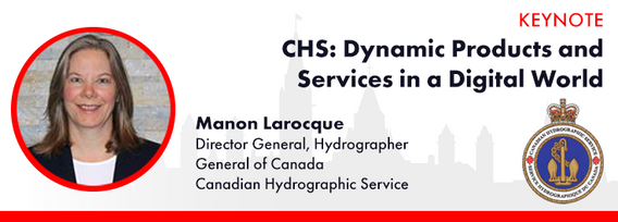
The Canadian Hydrographic Service (CHS) is Canada's agency for charting Canadian waters. Canada has the longest coastline of any country in the world, with more than a third of its territory under water. As a maritime nation, global maritime transport traffic is significant. Hydrography supports safe navigation and shipping through the production of nautical charts and other publications including water levels. With opportunities provided by emerging technologies and the move to e-navig...
In 2006, British mathematician Clive Humby declared that data was the new oil. Soon after there was a significant rush around the world to embrace a data revolution to try and improve humanity’s social, economic and environmental well being. Twenty-years later, the hard work of data continues. Like Canadian oil and gas, it is for the most part – a landlocked asset; unable to push us to the next levels of productivity and innovation. This keynote looks at ...
Artificial Intelligence is transforming how we interpret and act on information—but what does that mean for the geospatial world? As AI models generate synthetic maps, infer locations, and automate analysis, geospatial professionals face a critical moment: will we shape the future, or be shaped by it?In this session, the CEO of the Open Geospatial Consortium (OGC) will explore the complex relationship between AI and geospatial systems—from the risks of black-box models and data halluci...
Top technical performers are often promoted into leadership roles, yet many struggle. In AI-driven, data-intensive industries, expertise alone is not enough—leaders must also navigate complexity, inspire teams, and drive execution. Without these skills, organizations face decision paralysis, disengaged teams, and stalled innovation.Senior leaders know that competency is crucial—technical excellence is the foundation of succes...
Enjoy a satisfying lunch inspired by classic Italian flavors. Begin with artisanal garlic focaccia and a classic Caesar salad with creamy dressing, croutons, and bacon bits. A medley of olives and marinated mushrooms adds a savory touch.For the main course, enjoy chicken scallopini glazed with a lemon caper sauce, served alongside potato gnocchi in a tomato and basil sa...
At GeoIgnite 2025, Alexander will explore how Canada's geospatial community is uniquely positioned to lead in developing solutions to environmental challenges in a rapidly changing geopolitical landscape. Drawing on compelling case studies from around the globe, including successful Dutch-Canadian collaborations, he will demonstrate how geospatial technologies are becoming indispensable tools for environmental monitoring, climate resilience planning, and sustainable...
Keith J. Masback is one of the most respected voices in the field of geospatial intelligence (GEOINT), with over three decades of leadership spanning the U.S. government, military, and private sector. His deep expertise in remote sensing, intelligence, and national security has positioned him at the forefront of how geospatial data is used for strategic decision-making.As the former CEO of the United States Geospatial Intelligence Foundation (USGIF) and a senior leader at the National ...
A seasoned leader in geomatics and Earth Observation with two decades of experience in the federal government, Eric Loubier has vast expertise in developing and implementing national geomatics and Earth observation strategies. In his talk, Eric will explore the integration of AI with Earth observation, and how this powerful combination is transforming Canada’s approach to addressing critical national issues like climate change, natural resource management, urban planning, and disaster response.
quarta-feira 14 maio, 2025
Mini Continental BreakfastGeoIgnite is delighted to offer a selection of chilled fruit juices, freshly baked croissants, muffins, and breakfast pastries, served with butter and preserves. Guests can also enjoy fruit cocktails and yogurt. Available beverages include coffee, tea, and decaffeinated coffee.
The Oceans cover more than 70% of our Planet… with offshore, near shore and coastal waters including rivers and lakes that are navigable or not.This Keynote Address will kick off the Hydrospatial Track on Day TWO of the GeoIgnite 2025 - Ottawa. The presentation will articulate the context and the timing of WHAT is HYDROSPATIAL in the global Geospatial community? SO WHAT is important to Measure, to Monitor an to Model? THEN WHAT is the Strategy, the Challenges, t...
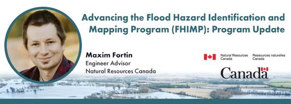
Under the FHIMP, Natural Resources Canada, supported by Public Safety and Environment and Climate Change Canada, collaborates with provinces and territories to create, and disseminate engineering-level flood hazard maps and information. In this presentation, Natural Resources Canada (NRCan) will provide an update on the ongoing work under FHIMP with results of the first stage of the FHIMP (2021-24) and the kickoff of the FHIMP expansion (2023-2028) which will see investments in every jurisdic...
The successful implementation of the S-100 suite hinges on various factors, with final product specification and comprehensive testing of route monitoring layers being paramount. Canada is proposing an international designated area for these tests, underscoring its commitment to the S-100 suite's success and global maritime safety. Canada has selected the St-Lawrence River in Québec as the S-100 sea trial area for 2025. The trial aims to evaluate the S-100 system's ability to ingest and displ...
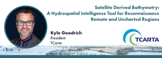
In 1976 the Canadian Hydrographic Service was the first hydrographic agency to recognize and display a satellite-discovered feature on a nautical chart. This was the discovery of Landsat island off the coast of Labrador.In the time since the capabilities of satellites to survey coastal waters have grown exponentially yet the use of satellite based depth information on nautical charts has not. Satellite based surveying offers a multitude of benefits to the safety of operations, empowering ...
Aerial thermal infrared (TIR) surveys have been a crucial tool supporting river restoration project across the North America as many salmonid-bearing rivers are projected to warm in the coming decades due to increases in atmospheric temperatures and concomitant decreases and earlier melt of snowpack. The objectives of collecting TIR imagery are to assess the current summer thermal state and the distribution of cold-water refuges within the river system, and to identify opportunities and...
In this session, we will explore key trends and insights from FEMA's National Flood Insurance Program (NFIP) data for the United States. Using publicly available data from OpenFEMA, we will analyze patterns in flood risk and claims frequency, with a particular emphasis on the impacts of major flooding events such as Hurricane Katrina (2005) and Hurricane Sandy (2012). Through a deep dive into historical claims data, we will uncover trends over time and examine how these significant storms, al...
New innovations in hydrography has led to the use of a next generation Uncrewed Survey Vessel for the collection of bathymetric data in Canadian waters. The Canadian Hydrographic Service contracted IIC Technologies to test the suitability of the latest Autonomous Survey Technology in remote locations with challenging weather conditions. The contract required the acquisition of high-resolution bathymetric data in water depths of up to 200m over an 8002km area off of Thunder Bay, Ontario,...
Enjoy a fresh and satisfying lunch featuring a house blend of baby spinach, kale, and mesclun greens with feta cheese, pumpkin, chia, and poppy seeds, dried cranberries, and golden raisins. A tomato and cucumber salad with lime and avocado dressing adds a refreshing touch, alongside a medley of mixed greens with assorted dressings.For the main course, savor freshly roas...
The Canadian Ocean Mapping Research and Education Network (COMREN) is a national group of academic, non-profit, and federal researchers in ocean and coastal mapping. Since 2016, COMREN has focused on developing research activities, technology transfer to industry, and educational programs that support ocean mapping as a network of dedicated individuals. The group partners with government agencies and international organizations to increase Canada’s domestic and global ocean and coastal mappin...
Join us as we wrap up another incredible edition of GeoIgnite with a celebration on the tradeshow floor. We’ll come together for a group photo of all our amazing participants, partners, and friends.This final moment is our way of saying thank you to everyone who helped make GeoIgnite a success — from speakers and sponsors to delegates and volunteers. Let’s end on a high note and capture the spirit of Canada’s national geospatial leadership event, together.


