
Will Cadell, Founder & CEO of Sparkgeo Consulting, Inc.
Will is a 25-year geospatial professional and technology executive. He started Sparkgeo in 2010 to serve the growing technology sector with cloud-centric location technology. Now, with both North American and UK operations, the Sparkgeo team serves a global customer base seeking geospatial modernization within the context of enterprise digital transformation. In addition to founding Sparkgeo, Will is an advisor for Cultivation Capital’s Geospatial venture fund, and supports enterprise companies and financial institutions on the uses and value of geospatial technology, especially within the context of climate and space. He has acted as a Teaching Fellow for Oxford MBA’s Smart Space Elective, discussing the unsettled nature of the geospatial analytics market, and supports the Taylor Geospatial Engine as an Industry Fellow. Will is a regular speaker on the international geospatial circuit and is a co-host of North America’s only geospatial thought leadership event, North51.
Sessions in which Will Cadell participates
segunda-feira 17 junho, 2019

Gain insights on the possibilities and challenges with leveraging and integrating a complete open source GIS stack into your applications and projects. Sessions will be led by members of OSGEO-Ottawa.The first session involves high level presentations showcasing use case scenarios and highlighting strengths and limitations of each tools. This session is designed for managers, analysts, and non-technical individuals to discover and learn about what open source GIS tools are available, ...
terça-feira 18 junho, 2019
Cloudy with a chance of data science.Sparkgeo had been building cloud first geospatial applications, from day 1. But that was not the plan. The plan was to make more maps for more people, using the internet.Sitting at the intersection of software development and GIS we see how these two communities can benefit from each other. But, to do so, we will have to step out of our comfort zones.Let me tell you the story of a lowly GIS tech's journey through the technol...
quarta-feira 22 julho, 2020

Strategic Geospatial for a Complex WorldWhere humans move and landscapes change there is value. That’s geospatial. This talk is about how to think strategically about geospatial technology in an increasingly complex world.In particular, we will focus on canada’s strengths, and how we might inject novel geospatial technology into new markets
quarta-feira 21 abril, 2021

Do you know what the geospatial product trap is? We fall in love with the technology, not the problem. I am a lucky person. My job has evolved to one where I primarily get to talk about geospatial technology all day. I could be scoping out internal or external projects or evaluating technologies. Increasingly, I provide advice on product ideas. This final situation has forced me to consider the nature of our community-of-practice. The common assumption that geospatial ...
quinta-feira 22 abril, 2021

With PetaBytes of data flowing out of Low Earth Orbit everyday, the opportunity afforded by Earth Observation seems to be greater than ever. But is our community realizing that opportunity yet? Are there winners? How should we be thinking about EO businesses in the roaring 2020s?


quarta-feira 2 março, 2022

Our planet is in flux: pandemics, climate change, inequality. This talk will explore the ideas of "planetary-scale" as it pertains to the geospatial community’s work. We will be looking at how we need planetary-scale thinking to address the planetary-scale problems we are now being challenged with. We don’t have a “Planet B", so how can geospatial technology be used to ethically approach some of the most pressing issues our species have collectively faced? &...
terça-feira 7 novembro, 2023

Is change the new normal? Every year seems to be the next warmest year. Those of us looking back at our planet from space are seeing these changes across our planet in near real-time through the eyes of satellites. But behind those pixels are real human stories of catastrophe and suffering. So, with all our constellations of satellites, massive computing power and new generative AI algorithms, can we do anything more than simply report what happened? What does the future hold for geospatial t...

Is change the new normal? Every year seems to be the next warmest year. Those of us looking back at our planet from space are seeing these changes across our planet in near real-time through the eyes of satellites. But behind those pixels are real human stories of catastrophe and suffering. So, with all our constellations of satellites, massive computing power and new generative AI algorithms, can we do anything more than simply report what happened? What does the future hold for geospatial t...

In the face of escalating environmental challenges, Canada grapples with the urgent need for advanced solutions in wildfire monitoring, emissions reduction, and natural resource management. This panel discussion explores how the burgeoning "New Space" frontier offers innovative approaches to address these critical issues.We aim to provide a platform for various industry players to share their own innovative technologies and insights, creating a vibrant dialogue on crucial geospatial...


quarta-feira 8 novembro, 2023

Great Leadership is central to our Industry – leaders that are adeptly able to connect and interoperate with business, government, and institutional entities. While traditional hub-and-spoke leadership structures remain, a wave of agile, resilient, and dynamic leaders are stepping up. But organizations aren’t made up simply of leaders. In our quest for the best leadership, have we overlooked or forgotten about the skills, resources, and commitment to developing and empoweri...


quarta-feira 15 maio, 2024

GeoIgnite is excited to present a high-profile panel discussion, "Navigating New Frontiers: The Role of Geospatial AI in Shaping Our World." This session brings together three influential leaders in the field: Bilyana Anicic, President of Aurora Consulting, Jon Lipinski, Co-Founder and President of Ecopia Tech; Abe Tarapani, CEO of Atlas AI; and Will Cadell, CEO of Sparkgeo.Bilyana Anicic, President of Aurora Consulting and the architect of the Federal Geosp...


In the rapidly evolving geospatial industry, modern advancements in technology have paved the way for companies to offer geospatial data as a service, revolutionizing the way businesses approach and use geographic information. The advent of micro services to ultimately drive managed services has significantly reduced the necessity for dedicated in-house geospatial teams, providing a cost-effective and efficien...
quarta-feira 30 outubro, 2024

Join us for an engaging panel discussion on Geo-Entrepreneurship, featuring distinguished experts from geospatial consultancies, geomatics communication and event companies, and geomatics software firms. This session is designed for those interested in the intersection of geospatial technology and entrepreneurship.Journey to Entrepreneurship: Hear from our panelists on their motivations for leaving traditional careers to pursue entrepreneurial ventures in the geospatial field. Dis...


segunda-feira 12 maio, 2025

This open forum invites all attendees to engage in discussions on Canada’s path toward greater self-reliance in the geospatial sector, particularly in light of emerging trade conflicts, including the recent U.S. tariffs, and evolving global geopolitical shifts. The forum will explore strategies to strengthen Canada’s technological capabilities and reduce reliance on external sources, with a focus on fostering innovation, security, and growth.


Sessions in which Will Cadell attends
quarta-feira 22 julho, 2020
Strategic Geospatial for a Complex WorldWhere humans move and landscapes change there is value. That’s geospatial. This talk is about how to think strategically about geospatial technology in an increasingly complex world.In particular, we will focus on canada’s strengths, and how we might inject novel geospatial technology into new markets
quarta-feira 21 abril, 2021

Join us for the the launch of GeoIgnite with Jonathan Murphy, the Chair of GeoIgnite, and Dr. Minda Suchan of MDA.Abstract of MDA Keynote: Canada is the world leader in wide area space-based radar Earth observation through the highly successful RADARSAT program, supporting numerous operational and scientific uses for Synthetic Aperture Radar (SAR) data. MDA, in conjunction with the Canadian government, has created an internationally recognized brand and reputation for...


Over the past year, Minerva Intelligence, a Vancouver-based cognitive AI company, has been awarded two contracts with Natural Resources Canada to design schemas at a national level: the National Flood Hazard Data Layer (NFHDL) and the National Hydro Network V2 (NHNv2). You might be asking yourself why an AI company is designing and building these important database structures. Minerva's cognitive AI system makes use of semantically inoperable data in knowledge graphs and has designed syste...

Explore the structure of an enterprise location intelligence platform at Agriculture Agri-food Canada and how they created a strategic road map to systematically diagnose strengths and weaknesses to drive the use of location intelligence in everyday program and policy decisions of a federal department.Agriculture and Agri-Food Canada supports the Canadian agriculture and agri-food sector through initiatives that promote innovation and competitiveness.

Maxar is building the highest resolution and most accurate 3D map of the planet and this talk will provide an overview of the products and capabilities that are making it possible.

Title: Advancing Space Based Observation in Canada:The GeoIgnite 2021 Directors General Geospatial Panel, part of Canada's National Geospatial Conference.Title: Advancing Space Based Observation in CanadaThis is a must attend panel for anyone interested in learning the direction Canada's Federal government geospatial leadership is taking.Join our panelists for an exploration of Canada's geospatial priorities and mission in this exciting discuss...


quinta-feira 22 abril, 2021

Abstract forth coming: Oversight for CSA program sectors, including in Space Utilization, Space Exploration, and Space Science and Technology.


At a time of rising climate change impacts, there is a vital and growing need to prepare for, respond to, and recover from natural disasters. But there is a critical communication gap between authorities and citizens. Drawing on the results of our massive multi-year climate change R&D project, and with assistance from hundreds of students, citizens, academics, NGOs, and government officials, we have identified the top perceived climate change-relatedcommunication problem...

Join us April 22nd for a Fireside Chat with Dr. Steve Liang, Founder and CTO of SensorUp. Professor and Rogers IoT Research Chair at University of Calgary and Dr. Nadine Alameh the OGC’s Chief Executive Office (CEO).Steve's goal is to disrupt the silos of the Internet of Things by creating, using, and implementing open and interoperable standards and products for device-cloud communications and cloud-cloud communications. Steve is chairing and the editor of several key IoT enabling...


In this presentation, Dr. Walter Scott will compare the satellite imaging constellations of Maxar and other commercial companies to show how they stack up in three key metrics: product-market fit, adaptability and capital efficiency. He will also share some key insights on the next generation of Earth Intelligence arriving in 2021 with the launch of WorldView Legion, and what impact that will have for the Canadian geospatial market in the months and years ahead.

Applying SafeGraph’s Canadian POI data for community-level analysis in ArcGIS and TableauGeospatial data empowers research bodies, government agencies, and the private sector to visualize and analyze complex problems in new and innovative ways. But location data is only valuable if it is accurate - something many GIS and data analysts know all too well. Armed with accurate, precisely geocoded POI data that includes key attribution related to brands and business types, analys...
sexta-feira 23 abril, 2021

The global geospatial industry is estimated at US$ 500 Billion and delivers an even more significant impact on society, with derived economic benefits estimated to be multifold. These benefits, however, are still not fully understood by key stakeholders and policy and decision-makers, ultimately hindering the global uptake of geospatial information. With decades of national spatial data infrastructure efforts around the world, how can this be? Focusing on the importance of...


With rapid advances in Earth observation, cloud computing, and analytics technologies, more information on our changing world is more readily available than ever before. Planet is an aerospace and data analytics company at the forefront of these advances -- working to make global change visible, accessible, and actionable, Planet images the full Earth daily at 3.5m resolution and anywhere sub-daily at <50cm. In this talk, we’ll hear from Tara O’Shea, Planet’s Director of Forest Programs, o...

This talk will be bringing together the power of location intelligence and blockchain technology for an increased speed and accuracy of transactions and improved decision-making.The value that blockchain brings to geospatial technology is security, immutability, and trusted data. On the other hand, geospatial technology provides the power of location to the blockchain. Together, they represent a game-changer both for their utility and disrupt...

Join GeoIgnite for this inaugural panel of provincial and territorial geospatial and location technology leaders.We will be discussing issues surrounding: What are main priorities and challenges across jurisdictions? What types of geospatial tools we use to monitor and respond to key challenges like emergency response? How are jurisdictions aligning geospatial tools, data, and people to address climate change? What are some current data...


segunda-feira 28 outubro, 2024

We are excited to announce that the next Canada Forum will be held during the GoGeomatics Expo in Calgary, from October 28th to 30th. This event will bring together key stakeholders from across Canada’s geospatial sector, including industry leaders, academics, indigenous communities, government representatives, and technologists, to continue vital discussions on advancing geospatial standards, interoperability, and spatial data infrastructure (SDI) in Canada.


We are excited to announce that the next Canada Forum will be held during the GoGeomatics Expo in Calgary, from October 28th to 30th. This event will bring together key stakeholders from across Canada’s geospatial sector, including industry leaders, academics, indigenous communities, government representatives, and technologists, to continue vital discussions on advancing geospatial standards, interoperability, and spatial data infrastructure (SDI) in Canada.

Join us at the National Geomatics Networking Reception Enjoy a selection of gourmet hors d'oeuvres, including savoury Moroccan lamb meatballs, smoked pork belly lollipops, and wild mushroom arancini with truffle oil. Vegetarian options like vegetable samosas with mango chutney and goat cheese tartelettes will satisfy all palates. Plus, your ticket includes a drink to enjoy while you connect with industry professionals. Elevate your evening with these delicious bites and great company!<...

terça-feira 29 outubro, 2024

Space, the final frontier. Or is it? Although many people are fascinated by space, most are relatively unaware of how space technologies pervade their everyday life. From global positioning systems (GPS) and satellite communications to weather forecasting and monitoring the health of crops or the extent of sea ice, the standard of living we currently enjoy is fundamentally dependent on satellites and space technology. Space is becoming even more important in monitoring the changing climate, p...


Session Human footprint datasets for Canada: mapping and monitoring in support of land and resource managementHuman activities have disturbed biodiversity, ecosystems, and ecological processes over the last century. Given the growing trends of habitat loss and biodiversity decline, understanding patterns of human pressures has become a crucial element of conservation planning. In this context, cumulative pressure mapping is used to quantify the extent and intensity of multiple pressure...


Regional and provincial conservation efforts require detailed human pressure mapping to manage and mitigate human impacts effectively. However, in the province of British Columbia (BC), existing efforts to map human pressures have faced significant challenges, particularly in adequately capturing their full extent. The Geospatial Centre of Biodiversity Pathways at the University of Northern British Columbia, in collaboration with the West Moberly First Nations and the Alberta Biodiversity Mon...


The health of the global ocean environment is of critical importance. Planetary limits for climate change and biodiversity are being reached, and unsustainable resource management practices are rampant. Space-based Maritime Monitoring has proven to provide foundational support for sustainable management of ocean resources. In the Keynote, John will provide a high-level overview of ocean problems, space-based maritime monitoring, the beneficiaries and outcomes of the application of...


30 years ago, a small group of engineers came together to work on the then difficult problem of interoperable technology, systems and data. These visionaries formed the Open Geospatial Consortium which has helped the world figure out how to collect, process, and share geospatial data over the internet and across a wide variety of technology systems. Today, with the proliferation of technology types, sensors and a...


In flood mapping and dam breach analysis, engineers and planners define inundation areas through flow modeling. A crucial input for this analysis is a comprehensive topographic surface of the area of interest and any upstream zones. These areas can span hundreds of kilometers and cover thousands of square kilometers.Previous studies have indicated that low-resolution topography can results in larger inundation areas, greater flow volumes, and faster flood streams. However, a comparison...


Despite the rhetoric surrounding the use of building information modelling (BIM) to enhance collaboration by connecting people and data, the status quo is to work with proprietary solutions and closed file formats, limiting accessibility and interoperability. Additionally, the increasing complexity of projects in the Architecture, Engineering, Construction, and Operations (AECO) industry requires technology that integrates data at a range of scales, from asset to city, and beyond. To address ...
quarta-feira 30 outubro, 2024
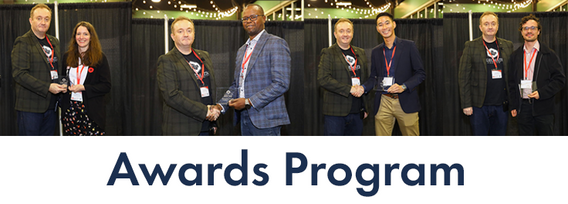
Canada’s National Geomatics Expo Awards are a great opportunity to recognize the people and organizations making a difference in the geomatics field. Whether it’s groundbreaking technology or strong leadership, these awards celebrate the achievements that are pushing the industry forward. This year, the nominees were chosen by the public, and now it’s your turn to make your voice heard. You can vote across all categories or select only the ones you’re interested in. You are limited to


Earth Observation technologies have experienced unprecedented innovation and accessibility over the past several years. The role of the commercial sector has stepped in to offer several capabilities historically only available from government. This session will focus on examples of how EO technology is being...

segunda-feira 12 maio, 2025
This open forum invites all attendees to engage in discussions on Canada’s path toward greater self-reliance in the geospatial sector, particularly in light of emerging trade conflicts, including the recent U.S. tariffs, and evolving global geopolitical shifts. The forum will explore strategies to strengthen Canada’s technological capabilities and reduce reliance on external sources, with a focus on fostering innovation, security, and growth.

Join us for the OGC Canada Forum! We’ll dive into key topics like the Canadian Geospatial Data Infrastructure (CGDI) and how Building Information Modeling (BIM) integrates with Geographic Information Systems (GIS). This event gathers experts from industry, academia, Indigenous organizations, and government to explore these technologies' impact on Canada’s built environment. We'll also cover how OGC standards boost interoperability and innovation. All Canadian organ...


📅 Date: Monday, May 12, 2025📍 Location: Rainbow Bistro, 76 Murray Street, ByWard Market, Ottawa⏰ Time: Networking at 6:30 PM | Panel begins at 7:00 PM | Live music to follow🍽 Details: Cash bar and hors d’oeuvres provided Event OverviewJoin us for an evening of high-level discussion, networking, and live music in the heart of Ottawa’s historic By...

