Scott Hunter
Sessions in which Scott Hunter attends
الثّلاثاء 7 نوفمبر, 2023
Join us for a riveting panel discussion featuring leading experts in the realm of reality capture. As the industry stands on the precipice of monumental change, this session aims to unpack the intricacies of current challenges, explore the intricacies of the digital twin concept, and envision the future trajectory of reality capture. Our esteemed panelists, with their wealth of knowledge and diverse experiences, will shed light on the multifaceted struggles the industry grapple...
What are the trends in education, technology, policy, perception and markets that will mold the future of Geomatics – and how has the profession responded? The presenter has worked in and written about numerous aspects of surveying for several decades and views the future of the profession as one of both challenges and opportunity – new, exciting and sometimes surprising opportunities. This session will be interactive, challenge conventional wisdom, poke a little fun, and hopefully provides s...
SUMMARYWith the increasing focus on damage prevention, public safety concerns, and environmental damage due to underground utility strikes, it has become more critical to accurately locate, store, and be able to visualize subsurface utilities. We show several key technical and business details when implementing a subsurface mapping system from data collection to the use of machine learning for 3D modelling and visualization and give real-world examples and use cases of the different le...
Over his decade plus at Suncor, Alonzo has been both witness to and active participant in a quiet digital Geospatial revolution. This revolution has democratized access to Geospatial data and tools to everyone at Suncor. Which meant that teams and professionals across a myriad of disciplines have embraced and pushed the limits of Geospatial data and software. The constant demand for newer and higher-resolution data has relegated the paper map to secondary status as the tool for spatial commun...
Teams can become the catalyst to co-elevate results-driven organizations accelerate outcomes, unleash their full potential, and create unprecedented internal and external value. But it’s not a given!In an increasingly volatile, uncertain, and non-linear Geomatics landscape, senior-level managers find it increasingly challenging to keep up and get things done – efficiently, effectively, and timely. The organizational silos have begun to come down, but often remain camou...
In February 2022, Balko Technologies, a Quebec-based company, launched the world's first modular drone Lidar, which aims to democratize geospatial data capture by offering a versatile, easy-to-use and quick to deploy solution. This technological showcase aims to demonstrate the performance, modularity and distinctive advantages for users of our brand new Connectiv solution and its e-LAS software, developed by a team of experts with more than 10 years of experience in airborne data capture....
The GoGeomatics Expo and our sponsors are proud to present the Diversity in Leadership Panel.As the common goals of diversity, equity, and inclusion become even more widespread, organizations have the daunting task of figuring out what works.It is our vision the expo will spur the grassroots of a more diverse ecosystem where diversity of thinking and knowledge w...
There is a pressing need for a global change detection system capable of persistently monitoring the entire earth with globally consistent coverage, temporally consistent sampling, scientific-grade geometric and radiometric quality, and cost-effective management of daily data. These four conditions enable near real-time monitoring and retrospective change detection applications while minimizing false positives and the required work to develop, maintain, and run harmonizing a...
Join us at the BIM/GIS panel of our conference as we delve into critical subjects shaping the intersection of Building Information Modeling (BIM) and Geographic Information Systems (GIS). Our expert panelists will explore the evolving landscape of BIM and GIS, offering invaluable insights into various aspects of this dynamic field.Agenda:The Importance of Standards and Interoperability...
As GIS professionals, we understand the pivotal role that geospatial data plays in decision-making across various industries. Now, imagine harnessing that power to transform facility management. This presentation delves into VertiGIS FM, a groundbreaking solution that revolutionizes facility management through the lens of spatial intelligence, creating new opportunities and efficiencies across organizations.
Join us for an immersive and interactive workshop led by the founder of Cyanic Automation, Doug Kondor. In this engaging session, you'll delve into the world of project management in the context of land surveying, guided by an industry expert with a passion for innovation.Workshop Highlights:Theory Meets Practice:Doug Kondor goes beyond theory, offering a hands-on journey through the best practices of project management. Learn how to bridge ...
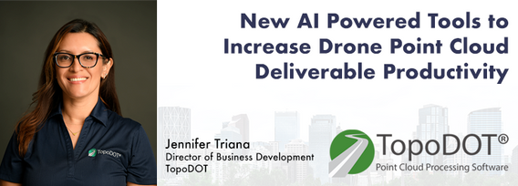
Learn how newly implemented surface modeling tools employing artificial intelligence reduce the turnaround time of point cloud surface models by 400% while maintaining high-fidelity results around break lines. Faster ground extraction routines for UAV data can be achieved without the need for classification or noise removal. In this presentation, we'll discuss several examples including how a query volume calculation project compared with traditional modeling workflows yielded nearly exact...
The end of the first day of the National Canadian GoGeomatics Expo is being marked by a lively party that is eagerly anticipated by all participants. The party is being held on the floor of the tradeshow in a venue that hosts many of the best rock concerts and shows for the Calgary Stampede. It promises to be a lot of fun, with an atmosphere buzzing with excitement and energy as attendees mingle, network, and celebrate the end of a successful day.The party is made even better by the in...
الأربعاء 8 نوفمبر, 2023
openBIM aims to make the built environment more efficient, sustainable, and productive, leading to more liveable and resilient communities. Smarter infrastructure and buildings help to improve energy-efficiency, sustainable practice and future-proof standards to ensure a more equitable society.Open standards ensure that different products and systems can work together seamlessly, regardless of who developed them or what platform they run on. This generates comprehensive, trusted and...
Join us at the GoGeomatics Expo for a dynamic panel discussion on the latest trends in Lidar technology. Our panel of experts will dive into the advancements in Lidar data, hardware, and software, providing valuable insights into the ever-evolving geospatial world. Discover the future of Lidar and its applications, and stay at the forefront of geomatics innovation.lidarcanex.com
Great Leadership is central to our Industry – leaders that are adeptly able to connect and interoperate with business, government, and institutional entities. While traditional hub-and-spoke leadership structures remain, a wave of agile, resilient, and dynamic leaders are stepping up. But organizations aren’t made up simply of leaders. In our quest for the best leadership, have we overlooked or forgotten about the skills, resources, and commitment to developing and empoweri...
الثّلاثاء 29 أكتوبر, 2024
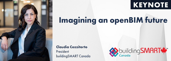
We explore the motivations behind the implementation of openBIM and its integral role in advancing the built asset industry. The built environment is immense and complex, it is also a huge responsibility. Our industry directly impacts it, designing, creating and maintaining it. In an era where what we all need is a better built environment, openBIM stands out as a key enabler. Together we will imagine a future where our industry works more effectively, efficiently and with more c...
Building Information Modeling (BIM) is transforming the built asset industry, yet firms of varying sizes—large, medium, and small—adopt BIM in distinct ways tailored to their unique resources and project demands. This session will explore BIM’s origins, current applications, and future directions as shared by representatives from three different firms. A significant focus will be on the importance of data integrity and governance, particularly as Artificial Intelligence (AI) becomes increasin...
Menu - Big Four OutletAppetizersRoasted Diablo Pork Bites (12) (GF/DF) SaladsSpiced Cauliflower, Chickpea & Tofu Bowl (GF/DF/V/VE) Sweet Potato, Roasted Cauliflower, Chickpeas, Mint Chutney,Grilled Tofu, Madras Curry DressingClassi...
Too often, when discussing the value proposition of geospatial data, we focus in on raw data or output products without spending a lot of time in the juicy middle of data throughputs. That is to say that modern geospatial is leaving a lot of value on the table and thus limiting our ability to good with our data by: -> Focusing too heavily on the capturing aspect of geospatial technologies;-> Ignoring or discounting analytical capabilities of geospatial technologie...
Construction contracts are the same worldwide. While there are differences in language, classification, project delivery and other factors, the one common denominator is that a construction contract requires Drawings and Specifications. While geometric modelling software and specification software have both evolved over time, very little effort is currently being exerted in Canada to integrate them in document development processes.According to Arcadis global surveys, the #1 cause of c...
Menu - Big Four OutletAppetizersRoasted Diablo Pork Bites (12) (GF/DF) SaladsSpiced Cauliflower, Chickpea & Tofu Bowl (GF/DF/V/VE) Sweet Potato, Roasted Cauliflower, Chickpeas, Mint Chutney,Grilled Tofu, Madras Curry DressingClassi...
For the last five years I have been providing reality capture services to documentary film producers. These series have included NatGeo's Buried Secrets of WWII, NatGeo's Drain the Oceans, Discovery's Expedition Unknown and Expedition Bigfoot. LiDAR, photogrammetry, thermography, magnetometry, and multi spectral imagine all provide context that professional storytellers (TV producers) crave. Join me as I share stories, successes, and failures of these unique service offerings.
The three building blocks of digital building delivery are BIM, VDC and Digital Twins. There are various definitions for these three things, but based on my experience I define them as follows:- Building Information Modelling: a model with or without 3D geometry that hosts the information about building material, dimensions, connections, forces, power, flow rates, and all other elements required in each element that forms the building. - A key subset of understanding BIM is under...
The integration of AI in infrastructure modeling has the potential to revolutionize decision-making processes by providing accurate predictions, identifying vulnerabilities, and optimizing resource utilization.The increasing complexity of modern infrastructure systems, coupled with growing demands on utilities, has necessitated the adoption of advanced analytical techniques. This panel discussion brings together ideas from acad...
Menu - Big Four OutletAppetizersRoasted Diablo Pork Bites (12) (GF/DF) SaladsSpiced Cauliflower, Chickpea & Tofu Bowl (GF/DF/V/VE) Sweet Potato, Roasted Cauliflower, Chickpeas, Mint Chutney,Grilled Tofu, Madras Curry DressingClassi...
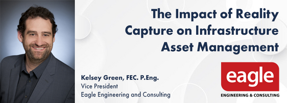
The integration of reality capture technologies—such as LiDAR, photogrammetry, and 3D scanning—into infrastructure asset management is revolutionizing how municipalities and organizations manage and maintain, their assets and deliver services. This presentation will explore the transformative impact of reality capture on the accuracy, efficiency, and overall effectiveness of infrastructure management practices. By enabling effective data collection and visualization, reality capture provides ...
Despite the rhetoric surrounding the use of building information modelling (BIM) to enhance collaboration by connecting people and data, the status quo is to work with proprietary solutions and closed file formats, limiting accessibility and interoperability. Additionally, the increasing complexity of projects in the Architecture, Engineering, Construction, and Operations (AECO) industry requires technology that integrates data at a range of scales, from asset to city, and beyond. To address ...
buildingSMART Canada will summarize the buildingSMART International Certification Program and its implementation in Canada. Attendees will gain insights into how the certification process works, including the steps required for individuals and organizations to achieve certification. We will explain the program's goals, benefits, and by adhering to internationally recognized standards, professionals and organizations in Canada can ensure enhanced collaboration, interoperability, and efficiency...
Wrap up the first full day of Canada's National Geomatics Expo with the GoGeomatics Meetup! This lively party and networking event, free to attend, starts right after the day's sessions, offering a perfect blend of fun and professional interaction. Held on the expo main floor, the meetup features a cash bar to help you unwind and enjoy the evening. Join us for an exciting night of music, mingling, and making connections with fellow attendees. Don't miss this chance to relax and expand your ne...
الأربعاء 30 أكتوبر, 2024
This presentation details the results of a field study conducted in July in Santa Cruz, California, where thirteen participants employed terrestrial laser scanning (TLS) to assess concrete tolerance on a construction site. The study aimed to establish the precision of TLS as a test method for verifying concrete tolerance in accordance with ASTM E-691-23. Additionally, it sought to quantify the bias of the TLS method by compar...
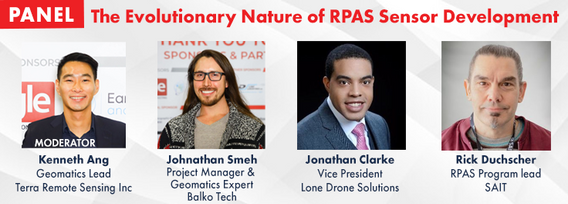
RPAS platforms and sensors have come a long way since their commerical adoption almost a decade ago and have quickly become a main stay of many professional's tool kits. This show's the industry's appetite for adopting new technologies and matching them up with the right application. With a pannel of very experienced professionals from various sectors of Canada's Geospatial RPAS scene, we explore what has driven sensor development and how sensors might further develop along the lines of use c...
The Virtual Assembly Showcase highlights the value of integrating advanced 3D laser scanning and virtual assembly in industrial construction. In a recent expansion at a major Oil Sands Refinery, detailed 3D laser scanning and surveying were employed to ensure the precise placement and assembly of three large modules while they were still in the laydown yard.The process involved scanning critical structural elements and newly poured foundation pilings to detect potential fitment issues ...
Join us for an engaging panel discussion on Geo-Entrepreneurship, featuring distinguished experts from geospatial consultancies, geomatics communication and event companies, and geomatics software firms. This session is designed for those interested in the intersection of geospatial technology and entrepreneurship.Journey to Entrepreneurship: Hear from our panelists on their motivations for leaving traditional careers to pursue entrepreneurial ventures in the geospatial field. Dis...
Photogrammetry is not just limited to aerial platforms. Modern mobile devices contain high-quality cameras and increasingly have LiDAR and depth sensors built in. When combined with high-accuracy GNSS systems, these mobile devices can quickly collect accurate data for utilities, infrastructure, inspection, as-builts, construction, and more. Utilizing these readily available devices can reduce project delays, capture better documentation of utilities, and lay the foundations for digital infras...
Menu - Big Four OutletAppetizersRoasted Diablo Pork Bites (12) (GF/DF) SaladsSpiced Cauliflower, Chickpea & Tofu Bowl (GF/DF/V/VE) Sweet Potato, Roasted Cauliflower, Chickpeas, Mint Chutney,Grilled Tofu, Madras Curry DressingClassi...
In this year's reality capture track, we have shown you the unprecedented value of reality capture systems when adopted into high-cost, high liability and fast pace environments, some of the problems these systems are solving today, and tools to help the effectiveness and quality of those solutions. However, our presenters will also have demonstrated how critical digital lifecycle planning can be to any asset, from pre-design through construction and lifetime operation right up to demolition,...
Dillon was retained by the Government of Nunavut to perform a Needs Assessment for the rehabilitation of the Runway 13-31, Taxiway A (Alpha), Taxiway C (Charlie), Apron A, and Apron C of the Rankin Inlet Airport.The project included pavement rehabilitation and geotechnical investigations for Runway 13-31, which is a 6000’ x 150’ asphalt paved runway, along with Phase I ...
The presentation is geared towards providing an engaging discussion on what are the opportunities organizations adopting BIM would benefit, such as:Enhanced collaboration: BIM facilitates collaboration among all disciplines, stakeholders, and contractors, reducing errors and miscommunication using real-time data when applications to ensure all parties have access to the most current project information.Risk Management: Early detection of issues and clashes during design c...
Menu - Big Four OutletAppetizersRoasted Diablo Pork Bites (12) (GF/DF) SaladsSpiced Cauliflower, Chickpea & Tofu Bowl (GF/DF/V/VE) Sweet Potato, Roasted Cauliflower, Chickpeas, Mint Chutney,Grilled Tofu, Madras Curry DressingClassi...
Traditional teaching methods in post-secondary often included using powerpoint presentations and writing on a white or blackboard. The newer generations of students have been exposed to different ways of learning and this requires instructors or teaching professors to change their way of presenting information to help the students learn it at a deeper level. Using a radical constructivism philosophy, the students are required to engage in the material in their own way, connect wit...
For the built environment, digitalization is a key sustainability enabler. It helps stakeholders across the construction sector increase productivity and transparency while reducing emissions, resource consumption and costs, and adding digital tools that can help companies establish and optimize their sustainability performance.
