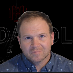
Kevin Grover is a seasoned geospatial professional with a passion for innovation and research. As the new Advanced Research and Technology Leader at McElhanney, Kevin brings with him over 15 years of experience in the field of surveying, engineering and reality capture technology.
Kevin is a firm believer in the power of research and innovation to drive growth and success in any organization. In his role at McElhanney, Kevin is dedicated to engaging with employees at all levels of the organization to ensure that everyone has a voice in the innovation process. Specifically with reality capture technology, he understands the importance of this technology from iPhones to manned aerial sensors and how to use this data to make informed decisions and provide innovative solutions for clients.
Prior to joining McElhanney, Kevin held a number of leadership roles in technology and engineering organizations. Most recently he was the Head of Product at Prevu3D which is an innovative startup leveraging reality capture data for creating realistic digital twins of industrial and manufacturing projects. Prior to this he was part of the Innovation Team at Stantec as a Geospatial Technology Lead focusing on laser scanning, RPAS, and mobile device solutions, as well as an Alberta Land Surveyor with the Geomatics team for many years.
He is committed to ensuring that McElhanney remains at the forefront of reality capture technology by investing in cutting-edge initiatives to better support their clients and share this across the organization.
Sessions in which Kevin Grover participates
Tuesday 7 November, 2023
Join us for a riveting panel discussion featuring leading experts in the realm of reality capture. As the industry stands on the precipice of monumental change, this session aims to unpack the intricacies of current challenges, explore the intricacies of the digital twin concept, and envision the future trajectory of reality capture. Our esteemed panelists, with their wealth of knowledge and diverse experiences, will shed light on the multifaceted struggles the industry grapple...
Sessions in which Kevin Grover attends
Tuesday 7 November, 2023
Over his decade plus at Suncor, Alonzo has been both witness to and active participant in a quiet digital Geospatial revolution. This revolution has democratized access to Geospatial data and tools to everyone at Suncor. Which meant that teams and professionals across a myriad of disciplines have embraced and pushed the limits of Geospatial data and software. The constant demand for newer and higher-resolution data has relegated the paper map to secondary status as the tool for spatial commun...
Geodetic Reference Systems are the foundation for geospatial data, serving as the official reference for latitude, longitude, height and gravity in Canada. There are many contributors to providing such standards to Canadians, including Federal, Provincial and Municipal governments, the private sector, academia, and others. Users will know that every few years there are new versions introduced of the datums or reference frames. A change in reference system, however, invo...
Wednesday 8 November, 2023
Join us at the GoGeomatics Expo for a dynamic panel discussion on the latest trends in Lidar technology. Our panel of experts will dive into the advancements in Lidar data, hardware, and software, providing valuable insights into the ever-evolving geospatial world. Discover the future of Lidar and its applications, and stay at the forefront of geomatics innovation.lidarcanex.com
Rapid, short-range data collection will only become more critical as the technological revolution continues. From planning and analytics to VDC and BIM, to Safety, Security, Project, and Facilities management, the applications for reality capture technology is only going to increase as industry calls for cost savings, awareness, accountability, and efficiency. In this climate, Simultaneous Localization and Mapping (SLAM) platforms are emerging as the solution that can meet the needs of ind...
The SLAM Scan-off results are in, but what does that mean, where can this technology be applied, and what technology can be applied to it?Join us for a discussion following the results of the GoGeomatics SLAM Scan-Off:- The strengths and weaknesses of adopting SLAM platforms into your workflow.- The appropriateness of SLAM platforms for specific uses.- The compatibility of SLAM platforms with downstream tools and methods.- The current and possible futures of SLAM sys...

