
Jesse Mauch is a Technical Project Manager at Sparkgeo with 19 years of experience helping clients to enhance their products using geospatial technologies.
By focusing on fostering collaboration between subject matter experts across multiple disciplines, Jesse has been able to assist organizations in a wide variety of industries, including energy, agriculture, international trade, and insurance.
When they're not at Sparkgeo, Jesse is an avid long-distance road runner that enjoys exploring the many park pathways of Calgary.
Sessions in which Jesse Mauch participates
Tuesday 7 November, 2023

The workshop focuses on the role of Cloud Optimized Point Clouds (COPC) datasets and the SpatioTemporal Asset Catalog (STAC) within geospatial cloud systems. Attendees will gain insights into the Pointcloud Data Abstraction Library (PDAL) and the nuances of creating cloud-native metadata. Demonstrations will showcase practical methods for managing and processing large datasets in cloud infrastructures.COPC & STAC Overview: Gain a clear understanding of COPC datasets and the role of...

Sessions in which Jesse Mauch attends
Monday 6 November, 2023

Join us as we open the GoGeomatics Expo with a memorable evening filled with delicious food and great conversation! Elevate your Expo experience and forge valuable connections with fellow attendees, exhibitors, speakers and panelists. Following dinner, there will be a special panel moderated by GoGeomatics founder...

Step into the exciting realm of the inaugural GoGeomatics Expo in Calgary, a historic event that is set to make waves in Canada's geospatial sector. This compelling panel discussion will delve into the groundbreaking significance of this first-of-its-kind expo, exploring why it is a game-changer for both the public and private sectors, and how it charts a new course for the geospatial industry in Canada. This panel discussion takes place after the expo reception buffet. Participants must b...


Tuesday 7 November, 2023


Join us for a riveting panel discussion featuring leading experts in the realm of reality capture. As the industry stands on the precipice of monumental change, this session aims to unpack the intricacies of current challenges, explore the intricacies of the digital twin concept, and envision the future trajectory of reality capture. Our esteemed panelists, with their wealth of knowledge and diverse experiences, will shed light on the multifaceted struggles the industry grapple...


Is change the new normal? Every year seems to be the next warmest year. Those of us looking back at our planet from space are seeing these changes across our planet in near real-time through the eyes of satellites. But behind those pixels are real human stories of catastrophe and suffering. So, with all our constellations of satellites, massive computing power and new generative AI algorithms, can we do anything more than simply report what happened? What does the future hold for geospatial t...

Over his decade plus at Suncor, Alonzo has been both witness to and active participant in a quiet digital Geospatial revolution. This revolution has democratized access to Geospatial data and tools to everyone at Suncor. Which meant that teams and professionals across a myriad of disciplines have embraced and pushed the limits of Geospatial data and software. The constant demand for newer and higher-resolution data has relegated the paper map to secondary status as the tool for spatial commun...


With climate change comes a massively increased risk to billions of people due to disasters, reduced food and energy security, environmental degradation, and sea level rise to name a few. For example, it is estimated that 200,000,000 people live in low-lying areas of the world considered highly vulnerable.The global OGC community has mobilized to improve how well we connect land, sea, and air Geospatial data and information, improve regional connectivity between various SDIS &nbs...

Addressing the escalating levels of methane in the Earth's atmosphere is among the most urgent issues humanity faces. Methane ranks as one of the most potent greenhouse gases (GHGs), trapping over 25 times more heat than carbon dioxide over a 100-year period; thus, significantly reducing methane emissions will make a substantial impact in the fight against climate change.One of the most impactful methods for mitigating methane emissions involves the prompt detection and repair of metha...


Teams can become the catalyst to co-elevate results-driven organizations accelerate outcomes, unleash their full potential, and create unprecedented internal and external value. But it’s not a given!In an increasingly volatile, uncertain, and non-linear Geomatics landscape, senior-level managers find it increasingly challenging to keep up and get things done – efficiently, effectively, and timely. The organizational silos have begun to come down, but often remain camou...


Flooding is Canada’s most costly natural disaster, and flood risk intensifies as a result of urbanization and climate change. These impacts will change over time and can jeopardize the overall sustainability of communities if they remain unaddressed. As socio-economic consequences worsen, it underlines the need for governments to provide current and accurate hazard information to vulnerable populations, including Indigenous communities who are disproportionately affected, to make decisions...


There is a pressing need for a global change detection system capable of persistently monitoring the entire earth with globally consistent coverage, temporally consistent sampling, scientific-grade geometric and radiometric quality, and cost-effective management of daily data. These four conditions enable near real-time monitoring and retrospective change detection applications while minimizing false positives and the required work to develop, maintain, and run harmonizing a...


Join us for an immersive and interactive workshop led by the founder of Cyanic Automation, Doug Kondor. In this engaging session, you'll delve into the world of project management in the context of land surveying, guided by an industry expert with a passion for innovation.Workshop Highlights:Theory Meets Practice:Doug Kondor goes beyond theory, offering a hands-on journey through the best practices of project management. Learn how to bridge ...
Wednesday 8 November, 2023
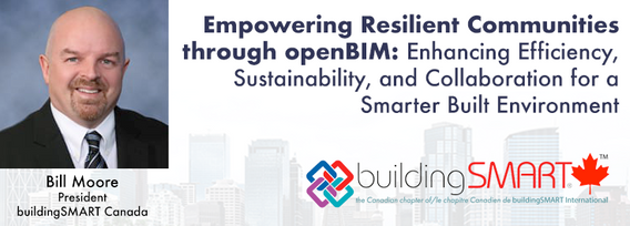
openBIM aims to make the built environment more efficient, sustainable, and productive, leading to more liveable and resilient communities. Smarter infrastructure and buildings help to improve energy-efficiency, sustainable practice and future-proof standards to ensure a more equitable society.Open standards ensure that different products and systems can work together seamlessly, regardless of who developed them or what platform they run on. This generates comprehensive, trusted and...


Wetlands are important to water quality, nutrient cycling, and biodiversity, and have been identified as a management priority across Canada. Reclaiming wetlands that have been impacted can be a long-term, costly process depending on the type of wetland, location, and potential access constraints. One challenge with wetland reclamation is that the work may cause additional or new wetland impacts during access and execution of the work. Concurrent with wetland reclamation priorities, there ...


This panel will delve into some Geoff Zeiss's favorite topics:Example - Colorado DOT, PennDOT. Not an explicit requirement but required for permitting in their RoW’s – effectively a regulatory standard. Metrolink Regulation1: Business Case for SUE DataASCE – Not a regulatory requirement but a recommendation.Regulate on Backend – Permitting Process requirement for ASCE Benefits of Accurate Data2: Standards


As part of Planet’s ethos of ‘agile aerospace’, we continually invest in the latest hardware and software advancements to improve the PlanetScope image quality. This dataset began life as a relatively simple 3-band image using commercial, ‘off-the-shelf’ hardware components. Through customer feedback, both software and hardware improvements were tested and launched, resulting in a second-generation of PlanetScope, or ‘Dove’ satellites. Replacing this second generation of satellites involved a...


Geoff Zeiss devoted over 30 years of his life to the Geospatial industry and global community, focusing on utility and construction sectors, and mapping underground utility infrastructure among many other projects. Sadly, Geoff passed away in September of 2022. The Geoff Zeiss Urban Infrastructure Mapping Fund was established to build on decades of innovation by Dr. Zeiss in developing effective and sustainable urban infrastructure through research and development supporting urban infor...


The Department of National Defence, as steward of a real property (RP) portfolio that includes tens of thousands of buildings and supporting infrastructure, is seeking to manage its Real Property (RP) assets more effectively by modernizing and improving its digital capability. In this effort, interoperability between BIM and GIS through open data standards is crucial to enable the Integrated Digital Built Environment. BIM allows representation of detailed information regarding building elemen...
