Vince Zafra
he/him
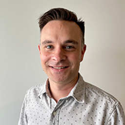
Vince Zafra is the GIS Specialist for Emergency Response Assistance Canada (ERAC) - a Canada-wide organization that supports its members with all their emergency preparedness and response needs for incidents involving dangerous goods such as flammable gases and liquids.
After obtaining a Bachelor of Science degree in Environmental Science with a specialization in Geography, Vince worked in the geomatics and environmental consulting industries before joining ERAC. Developing, designing, and maintaining effective and user-friendly solutions has been Vince's focus where various platforms are leveraged and used in tandem. Examples include Esri products (ArcGIS Pro, ArcGIS Online, Survey123, Dashboards, etc.), Make, PowerAutomate, and Python.
As a one-person GIS team, efficiency and automation are essential for Vince who is always on the lookout for new, innovative, and effective solutions.
Sessions in which Vince Zafra participates
Tuesday 7 November, 2023
Incidents involving dangerous goods, including flammable gases and liquids, can happen at any time and in any place. When they do, Emergency Response Assistance Canada's 320+ members count on us to provide a safe and effective emergency response 24 hours a day, 365 days a year.Various GIS solutions exist within Emergency Response Assistance Canada (ERAC) to support these functions. Examples include our resource locator tool that spatially queries and returns key information from 40+...
Sessions in which Vince Zafra attends
Tuesday 7 November, 2023
Join us for a riveting panel discussion featuring leading experts in the realm of reality capture. As the industry stands on the precipice of monumental change, this session aims to unpack the intricacies of current challenges, explore the intricacies of the digital twin concept, and envision the future trajectory of reality capture. Our esteemed panelists, with their wealth of knowledge and diverse experiences, will shed light on the multifaceted struggles the industry grapple...
Is change the new normal? Every year seems to be the next warmest year. Those of us looking back at our planet from space are seeing these changes across our planet in near real-time through the eyes of satellites. But behind those pixels are real human stories of catastrophe and suffering. So, with all our constellations of satellites, massive computing power and new generative AI algorithms, can we do anything more than simply report what happened? What does the future hold for geospatial t...
Over his decade plus at Suncor, Alonzo has been both witness to and active participant in a quiet digital Geospatial revolution. This revolution has democratized access to Geospatial data and tools to everyone at Suncor. Which meant that teams and professionals across a myriad of disciplines have embraced and pushed the limits of Geospatial data and software. The constant demand for newer and higher-resolution data has relegated the paper map to secondary status as the tool for spatial commun...
Addressing the escalating levels of methane in the Earth's atmosphere is among the most urgent issues humanity faces. Methane ranks as one of the most potent greenhouse gases (GHGs), trapping over 25 times more heat than carbon dioxide over a 100-year period; thus, significantly reducing methane emissions will make a substantial impact in the fight against climate change.One of the most impactful methods for mitigating methane emissions involves the prompt detection and repair of metha...
Teams can become the catalyst to co-elevate results-driven organizations accelerate outcomes, unleash their full potential, and create unprecedented internal and external value. But it’s not a given!In an increasingly volatile, uncertain, and non-linear Geomatics landscape, senior-level managers find it increasingly challenging to keep up and get things done – efficiently, effectively, and timely. The organizational silos have begun to come down, but often remain camou...
Geodetic Reference Systems are the foundation for geospatial data, serving as the official reference for latitude, longitude, height and gravity in Canada. There are many contributors to providing such standards to Canadians, including Federal, Provincial and Municipal governments, the private sector, academia, and others. Users will know that every few years there are new versions introduced of the datums or reference frames. A change in reference system, however, invo...
Creating, managing and sharing geospatial information has never been easier, but how do we ensure the information we are using to make key business decisions is current, correct, accurate and the best fit for purpose? This session will explore the different types of geospatial information assets being used at The City and the different tools, methods and standards that are being used capture, manage and share authoritative City data across the organization and to the Citizens of Calgary.
As GIS professionals, we understand the pivotal role that geospatial data plays in decision-making across various industries. Now, imagine harnessing that power to transform facility management. This presentation delves into VertiGIS FM, a groundbreaking solution that revolutionizes facility management through the lens of spatial intelligence, creating new opportunities and efficiencies across organizations.
Harnessing the power of regular collection of imagery and Lidar, the City of Calgary provides valuable information for municipal service delivery. The City publicly shares various datasets in different formats, including Orthophotos, Lidar, and 3D buildings, oh-my! Beginning in 1990, the Aerial Imagery Program supported planning, development, and operations.Regularly collecting spatial data allows for more accurate assessments of changes over time. Annual Orthophoto collection aids in ...
Wednesday 8 November, 2023
Wetlands are important to water quality, nutrient cycling, and biodiversity, and have been identified as a management priority across Canada. Reclaiming wetlands that have been impacted can be a long-term, costly process depending on the type of wetland, location, and potential access constraints. One challenge with wetland reclamation is that the work may cause additional or new wetland impacts during access and execution of the work. Concurrent with wetland reclamation priorities, there ...
How do you decide when to mobilize and when not to, or even where can you safely and legally fly. As the frequency of unpredictable weather and forest fire smoke increase, so too does the risk in mobilizing to a job site. This presentation will demonstrate OGL Engineering’s process and different geospatial resources available to better inform your decision and minimize risks.


