Victoria Desjardins
Victoria is a new Instructor in the Geomatics Engineering Technology program at the Southern Alberta Institute of Technology. Prior to teaching, she worked as a Geospatial Analyst for an aerial LiDAR acquisition company, working with LiDAR data from calibration to delivery. Victoria is passionate about education and learning - holding a BSc with Combined Honours in Earth Science and Environment, Sustainability, and Society; a certificate in Environmental Geoscience, and a diploma in Geomatics Engineering Technology - and volunteering in the past with a local outreach group, providing Geoscience education to community members of all ages. As an artist who creates works inspired by the geospatial realm, social justice and mental health advocacy, Victoria seeks to find creative approaches to inspire, educate, and problem solve. She finds inspiration and perspective through raising a toddler, including the value of play in learning and the importance of having strong foundations, and is interested in exploring and developing a connection between early learning and the field of Geomatics.
Sessions in which Victoria Desjardins participates
- Geomatics Education Panel Big Four Roadhouse - Theatre 2
- 11:00 AM MST - 11:45 AM MST | 45 minutes
- Join us at the GoGeomatics Expo in Calgary for a concise panel discussion on the present and future of geomatics educat...
- Panel


Sessions in which Victoria Desjardins attends
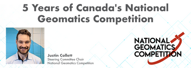
- 5 Years of Canada's National Geomatics Competition Big Four Roadhouse - Theatre 1
- 10:00 AM MST - 10:25 AM MST | 25 minutes
- Since 2018, students from geomatics programs across Canada have been participating in the annual National Geomatics Competition. Now in it's 5th ye...
- Talk

- SLAM Scan-Off Results Big Four Roadhouse - Theatre 2
- 11:00 AM MST - 12:00 PM MST | 1 hour
- Rapid, short-range data collection will only become more critical as the technological revolution continues. From planning and analytics to VDC ...
- Talk


- Establishing an Urban Infrastructure Mapping Research Program Big Four Roadhouse - Theatre 1
- 12:30 PM MST - 12:55 PM MST | 25 minutes
- Geoff Zeiss devoted over 30 years of his life to the Geospatial industry and global community, focusing on utility and construction sectors, and ma...
- Talk

- Airborne Topo-Bathymetric Lidar Combined with Thermal Imaging for Fish Habitat Studies in Rivers Big Four Roadhouse - Theatre 1
- 1:45 PM MST - 2:10 PM MST | 25 minutes
- Research Presentation:Airborne Topo-Bathymetric Lidar Combined with Thermal Imaging for Fish Habitat Studies in RiversResearchers at ...
- Talk


- Surveyor Succession Planning Panel Big Four Roadhouse - Theatre 2
- 2:45 PM MST - 3:30 PM MST | 45 minutes
- Join us at the GoGeomatics Expo for an insightful panel discussion that tackles the pressing question: Where will the next generation of land surve...
- Panel