
Sara Richard
Geomatics Specialist
GNWT
I am a graduate of SAITs BGIS program and currently work for the Government of the NWT as a Geomatics Specialist.
I have a background in mining, however, I migrated to public service in the Geomatics Division nearly 4 years ago.
I find the GIS industry and career to be very exciting and forever evolving which feeds my desire for learning.
Sessions in which Sara Richard attends
10:30 AM
10:30 AM
- Positioning for future headwinds: a new era of working with governments
- Available Sold out Ticket sales have finished Ticket sales haven't started yet You've purchased a ticket Big Four Roadhouse - Education & Workshop Theatre
- 10:30 AM MST - 11:30 AM MST | 1 hour
- Over the past three decades, global and national economies have undergone profound transition while the governments that have tried to steer worldw...
- Workshop


12:30 PM
12:30 PM
- Flood Hazard Mapping Data and Its Importance: Jurisdictional Complexity, Innovation in Data Dissemination, and Advancing Adaptation Big Four Roadhouse - Theatre 3
- 12:30 PM MST - 12:55 PM MST | 25 minutes
- Flooding is Canada’s most costly natural disaster, and flood risk intensifies as a result of urbanization and climate change. These impacts will...
- Talk


2:15 PM
2:15 PM
- GIS Solutions Enhancing Emergency Response, Management, and Response Team Assessments Big Four Roadhouse - Theatre 1
- 2:15 PM MST - 2:40 PM MST | 25 minutes
- Incidents involving dangerous goods, including flammable gases and liquids, can happen at any time and in any place. When they do, Emergency Res...
- Talk


2:45 PM
2:45 PM
- buildingSMART BIM/GIS Panel Big Four Roadhouse - Theatre 2
- 2:45 PM MST - 3:30 PM MST | 45 minutes
- Join us at the BIM/GIS panel of our conference as we delve into critical subjects shaping the intersection of Building ...
- Panel


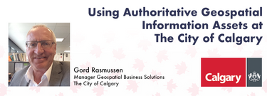
- Using Authoritative Geospatial Information Assets at The City of Calgary Big Four Roadhouse - Theatre 1
- 2:45 PM MST - 3:10 PM MST | 25 minutes
- Creating, managing and sharing geospatial information has never been easier, but how do we ensure the information we are using to make key business...
- Talk

3:30 PM
3:30 PM
- Unlocking the Power of GIS in Facility Management: An Introduction to VertiGIS FM Big Four Roadhouse - Theatre 3
- 3:30 PM MST - 3:55 PM MST | 25 minutes
- As GIS professionals, we understand the pivotal role that geospatial data plays in decision-making across various industries. Now, imagine harnessi...
- Talk


4:00 PM
4:00 PM
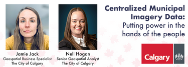
- Centralized Municipal Imagery Data: Putting power in the hands of the people Big Four Roadhouse - Theatre 3
- 4:00 PM MST - 4:25 PM MST | 25 minutes
- Harnessing the power of regular collection of imagery and Lidar, the City of Calgary provides valuable information for municipal service delivery. ...
- Talk


10:00 AM
10:00 AM
- Unlocking the Power of Geospatial Marketing
- Available Sold out Ticket sales have finished Ticket sales haven't started yet You've purchased a ticket Big Four Roadhouse - Education & Workshop Theatre
- 10:00 AM MST - 10:25 AM MST | 25 minutes
- Join us at the Calgary GoGeomatics Expo for an exclusive workshop hosted by Jonathan Murphy, the founder of GoGeomatics and GeoIgnite. In this sess...
- Talk


- Empowering Resilient Communities through openBIM: Enhancing Efficiency, Sustainability, and Collaboration for a Smarter Built Environment Big Four Roadhouse - Theatre 3
- 10:00 AM MST - 10:25 AM MST | 25 minutes
- openBIM aims to make the built environment more efficient, sustainable, and productive, leading to more liveable and resilient communities. Smar...
- Talk


12:00 PM
12:00 PM
- The Evolution of Planetscope Data and the Application of Planetary Variables
- Available Sold out Ticket sales have finished Ticket sales haven't started yet You've purchased a ticket Big Four Roadhouse - Education & Workshop Theatre
- 12:00 PM MST - 12:25 PM MST | 25 minutes
- As part of Planet’s ethos of ‘agile aerospace’, we continually invest in the latest hardware and software advancements to improve the PlanetScope i...
- Workshop


12:30 PM
12:30 PM
- Establishing an Urban Infrastructure Mapping Research Program Big Four Roadhouse - Theatre 1
- 12:30 PM MST - 12:55 PM MST | 25 minutes
- Geoff Zeiss devoted over 30 years of his life to the Geospatial industry and global community, focusing on utility and construction sectors, and ma...
- Talk


1:45 PM
1:45 PM
- A High-Resolution, Continental Scale, and Modular Flood Risk Estimation Framework Big Four Roadhouse - Theatre 3
- 1:45 PM MST - 2:10 PM MST | 25 minutes
- The lack of up-to-date, easily available flood risk data has slowed down Canadian attempts to mitigate flood damage, notwithstanding the substantia...
- Talk


- Airborne Topo-Bathymetric Lidar Combined with Thermal Imaging for Fish Habitat Studies in Rivers Big Four Roadhouse - Theatre 1
- 1:45 PM MST - 2:10 PM MST | 25 minutes
- Research Presentation:Airborne Topo-Bathymetric Lidar Combined with Thermal Imaging for Fish Habitat Studies in RiversResearchers at ...
- Talk


2:15 PM
2:15 PM
- Integration of BIM / GIS to achieve the digital built environment for the Department of National Defence Big Four Roadhouse - Theatre 1
- 2:15 PM MST - 2:40 PM MST | 25 minutes
- The Department of National Defence, as steward of a real property (RP) portfolio that includes tens of thousands of buildings and supporting infras...
- Talk
