Mapping the Future: Honoring Geoff Zeiss and His Transformative Work in Geospatial Technology

My Session Status
In the upcoming Canada's National Geospatial Conference, we are delighted to host a special plenary session, "Mapping the Future: Honoring Geoff Zeiss and His Transformative Work in Geospatial Technology," on May 14th in Ottawa. This session is dedicated to celebrating the remarkable contributions of Geoff Zeiss to the fields of mapping, utilities, and Geographic Information Systems (GIS).
Geoff Zeiss, renowned for his insightful blog "Between the Poles," has been a pivotal figure in advancing the integration of GIS with utility management. His innovative approach has significantly enhanced the efficiency and management of utility infrastructures, ranging from water to telecommunications. Geoff's advocacy for open standards and interoperability in GIS has been instrumental in fostering seamless data exchange and system compatibility across the industry.
A notable area of Geoff’s work is his focus on 3D mapping and the meticulous management of underground infrastructure. His contributions in this field have been crucial in mitigating risks associated with underground assets, thereby enhancing urban safety and operational efficiency. Moreover, Geoff’s vision has extended to the realm of urban planning and smart cities, where he has championed the use of geospatial data to foster sustainable and intelligent urban development.
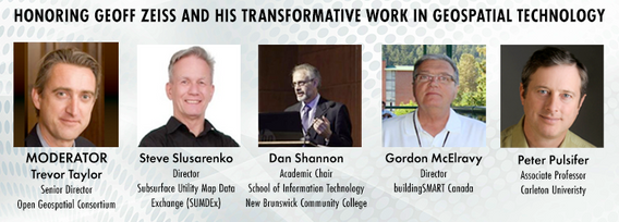
This session will feature colleagues of Geoff Zeiss, who will share their perspectives on his work and its impact on the global geospatial community. They will reflect on his legacy, particularly his role in shaping industry practices in GIS and utilities, and his contributions to developing industry standards and participating in key industry organizations.


