Wednesday 19 June, 2019

John Roos welcomes delegates and introduces the morning Industry tract as MC for GoGeomatics Canada.
Marikka Williams, MSc, GISP and Professor, Fleming College Geographic Information Systems welcomes delegates to the morning and will be master of ceremonies for the morning.
Mainstreaming of the geospatial market has created a big demand for geospatial content and solutions across governments, businesses and consumers. The Fourth Industrial Revolution (4IR) has also helped scale up applications and value to much larger markets, amplifying overall impact and contribution of geospatial information in the world economy and society. With every added application and consumer, the return on investments get bigger and better. The panel shall focus...


Lauriault’s work on open data, big data, open smart cities, is international, transdisciplinary and multi-sectoral. She is one of the founders of critical data studies and of open data in Canada and founded Open Smart Cities with OpenNorth a data and technology governance approach to shape how Canadian cities roll out their ‘smart’ programs. She has expertise in data infrastructures, spatial media and smart cities, and is especially interested in the assemblage of social and technological pro...
The coastal zone is a challenging place to map, techniques for mapping the land elevation do not work under water and echosounding methods for mapping the seabed elevation work well in deep water but are dangerous and expensive in shallow water. As a result, detailed information in the shallow coastal zone is lacking. This presentation will focus on the Chiroptera II shallow water topo-bathymetric lidar sensor that can collect seamless elevation data in coastal or freshwater environments. The...
Asset management is critical for many government agencies to manage their street assets. A.I. and machine learning technology is expanding to automate government work-flows which have traditionally required significant investments in field work, manual intervention, and data analysis. This session will showcase real-world examples of the benefits of street-level imagery and the power of A.I. in scaling up data collection and extraction for asset inventory, site surveys, property appraisals an...
This Canadian military presentation will show various datasets of survey grade terrestrial LiDAR, discuss collection methods to achieve the best results and talk about possible applications/analysis that the data can be used for. Presentaers will demonstrate some workflows in Leica Cyclone to show how survey grade points can be extracted and discuss the pros/cons and considerations of using terrestrial LiDAR.

NAV CANADA is a privately run, not-for-profit organization that is the Air Navigation Service Provider for Canada. With an airspace that spans all three coastlines of the country, from the west coast of British Columbia to the Arctic Ocean in the North to the east coast of Newfoundland, NAV CANADA covers a lot of territory. The Aeronautical Information Management group is responsible for creating instrument flight procedure designs (airways, instrument approach procedures, departure procedure...

Ecopia.ai will present how its semi-automated approach of combining deep neural networks with scalable crowd map annotators can be combined to create continental scale vector map data while achieving human-level accuracy. In this discussion, Brandon Palin will speak to use cases and industries that are using our technology to make better decisions quicker, including governments, and NGOs globally.

Megan works with national players in the Construction Industry, balancing high-level strategic direction and thinking with operational needs and technologies. She works with Departmental Stakeholders, Clients, and Private Sector Service Providers alike to bring digital efficiencies and innovation to workflows and processes in Real Property portfolio, program, and project, management. Megan has been a strong voice for digital transformation within the Federal Government's Real Property Communi...
Remote sensing is the most cost-effective means for gathering timely detailed and reliable information over large areas with high revisit frequency. The integration of remote sensing data with national statistics, field observations and secondary data show great potential for mapping crop acreages. This requires the selection of appropriate satellite data, the collection of quality ground information, the application of suitable pre- and post-processing methods and the implementation of a rob...

Brampton built a hub for the City’s Open Data and made it available to Staff, Citizens, Businesses and Students. The GeoHub makes discovering and using the City’s data more purposeful, and promotes transparency, fostering innovation everywhere. In our ongoing effort to develop a mature GIS system, the GeoHub is a big step in our goal of creating a self-serve environment. The City leveraged ArcGIS Open Data to transform it into a community hub, effectively increasing the usage of Open Data and...

Global Grid Systems is on the leading edge of DGGS technology and is applying it in many exciting applications. A Discrete Global Grid (DGG) is a partition of the Earth’s surface into a set of regions (a.k.a. cells) containing a single point and meeting the needs for global sampling, storage, modeling, processing, analysis, discovery, integration, and visualization.We're building an engine that powers applications in marketing, telecommunications, insurance, and gov...
The GeoIgnite Conference and our sponsors are proud to present the inaugural Diversity in Leadership Summit (DILS). It is our vision that GeoIgnite will spur the grassroots of a more diverse ecosystem where diversity of thinking and knowledge will ignite innovation and better outcomes for us all. The DILS is the flagship forum for of geo professionals of all ages and stages in...


Creating maps has traditionally been a one-way process in which GIS professionals and cartographers translate spatial data into for use by maps used by other knowledgeable professionals. However, as the volume of data being collected by virtually every industry increases the demographic of the map consuming audience is changing to include more people with less GIS knowledge. The challenge has become how best to simplify maps for the user and also to find ways to incorporate input from users i...
Synthetic Aperture Radar (SAR) satellites image the Earth in all weather conditions, day or night. Canada’s RADARSAT-2 satellite, launched in 2007, orbits the Earth with a 24-day revisit cycle. It is used for mapping ground deformation produced by natural and anthropogenic hazards; natural resource development; permafrost, glacier and coastal changes. The next generation of Canadian satellites, the RADARSAT Constellation Mission (RCM), to be launched in June 2019, will improve the revisit cyc...

As we worked with multiple government organizations this past year, we faced this same question along the way: Should we move our data processes to the cloud? Now as much as we would like to give you a yes or no answer, there are different paths or options you need to explore inside your organization before taking this decision. In this presentation, you will hear about the latest trends and some ways to use the Cloud as a platform for geo data processes. You will also learn different conside...

Investment in building construction statistics for the residential and non-residential sectors account for approximately 5% of GDP and are used extensively by internal and external clients. The statistics available for the residential and non-residential building construction sectors provide an invaluable portrait of this activity in Canada at the national, provincial and census metropolitan area (CMA) level. In order to improve the quality of our estimates, while als...
Canada has at least four federal level road network products. Knowing the differences, and when to use which one, is not as straight forward as it should be. Even worse, these products are updated on different schedules, so knowing which one has the most up to date information is a tricky task.We will discuss what the respective networks are and their intended use, covering distribution formats, dataset coverage, and examples of the types of analysis that can be performed with each on...

An experienced, senior executive, and strategic thinker, with an entrepreneurial attitude and a successful track record of growing Companies in the software and data industries through to IPO and acquisition exits. Possessing a strong technical grounding in IT, particularly in geospatial-related technologies, with extensive knowledge and experience of Marketing/Business Development, direct and indirect (channel) sales, Product Management, Systems Architecture and Software development....

The Government of Canada purchases on average $22 billion in goods and services each year to help deliver programs and services to Canadians. Many departments and agencies collect and manage large amounts of geospatial data, and significant investments have been made within these organizations. The demand for, and use of, geospatially-related data and tools is rapidly increasing across government, as well as in the broader public context. This information session will help you understand the ...
The value of geospatial big data and how to efficiently convert it to useful information is an important cross disciplinary question. There has been significant investment in the collection and archiving of geospatial and other environmental data and numerous organizations recognize the importance of this information resource. However, the software and computing systems to effectively and efficiently access, interrogate, and utilize this information for specific applications has not seen the ...

Geographic data is ubiquitous in the landscape of organizations, corporations and governments. CartoVista allows you to profit from it by building interactive web maps. Leveraging the best of HTML5, CartoVista delivers a rich, immersive mapping experience that can even surpass desktop GIS! Discover how you can tell a story in your web browser and make your GIS data shine! This presentation will highlight concrete examples of web mapping cartography involving advanced styles and rich data visu...
For the second day of the conference executive Chef Derek Ragnitz and his award winning culinary team offer a Mexican themed selection for delegates enjoyment.GeoIgnite Day 2 Mexican Style LunchChef Dereks Ragnitz's tasty Chicken Fajitas using fresh ingredients.Tortilla chip platters: Chips, fresh guacamole and salsa. Shredded cheese, sliced jalapenos, sour cream and Mexican re-fried beans.Southwestern three bean salad.<...
Come One, Come All: Utility GIS Data AggregationTo illustrate and make the case that cooperation between utility stakeholders is long overdue, and in everyone’s best interest…not only for damage prevention, but public safety as well.For over a decade, we have been successfully aggregating data on behalf of utility stakeholders, municipalities, one call centers, locate service providers, excavators, and engineering firms. In so doing, we add situational awareness, improve data quality,...

It takes village to raise a business, but there is no reason it shouldn’t be a global village. Sparkgeo started with the simple idea that it would be good to put maps on the internet. From there we have evolved into a geospatial consultancy providing generalized non-vendor specific geospatial advice, with an ability to back up what we say with code and data. This is a story about serendipity, intermingled with a pinch of good fortune with an occasional lucky break.

The purpose of this presentation is to make the case for greater Indigenous participation in the development of geospatial technology and information. Next to government and resource companies, Indigenous people are the prominent stakeholders of the land and all the economic development that can happen on their territory. For this reason, they should have access to their own Geospatial data such as GIS data and ground imagery. Often the sources for Geospatial data comes from the proponent who...

Over the last few years, the Data Exploration and Integration Lab (DEIL) at Statistics Canada has conducted an increasing amount of work with open data using various open source tools in an open ecosystem. This exploration and experience has given rise to the idea of using an “open project” approach; that is, an approach that, to the extent possible, makes use of open source software, open code, open standards, open data, open platforms and open project management tools. The presentation outl...
UrtheDaily will be a 6-satellite constellation to acquire scientific-grade quality, 9-band multispectral imagery, at 5-meter Ground Sampling Distance (GSD), of 92% the whole Earth’s landmass every day. The cloud-based, scientifically-calibrated processing system will produce Analytics Ready Data (ARD) for geoanalytics—machine learning and AI—to provide evidence-based, actionable insights for sustainable development strategies ranging from but not limited to agriculture, ecology, forestry, dis...
The internet is an excellent channel for GIS professionals to reach their audiences. However, much of what is being diffused leaves people wanting. In many cases, static or limited functionality doesn't inspire people. Worse, some absolutely great maps are made but never reach their intended target. Karl Spencer takes us through the process of creating one of CartoVista's mesmerizing Mystery Maps. From digital research, through to design, development and finally distribution, Karl will presen...

Due to climate change, natural hazards are happening more in recent days. Analyzing these changes and prediction of future hazards have been always a challenge in the field of Geographic information systems (GISs). Traditional GIS aims to use map versus globe for their models, standards, and analysis. With the advances on Discrete Global Grid Systems, a new research question has been raised on what if we adapt our traditional approaches into a Digital Earth rather than a map. Digital Earth (G...
The City of Hamilton has many service delivery applications for resident addresses. For example, street addresses are solicited in a free form method and not validated against a common address database. Thus, the City has numerous instances of address databases, used on a daily basis, that are not accurate or consistent. In many cases, addresses are misused and often invalid causing a breakdown of communications. Leading to embarrassment for the City, anger by the residents and in some cas...

Natural Resources Canada provides mapping and engineering advice and expertise to Public Safety Canada in support of the National Disaster Mitigation Program. Notably, NRCan develops the Federal Flood Mapping Guidelines Series and is nearing publication on two documents that will move Canada closer to having common practices for flood risk: • The Federal Hydrologic and Hydraulic Procedures for Flood Hazard Delineation, and • The Federal Geomatics Guideli...

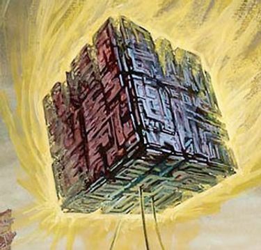
While much of the data available about the Earth pertains to the surface, there also exists a large amount of data available about the atmosphere and regions below the surface. Examples of such data include weather information, lithospheric properties such as velocity, aircraft and satellite flight paths, and underground utility networks. Flattening such volumetric data to the surface for integration with a traditional discrete global grid system (DGGS) discards the spatial relationship betwe...