Adam Schaubel
Sessions auxquelles Adam Schaubel assiste
Mercredi 22 Juillet, 2020
Opening Remarks by GeoIgnite founder Jonathan MurphyKeynote address: Geospatial Opportunities in COVID TimesGeospatial capacity has been helpful in providing answers to Canadians during a time where nothing seems normal anymore. At the forefront of tracking, reporting and managing the response to the COVID crisis are geospatial tools, data and leadership. Natural Resources Canada’s Canada Centre for Mapping and Earth Observation supported the Government of Canada’s response b...
The U.S. reference system modernization effort will replace the North American Datum of 1983 (NAD83) with a new North American Terrestrial Reference Frame (NATRF2022), creating 1.3 to 1.5 m horizontal coordinate differences at the Canada–U.S. border with respect to Canada’s NAD83(CSRS). Never before have such significant differences existed between our two countries’ reference frames.There are compelling reasons for Canada to follow suit and adopt the NATRF2022 frame as our ...
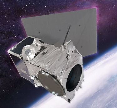
Presented by: Jake Dickinson & John Roos Abstract: As shrinking polar ice creates new opportunities for resource exploration and shipping routes, the importance for Arctic nations to monitor the ongoing expansion in the Arctic is ever increasing. Additionally, climate change continues to impact people and the environment. High resolution satellite imagery remains one of the most effective means of monitoring inaccessible and de...
Geospatial and location technologies is present and continues to expand its reach in many sectors. Much of the current digital transformation taking place globally is built upon geospatial foundations. In this open panel discussion, our experts will discuss the latest developments and challenges facing the Canadian and global geospatial sector and what the future holds. Key components to be addressed include how has the global pandemic affected our sector and how may we be impacted in the...
Jeudi 23 Juillet, 2020
Title: Growing Canada’s Next Earth Observation (EO) GenerationCanada has a proud history in Earth Observation, supporting a strong export industry driven on EO imagery and geospatial analytics. It is incumbent on all of us to continue Canada’s strong presence in the global EO community and we can only do that with a concerted effort and plan to grow the next generation of leaders. After 51 years of leadership in space and spatial information technology MDA was recen...
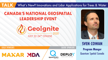
A closer look at some of the lidar-derived innovations for enhanced forestry management solutions and topobathymetric flood mitigation from Quantum Spatial Canada. Presented by Sven Cowan, Dr. Andrew Brenner, and Colin Cooper. Quantum Spatial, Inc., an NV5 company, is one of North America's largest geospatial services firms, providing insights to organizations that need geospatial intelligence to mitigate risk, plan for growth, better manage resources and advance scientific ...
Vendredi 24 Juillet, 2020
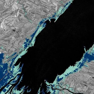
In recognition of the increasing costs and risk due to flooding, the Government of Canada is investing in flood mapping as part of the Government’s commitment to build safer and more resilient communities. Flood maps are critical for the public to understand their flood risks, and the availability of up to date flood hazard maps are key to strengthening the resilience of Canadian communities to overland flooding. Natural Resources Canada (NRCan) has been working in collaboration to advance...
The key elements to take into account a successful implementation of drone survey with a mm accuracy are: Know your camera; Trust your measurement; Control your space; Understand your photogrammetry software. Working out that, we present this nuance including special tags around the surveyed object as the measurement system to get details.A correct implementation of photogrammetry tags with consumer grade measurement devices and consumer grade UAVs and cameras enables very precise a...
Title: DEIL experiments and outputs with open geospatial dataThe Data Exploration and Integration Lab (DEIL) at Statistics Canada has implemented a number of projects using, to the extent possible, open georeferenced data and open source tools. This presentation outlines some of this work. We will present recent developments of the Linkable Open Data Environment (LODE), examples of the use of LODE data, the development of a Proximity Measures Database and Data Viewer, and an R&amp...
Mercredi 21 Avril, 2021
Le Canada est le chef de file mondial dans le domaine de l'observation de la Terre par radar spatial à grande échelle grâce au programme RADARSAT, qui soutient de nombreuses utilisations opérationnelles et scientifiques des données radar à synthèse d'ouverture (SAR).MDA, en collaboration avec le gouvernement canadien, a créé une marque et une réputation d'excellence internationalement reconnues en matière de données SAR en temps quasi réel sur de vastes zones pour les applica...
Le Centre canadien de cartographie et d'observation de la Terre (RNCan) poursuit ses travaux de mise en œuvre de la Stratégie nationale sur les données d'élévation. Grâce à cette stratégie, l'un des objectifs de RNCan est de fournir aux Canadiens une représentation tridimensionnelle précise du pays, à l'appui des priorités du gouvernement comme la cartographie des inondations. En raison de l'énorme tâche d'obtenir une couche d'élévation nationale de haute précision et à jour, RNCan travail...
Session hébergée par NRCan
Titre: Faire progresser l'observation spatiale au Canada: Le Panel géospatial des directeurs généraux de GeoIgnite 2021, dans le cadre de la Conférence géospatiale nationale du Canada. Titre: Faire progresser l'observation spatiale au Canada Il s'agit d'un panel incontournable pour quiconque souhaite connaître la direction que prend le leadership géospatial du gouvernement fédéral du Canada. Joignez-vous à nos pané...
Jeudi 22 Avril, 2021
Résumé à venir: Surveillance des secteurs de programme de l'ASC, y compris l'utilisation de l'espace, l'exploration spatiale et les sciences et technologies spatiales.
Application des données de POI canadiennes de SafeGraph pour l'analyse au niveau de la communauté dans ArcGIS et Tableau Les données géospatiales permettent aux organismes de recherche, aux agences gouvernementales et au secteur privé de visualiser et d'analyser des problèmes complexes de manière nouvelle et innovante. Mais les données de localisation ne sont utiles que si elles sont exactes - ce que de nombreux analystes de SIG et de données ne savent que trop bien. Arm...
Depuis près de 50 ans, des représentants de la géomatique des provinces et territoires canadiens ont collaboré avec le gouvernement fédéral à des initiatives de géomatique. Cette présentation explorera pourquoi un tel conseil a vu le jour et pourquoi son travail est important pour le secteur canadien de la géomatique et les citoyens. Alors que le secteur de la géomatique et le monde dans lequel nous vivons continuent d'évoluer, le besoin de coordination entre les juridictions demeure crucial ...
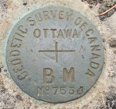
Le levé géodésique canadien (SCG) de Ressources naturelles Canada (RNCan) est chargé de définir, de maintenir et de fournir l'accès au Système canadien de référence spatiale (SCRS). Le CSRS fournit une référence cohérente pour l'arpentage, la cartographie et d'autres applications qui nécessitent un positionnement précis. Cette présentation décrira les produits, les outils et les services de BESC actuellement disponibles et donnera accès au Système canadien de référence spatiale (SCRS). Il ...
Avec des PetaBytes de données sortant de l'orbite terrestre basse tous les jours, l'opportunité offerte par l'observation de la Terre semble être plus grande que jamais. Mais notre communauté réalise-t-elle encore cette opportunité? Y a-t-il des gagnants? Comment devrions-nous penser aux entreprises EO dans les années 2020 rugissantes?
Vendredi 23 Avril, 2021
L'industrie géospatiale mondiale est estimée à 500 milliards de dollars américains et a un impact encore plus significatif sur la société, avec des avantages économiques dérivés estimés à être multiples. Ces avantages, cependant, ne sont toujours pas pleinement compris par les principales parties prenantes et les décideurs politiques, ce qui entrave en fin de compte l'adoption mondiale des informations géospatiales. Avec des décennies d'efforts d'infrastructure nationale de données spatial...
Dans cette présentation d'Avenza Systems, nous montrerons comment des résultats cartographiques de haute qualité après votre analyse de données peuvent réellement être obtenus! Nous montrerons comment développer et concevoir une carte à partir de données de recensement statistiques brutes dans Adobe Illustrator en tirant parti des fonctionnalités géospatiales de MAPublisher - la solution de cartographie standard pour une sortie graphique de haute qualité.Nous allons montr...
Avec les progrès rapides des technologies d'observation de la Terre, de cloud computing et d'analyse, plus d'informations sur notre monde en mutation sont plus facilement disponibles que jamais. Planet est une société aérospatiale et d'analyse de données à la pointe de ces avancées - travaillant pour rendre le changement global visible, accessible et exploitable, Planet visualise la Terre entière quotidiennement à une résolution de 3,5 m et n'importe où sous-quotidienne à <50 cm. Dans cett...
oignez-vous à GeoIgnite pour ce premier panel de chefs de file provinciaux et territoriaux de la géospatiale et des technologies de localisation. Nous discuterons des problèmes entourant: Quelles sont les principales priorités et défis à travers les juridictions?Quels types d'outils géospatiaux utilisons-nous pour surveiller et répondre à des défis clés tels que les interventions d'urgence?Comment les juridictions harmonisent-elle...
Mardi 27 Avril, 2021
Les billets pour cet atelier doivent être achetés à l'avance.
Mercredi 28 Avril, 2021
Les billets pour cet atelier doivent être achetés à l'avance.
Mardi 26 Mars, 2024
Airborne Topo-Bathymetric Lidar Combined with Thermal Imaging for Fish Habitat Studies in RiversResearchers at Nova Scotia Community College’s Applied Geomatics Research Group have been using the airborne Leica Chiroptera 4X topo-bathymetric lidar sensor for nearly a decade and have surveyed coastal, riverine and lake environments. They have concentrated on mapping submerged aquatic vegetation (SAV). Topo-bathy lidar data of rivers provides an opportunity for improved flood hazard h...
The Canadian government first formally created LiDAR Guidelines in 2017. The document was updated in 2022 to Version 3.1. This session will review the Canadian Guidelines and compare them to the USGS LiDAR Base specification, updated in 2023. Included in the presentation will be:LiDAR for Flood Mapping and funding from the National D...
As traditional infrastructure design methods migrate from 2D to 3D modeling, LiDAR data acquisition continues to present an opportunity to improve the base modeling process. This presentation will show how TopoDOT can be used to extract DGN vector data from point clouds to improve the quality of digital as-built base models which enable better transportation 3D design processes like Bentley’s ORD.
Canada has just experienced a record wildfire season with devastating impacts. Public safety and damage mitigation is a priority for all impacted by these disasters. From mapping vegetation, analyzing slope stability, planning fire breaks, qualitfiying wood debris and fuel loads, how does LiDAR play a role in meeting post wildfire needs?
Come sit down with us as we outline our ambitious initiative, how you might help, and how you will benefit regardless. Oh, how the world is changing. Technology is progressing faster than ever before; robotics and geomatics have become fused together in revolutionary technology that is sweeping industry for all the right reasons. Simultaneous localization and mapping (SLAM) isn't just knocking on the geomatics industry door, it kicked it in! Machine Learning and computer vision ar...
Canada’s LiDAR Panel: Future Trends in Service and Tech, is a deep dive into the evolving landscape of LiDAR technology in Canada. Our panel of experts will explore cutting-edge developments in LiDAR, focusing on new trends in service delivery and technological advancements. Expect insights into the integration of AI, enhancements in data processing, and future applications in sectors like urban development and environmental management. This session promises to equip attendees with a forward-...
Mercredi 27 Mars, 2024
The United States’ National Geodetic Survey (NGS) plans to modernize their National Spatial Reference System (NSRS) in 2025, including adopting a new dynamic geometric reference (the North American Terrestrial Reference Frame of 2022 (NATRF2022)) and a new geoid-based height system (the North American-Pacific Geopotential Datum of 2022 (NAPGD2022)). To ensure continued geospatial referencing compatibility, the Canadian Geodetic Survey (CGS) plans to modernize the Canadian Spatial Reference Sy...
Mercredi 29 Janvier, 2025
This keynote presentation will revisit some of the fundamentals behind lidar that influence the precision and detail the systems produce. The laser ranging systems that are used strongly influence how the lidar system works and factors including: wavelength, beam divergence, pulse width and pulse repetition frequency will be reviewed and discussed. Most airborne topographic lidars use a 1064 nm Near-Infrared laser, while topo-bathymetric lidar systems deploy both a NIR laser and a green laser...
AI-driven mapping revolutionizes the use of LiDAR and photo datasets, addressing challenges like underutilized data and the complexity of heavy datasets. By transforming big data into lightweight, accessible information, XEOS offers practical solutions for municipalities and private companies. Through a step-by-step breakdown of the AI mapping process and product demonstrations, attendees will discover how this innovation enables smarter decision-making and brings more value to LiDAR data.
Join us at LiDARCanEX 2025 for an insightful panel discussion moderated by Dr. Tim Webster. This session will bring together experts to explore the current state of LiDAR projects in Canada and discuss what the future holds. Topics include:Wide-Area Topographic LiDAR Mapping: Applications in forestry, flood risk assessment, powerlines, infrastructure, and urban development.Topo-Bathymet...


