Adam Schaubel
Sessions in which Adam Schaubel attends
الأربعاء 22 يوليو, 2020
Opening Remarks by GeoIgnite founder Jonathan MurphyKeynote address: Geospatial Opportunities in COVID TimesGeospatial capacity has been helpful in providing answers to Canadians during a time where nothing seems normal anymore. At the forefront of tracking, reporting and managing the response to the COVID crisis are geospatial tools, data and leadership. Natural Resources Canada’s Canada Centre for Mapping and Earth Observation supported the Government of Canada’s response b...
The U.S. reference system modernization effort will replace the North American Datum of 1983 (NAD83) with a new North American Terrestrial Reference Frame (NATRF2022), creating 1.3 to 1.5 m horizontal coordinate differences at the Canada–U.S. border with respect to Canada’s NAD83(CSRS). Never before have such significant differences existed between our two countries’ reference frames.There are compelling reasons for Canada to follow suit and adopt the NATRF2022 frame as our ...
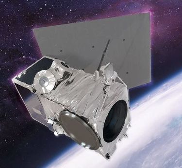
Presented by: Jake Dickinson & John Roos Abstract: As shrinking polar ice creates new opportunities for resource exploration and shipping routes, the importance for Arctic nations to monitor the ongoing expansion in the Arctic is ever increasing. Additionally, climate change continues to impact people and the environment. High resolution satellite imagery remains one of the most effective means of monitoring inaccessible and de...
Geospatial and location technologies is present and continues to expand its reach in many sectors. Much of the current digital transformation taking place globally is built upon geospatial foundations. In this open panel discussion, our experts will discuss the latest developments and challenges facing the Canadian and global geospatial sector and what the future holds. Key components to be addressed include how has the global pandemic affected our sector and how may we be impacted in the...
الخميس 23 يوليو, 2020
Title: Growing Canada’s Next Earth Observation (EO) GenerationCanada has a proud history in Earth Observation, supporting a strong export industry driven on EO imagery and geospatial analytics. It is incumbent on all of us to continue Canada’s strong presence in the global EO community and we can only do that with a concerted effort and plan to grow the next generation of leaders. After 51 years of leadership in space and spatial information technology MDA was recen...
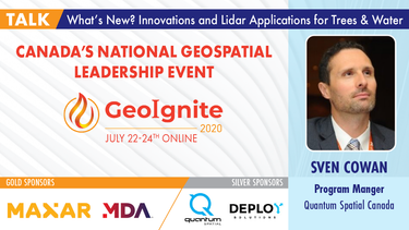
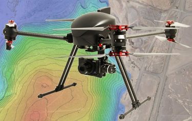
A closer look at some of the lidar-derived innovations for enhanced forestry management solutions and topobathymetric flood mitigation from Quantum Spatial Canada. Presented by Sven Cowan, Dr. Andrew Brenner, and Colin Cooper. Quantum Spatial, Inc., an NV5 company, is one of North America's largest geospatial services firms, providing insights to organizations that need geospatial intelligence to mitigate risk, plan for growth, better manage resources and advance scientific ...
الجمعة 24 يوليو, 2020
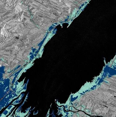
In recognition of the increasing costs and risk due to flooding, the Government of Canada is investing in flood mapping as part of the Government’s commitment to build safer and more resilient communities. Flood maps are critical for the public to understand their flood risks, and the availability of up to date flood hazard maps are key to strengthening the resilience of Canadian communities to overland flooding. Natural Resources Canada (NRCan) has been working in collaboration to advance...
The key elements to take into account a successful implementation of drone survey with a mm accuracy are: Know your camera; Trust your measurement; Control your space; Understand your photogrammetry software. Working out that, we present this nuance including special tags around the surveyed object as the measurement system to get details.A correct implementation of photogrammetry tags with consumer grade measurement devices and consumer grade UAVs and cameras enables very precise a...
Title: DEIL experiments and outputs with open geospatial dataThe Data Exploration and Integration Lab (DEIL) at Statistics Canada has implemented a number of projects using, to the extent possible, open georeferenced data and open source tools. This presentation outlines some of this work. We will present recent developments of the Linkable Open Data Environment (LODE), examples of the use of LODE data, the development of a Proximity Measures Database and Data Viewer, and an R&amp...
الأربعاء 21 أبريل, 2021
Join us for the the launch of GeoIgnite with Jonathan Murphy, the Chair of GeoIgnite, and Dr. Minda Suchan of MDA.Abstract of MDA Keynote: Canada is the world leader in wide area space-based radar Earth observation through the highly successful RADARSAT program, supporting numerous operational and scientific uses for Synthetic Aperture Radar (SAR) data. MDA, in conjunction with the Canadian government, has created an internationally recognized brand and reputation for...
The Canadian Centre for Mapping and Earth Observation (NRCan) continues its work to implement the National Elevation Data Strategy. Through this strategy, one of NRCan's goal is to provide Canadians with an accurate three-dimensional representation of the country, in support of government priorities such as flood mapping. Because of the enormous task of obtaining a high-precision and up-to-date national elevation layer, NRCan works with different entities.The data coverage of the st...
À l'automne 2020, NV5 Geospatial, propulsé par Quantum Spatial, a été mandaté par la Communauté Métropolitaine de Montréal (CMM) pour réaliser l'un des plus grands levés lidar topobathymétriques aériens fluviaux jamais entrepris au Canada. Cette présentation examinera de plus près le contexte, les objectifs, les défis, la technologie, la méthodologie, ainsi que les résultats et conclusions préliminaires de cette importante étude aérienne des vingt-huit principaux cours d'eau entourant la v...
Title: Advancing Space Based Observation in Canada:The GeoIgnite 2021 Directors General Geospatial Panel, part of Canada's National Geospatial Conference.Title: Advancing Space Based Observation in CanadaThis is a must attend panel for anyone interested in learning the direction Canada's Federal government geospatial leadership is taking.Join our panelists for an exploration of Canada's geospatial priorities and mission in this exciting discuss...
الخميس 22 أبريل, 2021
Abstract forth coming: Oversight for CSA program sectors, including in Space Utilization, Space Exploration, and Space Science and Technology.
Applying SafeGraph’s Canadian POI data for community-level analysis in ArcGIS and TableauGeospatial data empowers research bodies, government agencies, and the private sector to visualize and analyze complex problems in new and innovative ways. But location data is only valuable if it is accurate - something many GIS and data analysts know all too well. Armed with accurate, precisely geocoded POI data that includes key attribution related to brands and business types, analys...
For nearly 50 years, geomatics representatives from Canadian provinces and territories have collaborated together and with the federal government on geomatics initiatives. This presentation will explore why such a council came to be and why its work matters to the Canadian geomatics sector and citizens alike. While the geomatics sector and the world we live in continue to change, the need for coordination across jurisdictions remains crucial to support decision-making and response to share...
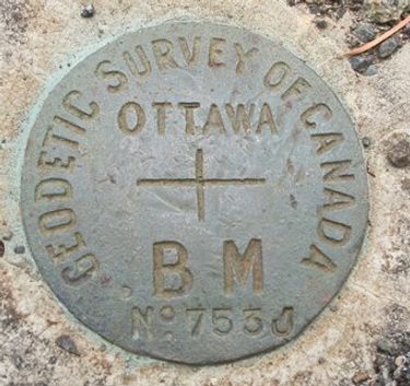
The Canadian Geodetic Survey (CGS) of Natural Resources Canada (NRCan) is responsible for defining, maintaining, and providing access to the Canadian Spatial Reference System (CSRS). The CSRS provides a consistent reference for surveying, mapping, and other applications which require accurate positioning. This presentation will describe the CGS products, tools and services which are currently available and provide access to the Canadian Spatial Reference System (CSRS). It will also take a ...
With PetaBytes of data flowing out of Low Earth Orbit everyday, the opportunity afforded by Earth Observation seems to be greater than ever. But is our community realizing that opportunity yet? Are there winners? How should we be thinking about EO businesses in the roaring 2020s?
الجمعة 23 أبريل, 2021
The global geospatial industry is estimated at US$ 500 Billion and delivers an even more significant impact on society, with derived economic benefits estimated to be multifold. These benefits, however, are still not fully understood by key stakeholders and policy and decision-makers, ultimately hindering the global uptake of geospatial information. With decades of national spatial data infrastructure efforts around the world, how can this be? Focusing on the importance of...
In this presentation by Avenza Systems, we will be showcasing how high quality cartographic outputs after your data analysis can actually be achieved! We will demonstrate how to develop and design a map from raw statistical census data in Adobe Illustrator by leveraging the geospatial functionalities of MAPublisher - the industry-standard cartography solution for high quality graphical output. We’ll show how GIS data can be imported, managed, and transformed on-the-fly all d...
With rapid advances in Earth observation, cloud computing, and analytics technologies, more information on our changing world is more readily available than ever before. Planet is an aerospace and data analytics company at the forefront of these advances -- working to make global change visible, accessible, and actionable, Planet images the full Earth daily at 3.5m resolution and anywhere sub-daily at <50cm. In this talk, we’ll hear from Tara O’Shea, Planet’s Director of Forest Programs, o...
Join GeoIgnite for this inaugural panel of provincial and territorial geospatial and location technology leaders.We will be discussing issues surrounding: What are main priorities and challenges across jurisdictions? What types of geospatial tools we use to monitor and respond to key challenges like emergency response? How are jurisdictions aligning geospatial tools, data, and people to address climate change? What are some current data...
الثّلاثاء 27 أبريل, 2021
Google Chrome is the preferred browser for this session.Tickets for this workshop must be claimed in advance.Have you ever wanted to learn more about Synthetic Aperture RADAR (SAR) and Electo-Optical (EO) products? Come join this session for an introduction to some of the basic imaging parameters and learn about the different p...
الأربعاء 28 أبريل, 2021
Tickets for this workshop must be claimed in advance.The use of drones, officially referred to as Remotely Piloted Aerial Systems (RPAS), has been forecasted to play a key role in the digitalization and further optimization of a variety of geomatics applications such as in resource aggregates management, landfill management, civil engineering (3D reality capture, virtual surveying), and precision agriculture. To help realize this forecast it is important for ...
الثّلاثاء 26 مارس, 2024
Airborne Topo-Bathymetric Lidar Combined with Thermal Imaging for Fish Habitat Studies in RiversResearchers at Nova Scotia Community College’s Applied Geomatics Research Group have been using the airborne Leica Chiroptera 4X topo-bathymetric lidar sensor for nearly a decade and have surveyed coastal, riverine and lake environments. They have concentrated on mapping submerged aquatic vegetation (SAV). Topo-bathy lidar data of rivers provides an opportunity for improved flood hazard h...
The Canadian government first formally created LiDAR Guidelines in 2017. The document was updated in 2022 to Version 3.1. This session will review the Canadian Guidelines and compare them to the USGS LiDAR Base specification, updated in 2023. Included in the presentation will be:LiDAR for Flood Mapping and funding from the National D...
As traditional infrastructure design methods migrate from 2D to 3D modeling, LiDAR data acquisition continues to present an opportunity to improve the base modeling process. This presentation will show how TopoDOT can be used to extract DGN vector data from point clouds to improve the quality of digital as-built base models which enable better transportation 3D design processes like Bentley’s ORD.
Canada has just experienced a record wildfire season with devastating impacts. Public safety and damage mitigation is a priority for all impacted by these disasters. From mapping vegetation, analyzing slope stability, planning fire breaks, qualitfiying wood debris and fuel loads, how does LiDAR play a role in meeting post wildfire needs?
Come sit down with us as we outline our ambitious initiative, how you might help, and how you will benefit regardless. Oh, how the world is changing. Technology is progressing faster than ever before; robotics and geomatics have become fused together in revolutionary technology that is sweeping industry for all the right reasons. Simultaneous localization and mapping (SLAM) isn't just knocking on the geomatics industry door, it kicked it in! Machine Learning and computer vision ar...
Canada’s LiDAR Panel: Future Trends in Service and Tech, is a deep dive into the evolving landscape of LiDAR technology in Canada. Our panel of experts will explore cutting-edge developments in LiDAR, focusing on new trends in service delivery and technological advancements. Expect insights into the integration of AI, enhancements in data processing, and future applications in sectors like urban development and environmental management. This session promises to equip attendees with a forward-...
الأربعاء 27 مارس, 2024
The United States’ National Geodetic Survey (NGS) plans to modernize their National Spatial Reference System (NSRS) in 2025, including adopting a new dynamic geometric reference (the North American Terrestrial Reference Frame of 2022 (NATRF2022)) and a new geoid-based height system (the North American-Pacific Geopotential Datum of 2022 (NAPGD2022)). To ensure continued geospatial referencing compatibility, the Canadian Geodetic Survey (CGS) plans to modernize the Canadian Spatial Reference Sy...
الأربعاء 29 يناير, 2025
This keynote presentation will revisit some of the fundamentals behind lidar that influence the precision and detail the systems produce. The laser ranging systems that are used strongly influence how the lidar system works and factors including: wavelength, beam divergence, pulse width and pulse repetition frequency will be reviewed and discussed. Most airborne topographic lidars use a 1064 nm Near-Infrared laser, while topo-bathymetric lidar systems deploy both a NIR laser and a green laser...
AI-driven mapping revolutionizes the use of LiDAR and photo datasets, addressing challenges like underutilized data and the complexity of heavy datasets. By transforming big data into lightweight, accessible information, XEOS offers practical solutions for municipalities and private companies. Through a step-by-step breakdown of the AI mapping process and product demonstrations, attendees will discover how this innovation enables smarter decision-making and brings more value to LiDAR data.
Join us at LiDARCanEX 2025 for an insightful panel discussion moderated by Dr. Tim Webster. This session will bring together experts to explore the current state of LiDAR projects in Canada and discuss what the future holds. Topics include:Wide-Area Topographic LiDAR Mapping: Applications in forestry, flood risk assessment, powerlines, infrastructure, and urban development.Topo-Bathymet...


