
Joe Kanera
Sessions auxquelles Joe Kanera assiste
Mercredi 6 Avril, 2022

Learn more about the transportation industry's most productive software solution for extracting topography, 3D models, GIS Assets, and more from drone (UAV) point cloud data. We will demonstrate how TopoDOT®'s comprehensive tool suite allows you to establish a highly productive process to extract break-lines, surface models and assets in a CAD environment. Learn how high quality data promote feature extraction automatization and productivity.

Mercredi 26 Avril, 2023

Join NavVis in-house specialists Gaspar Lima, Senior Channel Manager, and Michael Dutch, Customer Success Team Lead, as they discuss how NavVis users successfully deliver complex survey projects by leveraging hybrid terrestrial and mobile laser scanning workflows. Discover how to get the best accuracy and coverage with reduced time on site and lower cost of capture.


Our team of experts will be running the TopoDOT software workshop showing multiple types of applications using Mobile, Terrestrial, Drone and Airborne point clouds. You will learn about the latest feature extraction workflow developments for transportation applications such as corridor topographies, GIS inventories, surface modeling. See the expanding applications of point clouds in engineering grade data analysis such as Wall Displacement, Cross Slope, Volume Calculation, Clearance/Encroa...


RIEGL's next generation of terrestrial laser scanners are focused on maximizing productivity, simplifying workflow, and improving the overall user experience. Join us as we provide a live demonstration of the features, capabilities and superior performance of RIEGL's innovative VZ-600i terrestrial lidar scanner, a purpose-designed sensor for the collection of engineering-grade data from both static and mobile platforms.


This session will help attendees understand the ability of Trimble Business Center (TBC) as a unique software that can handle different LiDAR data types and merge them with other Surveying datasets towards generating different deliverables.

Mardi 26 Mars, 2024

As traditional infrastructure design methods migrate from 2D to 3D modeling, LiDAR data acquisition continues to present an opportunity to improve the base modeling process. This presentation will show how TopoDOT can be used to extract DGN vector data from point clouds to improve the quality of digital as-built base models which enable better transportation 3D design processes like Bentley’s ORD.

Mercredi 27 Mars, 2024

The United States’ National Geodetic Survey (NGS) plans to modernize their National Spatial Reference System (NSRS) in 2025, including adopting a new dynamic geometric reference (the North American Terrestrial Reference Frame of 2022 (NATRF2022)) and a new geoid-based height system (the North American-Pacific Geopotential Datum of 2022 (NAPGD2022)). To ensure continued geospatial referencing compatibility, the Canadian Geodetic Survey (CGS) plans to modernize the Canadian Spatial Reference Sy...

Mercredi 29 Janvier, 2025

This keynote presentation will revisit some of the fundamentals behind lidar that influence the precision and detail the systems produce. The laser ranging systems that are used strongly influence how the lidar system works and factors including: wavelength, beam divergence, pulse width and pulse repetition frequency will be reviewed and discussed. Most airborne topographic lidars use a 1064 nm Near-Infrared laser, while topo-bathymetric lidar systems deploy both a NIR laser and a green laser...

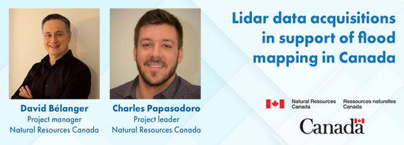
Flooding is the most costly natural disaster in Canada. Although flood hazard maps are essential for understanding a community’s risk to flooding, in Canada, many flood maps are not always available or up to date. High quality flood mapping that is current and accessible will help governments, communities, and individuals understand flood hazards and to implement effective mitigation strategies to reduce their impacts.Since 2021, Natural Resources Canada (NRCan) has been leading the Fl...


Traditional LiDAR acquisition platforms are commonplace in the industry and can be relied upon for efficient data acquisition for most relatively flat and uniform project areas. However, when multisource data acquisition is required or acquisition is impacted by complex corridors, excessive terrain, low-hanging clouds or airspace limitations, alternative approaches are required. This presentation will highlight some of NV5’s innovations to address these challenges including the Comprehensive ...


AI-driven mapping revolutionizes the use of LiDAR and photo datasets, addressing challenges like underutilized data and the complexity of heavy datasets. By transforming big data into lightweight, accessible information, XEOS offers practical solutions for municipalities and private companies. Through a step-by-step breakdown of the AI mapping process and product demonstrations, attendees will discover how this innovation enables smarter decision-making and brings more value to LiDAR data.


As we navigate the peak of Solar Cycle 25, the geomagnetic storms it brings are more than just cosmic phenomena—they're operational challenges that demand our attention. In this talk, Gavin explores how solar storms disrupt GNSS, a foundational technology underpinning nearly all reality capture workflows, including LiDAR-based field operations. Drawing insights from recent solar events like the Gannon Geomagnetic Storm of 2024, Gavin unpacks the impacts of ionosphe...


We believe that the selection of the aircraft for any aerial collection must be carefully considered. Considerations for type of sensor equipment installed relating to weight and power requirements along with environmental challenges should be taken into account to ensure the safest conditions in all areas.In addition to the aircraft selection, preparing for the challenges for the collection itself will help mitigate the inherent risks that we face regarding airborne operat...


Join us at LiDARCanEX 2025 for an insightful panel discussion moderated by Dr. Tim Webster. This session will bring together experts to explore the current state of LiDAR projects in Canada and discuss what the future holds. Topics include:Wide-Area Topographic LiDAR Mapping: Applications in forestry, flood risk assessment, powerlines, infrastructure, and urban development.Topo-Bathymet...

