
Jane Ho
Sessions auxquelles Jane Ho assiste
Mercredi 22 Juillet, 2020

The U.S. reference system modernization effort will replace the North American Datum of 1983 (NAD83) with a new North American Terrestrial Reference Frame (NATRF2022), creating 1.3 to 1.5 m horizontal coordinate differences at the Canada–U.S. border with respect to Canada’s NAD83(CSRS). Never before have such significant differences existed between our two countries’ reference frames.There are compelling reasons for Canada to follow suit and adopt the NATRF2022 frame as our ...

Space-Based Earth Observation in Canada - A Vision for the Future Today, Canada’s landscape, coasts, waters, and cities are changing rapidly, in a large part due to unstable geopolitical currents and the acceleration of global climate change. Our future economic and environmental security, as well as the safety and well-being of its citizens, depend on our ability to understand, plan, and respond quickly to change. Space-Based Earth Observation (SBEO) technologies ...

GIS users’ numbers are expanding around the world. It is now possible to find a GIS use in every field and to optimize their success. Discover how Business Geografic work throughout all fields to offer a new and modern approach to use Geografic Information Systems. Wheter your need are the one of an expanding business, a wide world telecom company or an official government entity, find out how we can help you vizualise your data and improve your process.

Our next-generation Earth imaging constellation will change everything. We're not just launching more satellites. In 2021, we will deploy WorldView Legion which will provide unprecedented visibility into our changing planet to solve the biggest challenges facing our world today. Grab your favorite beverage and join Maxar for a casual conversation about our next constellation, Legion! Everyone who joins will be entered for a chance to win an IPad!


Jeudi 23 Juillet, 2020

A closer look at some of the lidar-derived innovations for enhanced forestry management solutions and topobathymetric flood mitigation from Quantum Spatial Canada. Presented by Sven Cowan, Dr. Andrew Brenner, and Colin Cooper. Quantum Spatial, Inc., an NV5 company, is one of North America's largest geospatial services firms, providing insights to organizations that need geospatial intelligence to mitigate risk, plan for growth, better manage resources and advance scientific ...

Agriculture Canada’s COVID-19 response with location data & technology helping drive Objectives and Key Results (OKR’s) on the Enterprise GIS Roadmap This talk is designed to provide insights and guidelines for managing and directing Geospatial programs and uses the COVID-19 response (Maps Apps and Data) and digital transformation as the means to achieve the Objectives and Key Results of the Geomatics program.At AAFC the strategic initiatives of our data driven...

Join space specialists Nick Kellett, CEO of Deploy Solutions and Kevin Jones, VP Product at PCI Geomatics for this informal, fun and insightful event! Nick and Kevin, both big hackathon advocates, will share their recent experiences of working together on exciting challenges, as well as looking at some of the coolest moments in recent space history. The session will be interactive and include a quiz and a prize giveaway, so be sure to join us for a great hour of space chat and socializing!


Vendredi 24 Juillet, 2020

In recognition of the increasing costs and risk due to flooding, the Government of Canada is investing in flood mapping as part of the Government’s commitment to build safer and more resilient communities. Flood maps are critical for the public to understand their flood risks, and the availability of up to date flood hazard maps are key to strengthening the resilience of Canadian communities to overland flooding. Natural Resources Canada (NRCan) has been working in collaboration to advance...

We are living through a transformative time, not least in the space industry. A graph of upcoming satellite launches looks like a hockey stick – soon there will be orders of magnitude leading to more satellites being launched and more downstream data being generated from space than ever before. The question is, what is the most effective means of ensuring that space data brings tangible benefits to business operations and value to end users? In our talk we cover a satellit...

Title: DEIL experiments and outputs with open geospatial dataThe Data Exploration and Integration Lab (DEIL) at Statistics Canada has implemented a number of projects using, to the extent possible, open georeferenced data and open source tools. This presentation outlines some of this work. We will present recent developments of the Linkable Open Data Environment (LODE), examples of the use of LODE data, the development of a Proximity Measures Database and Data Viewer, and an R&amp...


Abstract A fundamental shift in the geospatial industry has occurred over recent years. Modern remote sensing technology has been developed at PCI Geomatics and in Canada through advanced research through partnerships with private industry, academia, and government researchers. Ubiquitous access to openly accessible earth observation data, cloud computing infrastructures and international collaboration have created opportunities to increase downstream access to inf...
Mercredi 21 Avril, 2021

Le Centre canadien de cartographie et d'observation de la Terre (RNCan) poursuit ses travaux de mise en œuvre de la Stratégie nationale sur les données d'élévation. Grâce à cette stratégie, l'un des objectifs de RNCan est de fournir aux Canadiens une représentation tridimensionnelle précise du pays, à l'appui des priorités du gouvernement comme la cartographie des inondations. En raison de l'énorme tâche d'obtenir une couche d'élévation nationale de haute précision et à jour, RNCan travail...

Au cours de la dernière année, Minerva Intelligence, une entreprise d'IA cognitive basée à Vancouver, a remporté deux contrats avec Ressources naturelles Canada pour concevoir des schémas au niveau national: le National Flood Hazard Data Layer (NFHDL) et le National Hydro Network V2 (NHNv2 ). Vous vous demandez peut-être pourquoi une entreprise d'IA conçoit et construit ces structures de base de données importantes. Le système d'IA cognitive de Minerva utilise des données sémantiquement in...

Explorez la structure d'une plateforme de renseignements de localisation d'entreprise à Agriculture Agroalimentaire Canada et comment ils ont créé une feuille de route stratégique pour diagnostiquer systématiquement les forces et les faiblesses afin de stimuler l'utilisation de l'intelligence de localisation dans les décisions quotidiennes de programme et de politique d'un ministère fédéral. Agriculture et Agroalimentaire Canada appuie le secteur canadien de l'agricultur...

Titre: Faire progresser l'observation spatiale au Canada: Le Panel géospatial des directeurs généraux de GeoIgnite 2021, dans le cadre de la Conférence géospatiale nationale du Canada. Titre: Faire progresser l'observation spatiale au Canada Il s'agit d'un panel incontournable pour quiconque souhaite connaître la direction que prend le leadership géospatial du gouvernement fédéral du Canada. Joignez-vous à nos pané...


Jeudi 22 Avril, 2021

Rejoignez-nous le 22 avril pour une discussion au coin du feu avec le Dr Steve Liang, fondateur et directeur technique de SensorUp. Professeur et titulaire de la chaire de recherche Rogers IoT à l’Université de Calgary et Dr Nadine Alameh, chef de la direction (PDG) de l’OGC.L'objectif de Steve est de perturber les silos de l'Internet des objets en créant, en utilisant et en mettant en œuvre des normes et des produits ouverts et interopérables pour les communications appa...


Application des données de POI canadiennes de SafeGraph pour l'analyse au niveau de la communauté dans ArcGIS et Tableau Les données géospatiales permettent aux organismes de recherche, aux agences gouvernementales et au secteur privé de visualiser et d'analyser des problèmes complexes de manière nouvelle et innovante. Mais les données de localisation ne sont utiles que si elles sont exactes - ce que de nombreux analystes de SIG et de données ne savent que trop bien. Arm...

Depuis près de 50 ans, des représentants de la géomatique des provinces et territoires canadiens ont collaboré avec le gouvernement fédéral à des initiatives de géomatique. Cette présentation explorera pourquoi un tel conseil a vu le jour et pourquoi son travail est important pour le secteur canadien de la géomatique et les citoyens. Alors que le secteur de la géomatique et le monde dans lequel nous vivons continuent d'évoluer, le besoin de coordination entre les juridictions demeure crucial ...

Le levé géodésique canadien (SCG) de Ressources naturelles Canada (RNCan) est chargé de définir, de maintenir et de fournir l'accès au Système canadien de référence spatiale (SCRS). Le CSRS fournit une référence cohérente pour l'arpentage, la cartographie et d'autres applications qui nécessitent un positionnement précis. Cette présentation décrira les produits, les outils et les services de BESC actuellement disponibles et donnera accès au Système canadien de référence spatiale (SCRS). Il ...
Vendredi 23 Avril, 2021

L'industrie géospatiale mondiale est estimée à 500 milliards de dollars américains et a un impact encore plus significatif sur la société, avec des avantages économiques dérivés estimés à être multiples. Ces avantages, cependant, ne sont toujours pas pleinement compris par les principales parties prenantes et les décideurs politiques, ce qui entrave en fin de compte l'adoption mondiale des informations géospatiales. Avec des décennies d'efforts d'infrastructure nationale de données spatial...


Dans cette présentation d'Avenza Systems, nous montrerons comment des résultats cartographiques de haute qualité après votre analyse de données peuvent réellement être obtenus! Nous montrerons comment développer et concevoir une carte à partir de données de recensement statistiques brutes dans Adobe Illustrator en tirant parti des fonctionnalités géospatiales de MAPublisher - la solution de cartographie standard pour une sortie graphique de haute qualité.Nous allons montr...

En 2003, lorsque GISPartner est entré dans l'entreprise, la Pologne était encore loin derrière les pays plus développés en termes de mise en œuvre informatique. En 2021, l'écart est incomparablement plus petit et certaines des solutions informatiques polonaises sont largement utilisées dans le monde entier. Lorsque l'administration publique est envisagée, c'est aussi GISPartner, qui a grandement contribué à transformer le papier et les timbres en solutions logicielles de haut niveau. Nous ...

Le gouvernement du Canada et des organisations comme l'ONU reconnaissent le rôle essentiel des normes en matière d'information géographique et de géomatique pour soutenir l'intendance et l'interopérabilité de l'information, en veillant à ce que les organisations accèdent, utilisent et partagent les données géospatiales de manière efficace et efficiente pour soutenir la prestation de programmes et de services aux citoyens. . L'inventaire / catalogue des données et les normes de soutien sont...

oignez-vous à GeoIgnite pour ce premier panel de chefs de file provinciaux et territoriaux de la géospatiale et des technologies de localisation. Nous discuterons des problèmes entourant: Quelles sont les principales priorités et défis à travers les juridictions?Quels types d'outils géospatiaux utilisons-nous pour surveiller et répondre à des défis clés tels que les interventions d'urgence?Comment les juridictions harmonisent-elle...


Lundi 26 Avril, 2021

Les billets pour cet atelier doivent être achetés à l'avance.

Mardi 27 Avril, 2021

Les billets pour cet atelier doivent être achetés à l'avance.

Les billets pour cet atelier doivent être achetés à l'avance.

Mercredi 28 Avril, 2021

Les billets pour cet atelier doivent être achetés à l'avance.
Jeudi 29 Avril, 2021

Les billets pour cet atelier doivent être achetés à l'avance.

ASCE 38 was first published in 2002. It served as the basis for subsequent standards in UK (PAS 128), Australia, Malaysia, and Ecuador. It serves as the principal standard for the practice of subsurface utility engineering around the globe, and is referenced as the standard to use for existing buried utility investigations in CSA S-250. The latest edition of ASCE 38 takes into account the practice improvements, technological changes, and various interpretations of ASCE 38 since 2002. The l...

Les billets pour cet atelier doivent être achetés à l'avance.


Moderator: Prashant ShuklePresenters: Rob Martindale, Olive Powell, DND, PSPC


Vendredi 30 Avril, 2021

Gyro mapping is rapidly becoming a widely accepted technology for obtaining accurate XYZ data of subsurface utility infrastructure. Whether through national regulation or the utility network owners’ diligent network management policies, gyro mapping is becoming a standard new-build specification, in particular for trenchless installation methods. In addition, Utility network owners see a great benefit in having an objective and accurate as-built profile during the hand-over process with infra...

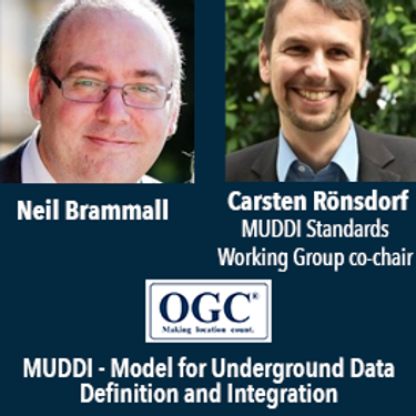
Speaker: Neil Brammall and Carsten Roensdorf

Les billets pour cet atelier doivent être achetés à l'avance.


In an era of growing utility digital transformation, why do utilities still collect construction as-built data with paper? Grid transformation requires utilities to manage data from source to consumer in a 100% digital manner. But, utilities have spent decades and millions of dollars on digital design, GIS and ADMS only to end up with digital bookends around a paper field process. The result - long cycle-times, manual project close-out, inaccurate facility maps and poor grid data. This se...
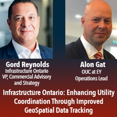
In July of 2020 the Government of Ontario passed Bill 171, the Building Transit Faster Act(“BTFA”) to streamline the delivery of the province’s four priority transit projects. In response to this new legislation, Metrolinx partnered with Infrastructure Ontario and the Ministry of Transportation to establish the Utility Coordination Program (UCP), a new initiative which oversees the development of utility relocation standards and the supporting process to improve the location, trea...

Municipalities in Canada manage over 60% of public infrastructure. They are the hub of activity in infrastructure spending and engaged in every facet of infrastructure construction. Most municipalities have developed, to varying degrees based on their size, centralized data and technology capabilities with more advanced municipalities implementing enterprise level data and technology environments. CAD, Mapping and GIS data interoperability efforts have been ongoing for some time. Open data...
Mardi 1 Mars, 2022


Mercredi 2 Mars, 2022

Join Jonathan Murphy and John Roos as they kick off the start of Day 2 Winter Geo:GeoIgnite 2022 and share some information on the upcoming workshop week.
Jeudi 10 Mars, 2022

Taking urgent action to combat climate change and its impacts" is a crucial goal set forward under Goal 13 – Climate Action as part of the United Nations Sustainable Development Goals (SDGs).Climate action requires global efforts related to climate change mitigation – reducing the flow of heat-trapping greenhouse gases into the atmosphere, or enhancing the "sinks" that accu...


Vendredi 11 Mars, 2022

At a time of rising climate change impacts, there is a vital and growing need to prepare for, respond to, and recover from natural disasters. But there is a critical communication gap between authorities, citizens, and communities. Drawing on the ongoing results of our massive multi-year climate change research project, and with assistance from hundreds of students, citizens, academics, NGOs, government officials, and industry partners, Deploy Solutions has identif...