Yui Tanagi
Sessions auxquelles Yui Tanagi assiste
Mercredi 14 Avril, 2021
Discours d'ouverture par MDA
Modérateur: Tania Panéliste: Bilyana, Nadine, Dave, représentant MDA et David A.
Jeudi 22 Avril, 2021
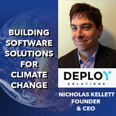
À une époque où les impacts du changement climatique augmentent, il est vital et croissant de se préparer, de réagir et de se remettre des catastrophes naturelles. Mais il existe un déficit de communication critique entre les autorités et les citoyens. En nous appuyant sur les résultats de notre vaste projet pluriannuel de R&D sur le changement climatique et avec l'aide de centaines d'étudiants, de citoyens, d'universitaires, d'ONG et de représentants du gouvernement...
Vendredi 23 Avril, 2021
En 2003, lorsque GISPartner est entré dans l'entreprise, la Pologne était encore loin derrière les pays plus développés en termes de mise en œuvre informatique. En 2021, l'écart est incomparablement plus petit et certaines des solutions informatiques polonaises sont largement utilisées dans le monde entier. Lorsque l'administration publique est envisagée, c'est aussi GISPartner, qui a grandement contribué à transformer le papier et les timbres en solutions logicielles de haut niveau. Nous ...
Avec les progrès rapides des technologies d'observation de la Terre, de cloud computing et d'analyse, plus d'informations sur notre monde en mutation sont plus facilement disponibles que jamais. Planet est une société aérospatiale et d'analyse de données à la pointe de ces avancées - travaillant pour rendre le changement global visible, accessible et exploitable, Planet visualise la Terre entière quotidiennement à une résolution de 3,5 m et n'importe où sous-quotidienne à <50 cm. Dans cett...
Vendredi 4 Mars, 2022
The Association of Canada Lands Surveyord (ACLS) has developed a certification model for hydrographers which, has been officially recognized by the IHO/FIG/ICA International Board of Standards and Competence for Hydrographic Surveyors and Nautical Cartographers (IBSC) in April of 2016. The ACLS program is the second internationally recognized scheme in the world. Certification for a hydrographic surveyor is desirable because: - Certification provides a formal...
In this short technical demonstration, I’ll explore some of the ways that Planetscope’s new 8-band capabilities can be used to both detect and monitor invasive plant species, such as Watermoss-Salvinia, within water bodies. We’ll focus on the role that the 4 new spectral bands (Coastal Blue (433-453nm) , Yellow (600-620nm), Green-II (547-583nm) and Red-edge (697-713nm)) can have in this use case. I’ll compare how some spectral indices unlocked via 8-band data compare to previous 4-band, RG...
Lundi 7 Mars, 2022
The world is dynamically changing and so are businesses. By some estimates, 20% of new businesses close within one year of opening. In 2020,
Mardi 8 Mars, 2022
Maxar’s WeatherDesk is a mature product platform that has continually evolved to satisfy changing customer requirements. It sets the standard for reliable and accurate weather forecasting through sound attention to science, an intense focus on customer service including 24/7 meteorological and operational support, and optimally solving customer problems. WeatherDesk products elegantly translate weather data into insights and actionable intelligen...
The Integrated Cadastral Information Society (ICI Society) is a leader in sharing geospatial information, promoting the integration, adoption, and use of spatial data for the social and economic benefit of British Columbians. In addition to data sharing, ICI Society works to facilitate opportunities for training, education, and collaboration across government, industry, and other interested organizations. Incorporated in May 2001 and registered under the BC Societies Act as a ...
This workshop will use open tools and standards to create STAC compliant data for a Canadian Federal Dataset. The workshop will focus on the nuances of working on Canadian Data in a Cloud environment. It will further demonstrate modern geospatial data science tools to create a SpatioTemporal Asset Catalogue. Sparkgeo will also demonstrate use in leading desktop and cloud mapping software.
Mercredi 9 Mars, 2022
The Topobathymetric Lidar Solutions & Applications Workshop presented by NV5 Geospatial is designed to provide a comprehensive overview of topobathymetric lidar in a relaxed, collaborative environment to allow discussion and answer any questions. This interactive, virtual event will review our latest sensor technology, present typical project planning and execution, and provide processing insights to successfully completing and delivering ...
Join us in this training to learn about some of the latest and greatest features in ERDAS IMAGINE! With the exponentially increasing amount of data being collected in the world today, customized repeatable, batchable workflows are needed to extract as much valuable information from raw data as possible. The Spatial Modeler is the key to setting up these types of workflows. The creation of spatial models and the use of AI, machine learning and deep learning allow mo...
Jeudi 10 Mars, 2022
Taking urgent action to combat climate change and its impacts" is a crucial goal set forward under Goal 13 – Climate Action as part of the United Nations Sustainable Development Goals (SDGs).Climate action requires global efforts related to climate change mitigation – reducing the flow of heat-trapping greenhouse gases into the atmosphere, or enhancing the "sinks" that accu...
Join this session to get the latest information on Maxar foundational products as well as demonstrations and round-table conversation with our subject matter experts. Please bring your questions if you're a current user, or come ready to experience the industry's best satellite imagery for the first time.
Vendredi 11 Mars, 2022
Please join us for the MDA-hosted workshop on multi-band SAR presented by MDA (Canada), Iceye (Finland) and VENG (Argentina). After presenting SAR fundamentals, we will dive deep into the specifications of X-band (Iceye), C-band (RADARSAT-2) and L-band (SAOCOM) missions, as well as the sensors’ merit and strength in specific applications that are of relevance to Canada. The last hour would be Q&As and discussion.
At a time of rising climate change impacts, there is a vital and growing need to prepare for, respond to, and recover from natural disasters. But there is a critical communication gap between authorities, citizens, and communities. Drawing on the ongoing results of our massive multi-year climate change research project, and with assistance from hundreds of students, citizens, academics, NGOs, government officials, and industry partners, Deploy Solutions has identif...

