
ZhiRui Foo
Elementy, w których ZhiRui Foo attends
wtorek 22 marca, 2022


The 2012 DT-DICT (Building without destroying) reform in France aims to prevent damage to utility networks. This legislation places heavy constraints on stakeholders because it requires them to georeference all networks in the vicinity of construction work with centimetric accuracy by 2032, everywhere in the country. Patrice Lemire, CEO ...


Albeit industry efforts, over 1 million underground utilities are annually hit around the world, with estimated damages exceeding $100 billion, not considering billions invested in technologies and inefficient processes aimed to protect utilities during earthworks operations. Available utility data is usually unreliable, and even if data is accurate, the excavator operator may still damage a utility. <...


Gyroscopic mapping of underground ducts and pipes has been around for a few decades now, and it continues to gain traction amongst the worlds' utilities as an accurate and unique technology. Nevertheless, the market perception until now is that Gyro-mapping, as it's also often referred to, is more expensive than traditional mapping and locating technologies. And although that perception is true, it is not due to the cost of the technology, but rather...


Arising 3-D modeling, visualization, and design software (e.g., BIM, VDC) greatly enhance advanced project designs with sophisticated risk analytics and conflict resolutions that accommodate existing infrastructure and enable proactive/predictive engineering and construction. However, without standardized and accurate utility data, new advanced digital project delivery and damage prevention technologies are compromised...


As the world continues to grow and urbanize, new urban infrastructure is being constructed at an unprecedented rate while old world infrastructure is being replaced and upgraded. This has lead to a greater demand for accurate and current utility locating and mapping. This demand is further exacerbated by the fact that infrastructure construction costs continue to rise and the slightest delay or extra cost associated with insufficient utility locating has an...


Digitizing and project management for infrastructure can be a complicated walled process. Leveraging Scribble Maps can allow for the rapid creation of vector data based on paper maps. Further, productivity and ROI can be improved by the leveraging of non-formally trained GIS employees via GIS managers.


This presentation will be focusing on the advancement of "Cloud and Mobile" technologies that are currenlty being used to easily and accurately map assets and underground utilities that can be shared, re-located and leveraged thoughout the many project phases.It is critical that data accruacy and integrity is leveraged and accumulated throughout every phase of the BIM procress, creating a live "digital twin" all the way back to t...


Utilities and their Contractor Organizations have traditionally been responsible for the safe and effective construction of new underground facilities. An important aspect of the construction process is the accurate documentation and location of the newly installed assets for update into the Utilities’ Geographic Information Systems, Work Management Systems and Asset Repositories. This process is typically performed via paper-based folders that may contain missing or incorrect attribute da...


Abstract:The total cost of underground infrastructure damage in Canada during excavation work is estimated to be over $1 billion dollars annually. The primary cause of these damage incidents is the lack of reliable information on the location and other information about buried utilities and other infrastructure. The Canadian Underground Infrastructure Register project is intended to improve the current damage prevention process by providing access to reliable data t...


środa 23 marca, 2022

In Singapore, almost all utilities are buried underground to free up valuable above ground space for more liveable environment. These underground assets which consist of power cables, telecommunication lines, water pipes, gas pipes and wastewater networks are critical infrastructure that keep our city functioning. Most cities have not been able to keep reliable, complete, and up-to-date maps of their underground utilities due t...


Synopsis: The UK National Underground Asset Register has gone through rigorous pilot and preparation phases and has learned a lot about the data which we will share for 3 regions before a national roll out. However, despite all the best laid plans there will always be exceptions and unexpected scenarios which will need to either be fitted into the data model or have the data model change in order to fit them. The way in which we make these changes could make or break a project like this wh...


Utility and energy buried pipelines represent an extensive underground network covering most of a country's territory. Their precise lateral, horizontal positioning along with their depth of cover is a critical element of any operator's GIS. It enables to deploy more accurate pipeline predictive maintenance models and avoid third party interferences. The latter being identified as one of the main causes of pipeline failures. The 2020 CGA Dirt report states that 3...


A longstanding and unsolved problem for utility companies has been how to keep geospatial network asset data up to date as networks are extended and maintained. Currently, it can take weeks if not months for “as-built” changes to make their way back into the enterprise system of record, typically a geographic information system (GIS). Existing mobile solutions can enable workers in the field to capture data about network asset data updates, but are too time consuming and comple...

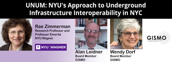
NYU and GISMO's Unification for Underground Resilience Measures (UNUM) is a multi-faceted research initiative aiming to improve our understanding of the city's underground infrastructure assets from the community level through city government and private asset holders. The many activities within the scope of this project include: community collaboration on developing a digital twin of their neighborhood, use of open data to develop an integrated application ...


As one of the oldest American cities, Boston holds a rich history and culture that runs not only through the streets but also beneath them. Many of the large underground infrastructure projects completed between the late 1890s and the late 1920s in Boston are still in use today. The preservation of infrastructure and the insights gleaned from the practices used to create it provide valuable lessons in how to maintain standards of excellen...


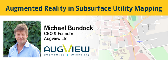
We live in a world where the skill required to interpret maps and engineering drawings is decreasing while the density of underground networks is increasing. The result is increased collateral damage, network outages and poor health & safety outcomes for our field workers.Today, we need better ways to accurately capture and comprehend the location and nature of those networks that are out of site under our feet. AR (Augmented...


Leading construction companies are finding a new software as a service component that enables them to view their virtual sites, saving them time and money. This technology breakthrough enabled pioneer construction companies serving clients in multiple industries (colleges, hospitals, residential compounds, malls) to use a new way of representing information about their buildings and utilities, above ground and underground. Benefits include avoiding planning mista...


Due to aging and lack of accurate utility location information, there is significant underground congestion and conflict. This results in increased operational risk especially at waterway, transportation, and utility crossings. The IMU Mapping methods are able to mitigate these risks by providing accurate digital as-built positional data at trenchless crossings, constructed via HDD methods. Unlike other technology mapping solutions, which rely on sending signals below ground, in-line IMU M...


czwartek 24 marca, 2022

Scribble Maps is an easy-to-use online GIS and web mapping visualization solution. The software has a robust toolset along with vast operations that can help you annotate maps, plot territories, filter and analyze data, optimize routes, add images, and more.Our powerful mapping software can easily be integrated with many different file formats including GeoJson, SHP, KML, CSV, GPX, DXF, and PDF. Founded in 2009, Scribble Maps has been developed from direct user f...

wtorek 5 kwietnia, 2022


Times have changed - dynamic mobile mapping is now more essential than ever to get the job done quickly and accurately. Join keynote speaker Marek Koltun LIVE as he discusses mobile mapping and its place as standard equipment in the laser scanning toolbox. Learn how scanning with a wearable device like NavVis VLX can significantly benefit your projects - big or small.


Simultaneous localization and mapping (SLAM) based systems have proved their value for rapid mapping of complex environments, but achieving survey grade accuracy and repeatability has been a challenge in some environments. Surveyors were faced with a compromise between fast data capture and data accuracy, depending on the job requirements.This is no longer the case with Emesent's Automated Ground Control feature, which enhances t...


Case study outlining the challenges, solution and final result associated to a complex commercial renovation project.


Use case outlining the challenges, solution and result associated to a Lidar data acquisition using drone and vehicle.


Multi-beam bathymetric surveys are used to gather detailed information about the features on the sea, river or lake bed by measuring multiple depths from a transducer array at high resolution. The result is a highly accurate 3D point cloud representation of the sea floor – similar to aerial LIDAR.

In recent years the geospatial drone market has expanded dramatically. Drone based UAS (LiDAR) and UAV (Imagery) systems vast differences make it difficult to choose one over the other. This presentation aims to explore their differences from the point cloud processing aspect. We will examine the pros and cons of each system for practical survey and mapping applications such as topographies, bare earth, volumetrics, etc. Learn how data accuracy, density, intensit...


The autonomous vehicle industry is in the process of developing high definition (HD) maps to serve as the reference for their real time navigation systems. By 2030 the HD maps market is expected to reach $16.9 billion per year. Currently there is no accepted standard for HD maps here in the U.S. and Canada. It is the Wild West with each vendor collecting their own data. This presentation will encourage the key players to develop a strategic plan that involve...

A distinguished panel of 3D laser scanning industry veterans will be offering examples of some of their more difficult projects, along with the best practices they applied and the lessons they learned. This will be one of the highlights of the event.


środa 6 kwietnia, 2022

In this informative discussion, learn how to easily display and manage mobile Lidar and static laser snap from a unique source of trustful data in the cloud. Key take-aways include:Turn structured and unstructured mobile point clouds in high-resolution 3D meshesMake the most of your static or indoor mobile scanners in a combined workflowEffortlessly use visual analysis to reconcile your BIM models to your scansUse cost effective pro...


Learn more about the transportation industry's most productive software solution for extracting topography, 3D models, GIS Assets, and more from drone (UAV) point cloud data. We will demonstrate how TopoDOT®'s comprehensive tool suite allows you to establish a highly productive process to extract break-lines, surface models and assets in a CAD environment. Learn how high quality data promote feature extraction automatization and productivity.


Lidar! This ubiquitous 3D technology is transforming how we visualize, map and analyze the world around us. What is it and how does it fit into the remote sensing toolbox? This presentation provides an overview of the core advantages of lidar data and an overview of the latest sensor solutions from RIEGL.

poniedziałek 16 maja, 2022

Event is in Eastern Time. This workshop cuts through the theory and fluff to present, in practical terms, the essential practices for successful GIS project planning and management. Its intent is to provide project managers, teams, and stakeholders with the key actions methods, and tools to launch and execute successful projects—delivering results on time and on b...

wtorek 16 maja, 2023


Geoff Zeiss was an instrumental influencer for the Minnesota Utility Mapping Project (MN UMP). The goals of the MN UMP are to 1.) increase the accuracy of underground utility maps, 2.) provide for a method of viewing this data in relation to a "One-call" excavation area, and 3.)reduce underground utility damages. This viewed utility mapping data is supplemental to the "One-call" process. Founded in 2020, the Minnesota Underground Mapping Project completed the Phase 1 prototype for viewing ...


Reveal are Australasia's leading underground utility locating specialists. Over the past 10 years, Reveal has moved from a 'paint-on-the-ground' provider to pioneering the digital and GIS deliverables for major infrastructure projects. Reveal continues to push the industry towards better practices of proactive mapping, data capture and engagement with all stakeholders of the underground.In this talk, CEO Sam Wiffen will outline a number of recent innovations, including new visualis...


Every year the vast majority of seemingly routine street excavations occurring around the world are adversely impacted by lack of usable information about buried utility infrastructure. Large-scale construction projects are frequently stalled, incurring delay claims and change orders that significantly increase costs, because the locations of utility installations were never properly recorded or depicted. Bid costs may be increased by a minimum of 10-30% for cont...


Utilities across North America are investing in a vast array of Distribution System improvements and system expansion efforts. As these investments progress, the current / manual 'as-built' data collection procedures are unable to address the increased reporting and documentation burden on the back office staff.To address these ever growing documentation demands, Utilities will need to revolutionize their field data capture process as well as their back office system updat...

Geoff Zeiss devoted over 30 years of his life to the Geospatial industry and global community, focusing on utility and construction sectors, and mapping underground utility infrastructure among many other projects. Sadly, Geoff passed away in September of 2022. The Geoff Zeiss Urban Infrastructure Mapping Fund was established to build on decades of innovation by Dr. Zeiss in developing effective and sustainable urban infrastructure through research and development supporting urban in...


Gyro mapping is rapidly becoming a widely accepted technology for obtaining accurate XYZ data of subsurface utility infrastructure. Whether through national regulation or the utility network owners’ diligent network management policies, gyro mapping is becoming a standard new-build specification, in particular for trenchless installation methods. In addition, Utility network owners see a great benefit in having an objective and accurate as-built profile duri...

The talk summarizes a market product of deep learning based semantic segmentation of point clouds and automatic 3D reconstruction of as-built BIM for underground utilities and pipework for 3D GIS. The presentation covers a general workflow of the approach (including point cloud labeling, definition of classes, deep neural network, information extraction, and pipe modeling), accuracy of semantic segmentation, real case studies, and foreseeable challenges down the road. Also, the speakers wi...

CUIR is a portal solution that will allow the owners of buried infrastructure to exchange information with firms requesting the nature and location of buried assets bounded within the area outlined in a One Call ticket. Unlike a central database, the CUIR process does not provide anyone access to the owners database, but rather allows the owner to receive the request and push the data to the requestor thus preventing any external party access to their database.This process will also...


środa 17 maja, 2023

Geoff Zeiss devoted over 30 years of his life to the Geospatial industry and global community, focusing on utility and construction sectors, and mapping underground utility infrastructure among many other projects. Sadly, Geoff passed away in September of 2022. The Geoff Zeiss Urban Infrastructure Mapping Fund was established to build on decades of innovation by Dr. Zeiss in developing effective and sustainable urban infrastructure through research and development supporting ...

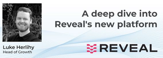
A deep dive into Reveal's new platform for major civil infrastructure projects, highlighting the workflow and features for project managers, engineers and contractors. Reveal for Projects helps stakeholders in the underground build a Unified Utility Model from multiple sources of data, with an intuitive and efficient web interface.

wtorek 25 czerwca, 2024

The applications of GeoAI are as wide and diverse as our imaginations. Many applications like remote sensing, image classification and object detection using computer vision, improve visual clarity and allow higher zoom levels using super-resolution networks, extract geospatial information from unstructured data using natural language processing, deep learning application for large 3D geospatial datasets etc. and have shown positive trends in GeoAI.With the increasing focus on damage p...
